 Walks and other things
Sadernes and river pools of St Aniol d'Aguja
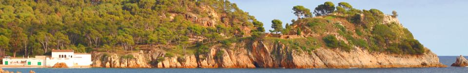
 Just to the north of Besalu and Castellfollit de la Roca (both worth visiting in themselves) are the the largely unpopulated hills and mountains of Alta Garrotxa that run to the French border. In amongst the hills is the small hamlet of Sadernes and a popular Catalan walking route through gorges up to a small refuge/chapel at Saint Aniol d'Aguja, along a small river that in summer forms a series of deep pools of crystal clear water that attracts families and locals for swimming. Along the way we walked past steep overhangs and sheer cliffs that were being tackled by intrepid climbers.
The path and walk is well-known among those who live near Girona and there were lots of families on the path, but it's well off the tourist trail. We saw it on the Costa Brava & Girona Hiking / Biking Meetup Group run by local English resident Nigel Perrin, who organises group hikes and walks in this area.
 The walk itself is relatively long. Though the river runs through Sadernes, from what we could see the best parts of the river pools start about forty-five minutes up the gorge, so there is a a good walk to be had before 'the start' along a somewhat dry track. Once the pools proper start, the path becomes a narrow track along the river that continues for about 60-70 minutes until you reach St Aniol with opportunities for swimming or dipping all the way up.
Despite the relative length of the walk, we saw lots of families with young children, and some groups laden with picnic boxes walking up for swimming. In fact the swimming is fabulous, so do take swimming trunks, but water shoes (or trainers you don't mind getting wet) help under foot.
For our walk, we parked at Sadernes itself. The small car park by the church and hotel/hostel was full when we arrived and we went back to park in an earlier layby, but as we started the walk we discovered there was additional parking past the chapel.
The track heads out along the valley and though the signs said no vehicles it is used occasionally by locals for the two or three houses along the valley. The track itself runs along the edge of a gorge to one side, but mostly we couldn't see the bottom, and where we could the river bed seemed to be dried out, so we weren't sure whether we'd see water. The path continues up, crossing the river at one point just below an high rocky overhang being used for climbing. As we were getting to the bridge we could hear shouts and splashes, possibly of a group canyoning through the streams, but again we could not see.
 From the bridge, the track continues but with high cingles (escarpment cliffs) above us on the far side of the river. The scenery feels a little harsh with the bare rocks, trees and dry path with a sense of remoteness were it not for all the people walking as we passed a group every five minutes or so.
The path makes its way up steadily but after about 40 minutes or so we weren't sure if there was anything worth going on for and we might have turned back were it not for the other people who clearly knew something we didn't.
The change came as the track turned across the river with stepping stones needed to cross the water and became a small single track path. Ahead of us we passed a group of Argentinians hauling big picnic boxes up the path, wearing flipflops of all things, though this was a proper walking path.
The path then continued along the side of the river up and down, meeting the water at points and climbing up over the sides high above the water in others. The river has a very rocky bed with large rocks smoothed by the water that have created large deep pools that are separated by small streams and waterfalls. The pools are full of cystal clear water, a little cool, but with the rocky ledges around, perfect for jumping into the pools and swimming around. As we walked up the path, families would drop off to take a place by one of the pools setting out for an afternoon enjoying the water and the scenery.
We continued up taking the path all the way to St Aniol where a small chapel and an old refuge house in the process of being renovated stand in a small dell reached by crossing a small suspension bridge. The place was busy with hikers and families sat around eating picnics with large numbers of rucksacks outside the building.
Above the refuge are two further paths. One goes up to a waterfall Salt de Brull (Salt is jump or used for waterfall in Catalan) with a deep blue pool of water where teenagers were jumping into the water. The second makes a loop back towards Sadernes via the Salt de Nuvia. We did try this path, but the path goes up and crosses across the top of some cliffs which triggered a dose of vertigo, so we eventually came back down the way we came.
Update 2016:
Returning this summer a little earlier in the season (July) there's more water, but it's a little chillier - though fine for a hot day. This time we were a little more prepared and though we didn't go all the way to the top, we had a great time coming down the river for part of the way back through the rock pools and waterfalls with water shoes in and out of the deep pools and over rocks.
Nearby: Mollo (Camprodon) - Pyrenees to France - Serinya and Illa del Fluvia - Banyoles lakeside walk - Olot - capital of Garrotxa - Sant Esteve d'En Bas (Olot) - Rupit - Els Set Gorgs (Campdevanol)
Comments | ||
Visitor: 86.172.156.166 |
06 Jun 2020 08:19 |
|
Sant Añol is the site of an 11th century Benedictine Monastery. The Catalans hold an annual Saint Day for him falling 40 days after St Swithins Day or around today the 6th June. The first time I went in 1981 as a student from Perpignan,we went from the French side at La Mouge bar and border crossing point not far from St Laurent-de-Cerdans.Great weekend(no jumping for me though!)and a Saints Day service in the church on Sunday. I went back again in June 2000,largely on the route you describe with the refuge now needing some renovation but the sunny peace and quiet still there! Michael from Huddersfield UK. | ||
