Sobrestany, Montgri and Bellcaire d'Emporda
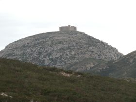 The mountain of Montgri stands dominates the plains of the Emporda and having already taken the path up to the Castle from the town of Torroella, this was a chance to visit the mountain from 'the back'. This route takes you up the other side from the village of Sobrestany (literally 'above the lake') just outside Bellcaire d'Emporda on the L'Escala side of Montgri. Like Ullastret's lake, Bellcaire also had a lake which was drained in the 19th Century. Bellcaire d'Emporda's other claim to fame is that it's the home village of Tito Vilanova, coach of Barcelona FC.
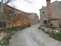 The walk itself has a range of contrasts and it's strongly recommended that you take a map. The end path down towards Bellcaire is marked with a dashed-line on our Emporda Costa Brava maps. Our experience with the smaller paths marked on the maps has been variable - sometimes they get heavily overgrown and seem to disappear, sometimes they are easy and obvious. Further down towards Sobrestany we actually missed the path back that we really intended to take and ended up with a longer loop.
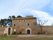 The walk starts easily enough along the flat following the untarmaced road from the parking area in the village (more a hamlet) itself. Sobrestany has signposts for an animal park which seems to have recently closed and you pass the remnants of this park. Once past the park, is a 'colonias' house with a sundial and tower. Colonias are holidays taken by schoolclasses with all the children together. They are very popular with Catalan and Spanish schools with most year groups having at least one trip away to a colonia for a few days during the year. The colonia itself is like a hostel for children, but with activities outside. For this particular colonia you can see the swimming pool, diving boards and zipwires outside for instance.
From the house the path continues into the woods. At the signpost marking the nature reserve of the Dunes Continental, turn right into the woods and start following the stream. The woods have grown on a sand base (and so Dunes) giving the path a very soft bed. The same type of sandy/dune bed can also be found in the woods near Mas Tomasi in Pals and presumably was established when the sand off the beaches was blown by the North wind until it met the mountain where it was deposited. From what we've seen so far, there is nothing equivalent on the north side of the mountain.
After a while through the woods, the path meets the road again and continues its gentle climb. At a sharp right a track ahead is marked with a 'no vehicles' sign. Follow the footpath and stream up the valley. The woods are fairly open and still sandy underfoot and there was plenty of evidence that the path was well used by mountain bikers and other walkers.
As you would expect, the path continues to rise as it tracks the stream up to it's head. At the top. towards the valley head, the path becomes steeper as it climbs out of the valley and past some stone piles that look as if they might have once been buildings. For this particular walk, we were in hunting season and saw quite a number of hunters in the woods and heard a few shots.
 After the top of the valley, the footpath comes down to meet the GR92 path. The GR92 covers some fabulous routes and would be worth writing about all on its own. This stretch is popular with walkers and there are signs at various points of interest. This time we follow the GR92 to the right along the ridge of the hill which should have views to the north and south, but unfortunately the trees limit the views.
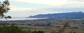
Eventually you pass across the top of the Torre Vella urbanisation. Between the houses you can look out across the plains of the river Ter and the bay of Pals towards Begur in the south. After the houses peter out, you find yourself on a tarmacked road and follow this to a picnic area at the Casa de Dunes. The view is much clearer here and it marks the start of the GR92's climb up towards the Montgri Castle
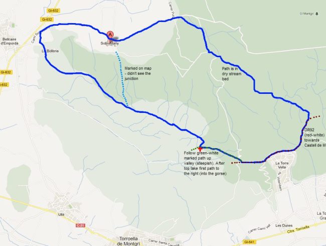
However, this time we didn't want to go up to the Castle and instead follow the route around the back of the hill - it's marked with a green and white flash on the trees. This path branches off the road and climbs up a rocky valley past a ruined farmhouse on the right and indications of stone walls built a long time ago. The climb up is steep enough to make you puff. Eventually you reach the top and the landscape is transformed into low gorse and bushes of rosemary. At this point we took a right hand fork away from the marked green-white path. It almost looks like it will take you to a cliff edge, but it doesn't. You will also have great views over the Gulf of Roses towards Cap de Creus and the plains of the Fluvia river.
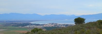 Unlike the soft dune path through the woods, this path is rocky and stony - classic Montgri - and you can feel the stones even through thick soled shoes. The path cuts through the gorse and up and down two or three valley heads before reaching the top of a small hill (Puig de les Cogullades). From this viewpoint we could see the mountains to the west above Bellcaire brilliant white and covered with snow, to the north the fields with water in them just outside Sobrestany and out along the plain to Empuriabrava and the white houses of Roses dotting the headland on the other side of the bay. To the east is Escala with the tower at Montgo just big enough to rise up and be seen above the hillside behind you. The low vegetation means that you have a clear view the whole time all the way back to Bellcaire.
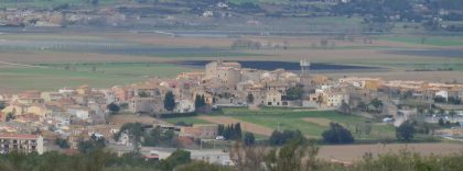 Our aim, at least on the map, was to find a direct path that is marked towards Sobrestany, but among the rocks and gorses we managed to miss the junction. In the end it didn't matter. The narrow track became a wider track for 4x4s and we followed it to the outskirts of Bellcaire (we didn't visit the centre), before following the road back to Sobrestany.
Neighbouring walks: Torroella de Montgri castle - L'Escala Riells to sea cliffs and viewpoint of Montgo - L'Estartit to Cala Pedrosa and Cala Ferriol - Bellcaire d'Emporda, Tor and Albons - Torroella de Montgri and Ulla

 Walks and other things