L'Estartit to Cala Pedrosa and Cala Ferriol
 Although originally L'Estartit was a fishing village it has become more of a resort catering to holidaymakers and second-home owners including a reasonable community of British ex-pats. It's also the connection route to the diving mecca of the Isles Medes, which according to diving friends, is one of the best locations on the Mediterranean.
The town of L'Estartit always feels like going to a different country. The town is slightly isolated as access is only possible from Torroella de Montgri with the river Ter to the south, and the Montgri hills to the back preventing any other access. Consequently, the town is almost entirely geared to holidaymakers as it is not really well enough connected for local inhabitants. Having said it's mainly for holidaymakers, this is not in a large or overgrown way, but it does have some well-design holiday hotels and apartment blocks and the main strip in the town is almost entirely shops focused on the tourist trade (and dead quiet in winter).
 The town's strong point for locals is that it is the main access point for the Isles Medes, two islands off the coast sufficiently large to have a lighthouse, that are the centre of a sea-based nature park famed for the quality of the diving. If you're visitng L'Estartit, then taking one of the many glass-bottomed boats to the Islands is recommended. If you're a diver (we're not), friends really recommend the Isles Medes.
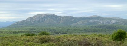
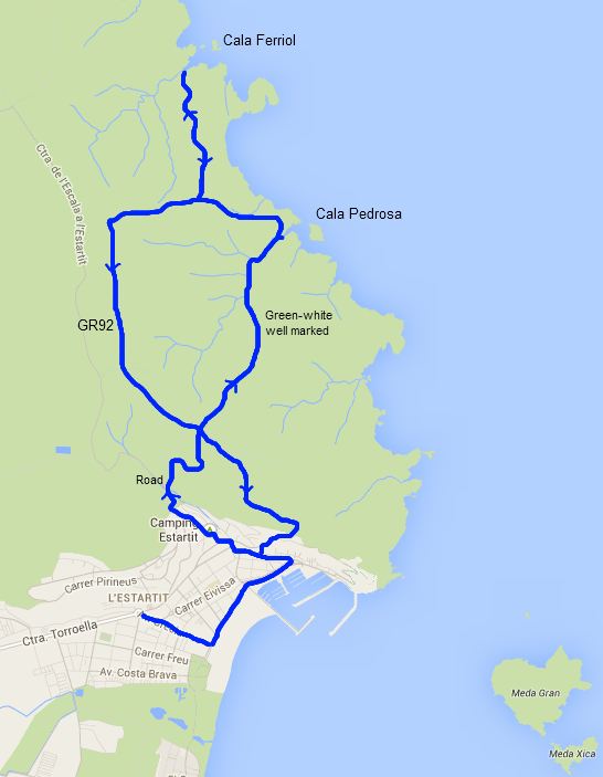
Behind the town is the Muntanya Gran of the Montgri mountains a large and very natural set of hills, cliffs and shrub that separates L'Estartit from L'Escala. We've walked this area before but have never quite got it right. The first time we were trying to follow the coast to L'Escala but came in the wrong shoes (the hills have a seriously rough under foot terrain - anything other than good walking shoes is not recommended). There's also a good walk along the ridge top over L'Estartit. Previously we've also tried to get up in to the hills above the furthest point of the port, and now we've discovered the best access point is the road up behind Camping Estartit which makes the start of the journey much easier. Google Maps doesn't show the paths very well, but they are clearly marked with signposts and green-white flashes and easy to follow on L'Emporda en Detall walking maps.
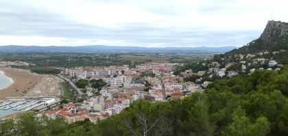
 We normally park near the photographers' shop who always has a great set of local pictures, then walk down to the beach. The beach has a fine sand and is gently sloping, but at the back are large areas used for parking. It rained overnight, so there are a few puddles, but out to sea the Isles Medes are the dominant feature. We explore the town a little - it's not somewhere we come to very often, and even at this late stage in the season there are still visitors from the UK and Netherlands about. After a skirt through the town we head out and follow the road in the direction of Camping Estartit and get the first of the walking signs. The route we're following connects to L'Escala/Montgo as well as the hidden Calas.
 The road runs past the campsite and continues up. To the right, above the campsite are some non-sea cliffs with a path running across the top through the woods (a good local route if you don't want to go fully onto the Montgri hills). Instead we continue with the road and it turns into a track with white painted rocks on either side - part of the access to Torre Ponsa. Our route then splits to the right rising steeply and we can see the grand Torre Ponsa buildings with Montgri Castle behind it. At the head of the road the terrain changes to the more typical Montgri terrain of rough stone underfoot and small shrubs dotted with alzines. At the crossroad, the paths are clearly marked with good signs and we take the route to Cala Pedrosa and Cala Ferriol along a stony track.
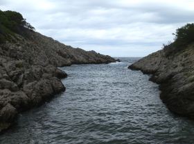
The path is clear and easy to follow (we pass a couple of mountain bikers coming the other way), then the path to Cala Pedrosa turns off to the left and becomes a little narrower with more stone. The terrain of the Montgri hills has a tendency to get harsh underfoot. It's a bit like walking over the remnants of a collapsed dry stone wall all the time with stones and rocks pointing up at odd angles making the path very uneven. Our path runs down through the woods and then along a dry river bed and we reach Cala Pedrosa (the stony bay). It's a pebble beach, with access to a channel of sea water. The whole beach/channel is about 10m wide at the widest Very natural, very stony and fine for skimming stones across the water, but not much else.
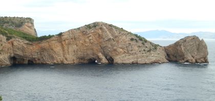
 The path now climbs out of the bay and up to the top. After an easy climb we reach a viewing point and can look back towards Cala Pedrosa and the Island of Pedrosa (also very stony), and in front of us we can see the remarkable cliffs and headland of Roca Foradada/Cap del Castell which juts out into the sea with sea cave and sea tunnels at the bottom and behind in the distance we can see Roses and Cap de Creus. The cliffs along the coast are high and vertical, and thankfully the path steers around the back.
Now as we're walking we run into a couple of other families with children younger than ours, properly shoe'd up for the rough ground. It feels like we're in the middle of nowhere surrounded by low shrub with no buildings or other access around so it comes as a slight surprise.
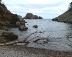
 We reach the top of the hill and our children cop out of the next stretch down to Cala Ferriol to avoid another climb out of a bay. We continue though and walk down along a broad but stonily-uneven track to get to Cala Ferriol another pebble beach but broader that Cala Pedrosa. There are a couple of small islets in the bay and a huge cliff above. Among the natural scenery, it looks like humans have created a space for fires in among the rocks.
On the map there's a second path out of the bay and back to the top, but we have to go back the same way we came. We walk past the families we saw earlier coming down. At the top we follow the flattish path in the direction of L'Escala (still well signposted), and then follow a flat track GR92 back towards Torroella and L'Estartit. We can't see the sea, but to the right as we go south are views towards Montgri and out to Bellecaire d'Emporda and the Pyrenees beyond. The GR92 bears off to the right, but we continue straight on the path to the crossroads where we took the route to Cala Pedrosa. We carry straight on and get to the heights above L'Escala, continuing along the top until we find a route down and back into town.
Neighbouring walks: Torroella de Montgri to Gola de Ter - Sobrestany, Montgri and Bellcaire d'Emporda - Torroella de Montgri castle - L'Escala Riells to sea cliffs and viewpoint of Montgo - Montgri Massif from Les Dunes L'Estartit
Swimming at: L'Estartit

 Walks and other things