Torroella de Montgri and Ulla
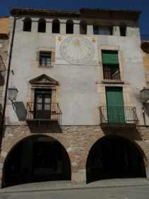 Torroella de Montgri is a historically important town and former royal port that that sits below the iconic Massif de Montgri and castle of Montgri, one of the most iconic and distinctive markers of the Empordan part of the Costa Brava. It is three or four kilometres from the coast at L'Estartit but remains an important crossing point for the river Ter.
Modern Torroella as a town is an odd mix. The outer parts of the town - where most people drive is a collection of modern town houses and apartment blocks. The inner part is much older and more medieval, but unusually for older towns is laid out on a grid pattern which can make for a confusing set of smaller narrow streets.
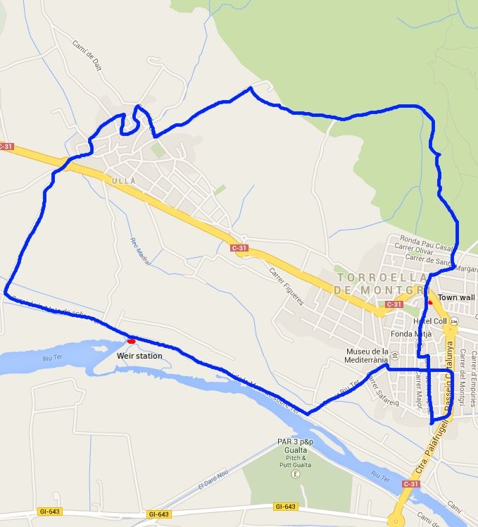
Our walk is also a mix - taking in the town, out to the dry and rough lower levels of Montgri with its rocky olive groves and harsher scrub, then coming down through Ulla to the extremely fertile banks of the Ter with apple trees in full blossom and hortas (allotments) showing their first crop of the year.
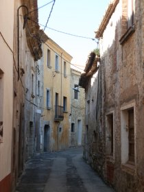
 We park at the southern end of the town in the municipal car park next to the CAP on the opposite side to Carrefour. The older centre is straight on, along Carrer de Hospital and almost immediately we pass the old hospital building. The way older Catalan towns were built was with flat fronted terraces with the front of the house directly on the street, instead of separated by a garden or space. The result is that the street looks like a uniform collection of buildings like the older Victorian terraces in English working towns. However, unlike English terraces, the buildings in a Catalan street can vary enormously and often extend deeply at the back into gardens with older houses having Boveda ceilings (vaulted ceilings). This means that on a old Catalan town street you might walk past an old grand Palau building one moment and a small 2-up 2-down the next. The facade initially looks the same.
 This is the case when we pass the old hospital building. Looking linearly down the street you would struggle to say which building was which. But as you pass and look laterally, the find carved windows and size of the frontage and the quality of the doors show the the ancient hospital building was a rich and important part of the town.
As mentioned Torroella de Montgri is laid out on an old grid system. The inner streets are relatively narrow - little more than one car's width and with the the layout of the facade, the only way to explore is to walk the street - a simple look along the street doesn't show you what you will find.
We walk along the Carrer de Hospital until a left turn that takes us into the main town square - an area with arches and vaulted arcades with tables and bars. From here we continue up to the main church and the old castle (now a hotel in front of the church). Skirting to the left of the church, the back streets lead to one of the old town gates. Prior to the silting up of the Ter, Torroella de Montgri was a royal port and so an important walled town, though now only a few of the rampart towers are remaining.
 Across the main road we walk through some of the newer streets with houses and apartment blocks. For many who just drive through Torroella these newer buildings will be their only impression of the town. We're heading up and follow the road to the right as it curls up towards the Montgri hill.
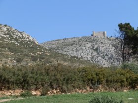
The road comes to an end and we have the choice of several tracks into the scrubby and rough terrain of the lower part of the hill. Above us we can see Montgri Castle on top of the mountain of Santa Caterina built by the Count of Barcelona (also King of Aragon) Jaume II, around 1300 as part of a power struggle for control of the Empordan lands with the more local Count of Empuries.
We take paths up towards the hill, but generally heading left where the paths split. The original aim was to go over the saddleback and walk around the base but we miss the connection up the hill and instead follow a side track past the rough olive groves that run around the base. The mountain is dry and dusty underfoot with grasses browning in the April sun, and we pass a farmer trimming the trees ready for new growth.
 We navigate by eye finding routes around the base before emerging at a road that looks like it will take us to Ulla just past an isolated metal recyling site. On the road are two climbers, who are just packing up. We can hear the shouts of voices higher up. Looking to the top of Puig Rodo we can just make out tiny figures abseiling down the rocky cliffs.
We take the track we've found down into Ulla. By car the main road between Torroella and Ulla is a collection of warehouses and shabby apartment blocks used by the migrant workers who find employment picking apples and other fruit from the espallier orchards along the Ter. From our path we enter into directly into the older part of Ulla.
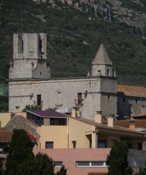
 Ulla centre is an old stone village of narrow streets with a small romanic church in the centre and houses with wisteria climbing up the walls, with many renovated houses. The village seems larger than might be expected from the road and the interior part has a sense of improving prosperity.
We leave the village toward the main road past slightly untidy breeze-block walled farms, arriving at a roundabout on the main Torroella to Verges road.
Crossing the road we walk into the orchards. The apple trees are in full blossom. The grasses are verdant and butterflies flit around our feet. The orchards and fruit are a huge part of the agriculture along the Ter with miles upon miles of espallier frames with bound netting ready to keep birds off the fruit. The abundant fertility is in marked contrast to the drier rougher mediterranean hillside we have just left.
 The path is clearly marked as both a cycle route and for walking, though warning signs explicitly prohibit leaving the path to enter the fruit trees. The path runs straightdown, then turns to the left and we start to follow the line of the Ter.
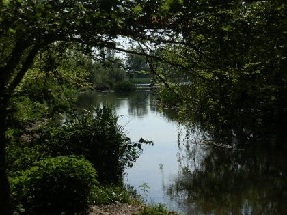
Our first sight of the Ter is at an old stone built weir station from 1650 (the name of the maker and date is carved into the stone). I'm not entirely clear of the purpose, but part of the waters of the Ter has been channelled through the weir station with rushing streams passing underneath, possibly to power a mill, or for irrigation or an early form of flood control. The weir itself is delightful with rushing water and translucent greens from the sun coming through the leaves of the trees.
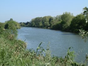
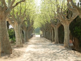
The path continues, now following the Ter and we can see how big and wide the river is. On the other side of the path are allotments with gardeners busily preparing for the spring season. Just after a bird viewing platform that stands above the river, the path turns back towards the town and we walk through a small avenue of pollarded trees which emerges by Espai Ter which houses the Tourist Centre in Torroella.
We traverse the centre again. Shops are opening at 5pm as the long weekend lunch break (1pm to 5pm) comes to an end. On the far side we reach the main avenue that drivers would see coming through the town and walk the avenue back down to the car.
Neighbouring walks: Torroella de Montgri to Gola de Ter - Torroella de Montgri castle - Bellcaire d'Emporda, Tor and Albons - L'Estartit to Cala Pedrosa and Cala Ferriol - Gualta, Llabia, Fontanilles and the lake of Ullastret - Ulla to Canet de la Tallada and civil war remains

 Walks and other things