Colomers and Jafre
 Colomers and Jafre are small villages that sit along the river Ter just to the west of Verges, so a little off the beaten track. The main reason you might visit Colomers is to hire a kayak from the canoe centre and gently paddle along the languid undeveloped Ter to Verges where the canoe centre will pick you up - a great alternative day out to the seaside. Alternatively you might come to Colomers for the ballooning centre next door.
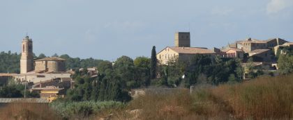
We're here to see the villages. We've had fun with the canoeing in the past, but didn't stop to look at the village so this time we park at the field by the double-decker London bus that houses the canoeing centre and walk into town. Colomers itself is a typical Empordan walled village rising from a height above the river (in the past the Ter would have flooded badly) to a church, a tower and then into the hills. The houses are generally being renovated, but there are still a few as yet untouched with the charm of grass growing on the roof and flowers growing out of the walls.
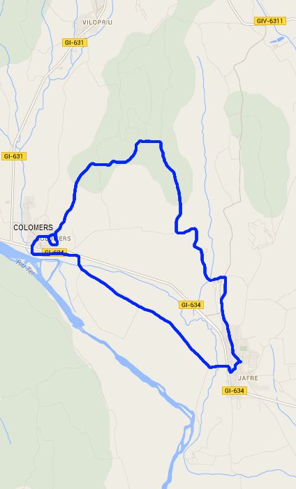
 After a brief tour of the village we follow a pebbled path up the outside of the what would have been the old walls to the top of the village and then cut onto a track that takes us into the woods beyond. It's a pine wood with sandy ground under foot and very open and spacious. For October, the day is surprisingly warm - into the upper 20s and the shade from the trees is welcome. A little way of the village a red squirrel scampers up one of the pines with our dog barking at it loudy from the bottom of the tree.
The path through the woods is one of those walks you like to take without necessarily having any highlights. Just an enjoyable hike surrounded by nature with no-one else about. We pass the top of a field and then come to a crossroads. The one problem with the woods, is that it's not quite clear which path is which, so we just follow our nose straight on, not particularly worrying if we get slightly lost. However, we're about right and we wind our way into the woods. At the next junction a little further on, the tracks are bigger to give access to timber lorries and there are signs of wood clearing all around. In these sorts of woods, during summer fire is a continual risk, so the woods need a level of management to reduce the fire-risk. However, the lumbar tracks don't help with directions so we continue, just about making our way to a path that runs along the top of a wooded hill turning south towards Jafre.
 The path emerges into fields and a pig farm. Across the fields are buildings - these were going to be a thermal spa. Apparently at one point they were doing test drilling for oil, but they didn't find it. Instead they discovered hot water. So the intention was to build a baleanari fed by the hot water. At least that was the plan until the money ran out.
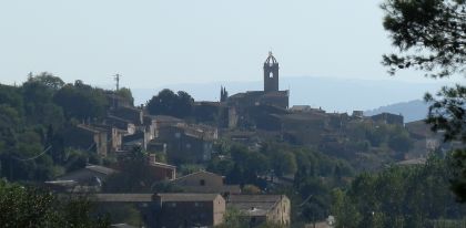
We walk into Jafre along the upper road. From the geography it seems that this might have been on the upper bank of an ancient lake from millions of years ago. Maybe the Ter or the sea were much much higher then. But enough speculating, we enter what is a relatively linear village and walk to the church, with the old castle building attached. Jafre is more work-a-day than Colomers but retains it's older buildings.
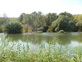
Hot from the sun we rest on a bench next to the church, before walking down the hill and out to the flat of the Ter's floodplain. The path doesn't connect us to the river though and we walk through fields recently stripped of maize across to Colomers, stopping to visit the bird hide that looks out over the river and weir.
Neighbouring walks: Vilopriu and Valldavia - Rupia and Foixa - Verges, Tallada d'Emporda and Maranya - Sant Jordi Desvalls, Colomers and Sant Llorenç de les Arenes


 Walks and other things