Montgri Massif from Les Dunes L'Estartit
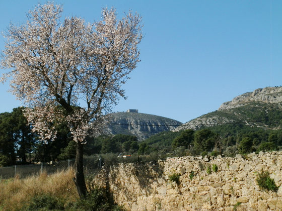 Montgri is probably the most iconic mountain of Emporda rising above the surrounding plains visible for miles in any direction, characterised as a reclining lady with its isolated castle acting as a beacon and signpost for visitors and migrating birds.
We have touched on Montgri in several walks in the past, but not really done justice to the mountain itself. For this walk we're following a route from Urbanisation Les Dunes, situated between Torroella de Montgri and L'Estartit, up to the top and along, then back down to Torroella to complete the loop along the flat.
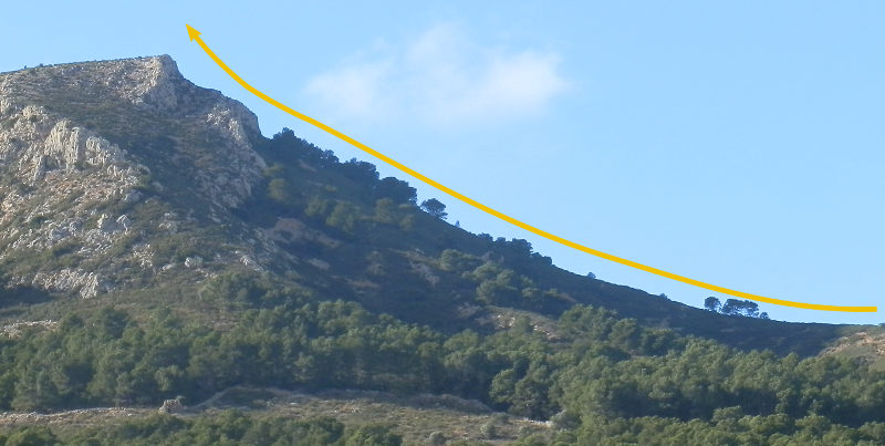 Though Montgri looks benign from below, in practice this is a challenging walk, particularly if you don't like heights or steep climbs. And unfortunately that includes me, so this is a walk that has parts I don't like - it's actually the second attempt to complete it, and even then, we didn't do the whole walk as I'll explain.
Montgri rises to 311m, so it's not that high as mountains go, and is a dry, relatively barren and rocky with vegetation limited to low holly and rosemary with plenty of loose stones and rocks underfoot. Even if just going up to the castle from Torroella, Montgri is a mountain that requires proper footwear.
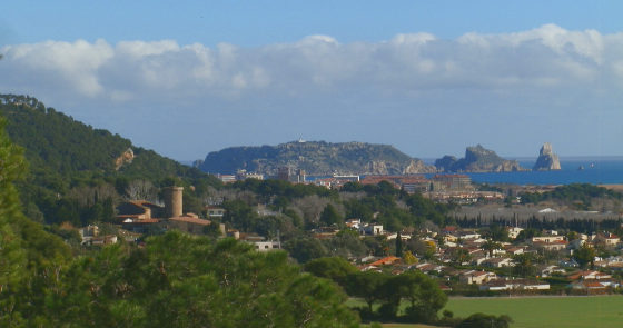 The walk starts gently, Les Dunes urbanisation up to the house of Les Dunes midway up is a walk on soft sandy paths through the cedar pine woods with views out to the Illes Medes and L'Estartit, and across the rice paddies around the Ter river.
At the house at Les Dunes, is a small picnic area and some parking, and views across to Cap de Begur. For walkers the Col de Sorres links paths to L'Escala and Sobrestany over the hills, with the main east-west path up to the mountain.
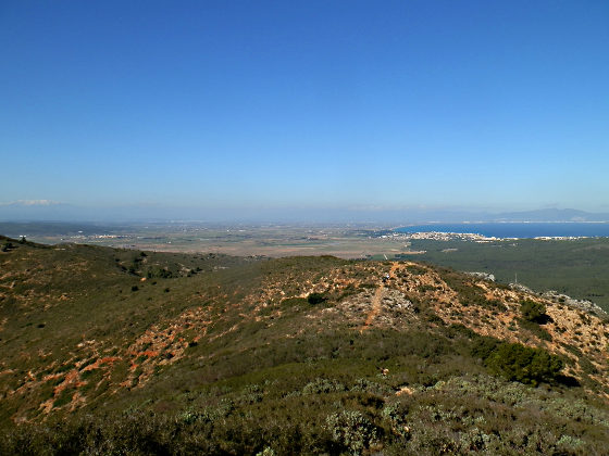 We take the path up, and soon we have left the trees behind us, and are fully on the hill, with the ground changing from softer soil to thumb and fist sized rocks lying loose on the ground, that slip and crunch as you walk on them.
The path steepens as it goes up - one of the features of the paths from this side is that they are steeper closer to the top. If you have a sensitivity to heights this generally means the walk will get worse for you the higher up you go.
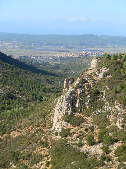
The low scrub means that anywhere you stand you can see clearly in all directions with nothing to obstruct the view. The views initially are best to the left and behind to L'Estartit, but quickly you get to see the view over the Bay of Roses with a grand vista that takes in Cap de Creus and out to Figueres and the Albera mountains, and then on to Canigou currently topped with snow.
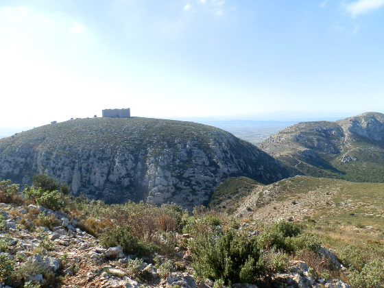 The path continues to go up. Ahead you will see a small white cabin - this is roughly the direction we'll take. The cabin is just above an escarpment, but our path will pass underneath and then come up from the other side. However, before then we have to keep going up. The higher we are, the more it seems the sides of the hill fall away, and we catch the wind blowing across the mountain.
Nothing is dangerous or difficult about the climb, but the height and steepness are uncomfortable for someone who doesn't like steep heights.
 Eventually the path reaches a point under the escarpment and levels out tracking under the rocks above. The hillside falls away to the right but no sharp verticals, though clearly you feel high up. Across the mountain you can see remains of a strange small stone hut, and out in the distance see the watch tower at Montgo.
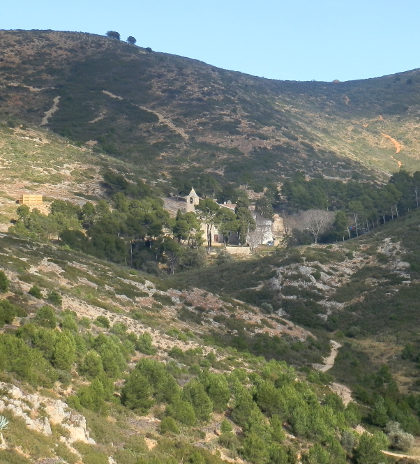
After passing along the flat path, we come to a T junction. The left hand path goes up into the escarpment and onto the top of the long flat peak of Montgri if you were looking from the bottom (Montpla). The right goes down and eventually reaches the church of Santa Caterina lower down, situated within the folds of the massif.
 If you are walking and finding it uncomfortable because of the height, this is the first opportunity to find a different route down. There are very few connecting paths, so once you are on a route, the only other alternative would be to go back. The first time we did this I took this lower path, while the others I was with continued over the top.
This time we head up through the last of the rocks, coming out on a large rounded top for the mountain, with views in all directions but the same scrub and low vegetation, so not really a comfortable place for a picnic or to sit and take a breath.
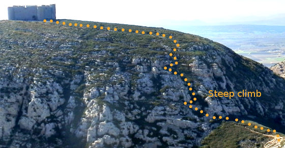
Instead, we carry on along the top and then track down, past a small Catalan flag. We can clearly see the castle ahead of us on the neighbouring peak, and the path to get there. And we can see that this is not going to be a path I'll take.
 We follow the track down to the saddle point between the two peaks and ahead of us we can see another couple making the route up to the castle. From where we look the path goes up through the rocks and is steep with a drop.
Fortunately there is an alternative, to the right is a steepish path in loose scree that will take us down into the valley at the bottom. There are no other options. Ahead is a family with children who also look as if they decided the climb to the castle was not for them. This is not a good path - the loose rocks slip and roll under foot, however, the only other alternative would be to go back over the first peak and down.
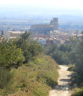 After a rough scramble down, we get to the bottom and the main path to Santa Caterina church. The church is also the site of a restaurant and attracts visitors in the summer.
We head to the left, and to the saddle point with the cross that sits under the castle on the main route up from Torroella town to the castle at the top. From here, we then track back down to Torroella - the path remaining rocky and rough under foot, until you almost get down as far as the olive groves at the bottom. We turn past Sant Gabriel school on the road, past the football ground and out along the flat path past more olive groves and eventually past fields back to Les Dunes.
Neighbouring walks: L'Estartit to Cala Pedrosa and Cala Ferriol - Torroella de Montgri castle - Gualta, Llabia, Fontanilles and the lake of Ullastret - Pals beach to Gola de Ter - Sobrestany, Montgri and Bellcaire d'Emporda - Torroella de Montgri to Gola de Ter - Bellcaire d'Emporda, Tor and Albons - Torroella de Montgri and Ulla

 Walks and other things