 Walks and other things
 One of the joys of the Costa Brava is the variety of landscapes and we like to visit places and walk (a lot), particularly into and around the Gavarres. Sometimes we travel around on bike. In the summer, we swim and canoe.
These then are write ups of walks, hikes and activities that we've done since November 2012, with photos straight from the original walk or activity.
We like to make circular walks and our walks range in length from about 4km (an hour) to around 16km (four hours) - but probably about 2 1/2 hours on average - though if you want to reduce the length, there are usually shortcuts.
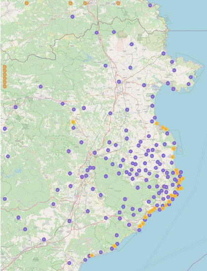
To find walks by location, click on the map, which goes to a full sized map with links to individual walks and visits. To our surprise, we were listed in the Sunday Times' Essential Costa Brava (Feb 2017).
The most visited walks are:
- Calella de Palafrugell/Cap Roig to Castell - classic wild Costa Brava
- Far de Sant Sebastia (Llafranc) to Tamariu
- Platja d'Aro and S'Agaro
- Sa Tuna, Cap de Begur, Begur
- Eulogy to the Ruta del Tren Petit (Palafrugell, Palamos, Mont-ras and Vall-llobrega)
- Fornells and Aiguablava walk (GR92)
- Mont-ras to Calella de Palafrugell and Llafranc
- Platja de Castell and La Fosca
- St Antoni de Calonge, Torre Valentina to Platja d'Aro (almost)
- Escala, St Marti d'Empuries and beyond
- Bell-lloc and Castell de Vila-Roma (Palamos)
- Platja Sant Pol to Sant Feliu de Guixols
- Roses - Canyelles beaches to Cap Falconera
- Blanes, Lloret de Mar, Tossa de Mar by GR92
Girona and Castell de St Miquel
One of the times I didn't have a camera, but the walk is good. You'd be surprised at just how easy it is to get out of Girona and into countryside. The motivation for the walk was driving along the N II (N2) past Girona - much prettier than the autoroute. As you pass the city midway into the hills you get a completely different sense of the city.
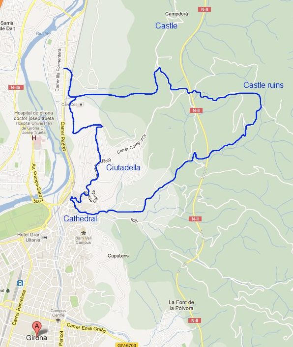
The walk starts in the northern part - the area called Pont Major. We actually parked near the prison, but there's a lot of space. The walk is then broadly straight up in to the hills. The road is signposted to Montjuic and passes under the railway line and for the first 4-5 minutes you need to walk along the road. As the road curves in an inverted U, the path heads up along by a stream. Keep walking up (past the cement factory). On the right of the path is a field with what looks like the world's most dangerous electric fence. Then as you get to the top, the path enters the woods. Keep going up past the farms and you'll reach a T junction. To follow this path go to the right. If you turned left though you'd get to a different castle (at one point on the walk you'll be able to see three - St Julia de Ramis, Castell de Campdora and Castell de St Miquel. The last one is more of a ruin than the other two).
Follow the road to the right past a farm. The first left that you can go down (a broad drivable track) takes you down to a bridge over the main N II road. Across the bridge take the first right and follow the track up - it's quite steep in places. At the top of the hill you'll find a smaller track that winds up to the ruin of the castle. It's quite tumbledown and overgrown. From here you can make your way down via the main signposted path - follow the sign post to Barri Vell. As you come out of the trees you suddenly see Girona laid out in front of you and the Cathedral between two hills. As you go down the valley you pass under the N II this time, close to a large white sculpture. The path opens out and you follow the stream down. It takes a while to reach the outskirts of the city - there is no building until you reach the old monestary of St Denis then it follows old streets to the back of the Cathedral.
We completed the walk by immediately turning up the hill to Montjuic. This is a modern estate now but at the top you can find the ruins of the old Girona Ciutadella. This is a large castle or fort with very big earthworks and walls as defences. Built for the wars between France and Spain around 1610-1659 - part of the extremely complex Thirty Years' War and the Catalan Reapers War (Catalan Revolt). These Ciutadellas can be found in the main Catalan towns (Rousillion in France was Catalan until 1656) - Barcelona's was in the Park de la Ciutadella, Girona, but also Roses, Perpignan - the Palais de Rois de Majorca - and as far north as Salses castle.
Neighbouring walks: Roman fort at St Julia de Ramis (Girona) - Celra, Juia and the Castle of Palagret- Girona valley of Sant Daniel - Gavarres Montnegre and Montigalar - Ruta del Carrilet - Girona cyclepath to the coast - Bescano, River Ter and free-style kayaking - Girona and Castell de St Miquel - Roman fort at St Julia de Ramis (Girona) - Girona - Festa Major of Sant Narcis
Visit to Besalu and Banyoles
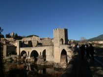 Besalu is a medieval town on the way into the mountains. It consists of a grand stone fortified bridge and a town full of curiosities and small crafts shops. The town sort of tumbles down to the river through the old historic jewish quarter. While around the church and main square it's quite common to have flea markets.
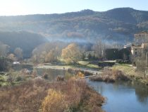 Through the narrow streets are oddities like chairs on the walls and from almost every quarter the bridge dominates. The bridge itself is a rennovation - the original was blown up during the Spanish Civil war - you can still see the old stong in the river below. In the summer you can walk along the river and see hops growing wild.
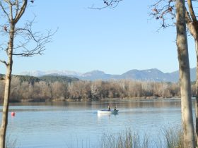 On the way back we called in on Banyoles. Banyoles is a famous town and fresh water lake just outside Girona. The lake itself can be walked around in a couple of hours and has a many boathouses on jetties stepping out into the water. You can swim in the lake but only in summer - the rest of the year is mainly for rowing.
Other visits: Arbucies autumn walk - Caldes de Malavella - Visit to Roda de Ter and Espinelves - Visit to Setcases - Canet d'Adri - Olot - capital of Garrotxa
Swimming: Swimming at Lake Banyoles
Mont-ras to Calella de Palafrugell and Llafranc
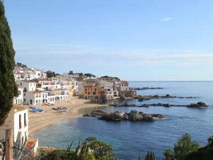 Calella de Palafrugell and Llafranc are two of the prettiest fishing villages on the whole of the Costa Brava with great restaurants and are almost totally unspoilt with no high-rises or other monstrosities.
As resorts they are chic and upmarket. Llafranc for instance has a Michelin starred restaurant. (Quick warning - don't mix up Calella de Palafrugell with the uglier Calella on the relatively feature-less Maresme coast on the way to Barcelona ).
There is an easy headland walk between the two villages that, in the summer has a steady flow of strollers and holiday makers enjoying the view of the cristal clear water.
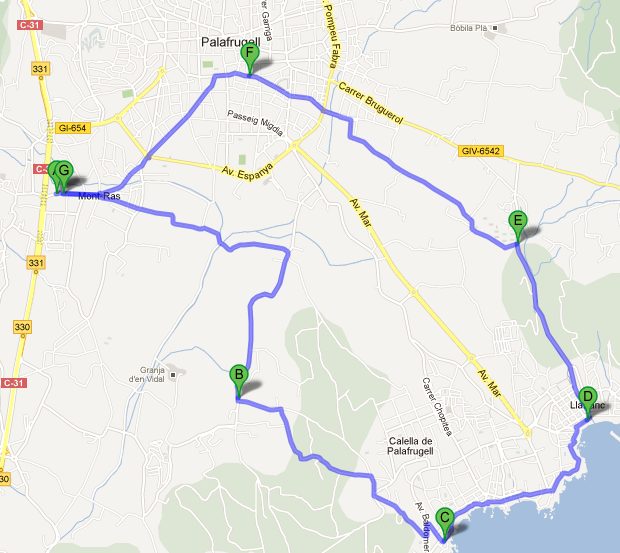
This time though we take a longer version bringing in more of the surrounding countryside (this version is about 12km in length). It's relatively easy to take shortcuts if the thought of a longer walk is too much.
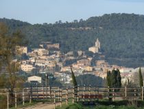 Instead of starting at the coast though, we start in the older part of Mont-ras just off the C31.
Mont-ras is a little known village/district bridging the gap between Palafrugell and Palamos, but offers an excellent range of walks and cycle routes from flat and simple to adventurous in the Gavarres.
From Mont-ras walk out across the fields initially along the route of the Tren Petit (La Ruta del Tren Petit). The path was established in the areas of the route of an old small-gauge train line that used to run from the mainline railway at Flaca through La Bisbal to Palafrugell and then to Palamos.
 The line was discontinued in the 1950s or 60s, but is fondly remembered by older locals. The train itself was very small - so small they say they passengers had to get off to allow the train to climb the rise through Torrent/Llofriu. Famous local Catalan writer Josep Pla wrote of the amazement on visitors faces when they first saw the size of the train.
Now the Ruta del Tren Petit is a very pleasant path and cycle way through the fields that joins Palafrugell, Mont-ras, Palamos and Vall-llobrega to the beaches of Calella, Golfet, Castell and La Fosca.
We walk and cycle this area very regularly as there is such a variety of landscape within such short distances. The path is flat and quiet and we follow the path to the junction at Mas Roja - an imposing large farmhouse with a tower glued to one corner.
At the crossroads, the main Tren Petit route goes to the right. This time instead of following the Tren Petit route too far, we continue past Mas Roja to meet a tarmac/concrete road at the next crossroads.
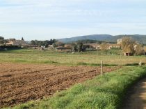
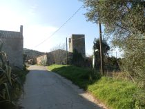 Following this to the right takes us down to the hamlet of Ermedas, a small hamlet in the plain with old farmhouses and a small chapel and field with horses.
Just before the chapel in the village between two houses is a turn to the left towards the woods.
Follow the path across a small stream (which is dry in summer and has water in winter), then a gentle climb into the woods past hidden houses fenced in and surrounded by cork trees.
Keep going through the woods and eventually you reach the top of a small hill and the outskirts of Calella village and the first houses, and the first glimpse of the sea.
 Even in winter, out of season, Calella retains its charm, though it can be very quiet in winter. The houses mostly have gardens and flowers like Bourgainvilla continue to bloom through the winter months and the village remains spotless and litter free.
Follow the road/footpath as it takes you down the hill and into town - you can see the church in the centre from the top of the village.
The path should take you past Moby Dick's Campsite, still not entirely empty even in December and down to Port Bo.
Take the time to admire the view from Hotel Mediterranean before taking the promenade along the cliff then down to the restaurants and fishing boats in the tiny bay that is used for the Festival of Haverneres (Sea Shanty) in summer.
There are three or four restaurants here and even in December there are a few people taking coffee in the sunshine and enjoying the warmth of the sun.
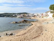 We now follow the classic coastal route to Llafranc keeping close to the sea-line.
Firstly, going past Canadell beach (excellent for snorkling in the summer as the beach is sandy, but the bay is rocky with loads of fish in the water), then up the steps and around the headland.
In winter there are few people about. Two or three people are in swimsuits basking in the sun on Canadell beach, but except for them the village feels empty.
We are always amazed at how few people stay in Calella or Llafranc year round. If it was the Italian lakes it would be bustling with people all year long.
From Canadell beach (Calella) we round the headline and get our first view of Llafranc then walk down the long flight of steps into town.
Some brave soul is swimming in the bay while others watch from the restaurants by the water's edge.
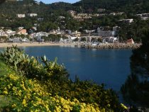 The beach in Llafranc is bigger than in Calella and the bay has a sandier bottom. At about the location of the tourist information booth, you'll see a dry river (probably looks like a grass channel with bridges across it).
Turn up by the empty river and head out and back towards Palafrugell walking beside the road out past the diving centre.
The road itself is more of a back way into Llafranc and it's quiet even in summer and we only see a couple of cars pass us before we reach the turning to the left just before the Llafranc tennis club marked in the direction Palafrugell.
Off the road the path turns to a track again and we walk past the courts and farm houses.
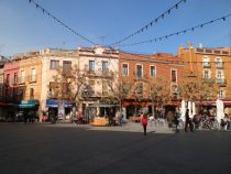 At the junction close to the last edge of the tennis club if you take the left hand fork up a small rise, you can get a view of the Pyrenees behind Palafrugell.
There's not much snow on them at the moment so they don't show up well in the photo, but it's amazing to realise you can see snow and sea on the same walk.
Going back to the main route we head into Palafrugell past the police station before cutting up into the centre.
Palafrugell itself is not so pretty. It was a working town making corks before tourism came in, and during the long Catalan lunch hours (about 1pm to 4pm) it can seem as dead as a dodo.
It comes to life though in the mornings and evenings. In the mornings there are regular markets and on Sunday a big market that snakes from the main Placa Nova out through the town. And then from the centre back to Mont-ras.
Update to clarify the route in Ermedas (see comment below)
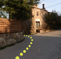
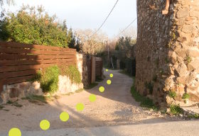
The route in Ermedas to Calella de Palafrugell is a turning between two houses about 30-40m before the chapel.
Though it looks a little like a driveway, the track leads though the woods to the back of Calella de Palafrugell. The photos show the turning and what the track looks like as you approach it.
Neighbouring walks: Calella de Palafrugell/Cap Roig to Castell - classic wild Costa Brava - Far de Sant Sebastia (Llafranc) to Tamariu - Mont-ras 'boar' walk - Mont-ras Fountain walk - Platja de Castell and La Fosca - Palafrugell, Tamariu, Begur residential and Esclanya - Eulogy to the Ruta del Tren Petit (Palafrugell, Palamos, Mont-ras and Vall-llobrega)
Swimming: Swimming at the beaches of Calella de Palafrugell
Torroella de Montgri castle
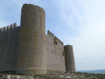 The Torroella de Montgri mountain is one of the distinctive features of the Costa Brava region. The mountain stands isolated and can be seen from as far away as Figueres. In the autumn when the birds are migrating south, they seem to use the mountain and the castle as a reference point before continuing their journey towards Africa.
Torroella itself has an historic centre and at one time was an important port on the Ter, but as the bay of Pals silted up and land was reclaimed, contact with the sea was lost. Now you have to go to L'Estartit to reach the sea. The mountain itself separates the bay of Pals to the south - a long long sandy beach that stretches down to Begur, and to the north the bay of Roses/Escala.
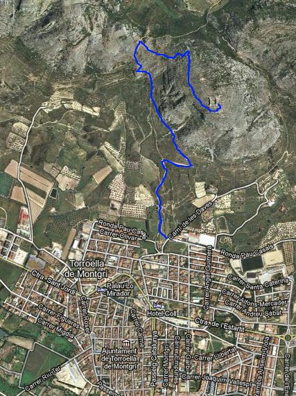
Montgris itself is a very rocky mountain and to reach the tower on the top you have to walk (I once tried to drive and got the car stuck because I had to reverse down the narrow gravel lane that I thought would go all the way up). The walking though is relatively difficult - the mountain is dry and the large stones slip and roll under foot or penetrate all but the sturdiest soles (of the shoes). It's definitely not a walk for flipflops.
The walk itself starts by St Gregory school - this is a private Catholic school in Torroella which apparently has a good reputation and is popular with ex-pats. The path is sign-posted and you immediately climb off the road and onto the path above. The walk is hilly and steep. It broadly has two parts the first part up to a ridge past a hermit's house. At the top of the ridge is a small cross. On one side you can look South towards Palamos and Platja d'Aro in the distance and to the other side look North towards Figueres and the French border.
The main path up to the tower is something of a long scramble from the ridge to the top - even more rocky that the lower part of the walk. The path zig-zags up and at time is difficult to keep track of what is path and what is just scattered rocks. Eventually it reaches the top and plateaus out. The tower itself sits on a broad flat area but with little vegetation. There is the remains of an old cistern cut into the rock to try to provide water but it is generally dry and barren. If there is a wind blowing you will definitely feel it since the area is very exposed. The climb up can make you quite hot and sweaty, but outside warmer parts of the year take a jacket to keep out the draft.
You can go into the tower and climb the walls, though there is little here apart from the walls themselves. The plaque describing the tower's history says it was abandoned before being fully finished. The views though can be amazing. Ideally pick the clearest day you can find. You can look across the plains towards the Pyrenees in the distance.
The walk down is pretty much the same as the walk up. There are alternative routes but be aware that if you do walk down the other side, it's a relatively long way to reach a main road to get back to Torroella.
Neighbouring walks: Montgri Massif from Les Dunes L'Estartit - Sobrestany, Montgri and Bellcaire d'Emporda - L'Escala Riells to sea cliffs and viewpoint of Montgo - Gualta, Llabia, Fontanilles and the lake of Ullastret - Pals beach to Gola de Ter - Torroella de Montgri to Gola de Ter - L'Estartit to Cala Pedrosa and Cala Ferriol - Bellcaire d'Emporda, Tor and Albons - Torroella de Montgri and Ulla
Platja de Castell and La Fosca
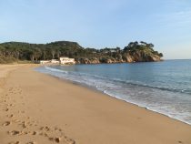 This is another classic Costa Brava GR92 coastal walk between Platja de Castell and La Fosca, just north of Palamos.
Even though we do other walks, sometimes just walking by the sea is just right. Particularly in winter when the sun is out, it's warm but the beaches are empty and there is no noise except for the waves breaking on the shore.
This walk starts in Platja de Castell - an isolated but large sandy beach that has been left deliberately unspoiled.
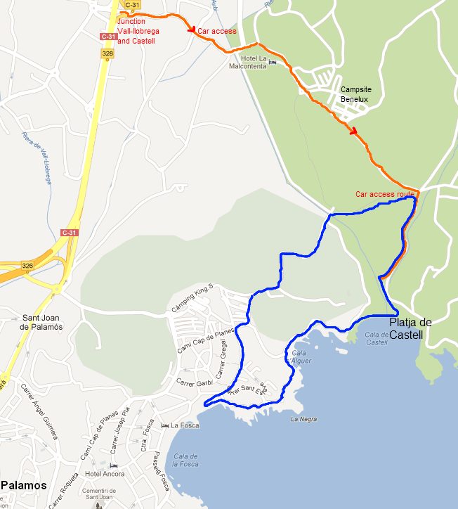
Access is along a lane from a junction off the C31 and there is plenty of parking at the bottom of the road.
You can walk in either direction from the beach - either into the hills towards Cap Roig (for another day), or head South around the costal path towards La Fosca.
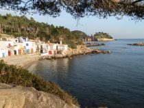 The walk itself is easy and flat around a couple of headlands where fishermen's huts snuggle into the bay hidden except to walkers at Cala S'Alguer.
Above the start of La Fosca beach are the ruins of the Castell de Sant Esteve de Mar - a former seat of the lords of this area.
In the water beneath the castle, the snorkelling and diving are excellent though it would be too far to swim from the main La Fosca beach.
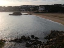 La Fosca itself is Palamos's hidden gem. Two sandy arcs reach into the bay separated by a solitary rocky presque-isle.
Behind the beach are low rise residential buildings laid out tastefully without disturbing the scenery including older modernista buildings.
If your impression of Palamos is more of the high rises along the main St Antoni beach then La Fosca is a complete contrast - a gentle cultured location with people playing boule by the beach.
In summer the water is shallow making it an excellent beach for children, though at times in the height of the summer the water can be clouded by harmless but naturally occuring algae as the water termperature reaches a maximum.
For the walk back we head out of La Fosca to the top road. A signpost points back towards Castell passing around Kings Campground.
The walk passes the back of some old beach-side mansions before crossing into fields and then a small wood with a bridge crossing the stream that feeds Castell. In summer in the stream is usually dry, but in winter particularly after heavy rains, the stream is strong enough to divide Castell beach into two parts.
The footpath joins the bike path (part of the Petit Tren route from Palafrugell) and then back down to the car park.
Update 2021: The Cami de Ronda route between La Fosca and Platja de Castell has been updated making it a little more of a strolling path, and the area around Platja de Castell has been overhauled moving the car park further back from the beach and making the whole area feel much more natural.
Neighbouring walks: Calella de Palafrugell/Cap Roig to Castell - classic wild Costa Brava - Mont-ras to Calella de Palafrugell and Llafranc - La Fosca to Palamos - Bell-lloc and Castell de Vila-Roma (Palamos) - Eulogy to the Ruta del Tren Petit (Palafrugell, Palamos, Mont-ras and Vall-llobrega)
Swimming: Swimming and beach at La Fosca
Monells and Mont-negre
 It's probably fair to say that the prettiest villages in Catalonia can be found around La Bisbal d'Emporda. La Bisbal is the 'capital' of Baix Emporda and seat of the bishops of Emporda. In the Middle Ages, this area was fertile and rich in farms and being inland was less open to attack from the sea by the pirate raiding parties.
The villages however kept their basic defensive structure of a continuous terrace of houses acting as a defensive wall that encloses in a central town or village square. However this means if you want to see the real ancient heart of the village you have to get out of the car - modern roads skirt the villages leaving the gems of gold-coloured stone houses and cloisters hidden inside, out of view from the road.
Monells is exactly one of these types of town. The main road passes through past an unprepossessing church and a tourist office for the Gavarres. Driving through it doesn't look anything special. But if you get out of the car and cross the river into the centre of the old village all of a sudden you are met by restaurant tables spilling across a cobbled town square with alcoves and arches providing shade from the sun.
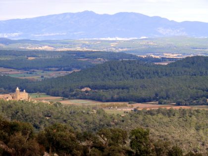
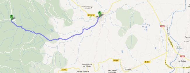
Our walk (c10km) starts in Monells and follows the river out of town towards the Gavarres. To begin with the walk is relatively flat past open farm countryside with old Masia farm house and patches of woods. The walk is pleasant if not spectacular. In the woods the main drive-able path stops and the climb up starts in more earnest. The path is broad but stoney, so good shoes are advised. As you climb the views across the plain of the river Ter come into view. On a clear day Roses and the Pyrenees are visible. The vegetation changes from broad woods to something more sparse as the Alzinas thin out. Towards the top the path switches from one side of the ridge to another giving you views in all directions. Mont-Negre at the top can be reached by car from Quart, but as one of the girls wasn't feeling well, unusually for our walks we came straight back down the way we had come.
Neighbouring walks: Cruilles, Monells and Sant Sadurni de l'Heura - La Bisbal, Vulpellac, Castell d'Emporda, Fonteta - St Pol de Bisbal and Santa Lucia - Corça, Casavells, Matajudaica - Celra, Juia and the Castle of Palagret - Madremanya and Millars - Monells spring walk in the woods
Fornells and Aiguablava walk (GR92)
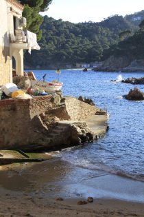 Fornells and Aiguablava are small coastal locations in the municipality of Begur heading out towards Tamariu.
Aiguablava, where we're starting, is a small sandy beach under a Parador (a particular type of historic Spanish hotel) and is an archetypical sandy bay beach with turquoise sea under rocky cliffs, and is the main beach used on the adverts for Begur and its blue Mediterranean waters.
At the other end of this walk is the village or hamlet of Fornells (not to be confused with the village of the same name just outside Girona) is right on the coast and almost tumbles into the sea with a small pretty harbour cut into the rocks and two older Costa Brava hotels.
This is a walk we do regularly out of season, taking in one of the luxurious hidden corners of the Costa Brava past a variety of large houses and villas that seem to nestle into the sides of the hill above the sea between Fornells and Aiguablava.
If it was summer, Aiguablava's car park and small exquisite beach would be full, but in December, when we are walking, it is empty, with practically no-one around.
This is one of the joys of the Costa Brava. Once the holiday season is over you pretty much have the place to yourself with the most beautiful spots shimmering in the winter sun, empty of anything but sand, sea and scenery.
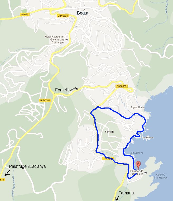
The walking route we are taking follows the GR92 coast road (marked with red and white stripes on the paths). We tried the walk last spring (2012) only to find a rock fall had closed the path above the Aguablava end. This winter the path has been replaced with a short bridge over the gap.
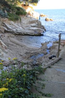 So we start at the Aiguablava car park. The actual path, like many others here, might not be found on Google Maps - some times Google misses connections so it's not so good for walking off the beaten track, however, the route and GR92 is marked on walking maps and when walking the GR92 is marked by red and white flashes. The maps we normally use to check out routes are the Emporda Costa Brava 1:30,000 series, but even on these maps you'll find routes that aren't completely marked.
From Aiguablava (blue water) we follow the beach to the left and up steps over the cliffs to the next bay, full of large pebbles and rocks in complete contrast to Aiguablava. Being winter and so a bit wetter here, a small stream tumbles through the pebbles down to the sea and a small pile of whitened driftwood has washed to the back of the cove.
From the bay, the path then goes under a covered walk way beneath a luxury villa up a tunnel of stairs before emerging higher up just outside fields and an olive grove.
The path is larger and turns down into a pocket of terraced fishermen's cottages of Fornells so closely packed it feels like you're walking in people's yards. The red and white stripes of the GR92 are a reassurance you're on a genuine path.
Below the cottages, the path reaches a tiny little bay with barely enough sand for a sandpit and traces the rocks under the village before turning more cottages and up to the harbour and hotel above.
If you keep walking around the harbour you can continue across the rocks to another narrow cove where the rocks are in a chessboard of dark and light.
You then run into a natural looking 'infinity' pool (Es Cau) that uses the natural rocks by the sea with hidden wall to give the contrast of the still pool water with the sea beyond (it's a private pool).
Finally head up to the road and back out past the pristine gardens of the larger houses here. The final bit of the walk runs along the main road. Not so pleasant but not busy at this time of year.
Update 1: If you're walking this in reverse - Fornells to Aiguablava, someone has removed the signposts just below the orange houses as you leave Fornells. The path runs up the stairs and through what looks like the yard of the house.
Update 2 (2022): The path up from the 'sandpit' beach mentioned in Update 1 has been amended so there is now a set of stairs leaving the beach, so you don't have to go through the yard of the house (which is now fenced off) and provides some pretty views back across the beach.
Neighbouring walks: Sa Tuna, Cap de Begur, Begur - Palafrugell, Tamariu, Begur residential and Esclanya - Far de Sant Sebastia (Llafranc) to Tamariu - Begur, Ses Negres and Sa Riera
Swimming: Swimming at the beach at Aiguablava
Events: Begur - Festa d'Indians
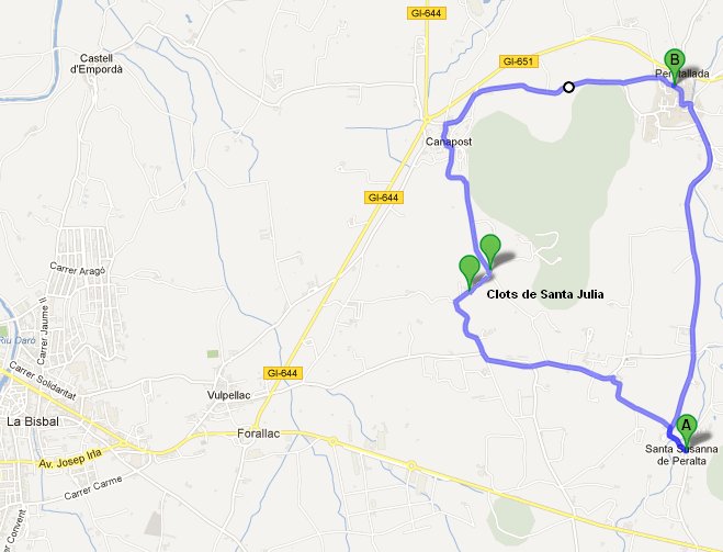
Clots de Sant Julia (Vulpellac)
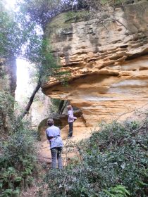 The Clots de Sant Julia are a collection of spectacularly coloured small-scale pre-Roman quarries located just outside Vulpellac close to La Bisbal d'Emporda (a clot is a hole in Catalan). We'd seen it marked on a map without being able to find very much information as to what to expect, so to make a walk of it we parked at Sant Susanna de Peralt and walked out.
The walk (7.5km) is pretty flat past open fields with the Gavarres in the background and the castle and outside of the historic village of Peretallada to our north as we walked past a number of very large masia estates. To get to the Clots, the path turns up into a wood and initially the only visible sign that you've arrived is a board describing the Clots with no clear direction of where to go or quite what to look for. So we headed into the woods along some narrow paths. To the left we saw the first quarry pit - nothing much to look at. Then suddenly you turn down into a second pit at this great wall of bright yellow sandstone almost jumps out from the trees. The sandstone is soft enough to rub away with your fingers and so it has wear marks where previous visitors, and probably the original quarry makers had come for the colour and quality of the sand. The site is not too large and well hidden within the tree cover. Someone had laid sticks to mark off the edges of the pits so you wouldn't get too close, but most of the pits are 3-4 metres deep so nothing too steep or dangerous.
On leaving the Clots we followed the GR92 - the great Catalan coastal path (even though we're several mile inland) to Canapost - a golden stone village and from there to Peretallada with moat, bridge, castle, coves and myriad of restaurants in amongst the stone houses and cobbled streets. It's one of the most famous Catalan historic villages - though perhaps not that well known by foreign visitors.
Neighbouring walks: La Bisbal, Vulpellac, Castell d'Emporda, Fonteta - Canapost, Poblet Iberic and Ullastret - Palau-sator and Peratallada - Santa Susanna de Peralta and Sant Climent de Peralta - Llofriu, St Llop and Torrent - Mont-ras to Fitor and on to Fonteta and Vulpellac - Canapost to the medieval fair at Peratallada
Pessebres
Pessebres are nativity scenes that, in Catalonia at least, become very elaborate and large displays often taking in some aspects of local life. The village of Mont-ras just outside Palafrugell organises a competition of Pessebres each year with around 15-20 nativity scenes designed and made by local people, on display.
Pessebres aren't the only Christmas nativity scene. Several villages also have living nativity scenes on certain evenings close to Christmas with actors playing the part of Mary and Joseph.
Christmas is also celebrated somewhat differently from Northern Europe. The traditional Catalan christmas dinner is usually a vast assortment of fish eaten and a special selection of pasta de navidad cooked in caldo (stock). It can feel strange to see supermarkets advertising shellfish for Christmas dinner, and turkeys can be extremely difficult to find as a traditional English turkey dinner is definitely not on the Catalan menu.
Having said that, some aspects are creeping in. Traditionally Catalans do not have Christmas trees (the northern Spruce pine is not a native tree here), instead they have a caga-tio. That is a little log with a red barretina cap (the traditional catalan cap). The tio is covered by a blanket and the children hit the log with a stick and it 'poohs' (literally the meaning of caga) sweets for the children. It's not the only thing poohing at Christmas. In the traditional nativity scene there is normally a small figurine squatting with its trousers around it's ankles - usually based on some current famous person or celebrity.
Comments | ||
adam@veggingoutwithadam.com |
17 Feb 2014 19:46 |
|
What a great blog. I am planning a walking holiday in the region and wonder if you can recommend the best walking maps, like UK ordnance survey ones. I shall be reading more of your walks over the coming days as we plan. Many thanks Adam | ||
Saul |
24 Feb 2014 17:25 |
|
Glad you're enjoying it. We have recommendations for maps in our 'Advice and FAQ' section | ||
Saul |
13 Jul 2017 12:46 |
|
Sorry I missed the comment, so I hope it's not too late - use the contact box if you'd like to send a message. For the coast, the GR92 is best and if you have driver you can just take it piece by piece. For hikers, around Cap de Creus is great, though it can be dry and hard walking in summer. For us, the stretch between Palamos and Palafrugell and on to Begur is the prettiest part of the whole Costa Brava and really good for walking. I'd probably also take the walk up and over Montgri, possibly starting at Pals, or L'Estartit to L'Escala. And though you said you prefer the coast, don't overlook inland routes as there are some wonderful villages and countryside out towards Girona, La Bisbal, or Olot. | ||
Sven-Gunnar Furmark |
24 May 2017 11:43 |
|
Hi, My name is Sven Furmark. I am from Sweden. I plan to go to Costa Brava with some friends (totally about 10 people) for hiking for one week (5 walking days). We are experienced hikers and we usually walk 4-6 hours per day. We prefer to walk along the coast as much as possible. We plan to rent a house and travel to each days hiking with a bus & driver which we plan to book for the whole week. Which five hikes would you recommend for us. Warm Regards Sven | ||

