 Walks and other things
 One of the joys of the Costa Brava is the variety of landscapes and we like to visit places and walk (a lot), particularly into and around the Gavarres. Sometimes we travel around on bike. In the summer, we swim and canoe.
These then are write ups of walks, hikes and activities that we've done since November 2012, with photos straight from the original walk or activity.
We like to make circular walks and our walks range in length from about 4km (an hour) to around 16km (four hours) - but probably about 2 1/2 hours on average - though if you want to reduce the length, there are usually shortcuts.
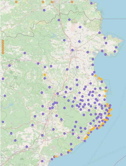
To find walks by location, click on the map, which goes to a full sized map with links to individual walks and visits. To our surprise, we were listed in the Sunday Times' Essential Costa Brava (Feb 2017).
The most visited walks are:
- Calella de Palafrugell/Cap Roig to Castell - classic wild Costa Brava
- Far de Sant Sebastia (Llafranc) to Tamariu
- Platja d'Aro and S'Agaro
- Sa Tuna, Cap de Begur, Begur
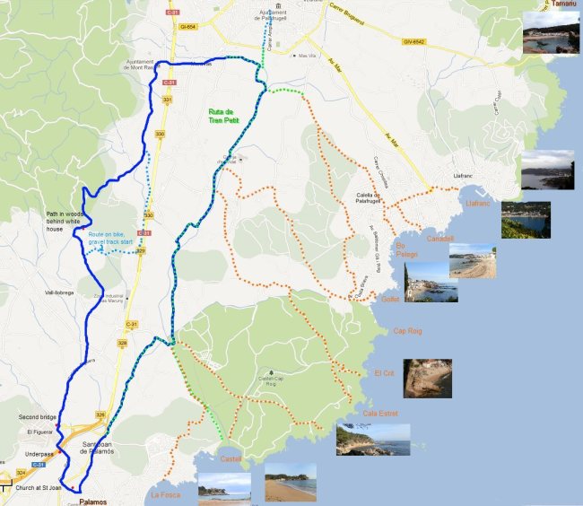
- Eulogy to the Ruta del Tren Petit (Palafrugell, Palamos, Mont-ras and Vall-llobrega)
- Fornells and Aiguablava walk (GR92)
- Mont-ras to Calella de Palafrugell and Llafranc
- Platja de Castell and La Fosca
- St Antoni de Calonge, Torre Valentina to Platja d'Aro (almost)
- Escala, St Marti d'Empuries and beyond
- Bell-lloc and Castell de Vila-Roma (Palamos)
- Platja Sant Pol to Sant Feliu de Guixols
- Roses - Canyelles beaches to Cap Falconera
- Blanes, Lloret de Mar, Tossa de Mar by GR92
Summer thunderstorms
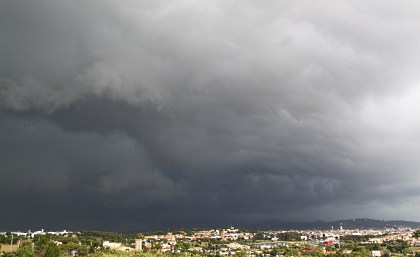 Our experience since we arrived in Spain has been that from around mid-June to mid-September the weather has pretty much been classic summer blue skies with the occasional wispy cloud. This year, we've just had about a week where the heat of the day has turned into big (and quite spectacular) summer thunderstorms by the end of the day. The morning and afternoons have been bright blue sky as normal, but from four o'clock onwards clouds have started to gather until at about 5 or 6pm huge dark storm clouds full of thunder and lightening have passed overhead with some torrential rain and even hail. From what we've experienced before, the storms don't usually come until mid-September at the earliest so these are probably to do with the later start to the summer this year.
We had to go out to Girona airport on one of the days and you could see the storms in the mountains over the airport and as we came back the clouds seem to follow across the Gavarres and across to the sea. It wouldn't be a problem, but when you're working here, you like to go to the beach in the evening - the sea's a bit warmer and it's easier to park or find space. The storms put paid to that idea. There's also a second downside, which is the rain tends to wash a lot of flotsam and jetsam into the sea and it can make the water mucky for the next day too. At least we're not in Barcelona where the storms clear out the indescrible debris of the city into the sea.
Summer on the Costa Brava
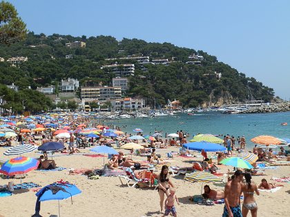 Mid-July and the weather is now officially hot (in the 30Cs). From the beginning of July onwards the roads start to fill from Friday evenings with weekenders up from Barcelona. Naturally there are tourists from across Europe arriving too, but at the start of July, it's still quiet enough to find a car park place. The really busy period starts in the middle of July all the way to the end of August when everywhere is full. But if you're prepared to walk it's still possible to find more out of the way places.
If you've been following the walks, we've slowed down too. We are still walking, but more frequently to the beaches or just in our neighbourhood. Spanish school holidays start at the last week of June and run all the way through to the second week of September - almost three months so we also spend some time travelling back to the UK or more northern parts of Europe. It's actually relatively common and we know of people who do house swaps during July and August. If you're on the Costa Brava all summer, then a couple of weeks somewhere a little cooler where the risk of rain won't ruin the whole summer is an attractive option.
The pattern of walks is also changing. We typically walk to the beaches in the evening, just as everyone else is going. Mid-day, like most people here, we're looking for shade. If you are in the woods or out and about, the tracks and paths are more dusty - your feet get covered by a thin crust of fine dust and many of the streams have dried up.
As we move into the middle of July, there are the numerous festivals around. Calella de Palafrugell has Havarnes (sea shanties) on the beach with people watching from fishing boats lit with candles on the sea. Calella de Palafrugell also hosts the Cap Roig Music Festival. Elton John was due to open, but has called off with appendicitis. Mark Knopfler is playing one of the other dates too.
The local villages also have their Festa Major, the village fete, with activities and naturally sardanes, the national dance of Catalonia.
We want to add some descriptions of the beaches - the types of sand, water, facilities, but we also want some proper photos to illustrate. May be, now the trips are out of the way, we'll follow this up a bit more.
Roses - Canyelles beaches to Cap Falconera
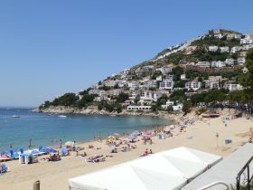 Summer's here. The first gloriously hot day in June with sunbathers on the beaches and the odd intrepid swimmer in the as yet slightly chilly water at the start of the season. We needed to go to the big retail parks just outside Figueres and so took the chance to make a day of it with a walk by some of the smaller beaches past Roses - Canyelles Petites and Canyelles Grans and Almadraba Platja.
Roses itself sits on a broad wide beach that connects all the way around the Gulf of Roses down to L'Escala. We'll include Roses more fully at some other time, but it is one of the main towns on the coast full of French holiday makers, many of which have popped across the border for the day or have holiday houses here as it's only about 40km from the border and closer to Perpignan than Girona. The town has a huge Ciutadella - a walled fortified area that used to surround the old town as Roses had an important strategic and defensive position militarily.
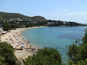 The walk though starts on the other side of Roses at the beaches of Canyelles and then more into the Cap de Creus area. We're two weeks away from July on a blazing hot day and yet the parking is relatively easy. It's always surprising just how short the summer season is. At the height of summer parking would almost be impossible.
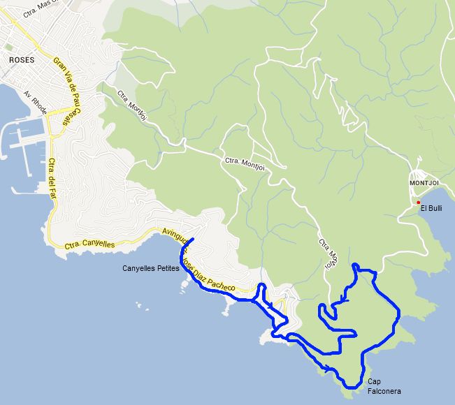
Canyelles has two beaches - Petites and Grosses. Both are fine golden sand with clear blue water and a gentle gradient into the water and are backed by relatively steep slopes peppered with houses overlooking the bay. We join the path (GR92 again) at the corner of Canyelles Petites - for a longer walk you could start from Roses itself. Almost immediately we are walking past one of the many beach-side restaurants. The path curls around the headland past a small string of rocky islets that you can wade across to. There are views everywhere. Straight ahead of us across the Gulf of Roses we can see down to the Isles Medes and make out the castle on top of Montgri. To the right is the beach line that runs along the bay with the huge apartment block at Empuriabrava dominating the beach line. At this distance it looks quite majestic. Behind the beachline are the mountains in the distance fading into the background in the hazy summer air.
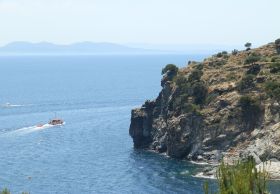 As we walk around the headland various orienteering race competitors come round the headland looking for the next marker on their race. We walk above a water-side restaurant that has topped it's sunshades with palm leaves then pass another string of islets to the right, before turning down to the beach of Canyelles Grosses. As it's name suggests this is a longer beach, but the same golden sand. Behind the beach, almost directly on sand are another collection of beach side restaurants. It's a little early for lunch, so holiday makers are taking coffees and beers at the tables.
The GR92 runs along the beach, but we're walking with a dog and in summer dogs aren't allowed on the beaches. Strictly they're not supposed to be on the beaches in the winter either, but if there's no-one about no-one complains, particularly if you leave the beach as clean as when you arrived.
So to get round the beach we have to climb a long flight of steps up to the road and then walk around the outside. There are more parked cars and it seems that almost every other car is French, and as we pass a group of houses the 'to let' sign is in French (A Louer) rather than Spanish or Catalan.
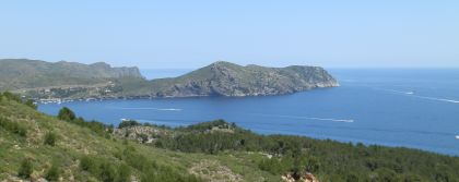 The road takes us around the beach and out to the edge of the estate. We then follow the sign on to a single track path heading towards Cap Falconera. The path is relatively dry with just a few cypressa trees for shade and a rocky shore below us. The path runs up and down following the coast and we have to step aside a few times to let more orienteerers pass. Mostly Cap de Creus is covered in low shrubs so there is relatively little shelter from the sun (do take water, hats and sunscreen). In the bay to our right speed boats are racing around the cape, possibly heading to Cadaques and we can hear the screams and shouts of the passengers as the boat skims and bounces along the water.
Following the path we reach the tip of Cap Falconera. To the right are the houses and villas of Roses. To the left are the barren wilds of Cap de Creus and in the distance boats moored in the bay of Montjoi, where the famous El Bulli restaurant is situated. We continue along the path along the other side of the Cap. Ahead of us, the orienteers have marked off half of the side of the hill and we can see someone competitors waiting with climbing gear - it seems they will have to climb down the cliffs to get one of their markers.
As we walk around the next inlet we can look back and see some competitors abseiling down a cliff-face of 20-25m in height but with instructors present to make sure nothing goes wrong.
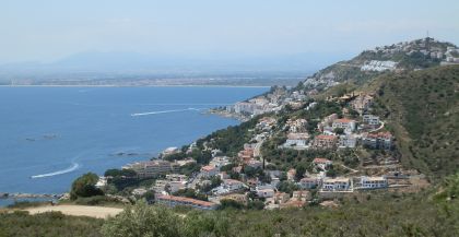 We have to scramble down to the next bay - the dry gravel and steepness of the slope down is slippy underfoot. At the bottom we reach a pebbly naturist beach. It seems isolated apart from the footpath and a couple of boats. Our aim was to walk down to Montjoi, but the path connections back aren't so good and the heat is getting to us (and our dog) a little because of the lack of shade. So we decide to start the loop back a little earlier than planned. It's a straightish route up to the road, though we have to take a right at a T-junction when our instinct would have said go left.
The road is the connecting road from Roses to Montjoi and there are a handful of cars, but being high up the views are immense over coastline. At sea level in the distance we can see a light mist rising around the base of the distant cliffs. It's not unusual to get sea mists in early summer or autumn when the air temperature and water temperatures are far apart.
At the top of the road above Cap Falconera, we decide to take a gravel road down. Again, the connecting paths back to Canyelles aren't so great on the map, so we take the road down. At the bottom is a picnic site and some of the orienteerers seem to have finished and are eating and sharing stories. The road returns us to Canyelles Grosses. This time, being hot and sweaty, some of us go down to the beach and into the water.As the temperatures heat up, the water will continue to get hotter through the summer, but in June it's chilly, though passable. We swim a little then meet up with the rest of the party at the far end of the beach and follow back round the headland to the car.
The restaurants have filled up with people eating great plates of Paella and seafood. We return to the car and head back to Figueres for shopping.
See also: Port de la Selva - Aiguamolls d'Emporda (Empuriabrava) - Cadaques and Port Lligat - Roses and Roses Ciutadella - Cadaques to Roses - Llança - Castello d'Empuries - Figueres and Castell de Sant Ferran - Sant Pere de Rodes
-
Solius, rocks for climbing and ruined castle
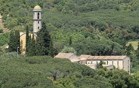 Solius is a small community (more scattered buildings, a small urbanisation and a golf course) near to Sant Cristina d'Aro into the Ardenya hills (confusingly called Cadiretes in Spanish) on the south side of C65 and Vall d'Aro - the hills on the other side of the valley being the Gavarres. We park next to the monastery of Sant Maria de Solius (Google labels it as Sant Agnes), which according to the information board outside is famous for its Gregorian chants at mass.
To reach the monastery the road passes by some well-tended masias and farm fields but the road after the monastery almost immediately climbs into the woods of the Ardenya hills. We're walking in the sun and the first hottish day (26C) of the year. June has just arrived and it feels like someone has just turned the oven up from an unusually cool wet May.
 The route out from Sant Maria is slightly peculiar because it starts as a broad two-lane tarmac road then suddenly turns into a rough dirt track as soon as it reaches the trees, and as soon as it reaches the trees the landscape changes immediately..
The Ardenya's at this area (and behind Sant Feliu de Guixols) are quite barren with a lot of bare rock and with the heat of the day it feels quite arid and dry even though there was rain in the past two days. We have water, but also need to ensure we have sun-lotion on for walking in the summer. The trees around are relatively sparse, most of the vegetation is low undergrowth and as we climb we get views across Vall d'Aro to the sea at Platja d'Aro. After a few hundred metres we notices that the trees, though green in full foliage, have blackened trunks and burnt stems from a forest fire last year. It's amazing though how quickly the vegetation has recovered.
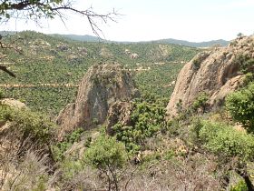
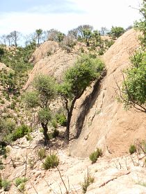 The road continues upward into the hills. Large isolated bare stones of 20-30m in size stand out from the terrain like huge oversized boulders. At the top of the forest path we meet a tarmac'd road. From a previous exploration we know this just leads to a composting centre. We turn to the right and continue into the hills. A few hundred metres on a few cars are parked in a layby and a handpainted sign points to Puig Ponça. We follow the track into the woods and down slightly and emerge at a clearing above a number of the isolated boulders standing like fingers pointing into the air. The map marks this as a climbing area and we can hear climbers around us and see a Catalan flag on one of the fingers.
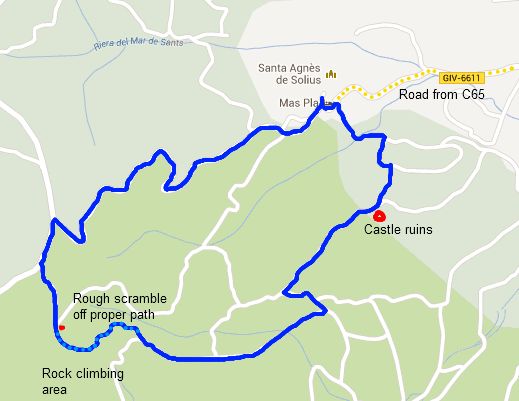
The elevations are not sharp and vertical, but they are smooth on the sides. We're not entirely sure of the path or how to get down so we follow a small track downwards. There is dry gravel on the stone surface and it's quite slippery so we end up scrambling and sliding down in various locations. We can see the path we're trying to reach down below us and just hoping the track we're on doesn't lead to a climbing point at an edge.
Fortunately we find a way through and reach the road and start with the walk back towards Solius. Ahead of us we can see the ruins of Solius castle on one of the jutting rocks. At the second junction we turn left and walk up to a ridge. At the top we can see the path that passes by the castle - part of the standard castle walk for the area.
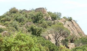 The terrain changes for the second time, shifting from the rough, arid, barren rock-scape to a gentle path under pine trees with a cool breeze blowing off the sea. Ahead of us another family are taking a picnic underneath one of the rocks and we can see pins and clamps knocking into the stone. It's a lovely picnic area with the pine trees and level - ground.
The castle ruins are above us to the left. There really is barely anything left of the castle. Even the steps carved into the rock seem to have worn and fallen away with large tree roots growing over them. It's still possible to climb up though and appreciate the views back over towards the monastery.
The last stretch is into the small urbanisation near Solius where the houses are broadly scattered and as we leave the landscape changes again, back to the fields and grasses as we return to the car.
Update: If you're interested in climbing, near Solius is a Via Ferrata (an 'iron' route across rock faces with iron pins, wire-walks and suspended bridges) at neighbouring Carcaixells and Montclar. An easier route can be found at Gorges de Salenys on the opposite side of the valley by Bell.lloc. There is also a cliff-face via ferrata over the sea just outside Sant Feliu de Guixols
Neighbouring walks: Romanya de la Selva - Romanya de la Selva to Puig d'Arques - Castell d'Aro and estate of Mas Nou - Via Ferrata at the Gorges de Salenys - Sant Grau and Cadiretes near Tossa de Mar - Sant Feliu de Guixols Pedralta
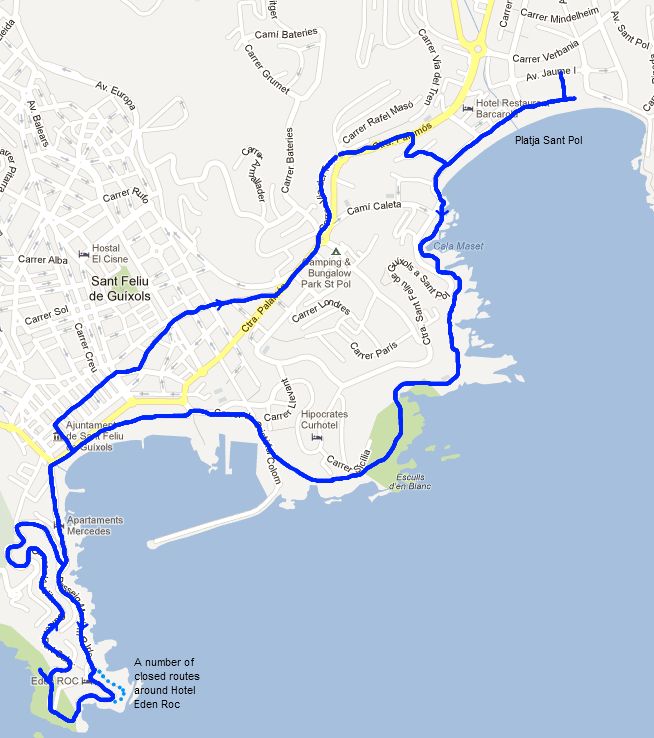
Platja Sant Pol to Sant Feliu de Guixols
 This walk from Platja Sant Pol to Sant Feliu de Guixols in some ways is an extension to the walk between Platja d'Aro and S'Agaro. S'Agaro is just around the corner from our starting point at the beach of Sant Pol. Like S'Agaro, both Sant Pol and Sant Feliu were some of the earliest areas of the Costa Brava that were developed for tourism. Originally Sant Feliu de Guixols was a naval and ship-building town and important medieval port for the Costa Brava area. However as the fashion for water therapies developed, Sant Feliu opened its first spa in 1870 - but based on fresh water springs - not around the beach as such. The neighbouring area of Sant Pol was developed a little later and has a handful of Modernist villas in the style of Gaudi built around 1910-1915, just a little earlier than the development of S'Agaro.
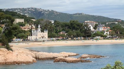 The main beach at Sant Pol is a wide sandy crescent with small hotels and the Modernist villas looking over the sand. The not particularly pretty connecting road between Sant Feliu and Platja d'Aro sits behind this area with no view over the sea, so it would be very easy to drive past and not realise there is one of the most romantic beaches on the Costa Brava a stone's throw away.
We start at the far end of the beach, almost at the point we started the return journey for the Platja d'Aro and S'Agaro walk. Along the start of the beach is a long run of brightly coloured beach huts but the weather this May has been relatively overcast with more rain than usual and though there are bursts of sun, the beach is empty apart from a group of children taking out canoes out on to the water.
 We follow the promenade along the front, passing the three main Modernista villas and the notice board explained when and how they were built. Like many Modernista buildings they are decorated with coloured glazed tiles making mosaics and pattens, with glazed tile roof parts. Two of the buildings are exceptionally well preserved (one is a restaurant), but the third and most notable, with a series of small turrets like a disney-style fantasy castle, is actually in a poor state of repair from close up, though it looks as work is being down for repairs.
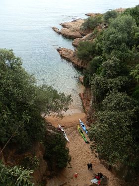
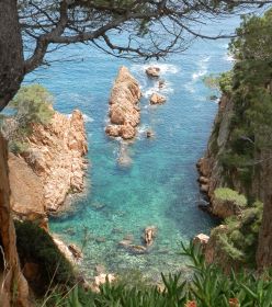
At the end of the beach the path runs out along the rocks of the headland - the GR92 again. To begin with it's very much a maintained footpath with walls to the rock edge and wooden beams helping create steps. However, as soon as you're off the main beach the views are remarkable with gold-coloured rocks and clear turquoise water inlets into tiny inaccessible beaches. Around the first headland is a tunnel made into the rocks, with an exit to the Mirador del Tunel from where you can look back over the Platja de Sant Pol across the rocks.
The path, though maintained, climbs up and down as it runs around and across the inlets climbing up to the road that connects the flats and houses above the bay. After we leave the road for the last time, the path turns more into the woods and is more of a natural trail almost feeling completely isolated from the surrounding houses. The path climbs up over the cliffs and we can see sea gulls nesting on the ledges, or seemingly sunbathing on the trees on the slopes below. The sun comes out again and sparkles on the water below.
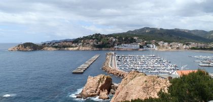
 At the top, we reach another estate, before cutting down the back of the houses and further along the headland. Ahead of us is the port and bay of Sant Feliu. Historically, Sant Feliu is one of the important ports on the Costa Brava with a natural harbour and former shipyards and strong naval (and corsair piracy) connections. However, despite being one of the early spa towns on the Costa Brava and having a long promenade just off the beach with a long row of traditional bars and restaurants, it is not particularly touristy, the town behind the main beach area is mainly a sprawl of older residential terraced streets.
We take the path down from the cliffs and the viewpoint and emerge at a car park at the back of the port close to the fishing wharfs and large modern fishing boats. We follow the road around the corner and reach the main beach promenade. The town and restaurants on the first line from the sea are set back from the beach in the shade of tree-lined park.
Our route takes us along close to the beach. There are signs every so often explaining the history and naval exploits of the town in addition to old photographs of how the town looked pre-tourism. The beach has a long broad expanse of sand and fills up during summer, but with its position in the same bay as the port, it isn't a main beach location.
 We follow the path around and along to the next headland. At the end of the headland is Hotel Eden Roc and the path should run around the back of the hotel. But for various reasons it seems closed. We do find a route around, though in places we feel we're walking in areas the hotel is claiming as its own private areas.
As we round the headland we can look south down the coast. In the distance we can see the white house and headland at Tossa de Mar. The connecting route from Tossa to Sant Feliu is notoriously bendy by road, and from the headland you can see the range of cliffs and hills between Tossa and Sant Feliu. For walking the Tossa - Sant Feliu route requires some planning as it's difficult to do in a round trip.
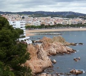 Around the headland we continue up and through the estates at the top of the headland. From here there are views back across Sant Feliu de Guixols, but the view is marred a little by one or two overlarge apartment blocks. As we've mentioned elsewhere, many of the historic towns in the Costa Brava have one, possibly two badly placed high-rises. It's not quite like Platja d'Aro which was almost made for tourism, but for historic towns like Sant Feliu (or La Bisbal) these badly sited high-rises can really diminish the town.
The path from the headland meets the road we started on, and so we double back. Rather than follow the path by the beach, we head into town. Despite being a Saturday, it's lunchtime, about 3pm, so the shops are pretty much closed and the streets are empty. We head out of town through the backstreets then out on the main road to Platja d'Aro. There are more hotels and built up buildings on the way out, but it also connects with the 'Ruta de Carrilet'. This is another former train route now converted into a bike path. This one though connects all the way to Girona (about 50km) and is the main Via Verde in the Costa Brava and well used by cyclists, either in part or taking the whole route.
The main road is not particularly attractive to walk on so we cut down past some holiday apartments and return to the beach of Platja de Sant Pol, just between the Modernista buildings. The children are still on the water, but now on stand-on surfboards balancing precariously as they paddle into the bay.
Neighbouring walks: Blanes, Lloret de Mar, Tossa de Mar by GR92 - Platja d'Aro and S'Agaro - Tossa de Mar north to Cala Pola - Sant Feliu de Guixols Pedralta - Solius, rocks for climbing and ruined castle
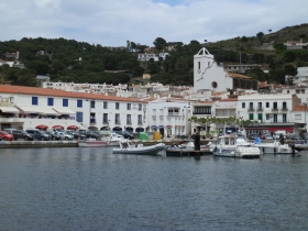
Port de la Selva
 Being based in Baix Emporda, our trips to the more northern Alt Emporda are relatively sporadic so we haven't done that much walking in the areas boarding the French border. Specifically, we haven't explored that much of the Cap de Creus areas - one of the most celebrated walking areas in Catalunya which is about an hour to an hour and a half from home.
The Cap de Creus is a hilly/mountainous cape that sits to the north of the Bay of Roses and geologically forms the final extent of the Pyrenees before the sea. The area is famous for its light attracting famous artists such as Picasso and Dali in the first half of the 20th Century. It's also the area of Cadeques, one of the best known white-walled fishing villages in Catalonia.
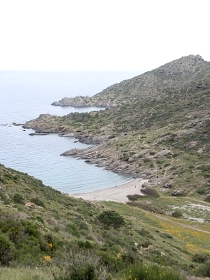
 The landscape itself is relatively harsh. It's quite rocky, barren in places with a covering of gorse and shrubs and in the height of summer is dry and windswept. In some ways it reminds you of Scottish moors and mountains. There are plenty of bays and views and isolated pebble or stony beaches. Routes through and around the Cap de Creus are full of curves and bends so car travel is slow. Walking wise, the GR92 passes through the area as do a number of other paths and routes. For instance it would be possible to walk from Port de la Selva to Cadeques - about 16km - though this is a long route if you have to come back too.
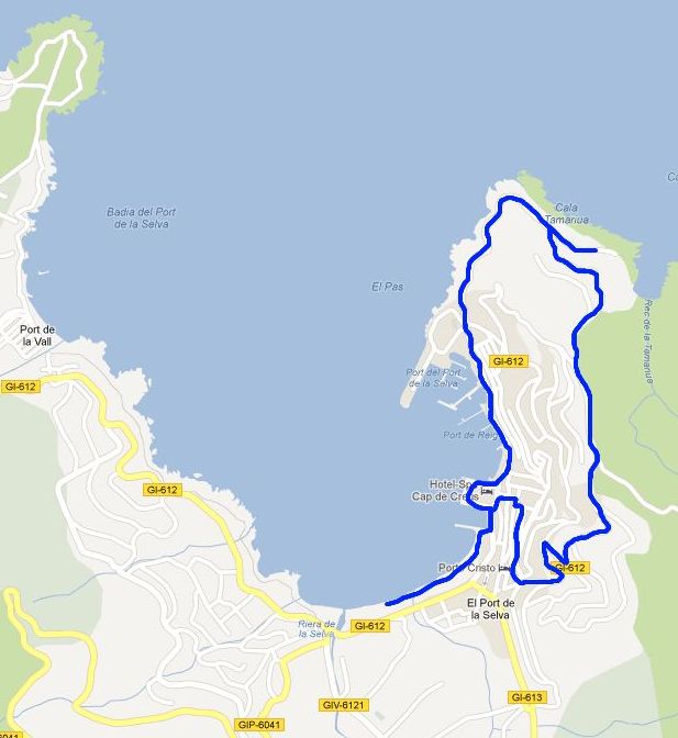
So this is more of a visit than a walk, but still the chance to see a little bit of the surroundings of Port de la Selva on the northern side of Cap de Creus. Port de la Selva is just around the corner from Llanca, so easily accessed. The town sits in a 3/4 bay and looks back towards Llanca and up the coast to Colera. Behind the town are hills/mountains that reach around to Cadaques. As you drive in from Llanca, you can see a monestery (Sant Pere de Rodes) and a castle up to the right. The monestary is a grey colour which can get camoflaged by the rocky hills around it.
 Port de la Selva has a small semi-pebbly beach and a small church. The time we were visiting most of the tourists seemed to be French, possibly from just across the border. Houses are built up the hills almost leaning precariously over the relatively steep hillsides.
We park in the car park before the town and walk along the beach. Even though we're in mid-May there is practically no-one on the beach. It's true it's a combination of sand and pebble and the day is overcast but the whole town looks quiet. As we get nearer to the buildings though, we can see that the restaurants look pretty full. Catalans (and French visitors), typically take dinner around 2-4pm, and take dinner very seriously. Shops close and shoo the last customers out as dinner time approaches and whole towns close down over lunchtime. At the weekend and for festas, 'lunch' - more properly dinner as in Christmas dinner type timing - can run from 1pm to 5pm, which to us who like to be out and active at the weekends seems to knock the stuffing out of a Saturday or Sunday.
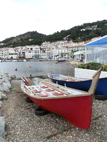
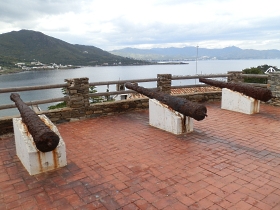 We walk round the edge of the town harbour. It's a proper working harbour, not a marina and fish nets, ropes and lobster pots are laid out carefully on the quay. There are other boats, but also the traditional Catalan Llagut/Sardinals boats made of wood and latin-rigged with a long yard arm that sail like a Dhow.
As we leave the town on the far side, the terrain becomes harshly rocky. We follow the sea over the rocks. On one of the pebbly beaches an set of French divers are exploring the water. The rock pools have crabs and snails and bits of sea-weed. Out of the last of the small pebbly beaches we walk up the stairs. The path is made for strollers and tourists. At the top of the steps we join the road as it climbs over a cove and up to the next headland. The road turns the corner and we can look out over the craggy hills around the next bay. These are deserted, just low scrub in a mottled green with dots of yellow from the gorse, which is in full flower.
There are still houses here though. It feels quite bleak and the houses and walls show the effects of the sea, salt and wind. Even though it's the Mediterranean in front of us, it could almost be a Scottish glen - except that is for the small swimming pools in the gardens.
The rock formations are strange. The movement of the earth has turned the stratification of the rocks around 90 degrees. So rather than lying flat, it juts up, and the rain and water has got in giving the rocks a jagged top that looks as it could cut. Down below we see another beach, pebble again, but we follow the estate around the top. We're back on the GR92 and though we're just doing a few hundred metres we can see the signs and maps pointing the way across the harsh landscape out towards Cadaques. And, at the top of the estate we turn back down and into town. We can see Sant Pere de Rodes in the heights above the bay looking grimly out over the sea. The restaurants have emptied and now the town genuinely is empty and closed. We walk round and there's a sense that everything could benefit from a little bit of TLC, white buildings tend to show the rain.
We'll explore more - this was really little more than a taster, but we're not sure about the terrain. It's dry and harsh with abandoned agricultural terraces (suggesting it was once more fertile?) and few trees. Some people love it. I'm not so sure.
See also: Roses - Canyelles beaches to Cap Falconera - Peralada - Cadaques and Port Lligat - Llança - Sant Pere de Rodes - Cadaques to Roses - Espolla to Rabos - La Jonquera to Fort de Bellegarde (France) - Collioure (France) - Peralada - Portbou to Cerbère (France) and back
Madremanya, Els Angels, Sant Marti Vell
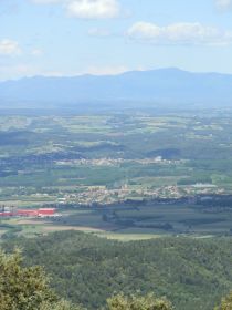
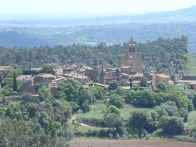 The best viewpoint across the Costa Brava is from the Santuari dels Angels above Madremanya. Els Angels is a monastery (but with cafe and viewing terrace), situated at the second highest point on the Gavarres (488m high) with huge views in an arc of about 270 degrees, from Montseny, across Girona, the mountains of the Pyrenees, out to Banyoles, across to Figueres, the sea from Roses and then around to Torroella Montgri around just about to Begur and the bay of Pals. The road up to the Santuari is very popular with road cyclists as a challenging hill climb and is used as a training climb by professionals (apparently including Lance Armstrong when he was based in Girona).
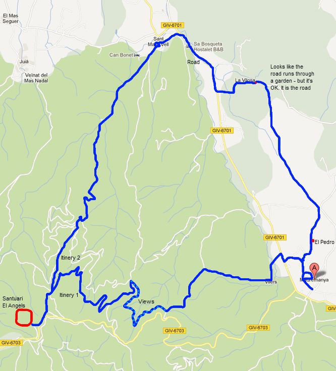
 This is a long walk (close to 5 hours) as we stretched the route to make a round walk via Sant Marti Vell. Though the village of Sant Marti is very pretty, the walk down from Els Angels is mostly a track through the woods with only trees to see, so for a shorter walk consider a more direct route back to Madremanya. The paths also run off the edge of the walking map we use (Emporda Costa Brava 1:30,000) - we don't know of a good walking map for the area around Girona - so it is difficult to plan alternative routes (update 2014: we've now found an ICC walking map for Girona area including the Gavarres). The walks are very clearly marked from Els Angels down. The markings (yellow and white) for the path up have faded/disappeared in some places.
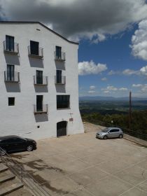 We start in Madremanya, a small medieval town with very thick town walls and arches at the foot of the road up to Els Angels. We decide to start into the hills and leave looking around the town until later and head out of town past a couple of garden restaurants (missing the signposted walk) on the road and then down, across the main road and along through the hamlet of Vilars - a collection of 4-5 renovated farmhouses. As the road passes the last house it switches to a dirt track which climbs gently into the hills through the woods. As the path climbs, we have views back down the valley towards Madremanya and the higher we go the further we can see, with views of the sea behind the village.
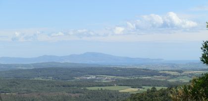 As we reach the limits of our map, the path divides. We're trying to follow a yellow-white marked path, but find we have to look very carefully to find the markings. At the divide it looks as if the path continues straight on, but we spot the cross and follow the track to the right as is snakes around the curves of the hill. We were expecting to still be going up, but this is relatively flat, though with fabulous views out across the Empordan plain to the sea.
We're slightly worried that we've taken the wrong path as it doesn't seem to go up, and we can see the hillside above us, but eventually we reach a junction, and the first proper signpost. We follow the direction to the Santuari dels Angels and path quickly turns up and starts to climb more quickly running across a ridge. We are on Itinery 1 and as we go up, the path seems to steepen with quite an energetic climb through the woods.
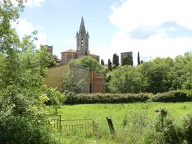 Eventually we reach a junction which meets the Itinery 2 path (the way down) and we make the final climb up to the Santuari past the picnic tables (it's very popular in summer), and up to the main building itself. The Santuari has a cafe and restaurant in addition to the church and main religious building. There is a viewing path and if you walk around the centre you can see for more than 50km in all directions. There are also a handful of cyclists who have stopped for a breather before taking the route down. A range of cycling plaques and medallions can be seen on the walls.
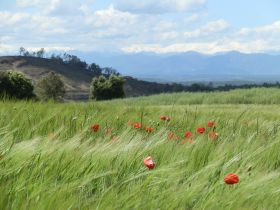 After taking a pause to take in the view, we head back to the Itinery crossroads and start to follow Itinery 2 out towards Sant Marti Vell. It's a gentle slope down and to start there are views, but after a while the path dips into a wooded valley past a chestnut grove and the views are replaced by the sheltered isolation of the trees and the valley. Wooded paths are pleasant, but not good for pictures.
After a while we emerge from the woods past some small vineyards and isolated farmhouses along the edge of a stream, and eventually reach Sant Marti Vell. Sant Marti Vell is a very small ancient village, but with what looks to be a well-adorned church, almost in an English style, with a steeple. We sit for a while enjoying the sun playing on the golden stoned buildings on the long stone bench that runs around the Placa Major. Sant Marti has a maze of narrow little streets and we follow them down emerging at the bottom of the village by a small stream.
 The easiest route is to follow the road back to Madremanya, but it's actually quite a fast and modern road recently updated so instead we follow the road for a while, then turn into the neighbourhood of La Vilosa in order to take a more leisurely route. At the top of the hills to the right we can see the white building of the santuari up above us in the distance.
 La Vilosa is another hamlet of large old houses with big gardens. There seems to be the constant smell of roses as we walk through. At the end, the road switched back to a track, but it's so prettily done that it looks as if we're about to enter someone garden and we ask the owner of the house if it's the right route. It is and we carry on. The path leaves the gardens and we turn right onto a track just past a farmhouse, and head out past fields of wheat and poppies. This is the area we walked from Pubol with the firedamaged woods on the side of the hill and we can see the path we walked then from this track.
 We're now pretty much walking through open countryside, but when we turn and look behind us we can see the Pyrenees still capped with snow. The heat of the day has lifted the cloud making it almost an alpine type scene. We're drawn on by the sound of a Cuckoo and the summer red of the poppies in the field contrast with the cold white on the mountains. The path meets up with a road and we have the option of following the road, or turning and taking the path up to a group of houses on the hill. We take the path and pass along what seems to be an isolated single street of stone houses perched on a ridge. This is El Pedro and it looks almost like a scene from the Cotswolds.
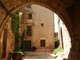
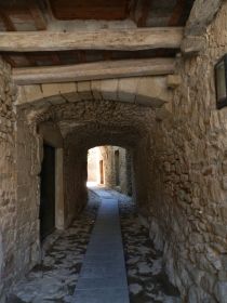
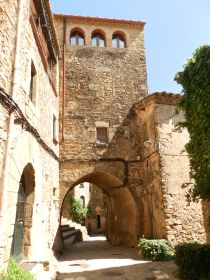
A few hundred metres further on we reach Madremanya and enter the town through an old town gate, passing under two long arches. From the width of the arches, the town walls seem very thick. Ahead of us is the Placa Major and the church. Churches always seem to be squeezed in among the houses and Madremanya is no exception - the church sitting pressed in on all sides by narrow streets and medieval terraced houses. All the streets seem to pass through archways that would have been part of the town wall. It's all very well preserved and restored. We find our way out and walk back to the car. In the garden of the town hotel, a great arbour of roses is perfuming the air.
Neighbouring walks: Monells and Mont-negre - La Pera, Pubol and around - Cruilles, Monells and Sant Sadurni de l'Heura - Celra, Juia and the Castle of Palagret- Cruilles and masias and streams - Madremanya and Millars - Monells spring walk in the woods - Gavarres Montnegre and Montigalar
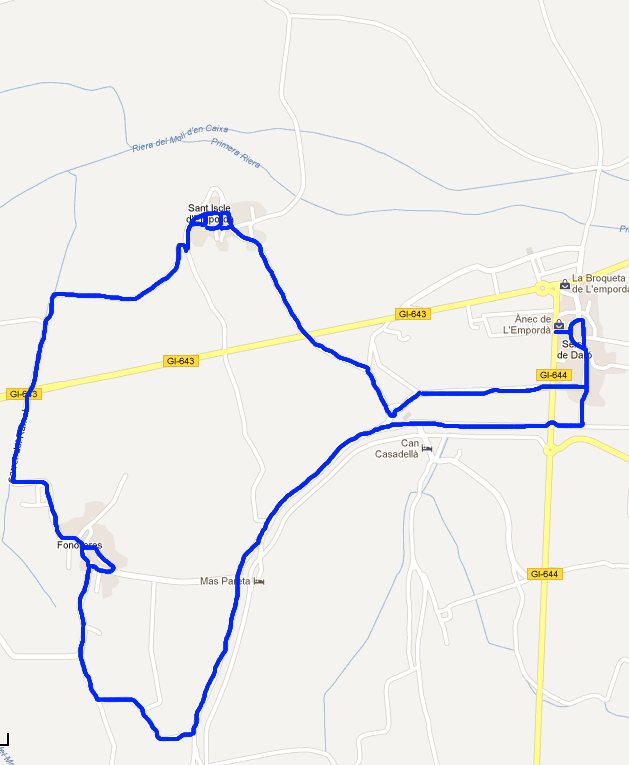
Serra de Daro, Fonolleres, Sant Iscle d'Emporda
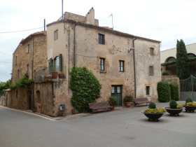
 Serra de Daro is a small agricultural village on the link road between Torroella de Montgri and Parlava. It's on one of the back routes up from Palafrugell/Palamos to Figueres avoiding La Bisbal. The village is on the river Daro as it heads north to join the Ter. In the main it is more of a productive farming centre more concerned with the fields and fruit trees that lie around the village than trying to look pretty. In some ways this adds character to the church and older heart of the village.
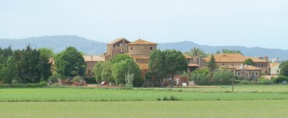
Originally we were heading for a walk further to the north, but as we were driving we noticed the small village of Fonolleres across the plain so not having visited Serra de Daro before we decided to stop and chance for the walk. The landscape is very flat in the immediate vicinity, but not far off is Montgri and there are views to the distant Gavarres and Pyrenees in the distance.
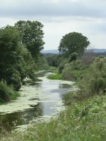
 From Serra de Daro we head through the village down to the river. The river Daro rises in the Gavarres close to La Bisbal, so it's not a major river but there is water in the stream and a steady flow through the reeds and grasses. The path follows the river on the north bank, with occasional fords crossing the river to reach a farmhouse on the other side. There's sufficient water flowing over the fords to keep us from trying to cross without getting feet wet.
To start the walk is pleasant but not exhilirating, but the sight of kingfishers in the trees above the river enlivens the day, their orange breasts and long beaks clearly visible above us. They're not the only birds either, ducks and moorhen are also on the fringes of the river. Across the fields the view to Fonolleres and Sant Iscle, the other villages we will visit is very clear and we can see out to Parlava and Ultramort in the further distance.
 Around the corner we skip the first route to Fonollores preferring to keep to the river for another while trying to see more kingfishers and we walk past a huge bank of poppies reaching out towards the field of recently planted corn to the right.
We're unlucky and don't see any more kingfishers, so take the next junction to the left past a grand, but seemingly abandoned farmhouse isolated in the fields. The path by the Daro would connect all the way to La Bisbal if we'd decided to continue.
Past the fields we reach the outskirts of Fonolleres, the gardens of the houses blooming with roses and other flowers. The first main building we come to is almost like a Catalan Palau - a large building in the centre of the village with arches across the top of it's facade to let the air in to the upper levels. We can hear children playing in the Palau garden behind the wall. The village is no more than 4-5 streets, but it is well groomed. The church is unusual in shape with what seems to be a fortification tower at one end, and a bell-tower at the other, and there are other golden coloured stone buildings around the main placa.
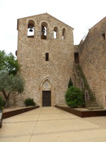 Having completed our brief tour, we walk out on the far side of the village past farmhouses marked as offering Turisme Rural. For masies and farms off the coast it is common to see directions marked to places offering rural tourist getaways - what in the UK would be farmhouse B&Bs, or chambre d'hotes in France. The countryside of the Costa Brava rivals that of the Cotswolds, or the Dordogne, or Tuscany so it's sometimes a pity to find people who only think of the Costa Brava as a 60s seaside destination.
Ahead of us, we cross the road and head along a lane towards the fruit trees. The area of the Ter close to Torroella de Montgri is a massive fruit growing area due both to the sunshine and the ready availability of water from the Ter. In places enormous long espalliers full of trees fill the fields, often apples, but also peaches and other warm weather fruit. At this time of year, leaves are returning and there is blossom on the trees.
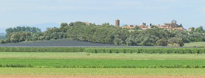
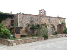 Our lane leads us up to Sant Iscle d'Emporda. It's a small hamlet set on an isolated hill above the plain with a small watch-tower and church. Unlike the groomed Fonolleres, Sant Iscle is more neglected, but in a traditional rustic way reminiscent of rural France, with wild roses climbing around the crumbling door of one old building. The watch tower itself seems to have been built crooked - it's base smaller than it's top and the neighbouring house, which at one time might have been the grand house of the village, is held together with metal beams and pins. Even the church has idiosyncratic lines of stones in it's construction.
We walk down off the hill across the road and back into Serra de Daro.
Neighbouring walks: Corça, Casavells, Matajudaica - Canapost, Poblet Iberic and Ullastret - Rupia and Foixa - Gualta, Llabia, Fontanilles and the lake of Ullastret
Eulogy to the Ruta del Tren Petit (Palafrugell, Palamos, Mont-ras and Vall-llobrega)
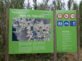 The Ruta del Tren Petit is a set of tracks that follow a disused railway line that has been converted into a footpath and cycle track (a Via Verde) that connects Palafrugell with Palamos (and also links to Mont-ras and Vall-llobrega).
The Ruta del Tren Petit is almost like a spine with routes off it connecting to all the main beaches between Palamos and Llafranc. On the way it passes through fields and plains that sit in the small plain the hills of the Gavarres to the west, and the coastal hills to the East.
As this is our neighbourhood, this is a path we walk a lot and we make much use of the connections from the Ruta del Tren Petit across to the beaches and coves of what is one of the most beautiful areas of the Costa Brava.
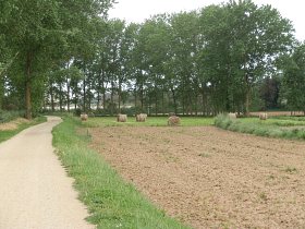 So in addition to describing a walk along the Ruta del Tren Petit, we have included a map of all the links from the Ruta across to all the main beaches and coast line from La Fosca to Llafranc (and Tamariu included at the top for good measure).
Click on the map below to see this fullsize. We also mentioned the Ruta del Tren Petit in our walk from Mont-ras to Calella de Palafrugell and Llafranc.
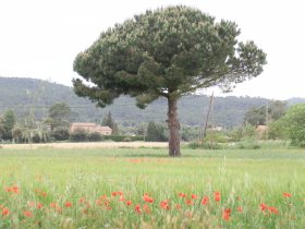 For visitors the beauty of the route is that it gives great walking and cycling and links to the best places through the countryside without problems of cars or traffic making it safe to take children or for casual quiet strolls.
For holiday makers it also connects various campsites, hidden restaurants and farm masias and if you are without a car, hiring bikes makes this a very easy way to visit the neighbouring areas.
To include the Ruta on the blog we're walking from Mont-ras/Palafrugell down to Palamos and then returning via Vall-llobrega.
In practice this would be best done as a bike route as it's pretty flat and easy cycling on a hard gravel surface. We're walking - a round trip of about 3 hours. On a bike, the full length Palafrugell to Palamos journey should take about 20-30 minutes.
We're starting in Mont-ras down through the village past the line of shops in the direction of Palafrugell. We walk through the small block of houses and reach the fields. The starting path is just along to the left, clearly marked with a big sign and map.
If you join from Palafrugell walk down to the Esclat on the ringroad and cross the road by the garden centre to get to the path.
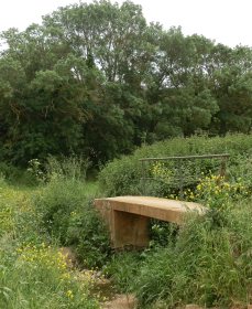 The starting route passes along the edge of a large field towards a large farmhouse (Mas Roig) with a tower on the right hand corner.
At the corner of the field a path comes in from the left - this is the route in from Palafrugell across a small stream. The path then continues around the top of the field and along through the plain following a small stream (the Aube river).
In fact the path follows this stream all the way down to Platja de Castell. There's a junction here, taking the left path takes you past Mas Roig and then out to the centre of Calella (see Mont-ras to Calella and Llafranc).
Walking is easy and enjoyable. The plain is punctuated by small tree covered hills, small copses and views out to the hills on either side. These are working fields and there is continual rotation of crops and foliage through the seasons.
In the first spring rains the fields can fill with water and resound to the sound of hundreds of croaking frogs. Now, in May, there is wheat and meadow grasses interspersed by poppies and wild-flowers.
A shepherd is tending a mixed flock of sheep and goats close to one of the farms and across the fields the tower of Torre Simona can be seen, one of the watch towers from when these coasts and villages were attacked by Barbarossa's Barbary Pirates in the 16th Century.
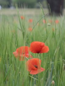 We come to the first crossroads where two paths cross. To the right the path leads back to the small urbanisation of Torre Simona, to the left are two small stone bridges each over a different stream.
The upper stream about a metre higher than the lower. There's water in the stream and a mass of verdent vegetation. In summer they will be dry, but in winter with the rains they become deep swollen rivers.
Across the bridges, this path links to a road that curls around the enormous house and estate of Mas Oliu and to paths that link to Ermedas and onwards to Calella de Palafrugell and Golfet.
We carry on and the next junction with a road. The roads in this area link the various masia farmhouses that dot the landscape, built in a traditional Catalan style out of stone with a long V roof. Many have been restored with large mature gardens and swimming pools. Others have been turned into restaurants or remain as farms.
This particular road runs towards El Crit, but turns back to a gravel track once it passes the last of the masies. The next junction also takes this route to the left, but the road is bigger and passes through a ford, empty now, but full of water a few weeks ago.
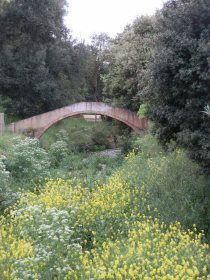 At this point, the Ruta del Petit Tren takes a sharp right, then down the track, a sharp left so it runs next to the small road that also takes this route.
We're walking past a large farmhouse hidden behind hedges and fences. Ahead a small arched-footbridge stretches across the stream, but at this point the stream is full of yellow flowers of rapeseed.
Past the Masia, we pass through a small grove of trees and then a very well maintained garden/allotments (horta) before walking past a pretty house with blue shutters looking over a field of olive trees. On the other side of the path, another shepherd is out with a mixed flock and a billy goat bossing the sheep about.
We pass the waterworks and on to what at first sight seems to be the end of the path. A road cuts across the Ruta. To the left the road runs down to Platja de Castell past Camping Benelux and Hotel Malcontent.
Straight on, there's a continuation - this heads down towards Castell too, but also links to La Fosca. We follow the path across the road to the right about 50m before it crosses the road again and we head on in the direction of Palamos.
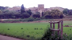 We're not too far from the C31 dual carriageway and can hear the cars, but a line of trees mean we still feel we're in the country. To the left is a large Masia with a tower. We keep going on past and reach the end of the path just behind a petrol station.
To make this a round trip the aim is to come back via Vall-llobrega, but first we go straight on, along the small road behind the houses on the main road. We're heading for Sant Joan de Palamos and can see the church ahead of us. We reach the old heart of the village (now part of Palamos itself) - a set of narrow streets.
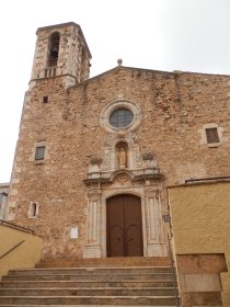 Sant Joan de Palamos is the original entry point into Palamos and the old entry road ran through the village.
From the narrowness of Carrer Major this main route would have been very difficult with any type of large vehicle. We walk past the church and then out across the main road to Carrer Riera and out through an industrial estate, before taking an underpass beneath the new dual carriageway and into the slightly haphazard estate at Vila-Roma.
Palamos has always been something of a working town and its houses and streets on the outskirts lack much in the way of charm.
We continue around Vila Roma - the white statue of a ladies face sits on the roundabout. This used to be closer to the main road until the dual carriageway was developed.
We take a small bridge which looks like a footbridge but still seems to be used for cars out in the direction of La Figuerar. Until we leave Vall-llobrega the route follows the road, but it's very quiet, only used by the occasional vien or vecino (neighbour).
We walk behind through an old hamlet and around the base of one of the isolated hills that sit in amoung the fields. At the second left we follow the road past a line of modern villas towards Vall-llobrega up to a cross roads. At the cross roads we continue straight on. Our route is towards Can Sidro.
Vall-llobrega consists of a number of luxury estates sheltered in a curve in the hills of the Gavarres. Mostly it's new villas and buildings, but along the road we're walking it consists of large older houses in several acres of land. The road climbs and we get a sea view across Cap de Palafrugell and out towards the high rises and port of Palamos.
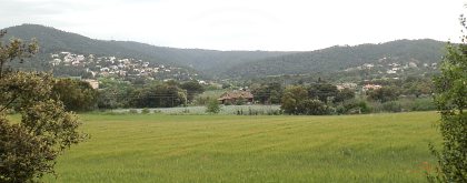 We pass Can Sidro - a restaurant with views across the village of Vall-llobrega and into the hills.
If you're taking this route as a bike path you need to take the right hand road just at the gates of the next house (not the private road), down the hill. This gravel track is the road that links to the road with Mont-ras below - being gravel it confused us when we first tried to find it - we were expecting a tarmac road.
As we're walking though we continue, past a pretty peach-coloured house with a vineyard in front of it to the next junction. We turn right up the hill at the back of a luxurious modern house with a big swimming pool in its grounds.
The path continues along by the fence and then almost round the back of a white farmhouse and into the woods. This path is quite secluded through the trees and it's peaceful.
We follow it round the valleyhead and out by a collection of small-holidings to the sound of chickens and geese. We continue straight on and eventually emerge across a small stream close to the estate of Molines in Mont-ras.
Still straight-on along the field track full of flowers in reds, yellows, purples and whites. The road we reach is the main old road through Mont-ras - as is typical here it's very narrow and passes old houses and masies with little traffic.
We continue and eventually return to the Ajuntament of Mont-ras and it's small village square outside the library.
Neighbouring walks: Mont-ras to Calella de Palafrugell and Llafranc - Palafrugell, Tamariu, Begur residential and Esclanya - Calella de Palafrugell/Cap Roig to Castell - classic wild Costa Brava - Platja de Castell and La Fosca - La Fosca to Palamos - Bell-lloc and Castell de Vila-Roma (Palamos) - Mont-ras 'boar' walk - Far de Sant Sebastia (Llafranc) to Tamariu
Swimming and canoeing: Swimming at the beaches of Calella de Palafrugell - Swimming and beach at La Fosca - Beach at Platja de Castell - swimming and canoeing - Swimming and wild beaches of Castell-Cap Roig
** Click the map below to see it full size **
Evening walk Pals to Sant Feliu de Boada
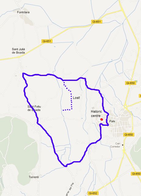
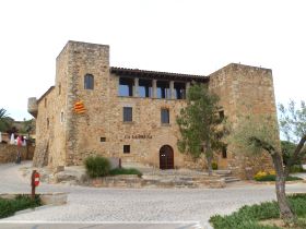 This is a short walk around the back of Pals across the fields to the neighbouring village of Sant Feliu de Boada that gives great views of the historic centre of Pals. Sant Feliu itself is a tiny village but packed full of restaurants which seem to be extremely busy at weekends and festivals.The walk can easily be extended to Sant Julia de Boada and Fontclara, but for reasons of time we needed to keep the walk short.
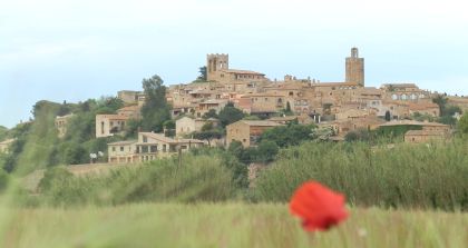
Pals itself has a historic old part that rises up on the hill with a tower and church at the top. It stands among levels that was once marsh or lake, but that is now used for growing rice and other crops. As a result it has a commanding position over the land around and is very prominent from all directions. The centre itself is in two parts. The first part you come to is the untouristy modern area with an array of local shops and restaurants. The historic centre sits a little way back from here and you have to get out of the car and walk.
 The starting point for the walk is in the car park underneath the older part of Pals. As we're not trying to visit the village directly we stay by the lower walls of the old town and find the track that leads out into the countryside past horta (cottage gardens or allotments) and out into the fields. The starting route is a bike route and the track extends out to Torrent and off to Palafrugell. The walk is level and we cross a bridge over a stream full of yellow iris.
After around 1km the path splits and we take the right hand path to Sant Feliu de Boada. To the right as we walk, there are excellent unspoilt views of Pals above the trees and meadows. Sant Feliu de Boada is small, but very well maintained with many traditional-style houses that look as if they have just been restored with rich full gardens. Following the main street we reach the heart of the village - a small nucleus of 3-4 streets around the church. Around the church and in the streets beyond though are several well-to-do looking restaurants. We know from experience from summer bike tours that Sant Feliu gets packed with cars at weekends with people coming to eat.
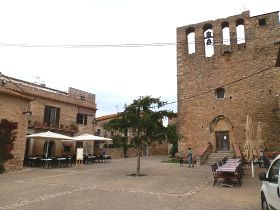 We continue out towards Sant Julia de Boada on the road. Ahead of us shepherds and their dogs are driving a large flock of sheep from one field up towards the farm for the evening, the dogs doing excellent work of keeping the sheep together. Sheep are common in many areas, though because the fields are unfenced the flocks are always watched by shepherds and dogs and then moved back into farms or enclosures for the night.
The road has a right turn back towards Pals. We could continue up to Sant Julia de Boada and Fontclara, but we're pushed for time. As we come down past the pig farm we think we can take a short cut off the road across a track to get to the back of Pals village. Wrong! We walk across the fields past an isolated farm house and then realise the path we're on has turned back towards Sant Feliu.
Now we're going to be late. So we double back rather than try any other routes or paths and follow the road back into Pals. No time to photograph the centre so still no photos of the heart of Pals for the blog.
Neighbouring walks: Regencos to Pals via Quermany Gros and Petit - Pals beach to Gola de Ter - Masos de Pals, Begur, Sa Riera and Platja de Pals - Palau-sator and Peratallada - Llofriu, St Llop and Torrent
Sa Tuna, Cap de Begur, Begur
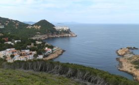
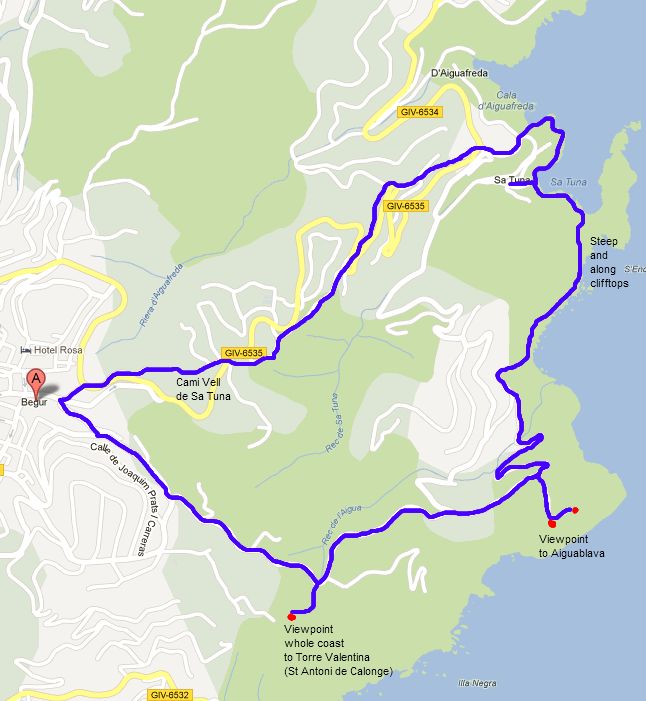
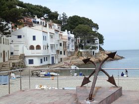 This is one of the classic senderismes (walking routes) of the Costa Brava around the cliffs and bays of the Cape of Begur. It's almost all GR92, but the path from Sa Tuna up the hill across the hilltops is steep and feels quite close to the cliff edge. Begur (pronounced Begu in Catalan, the r doesn't sound) is both the name of the village of Begur that stands high on the hill with a castle and fort with commanding views around and across the Empordan plain, and the name of the area of the Cape of Begur. The Cape takes in the sub-villages or Sa Riera, Aiguafreda and Sa Tuna and a number of other estates and areas in between. The Cape itself rises from sea-level at the beaches upto heights of about 250m and is therefore very hilly and up and down, and by the coast is a collection of bays, soaring cliffs and woody hillsides. It is possible to walk the whole Cape in one day, but now we prefer to take it more piecemeal as there are lots of climbs and lots to see. In the past we might have started at Begur and walked down, but we've found starting at the low point and walking up in the first half of the walk when we have most energy gives us a downhill for the second half which makes the walk more rewarding.
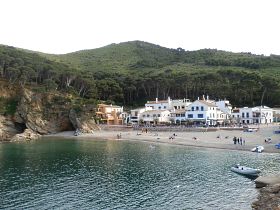
 We start at the beach at Sa Tuna, a charming pebbly bay surrounded by a small collection of old-style fishermen houses and restaurants ('Sa' would have been local dialect catalan for 'La' - you see something similar in 'Ses' which would be more conventionally 'Les'). After the relatively cold and wet weather recently it's a little bit of a surprise to see the first sunbathers in bikinis on the beach, as we're still in long trousers.
 The path from Sa Tuna wraps up behind the beach towards the headland/penisula to the right. This is a GR92 path, so follows the red-white flashes and it's fortunate that we are looking for them, otherwise we would have walked right out to the peninsula when actually the path climbs into the woods to the right. to begin with it's relatively easy, but it steepens just under a viewpoint marker, with the cliff to the left not so far away, and turns into more of a scramble on loose soil/stone (for safety good footwear is a must). The view from the marker looks back over the bay of Sa Tuna and around to the relatively ugly large hotel at Cap Sa Sal which is out of keeping with the surroundings (but probably has great views from inside).
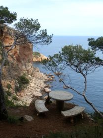
 The viewpoint though is only really about halfway up and the path continues to climb up through the scrub and bracken. You can't help but realise that the cliff face to the side is rising too, but the path is just sufficiently far away from the edge that you don't see the drop except in one or two places. Over the crest, the path becomes more wooded but still on the sea-side of the hill. At one point in the woods someone has installed a stone picnic table and bench right on top of the cliff with views out to the sea. I didn't take the opportunity to see how high up it was.
Back through the woods and the path emerges on a road in a sparsely populated estate. Large individual houses seem to cling to the hillside just to have a sea view. We walk on the road, but there is no-one around and the path soon heads back into the woods. As we walk we almost step on a small grass-snake sunbathing in the May sunshine. It ignores us completely and doesn't move as we stare at it.
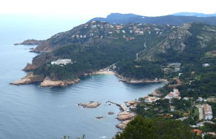 The path climbs through the woods and we get the first glimpse of the lighthouse/military station perched on the point of Cap de Begur. We reach a road at the top of the path - a viewpoint is marked to the left down towards the military station (which as we find seems disused). At one point there are views to the south down to the watchtower above Llafranc and across to the beach at Aiguablava and round to Fornells. There are scattered dots of people on the sandy beach at Aiguablava and the first yachts in the bay. Close to the military station are views to the north along past the Isles Medes and up to Roses and beyond.
The path becomes a road through another luxury estate before climbing out along a ridge in the direction of Begur and Tamariu. At the top of the gentle climb the route splits. The main GR92 turns to the left across a high hillside above the sea covered with yellow gorse and other flowers in pinks and whites. We take the GR92 as far as the next viewpoint. This is even grander than the two before. From the top you can see all the way down the coast past Palamos to Torre Valentina past St Antoni de Calonge. The GR92 from the viewpoint down is a long steep climb and having done it once we're not that keen on doing it again, so instead of continuing with the GR92 we double back and take the route to Begur itself.
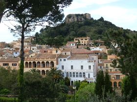
 We're still on road and we walk to the outskirts of Begur village with views of the gardens at the back of the grand Indianer houses with their murals and mosaics sitting underneath Begur's castle. At one point you can see three or four of the medieval defensive towers, plus the church all peaking above the general hubbub of houses of the village. Begur centre is known for the grand houses (Indianers) built by Catalans who had made their fortunes in the 19th Century out in Cuba and the Carribean. It holds a Festa de Indians every year when the whole town seems to dress up in whites for food, drink and music on the (packed) streets.
From the town itself there are options as to how to return to Sa Tuna depending on how long a walk you want to take. We take the 'classic' way down the Cami Vell de Sa Tuna. This is the old road, but is now really a track that runs above, below, across the modern tarmac road as it zigzags down the hill. The Cami Vell is quiet and relatively straight and we pass behind houses and fields on the way down.
At the bottom close to the junction split for Aiguafreda/Sa Tuna, the path runs straight down past a no-entry sign into a network of houses. Steps take you down to a stone-built walled path that runs along the side of the bay looking out across Aiguafreda. It's marked with a cross for the GR92, but it seems new and you can follow it around the headland overlooking the sea and back to Sa Tuna.
Neighbouring walks: Masos de Pals, Begur, Sa Riera and Platja de Pals - Fornells and Aiguablava walk (GR92) - Palafrugell, Tamariu, Begur residential and Esclanya - Begur, Ses Negres and Sa Riera
Swimming and canoeing: Swimming and canoeing at Sa Tuna (Begur)
Events: Begur - Festa d'Indians
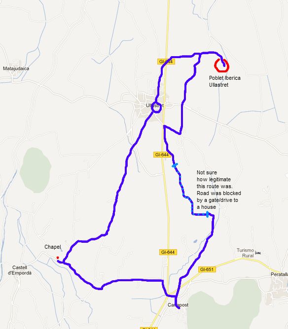
Canapost, Poblet Iberic and Ullastret
 The weather in spring is usually a mix of a day's rain followed by 4-5 days of sun. The last weekend though we had almost four-five rainy days on the trot. It doesn't stop us walking, but it does mean we keep the walks shorter and closer to home, and the wet weather doesn't help with photos. To make up for the rain, May Day was back to glorious blue sky and sunshine, and combined with the wet ground meant that it almost felt like we could see the grass and flowers growing. In places it was like an impressionist painter had thrown splashes or yellow and red paint across the fields.
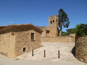
Canapost is a small village not far from La Bisbal and Peratallada, and like Peratallada it is built of the rich golden stone of the area. It's not big - about two or three streetsworth of houses, but it has a delightful small church (Sant Esteve). We parked in the centre of the village. Some local children were trying to profit from the sunshine by selling lemonade along the street in a little hand-made stall. The path though takes us out across the Peratallada road and out towards the Bobilla (brickworks) factory.
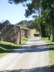 The wet weather meant both the fields seem to have grown 10-20cm in the last week. What was burgeoning stalks are now ears of wheat and barely waiting to be sun dried. Along the edge, hundreds of poppies make blush red edges to the field, alternating with the mauve flowers of borage and the bright yellow of a host of other flowers.
The path splits and we take the right fork, the left heading towards the brickworks and the factory disappears behind a hill. The map is not clear as to whether there is a connecting route so we're taking a little bit of a chance and as we carry on, we're met by a gate and driveway entrance for a house directly in front of us. There's a path to the left that seems to skirt the house's paddock and looks as if it's used for biking or bmxing.
 The path continues up the hill behind the brickworks, practically to the top, but with no obvious fork in the direction we want to go. Eventually it stops at the wall of a bank. Having no where else to try, we scramble up the bank and find a new path along the ridge of the hill. It's by no means clear if this is a legitimate path, but something or someone does use it and we continue across the ridgetop to a field which has views out to the coast and the Isles Medes and all the way up to Empuriabrava and Albons in the distance. From the field we join what seems to be a more valid track out past an olive grove. The birds around seem to be in full conversation. In the quiet location, it's almost like being serenaded by a songbird choir.
 The path emerges close to Ullastret. Our intention is to go into the village, but first to take in the Poblet Iberic (Iberian Village) of Ullastret which sits a little way off from the current modern village. So instead of taking the road into the centre, we head the opposite direction past some houses, before finding the first track that takes us to the left towards the Poblet, across a bigger road and then out towards the hill on which the Poblet stands.
From the track you don't see anything of the Iberian village until you get to the end, and see the car park. The gates were open and entry was free (at some times of the year you have to pay to go in).
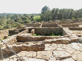
 The Ibers were Bronze age peoples of Spain (hence the Iberian peninsula) before the Romans and around the Empordan region there are a number of Iberic ruins. For example just above Platja de Castell and at the Farde San Sebastian lighthouse above Llafranc. The village at Ullastret is built on a hill, which would have been above the lake of Ullastret (see the walk from Gualta). From the entrance you walk past an impressive defensive wall, which according to the signs was built in around the 6th and 7th Centuries BC - though it looks medieval in layout and stonework. The main part of the Iberic village is a little higher up), though all that remains are the foundations and building layout. It has views in all directions and a museum (closed when we were there) and it is worth visiting just for the views and to take in the location.
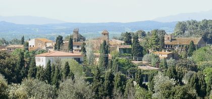
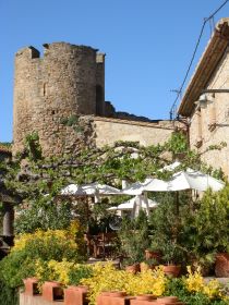
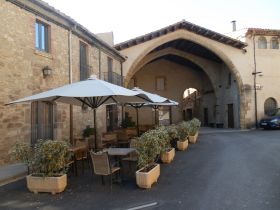 From the Iberic village we walk along the road and into Ullastret. As you come into the heart of the current village the first things that greet you are the old buildings of the medieval hospital and the stone wall complete with two towers - one square and one circular that would have guarded the inner houses, and inside the village walls are a nestle of streets and a romanic church - another of the very pretty villages that surround La Bisbal.
We head out of the village on the Cami de Castell d'Emporda. The route which would have taken ancient travellers towards the castle of Emporda and then onwards to La Bisbal. The road is tarmacked, but very quiet with views to the west to the Pyrenees, still carrying snow, but getting hazier as the days turn to summer. The road passes a small hill to the right, then there are the first views of the Castell d'Emporda on its promentary point, but the view is marred slightly by the pig-farm and the sound of squealing pigs. Along the road we get to a junction. We're going left back towards Canapost, but just to the left is the small chapel of St Marti de Llaneres.
We return to the path and past the fields and an old masia. Canapost is nestled in the hill ahead with the Gavarres to the right and we return to the car. Homemade lemonade would have been wonderful as we were low on water, but unfortunately the children have packed up for the afternoon.
Neighbouring walks: Gualta, Llabia, Fontanilles and the lake of Ullastret - Clots de Sant Julia (Vulpellac) - Palau-sator and Peratallada - La Bisbal, Vulpellac, Castell d'Emporda, Fonteta - Corça, Casavells, Matajudaica - Serra de Daro, Fonolleres, Sant Iscle d'Emporda - Santa Susanna de Peralta and Sant Climent de Peralta
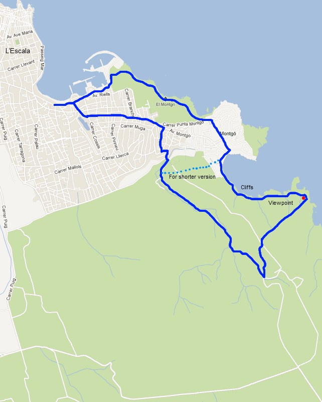
L'Escala Riells to sea cliffs and viewpoint of Montgo
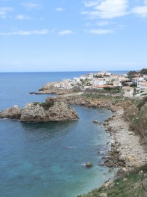
 This is a walk for cliff lovers with some fabulous views across the Gulf of Roses and across to the Pyrenees, but it is challenging underfoot with an uneven rocky terrain and a path that runs very close to the edge of the cliffs around the bay of Montgo (with no barrier). It's a different, dryer type of cliff path to other coastal paths on the Costa Brava. Trying to do the walk in flipflops or other flimsy shoes is not recommended. The final viewpoint (shown on the map) though can be reached easily by track if you take the inland path.
 The start point is L'Escala by the beach at Riells. L'Escala is a town in two parts. The older fishing village is at the north end of the town, while the bulk of the Riells area consists of lots of streets of holiday houses and villas from what looks like a big building spree in the 60s and 70s, which can look a little jammed in and careworn in places. Even though some houses have year-round inhabitants, many of the businesses around Riells are seasonal. At this time of year in mid-April, the holiday makers are returning and shops and cafes are starting to re-open, with the first people appearing on the beach, though not in the water yet.
We're starting at Riells so as to be able to walk the coast to Montgo from l'Escala, but if you're just interested in the wilder parts of the walk you might just start in Montgo, to save the walk through the estates and town on the way back.
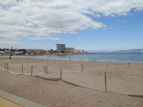
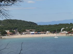 We park near the beach. In summer the roads around Riell beach can be packed, but in spring the streets are relatively empty and parking is easy. Riells beach itself has great views across the Gulf of Roses to Cap de Creus and Empuriabrava. The beach is northerly facing and open to the wind. To prevent sand being blown off the beach during winter, there are nets strung across the beach creating undulating mounds of sand, that children are playing on.
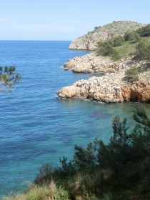 We walk along the promenade past the rotisserie shop which has a long queue outside waiting for whole flame-cooked roast chickens to take away for Sunday lunch. This is something of a Spanish tradition. Most food on the Spanish coast is thin cut for frying or grilling (in supermarkets it's almost impossible to get a 'joint' for roasting). The story we were told was that traditionally Spanish houses didn't have an oven. Instead if there was a joint or a piece of meat for a celebration, they would take it to the local baker to cook it in the bread ovens. The roast chicken seems to be a continuation of this.
The route runs past the port, and we get the first glimpse of a snow-capped Canigou mountain rising up behind L'Escala and the port. At the end of the port the path cuts behind a boat yard and into the rough scrub land behind. We're on the GR92, so keep an eye out for the red-white flashes. Just around the corner are two former gun emplacements from around the time of the second world war, that look up the coast and across the bay to Roses.
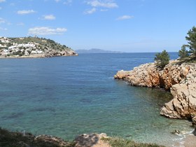 The path snakes around a few headlands above a couple of very pebbly and rough beaches. Ahead of us is the promentary of Mont-go with it's watch tower at the top, flanked by a small estate of whitewashed holiday homes and villas. The ground is rocky and stony underfoot with the angle of the stones making the ground harsh and uneven.
At the estate of Montgo, we cut across the estate and down to the main Montgo beach. There's a small collection of shops and supermarket that have just re-opened and the first handfuls of tourists in the few bars and restaurants around Montgo. The beach itself is broad and sandy and looks out over a semi-enclosed bay. The water is crystal clear turquoise blue, but still much too cold for swimming.
We walk past the beach and follow the signs into the woods above the cliffs. There are a few other walker around and the narrowness of the path means we have to do a little dance to let them pass. The route climbs over cliffs with sharp jutting rocks underfoot all the time, so walking is slow and as we climb, the edge of the cliffs seems to get closer. We are on a GR92 route and from the wear marks on the stones it is well used, but the route is challenging, particularly if you have a dislike of heights and sheer drops. At various points it passes through gorse and low shrubs which can catch your legs if you're in shorts. Compared to other walks, it's relatively slow going, certainly slower than expected.
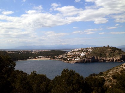 We continue up and down a few small coves, with fabulous views back towards Montgo and across the Gulf. The path down to the last cove is a proper scramble with the path very close to the edge that takes some care to negotiate. Then from this last cove the path climbs up past a refuge hut and up along what is almost a scree path and into the woods where the footway becomes much easier.
It's a steady climb up to the top and the viewpoint above the high cliffs. There is the remains of another gun emplacement - large concrete groundworks that would have supported a gun. From the top the view extends across the Empordan plain to the mountains to the west, and northwards almost up to the French coast.
Off from the viewpoint is a large track - it would be possible to drive up here - and we follow the track back into the forest, then down into the neighbouring valley and a roadway. The road has a few cars on it, but is otherwise quiet among the trees and relatively unremarkable scenery. We walk down past an as yet unopened campsite and back into Riells heading for the beach and an ice-cream.
Neighbouring walks:Escala, St Marti d'Empuries and beyond - Sobrestany, Montgri and Bellcaire d'Emporda - Aiguamolls d'Emporda (Empuriabrava) - L'Estartit to Cala Pedrosa and Cala Ferriol - Empuries Greek and Roman remains
Swimming: Swimming at Cala Montgo (L'Escala) - Swimming and beaches at L'Escala
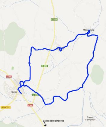
Corça, Casavells, Matajudaica
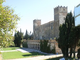 Just outside La Bisbal d'Emporda on the main road towards Flaça and Girona is the village of Corça. As is common with Catalan villages around the Costa Brava the main road skirts past the village so it's possible just to see the traffic lights and miss the rest of the village. Though from the Flaça direction, you would see the Castle of Alberca to your left as you come towards the village, a castle that looks more like a gentile country house than the rougher older romanic castles of other Catalan villages (but it looks as if it is in private hands, with much restoration work still to be done).
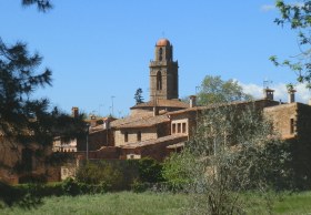
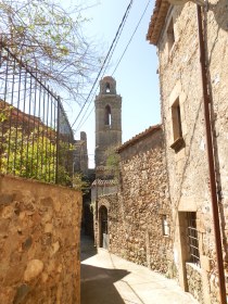 Parking on the main road we walked towards Corça village itself crossing a small stream to be greeted by an open plaça shaded by plane trees. The houses for the village started on the far side of the plaça, built in the customary catalan stone. To orientate ourselves we walked through the narrow streets around the centre to find the church and the old village walls. Like many of the villages around La Bisbal, the village heart is unspoilt and retains its medieval and period charm.
 After exploring the centre, we head out to the north. The path is marked by a bikeway sign in the direction of Casavells and we head out into the country side. The initial part of the walk is on road, but at the first junction, the tarmac road turns to the left and we continue on a track through the fields (the signpost was missing when we walked - good to have a map).
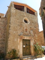 Mid-April means the wheat is growing quickly in the fields and with about one day of rain a week through spring, the fields are lushious verdant green. Along the path are the bright yellow flowers of rapeseed that escaped from a previously year's harvest, interspersed by the red of poppies. Many of the plants and flowers in Catalonia are a few weeks ahead of the UK. There are also swallows and swifts skimming across grass playing in the sun.
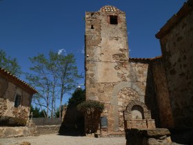 The path reaches a T-junction and we turn to the right with a view across the plain in all directions. The rain from the previous day has cleared the air and there are clear views to Els Angels on the Gavarres, out to the castle of Montgri and even as far as the villages in the hills behind Roses to the north. We cross the main road (take care cars drive very quickly on this road).
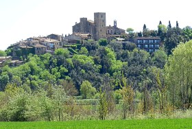 Casavells is just a couple of hundred metres off the main road and as the name suggests, it's a collection of old houses around a small church. It doesn't take more than a four or five minutes to circumnavigate to have a look around.
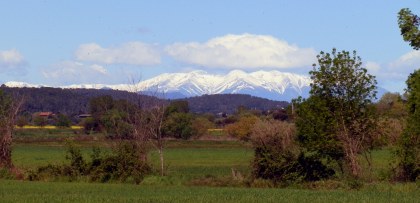
The road between Casavells and Matajudaica is tarmac again, but as we walk to the left suddenly we're greeted by the site of the mountains standing clearly in the bright spring light, their majestic white sides standing out against the vivacious greens of the plain.
We reach Matajudaica, another hamlet similar in size to Casavells. The name is particularly intriguing since Matajudaica seems to suggest some dark past history (mata=kill and judaica suggests jews?). We're not far from Ultramort or from Verges (known for it's dance of the dead). Unfortunately, Wikipedia and Google give no further clues or reasons for the etymology, so it will have to remain interesting speculation.
 From Matajudaica, we walk to the river Riussec. As the name would imply, this is often a dry river, but at the point the path meets the river, there's water rushing over a small weir. As we follow the river upstream, the water level slowly drops, and when the path crosses the river further upstream, the bed is dry. Crossing the river though means we can see Castell d'Emporda sitting on it's outcrop above the plain, with tractors tending to the fields below.
We continue by the side of the river. We ignore the first signpost back to Corça and carry on, following the footprints of sheep along the path then down and along the river bed. About 150m along the riverbed, a path can be seen to the right and we follow it out past a farm. The sheep are fenced in to one of the barns, with dull khaki-brown looking fleeces they look quite dirty.
We walk across another small stream - this one with water and stepping stones, then take the walk through underneath the busy road we crossed before and head back into Corça itself. Families are starting to gather in the restaurant and bar by the plaça at the village entrance.
Neighbouring walks: Canapost, Poblet Iberic and Ullastret - Cruilles, Monells and Sant Sadurni de l'Heura - La Bisbal, Vulpellac, Castell d'Emporda, Fonteta - Serra de Daro, Fonolleres, Sant Iscle d'Emporda - Rupia and Foixa
La Pera, Pubol and around
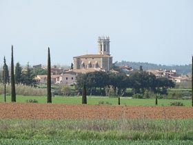 The village of Pubol is known as being part of the Dali triangle, named after the famous surrealist painter Salvador Dali. Pubol is the site of the Castle of Pubol, the residence of his wife and muse Gala, who allowed Dali to visit her when she wanted. Dali himself lived in Port Lligat close to Cadaques and the third point on the triangle is the Dali Theatre-Museum in Figueres created by Dali himself at the site of the town's theatre and now world famous for its collection of Dali works.
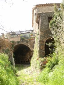 While the theatre-museum is extremely extravagant in the Dali style, Pubol remains a small Catalan village built in traditional stone with the castle itself a relatively plain catalan village castle and not particular striking with high walls with few windows. From the outside the only signs of the collection with Dali are a white statue that is just visible from a distance above the walls of the castle, and the Dali souvenir shop next to the church and the bus loads of tourists that appear from time to time. Somewhat disgracefully, we still haven't been inside the castle itself to see what the interior looks like.
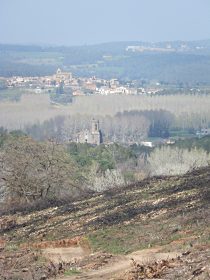 The aim of the walk though was to come past Pubol on the way back as we decided to start in the neighbouring (and grander) village of La Pera. The area itself is off the beaten track - it's neither in among the Gavarres, nor on the way to anywhere. Instead the area is rolling countryside alternating between woods and fields, interspersed by large masia farmhouses, and the occasional hamlet, and makes for very pleasant walking.
We parked and started at La Pera. The first part of the walk is on a tarmacked road, but it's very quiet as the road only connects La Pera to the neighbouring hamlet of Riuras. The road passes through green fields and the first real signs of leaves returning to the trees can be seen, with a collage of greens.
We get to Riuras and find a small collection of houses, one built with an arch over the torrent path. Continuing through the village we run into woods and a stream that carves its way down the hill to our right. The sun has brought out the first butterflies in creams and yellows flitting amongst the growing grasses.
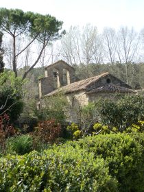 In the woods, the path turns to the left and half a couple of hundred metres on the woods break into a mass of stumps and lumber across the side of the hillside. A forest fire ripped through the area in August 2012 leaving blackened branches on the floor, but most of the trees themselves have been collected and cleared leaving a broad open expanse with views across to Flaca and Celra.
At the first left we turn up the hill through the remains of the woods. The path is muddy underfoot and great bundles of tree trunks lay stacked up to the side in dark piles. The burning must have been very extensive as it continues for 2-3 km. However, the dead trees constrast with the vivid greens of the grasses and meadow flowers growing in the light. The loss of trees also means you can see the remains of terraces and we speculate that in the past this might have been an area of vineyards before the woods took over, possibly after the phylloxera devastation in the 1880s-1890s.
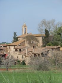 We arrive close to the hamlet of La Vilosa and pass a family out gathering wild asparagus. The path takes a left hand turn (it's the second left as you pass), past a house with an enormous long sloping roof and enough space for it's own private basketball court. By now we're back in green woods and the trees alternate with fields, with a sea of bright yellow rapeseed in flower and views up to Els Angels monestary on the Gavarres.
The path continues down the hill and emerges at the chapel and three or four houses of Pedrinya. A small brook runs past the chapel with a vegetable garden (horta in Catalan) in verdent growth. We could take the path back to La Pera here, but cross the road and back into the woods, before turning left up and around the side of a low hill. At the end we emerge to the sound of tennis just outside the municipal sports ground.
The road is tarmac again, but still quiet though there are two or three cars heading to the football ground for a Sunday afternoon match. The road runs down the hill with views over Pubol and La Pera. La Pera's grand church standing over the plain in constrast to the more modest church of Pubol.
Pubol village itself is small with a small courtyard in the centre. From the courtyard, you turn up to the Dali-Gala castle and the church next door. From outside it is not particularly remarkable. Only the ticket office and the souvenir shop across from the church indicate that there's anything special inside.
And from Pubol we walk back along the road to La Pera. There's a pavement next to the road. In La Pera families are enjoying the sun sitting outside the cafe by the church in a classic village setting of narrow streets and clustered houses.
Neighbouring walks: Rupia and Foixa - Celra, Juia and the Castle of Palagret - Madremanya, Els Angels, Sant Marti Vell - Monells and Mont-negre - Corça, Casavells, Matajudaica
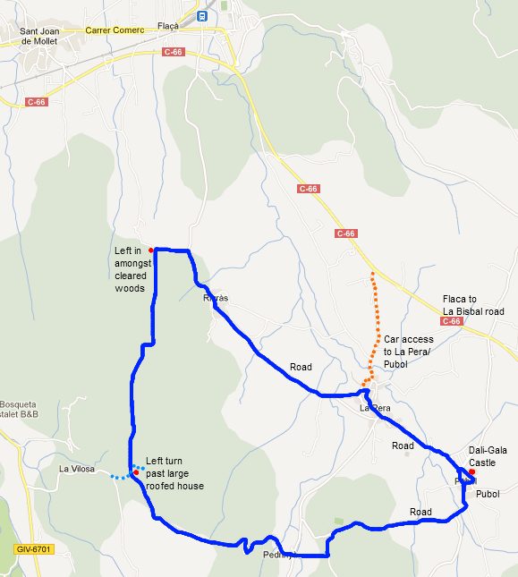
Verges - Dansa de la Mort
 In both Spain and Catalonia, the Catholic church is a very important part of the history and culture of the region. Around Easter many places in Spain have processions which tell the Easter story. And in towns at Easter you'll find people dressed as Roman soldiers and disciples acting out the story of the crucifiction.
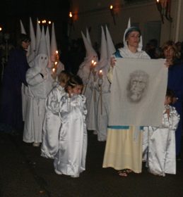 In the Costa Brava area, the most important of these traditions is the procession which takes place at night in Verges. Known as the Dansa de la Mort (Dance of the dead) as it includes a dance of skeletons as part of the procession. This is so famous that it attracts thousands of visitors to see the spectacle.
The evening has several parts. During the early evening, a re-enactment of the life of Jesus takes place in the village centre (a ticket only event). Then at midnight, the procession starts and slowly winds through the streets under the light of burning torches fixed to the buildings.
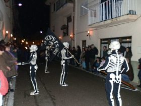 We just went for the procession and the place was absolutely crowded, though the centre at the heart of the village was closed off to all but ticket holders. Not knowing where to go or what was going to happen, we found a place which seemed to be on the route and waited.
According to the programme, the procession left the village centre at midnight, but it was almost 01.00am before it passed our location, which according to the route plan was about half way round. The procession itself was very long - it took 45 minutes to pass us. Firstly a troop of Roman soldiers marching in formation beating drums, then a group representing Herod, followed by a Simon figure carrying the cross with Jesus ahead of him being berated and taunted, followed by the other crosses. Behind them, the women (Mary), then the disciples and group of children in the classic spanish pointed hoods. This was followed by five skeletons dancing - the main iconic image of the Verges procession. After which came groups carrying or pushing the sacred icons and statues from the church.
We left after the procession had passed us, but it still had about another half to go, before a final ceremony back in the centre of the village.
Neighbouring walks: Verges, Tallada d'Emporda and Maranya - Colomers and Jafre - Vilopriu and Valldavia - Serra de Daro, Fonolleres, Sant Iscle d'Emporda - La Pera, Pubol and around - Parlava, Rupia and La Sala
La Fosca to Palamos
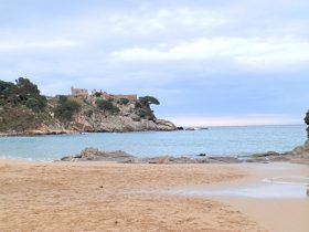 La Fosca is Palamos's 'hidden' beach, on the other side of the town to the main Palamos bay that runs down past St Antoni de Calonge. And in total contrast to the main beach, La Fosca is a gem of a beach formed by two crescents of sand under the ruins of the castle of Sant Esteve.
La Fosca is the beach with the softest sand and, because the water is shallow for a long way out, it's both great for children and as the best beach for an early summer swim at the end of May or start of June, as the shallowness helps the water temperature.
In fact La Fosca is so close to Palamos that it'll seem a little odd to describe a walk between the two. Most people will know the road route. In fact the footpath runs over a small headland that is sufficiently high to give excellent views along the coast to Castell and across the countryside up towards Palafrugell, so it is good as a shorter evening walk as the nights become longer.
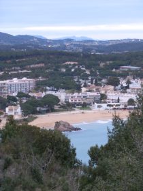 To start we parked just outside King's Campsite - a campsite popular with British visitors and children on PGA adventure holidays. Walking around the back of the campsite, we reach the sea just ahead of the Castle of St Esteve.
The castle was an important outpost in the fortification of the area and though ruined now, it's scheduled to be renovated at least to the point that visitors can have access.
From the castle, we follow the steps down to the beach and then walk across the beach. Beach volleyball players were just packing up. As the beach has the best sand and is relatively broad with good access, it's the perfect local beach for volleyball players.
At the back of the beach are a number of older Indiana-type houses (built by returning Catalans who had made their fortunes in tobacco or sugar out in Cuba), but the area has been tastefully developed and feels like a graceful place for holidays.
From the second half of the beach we have to take the walk a little way, before following the red-white flash of the GR92 past the boat houses and then round the edge of a house and up onto the headland.
The path climbs quickly above a crag in the rocks, with views back to La Fosca and the castle across the bay. At the top of the headland is a vantage point where you can look up the coast to the Formiga islands and the bays along past Platja Castell.
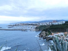 On the other side of the headland, the marina at Palamos is in front of us, with the first evening lights coming on and the town church standing on top of the end hill of the town.
Walking off the headland, is a final treat - a small hidden bay tucked off the path. Then we're on the road towards Palamos.
Instead of going all the way into Palamos, we cut through the houses. These are small streets of terraced houses of working people, far from the holiday villas you find elsewhere.
Palamos was once a royal port and garrison and has a harbour large enough for cruise liners. It's also renowned for its fishing - in particular Palamos Prawns, a speciality of the area which are feted by chefs across the world (with prices to match).
The tangle of streets emerges at a roundabout opposite one of the other campsites in the area. We walk along the lane with the evening closing in and return to the car.
Update 2021: The path from up around the headland as you leave La Fosca has been updated, and the path greatly improved at the back of the port, with a wooden walkway off the cliffs to avoid the road making the path much more attractive and giving a much better connection to Palamos without the diversion through town.
Neighbouring walks: Platja de Castell and La Fosca - Calella de Palafrugell/Cap Roig to Castell - classic wild Costa Brava - Mont-ras to Calella de Palafrugell and Llafranc - Bell-lloc and Castell de Vila-Roma (Palamos) - Eulogy to the Ruta del Tren Petit (Palafrugell, Palamos, Mont-ras and Vall-llobrega) - St Antoni de Calonge, Torre Valentina to Platja d'Aro (almost)
Swimming: Swimming and beach at La Fosca
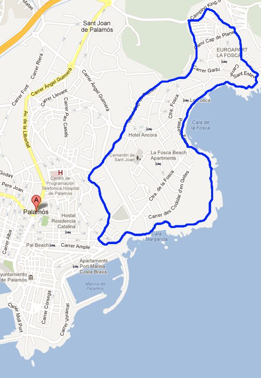
Mediterranean International Cup - football
This is just a marker to note that the Football Mediterranean International Cup (MIC) is on during Easter. MIC brings the junior and cadet teams of professional football clubs (and local teams) in a tournament organised by age group. It's the chance to see top players for clubs like Manchester United, Liverpool, Inter Milan, Barcelona, Real Madrid while they are still juniors (from under 11s up to under 19s) . Players like Messi, Neymar, Fabregas, Marcelo, Pique have taken part in the MIC. It's spread across the local clubs in the Costa Brava with different age groups in different geographic areas and entry and matches is free.
St Antoni de Calonge, Torre Valentina to Platja d'Aro (almost)
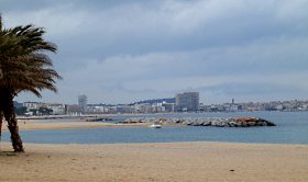 Platja d'Aro and St Antoni de Calonge (which runs into Palamos, so is sometimes referred to as being part of Palamos) are two neighbouring package-holiday type resorts, both with big flat beaches and high-rise hotels and apartment blocks. Neither look too inspiring for walking. But in actual fact between the two, around the cape of Torre Valentina are a series of small sandy bays (cala) and rocky headlands including some of the most photographed beaches of the Costa Brava. This is also part of the GR92 path.
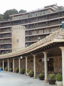 We start in Sant Antoni de Calonge. There is an older heart to Sant Antoni, but it's now dominated by the more recent buildings and we actually park out towards the supermarkets (and tourist office) close to the main roundabout that links the Calonge road to the main Palamos to Platja d'Aro road. We head straight for the beach and there is a steady stream of people and families out for a Sunday stroll, some of them carrying palm-leaves for Palm Sunday. And though it's the start of the Easter holiday, there are relatively few foreign holiday makers about.
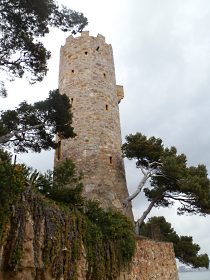 The passeo route along the beach in front of the hotel and apartment blocks passes over a metal bridge then on and past the Hotel of Torre Valentina. Around the hotel you can also see two original torres, one in the grounds of the hotel and the other on the headland. With all the modernity around, it's easy to forget that in the 1500s this was an area under frequent attack by the Barbary pirates (part of the Ottoman Empire navy that dominated the Mediterranean sea in the same epoch that the Spanish were dominating the Atlantic to the Americas) . Watch-out towers and defences were essential against the raiders.
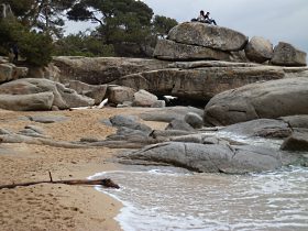 As soon as the path turns past the hotel it climbs over the headland and its character changes completely. Instead of the vast holiday-sand, there are rocky coves with pebble beaches that run into crystal clear water. The path follows the headland and then passes the tower Torre Valentina itself. The tower is connected to the hotel and has been restored, but access is only possible from the hotel itself. The path turns under a small road and head is the first of the many little bays and beaches. This starts with a series of flat rocks that stretch out into the water (Roques Planes), with a small sandy beach. We cross the sand to reach a series of steps and another small headland. Then again another sandy cove.
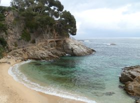 Eventually we reach the first of the larger sandy bays. Along the path are a series of sandy bays and beaches. The beaches themselves are all linked to campsites (these are Treumal, Calonge International and Cala Gogo) and we see the first campers, mostly in caravans or motorhomes in the choice spots close to the beach. In the summer there is limited parking near to the beaches except for the campsites, so for the most part the beaches are used by campers or those willing to walk a little to find a better beach.
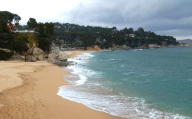 At the end of the third bigger beach we run into the first problem. The GR92 path is closed due to landslides and storm damage. This happens relatively regularly, but often by the time Easter comes the path is renovated and passable. On this path at several points where the official path is closed, it can be possible to work your way around the headland over the rocks, but the sea has a swell and we don't want to risk it. Instead we follow the alternative path back up to the main road and then look for the next connection to the next beach.
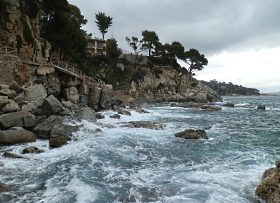 This means passing Hotel Cap Roig - a hotel with direct access to the bay. We find the path down and find ourselves on the absolutely empty beach. The beach itself is one of the most photographed on the Costa Brava as it has a small red island/presque isle at one end which means a beach with two sides. With the sky overcast and the chance of rain, the beach itself is totally empty.
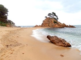 We check the path back to where we should have come from, and railing are missing and the sea swell is pounding against the rocks. So instead we try to continue to Platja d'Aro along the beach. In theory it's just another couple of small bays along, but once again the path is closed due to rock falls/storm damage.
Instead we find the stairs out which take us up and out by Hotel Sant Jordi - the second of the fabulously well placed hotels on this stretch.
The one downside to this route is that it's pretty much a one-way route - the route back is either along the road, or back the way we came along the bays. For completeness and speed we take the road route which means you can see just how big the three campsites are. Calonge International even has it's own bridge over the road. By Treumal we come off the main road and through the backstreets of modern apartment blocks and holiday homes.
Neighbouring walks: Platja d'Aro and S'Agaro - Calonge (Cami de Molins and over Cabanyes) - Calonge into the Gavarres - La Fosca to Palamos - Platja Sant Pol to Sant Feliu de Guixols
Swimming: Swimming at beaches between Platja d'Aro and Sant Antoni de Calonge - Swimming and beach at Platja d'Aro - Swimming and bay of St Antoni de Calonge
Update: Some parts of the walk that were closed have been repaired and re-opened (July 2014) with a new walkway in the parts that washed away, so it should be possible to complete the walk without having to go back up to the road.
Update 2: The final final parts of the walk that were still closed are now fully open (October 2016) with the path in a much better condition between Cala de Pi and Platja d'Aro. One little detail is that at the end of Cala Belladona beach the path is still a little confusing as there look as if there are three potential sets of stairs out of the beach - two straight ahead and one to the right. The ones straight ahead are closed - take the one to the right it leads to a path around the headland to the next beach.
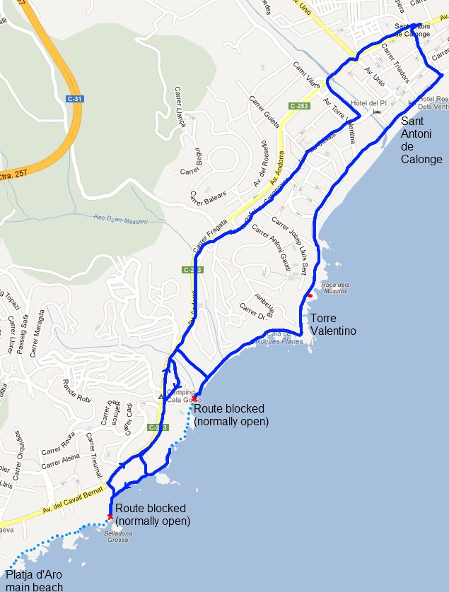
Calonge (Cami de Molins and over Cabanyes)
 The road from Calonge up to Romanya de la Selva follows a small stream up the valley. Along this stream is a path known as the Cami de Molins which runs at the bottom of the Cabanyes urbanisation just outside Calonge. This estate seems to fill the whole hillside as you drive past on the dual carriageway and isn't immediately that inspiring as somewhere to walk.
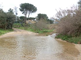 In fact, the urbanisation is both mature and well maintained and sensibly spaced out, though it still suffers as most urbanisations in Spain do, from being too separate from the main old historic centre of Calonge. The buidling of estates in isolation, means they have relatively few facilities such as shops or bars, while the old town centres fell into a little bit of decay as the population moved out into the newer more luxurious houses in the surrounding estates, but then have to rely on driving to reach even the most basic amenities.
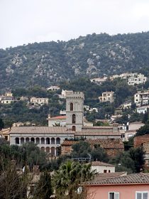 The walk though, mostly passes along the fringes of the estate running along the stream and then into the Gavarres and over the top, only coming through the estate for the last part of the loop. We parked on one of the estate roads and walked along the main Romanya road (not much walking space) to a clearly marked footpath junction (we're following yellow-white flashes). The path was more of a gravel road and passed through a ford. Unfortunately we've had some rain recently and the ford lacked stepping stones - so crossing meant taking shoes and socks off and walking through.
We then walk along the stream past houses and a few tarmac roads before the path turns into a proper track only suitable for walking. We're at the start of spring and we saw the occasional asparagus hunter in among the trees by the stream. The first leaves were budding on the trees and meadow flowers were coming out.
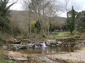 As the path runs beyond the final houses of the estates it runs past a series of brick wiers with water gushing over into mill ponds. The path runs up and over the valley of a tributary before rejoining the main stream passing through fields and then an old mill.
From the old mill it turns up to the main Romanya road and we cross the road and start upwards into the hills. It's a typical Gavarres gravel road with deep water tracks gouged out of the surface making them only really suitable for high-mounted 4x4s. We walk past a couples of renovated masias and an old farm with peacocks sharing a paddock with donkeys.
At a junction at the top we follow the signs towards Calonge. We keep going up, but finally reach a flattish path across the top. The trees are too high to give us any views, but there is a viewpoint marked and we scramble onto the top of some flat rocks to look out over the valley below and parts of Romanya in the distance.
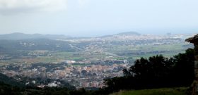 The path continues and we come to a block in the path - a chain across the direction we should go. This isn't that common particularly on officially marked paths, but it does happen - there are infamous cases of foreign buyers putting up fences to walkers, in one particular case on the GR92 leading to local officials cutting the fence and leaving notices. So we double check both on the map and for the yellow and white flashes. Despite the barrier, the path does go on. It takes us along past some vineyards then along past an old masia on top with fabulous views out towards Palamos across Calonge. The path becomes the masia's drive and we continue out and down the hill. A big gate is in front of us, but space has been left to let us past. As if to double confirm it is the right route, the yellow-white flash has been painted right next to the gate and 50m further down the road is another official waymarker sign.
We now continue down the hill all the way until it reaches the first tarmacked roads of the estates then navigate through the estate finding a series of stairways down through the zig-zagging roads.
Neighbouring walks: Romanya de la Selva - Calonge into the Gavarres - Bell-lloc and Castell de Vila-Roma (Palamos) - St Antoni de Calonge, Torre Valentina to Platja d'Aro (almost) - Castell d'Aro and estate of Mas Nou
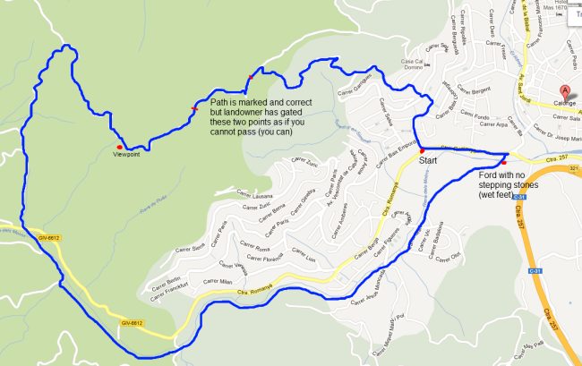
Update 2021: We returned to walk this path in reverse, this time taking in the Torre de la Creu de Castellar. The signpost markings still look like they are being deliberately removed at the top in the Can Mont area, and despite knowing the route from the other direction, we couldn't find the right path around Can Mont, which stupidly led to us having to traipse around their farmyard looking for the right way out. Clear signing would help everyone, and protect the property!
Romanya de la Selva
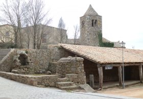 When we first moved to Catalonia, we had never visited before and knew practically nothing about any of the places. Like most people our impression was much more of coming to Spain, than coming to Catalonia. We started in Barcelona and the first year we were here, we took a holiday up in Val Repos - a meandering urbanisation just outside Romanya de la Selva. Our impression from a few summer days was that the Gaverres was hot, arid and easy to get lost. Now we've been here a while, it is true that in the heat of summer, the Gavarres can see an unbroken stretch of cork trees and dusty roads, but there is a lot more to explore and particularly in the wetter months, the Gaverres becomes a great playground of muddy tracks and hidden views.
The Gavarres are also surprising because of how quickly the landscape and terrain changes. At the lower levels of the hills at the bottom of the valleys, it's common to find meadows, streams and fields and farmhouses. As the path rises through the valley it typically gets a little steeper, then turns a corner and suddenly you're in unbroken woods with stones and rocks around.
Romanya de la Selva is a small hamlet with a church and some old pretty building at the top of the Gavarres with a grand vista looking out across the Vall d'Aro and a number of popular restaurants. We were a little limited for time so the walk is relatively short - a little over an hour in length (we'll come back to do more). The aim was to walk up to Puig d'En Ponç. Puig means hill in Catalan, and Ponç (ponce) - is the name of numerous counts of Emporda (a long stream of Ponç and Hug I, II, III).
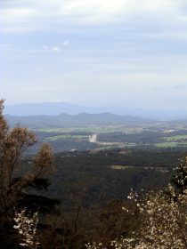 The walk runs through the village past the chapel - go to the courtyard for the views. The path to the Puig is very clearly marked (yellow-white stripes) to start with on the road, then running down into the valley into the woods. The path is pleasant, but not really photogenic - wooded paths are always difficult to capture with a photo. Occasionally there are views out towards Palamos and the sea in the distance. After descending for a while, the path turns back up the hillside and climbs up - for long enough to make you puff. At the top it meets a road (this feels quite surprising given the feeling of remoteness in the woods. Following the path again, we go up the path to the top of the Puig. And now we're disappointed. The peak is marked as a viewpoint and it has a triangulation point on top, but though there is a clearing on top, the trees all around mean it is impossible to see anything of a view - even climbing on the triangulation point doesn't help.
So we wend our way down the route we came and turn to the left down the road (very quiet). The road actually has better views than the path we were on. It runs along a ridge with views down into the wooded valley on one side, and out into the more open developed valley of St Christina d'Aro on the other side. In front of us is a radio mast and we take this road to try to get the best views. Then follow the track into the urbanisation. We get slightly stuck as it seems the only route is to go through the garden of an empty house. Then it's a simple urbanisation road back to Romanya de la Selva.
Neighbouring walks: Calonge (Cami de Molins and over Cabanyes) - Solius, rocks for climbing and ruined castle - Romanya de la Selva to Puig d'Arques - Castell d'Aro and estate of Mas Nou - Romanya de la Selva to Platja d'Aro via Golf d'Aro Mas Nou - Llagostera to Sant Llorenç
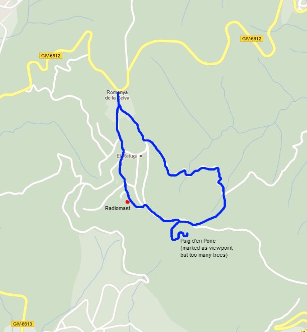
Llofriu, St Llop and Torrent
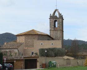 Llofriu is a small village that sits just off the main road between La Bisbal and Palafrugell. The main road passes through a small collection of restaurants - this is La Barceloneta of Llofriu, while the main older village heart of Llofriu is set a little way off the road. On the hill above the Llofriu-Torrent roundabout is the small chapel of St Llop. It's visible from the older village, but I don't think you can see it from the main road. The aim was to try to see the chapel.
Now technically (and on the map below), we actually started in our neighbourhood of Mont-ras and then walked to Llofriu, but for practical purposes most of the places we wanted to see were in the Llofriu-Torrent area, so you'd be better off with the smaller walk on the map. The long route from Torrent back to Mont-ras is fine as a bike route, but as a walk you find yourself walking a little below the height of the fields to the sides, which means there's not so much to see.
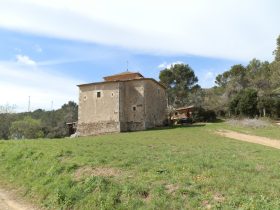 We start just outside Llofriu old village between the main road and the village itself. Next to the large individual house is a track that runs to Llofriu Barceloneta allowing us to reach the nest of restaurants without needing to go on the main road. As we approach the back of the buildings and the first houses, the path splits to the left by a field towards the gate of a house. We follow this path along the field, then at the gate a bigger path takes us into the hills. A little way along it forks again and we take the right hand fork eventually reaching a line of electricity pylons with a road track and path under the pylons up the hill. It's a steady climb and eventually at the top we reach a fiveways point.
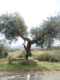 Now one problem we have with both Llofriu and Torrent is that the maps don't mark the paths very well. From Llofriu many paths aren't on the map, and around Torrent there are lots of paths and tracks, but it turns out when you try to walk them, many are closed or private. So at the top it wasn't entirely clear either where we were, or which path we should take. After a few minutes orientation, we take the road-like track to the left. This climbs up and when we reach the crest of the hill we can see a radio mast ahead of us. The track runs along the top of a ridge and has two houses taking the views - on one side to the sea and out to the Isles Medes and on the other side across to the mountains, full with snow.
We walk past the radio mast continuing straight-on (on the footpath, not on the track) and it winds off the hill. There are glimpses of views through the trees in all directions but no single clear spot to stop and admire the view. The footpath runs down until it meets another track. Again we're not entirely sure where we are but we know the chapel is near. After exploring we realise the chapel is to the right next to a farmhouse - it wasn't clear if public could go along the road to the farmhouse.
The chapel is quite plain and there is a board outside which explains that St Llop became venerated as a saint against the plague (black death). Like England the plague wiped out a large proportion of the population in the 1300s devestating medieval Catalonia at the time of its ascendency on the Mediterranean. (Also as in England, Catalonia suffered against the in the 1600s the time of the Great Fire of London).
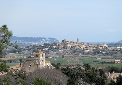 We follow the track down past the chapel, past an odd curved ball-type house and down to the main Torrent-Llofriu roundabout. Across the road are the vineyards of Mas Oller - one of the vineyards of DO Emporda - with large vats outside. We cross the road and head up the old, now disused, roadway that would have been used before the new main road was instigated. On this road is a tree with a sign (which is also marked on the maps) - but we're not entirely sure why it's celebrated. Reading later it is the Llentiscle of Torrent. Llentiscle is a tree that produces a mastic gum which was chewed in ancient Greece and Rome.
From the old road are excellent views across Torrent towards Pals and beyond, but there's no easy link to the proper footpath below so we scramble down a slope under the electricity wire to get to the path. We now head along the path - we thought there was a connection directly to Torrent, but again the map is deceiving. Instead we have to carry on to the north, then find the roadway back. The roadway itself is a little odd as it's marked by pillar-lights of about four feet high all the way down to the Torrent Hotel at the bottom (there's actually an exclusive estate at the other end of the road). The hotel itself is also pretty exclusive - another inland wonder for those in the know.
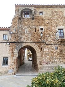 Torrent is another small medieval village, though with some modern stone houses in the centre. It feels well manicured as villages go, though it's main point of interest is the Museum of Confiture (yes, a museum of jam) just outside the main square. We pop our head round the door, but don't go in. It looks as much a shop as a small museum.
To make the loop we head out of the village to the main Pals road and have to walk along the road for about 100m before crossing to find a track through the fields opposite the Paint-ball centre. This cuts across to a masia and then meets with a road-track that would head towards Llofriu and complete the loop.
The route we take to get to Mont-ras is a bit longer. We cross the road and follow the path, firstly past a renovated masia and across a field, and then into the woods. The aim is to meet the Pals to Mont-ras path which we eventually get to after a couple of mistaken diversions. This is a good cross-country route, especially for bikes as there is no traffic and it avoid the main roads which can get busy, but for us it was a bit of a long-way round. We join the main Pals-Palafrugell route near the orange masia. At the next farm in the woods, the path forks - the right hand path runs along a dry stream bed before forking to the left off the streambed down to La Fanga. This route isn't particularly noteworth - the path sits below the level of the fields so there's not so much to see. (If we'd take the fork to the left by the farmhouse, we'd have come through the woods to the industrial estate by Esclanya which is much nicer).
At the bottom it emerges back to a main road by the farmhouse of La Fanga. This is also the name of the new shopping mall and cinema complex which is just in the process of being built just outside Palafrugell which is just across the road. Our path crosses the road and continues along the lane that runs past Mas Pla - the former house of Joseph Pla who is the most famous Catalan writer from here. The lane comes out by the dogs home Rodamon which was where we found our dog. Rodamon is a refuge for abandoned dogs and they are always looking for homes or, if you're on holiday, for people to walk the dogs. This last stretch is quite long, so if you just want to see Llofriu and Torrent, do just take the shorter route marked on the map.
Neighbouring walks: Evening walk Pals to Sant Feliu de Boada - Mont-ras Fountain walk - Mont-ras 'boar' walk - Palafrugell, Tamariu, Begur residential and Esclanya - Regencos to Pals via Quermany Gros and Petit - Santa Susanna de Peralta and Sant Climent de Peralta - Mont-ras to Fitor and on to Fonteta and Vulpellac
Local blog in Catalan (suggested from a comment): http://llofriu.blogspot.com.es/
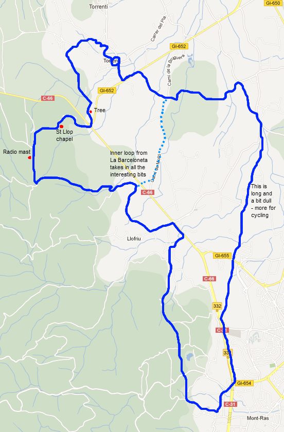
Palafrugell, Tamariu, Begur residential and Esclanya
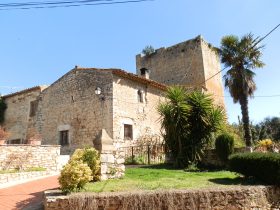 Palafrugell is the main town for many of the coastal villages and unlike the coastal villages it remains busy all year long. On Sundays there is a big market with fruit and vegetables plus clothes and ancillary items. This walk starts in Palafrugell and takes the old road down to Tamariu (Cami Vell de Tamariu). It would have been the main access route to Tamariu in the early 20th century and though the top half to the Boblia (brick factory), past the deixillaria (tip) is tarmacked, the lower section is a sandy track barely wide enough for one car. It's difficult to imagine the route as a main road.
We start in Palafrugell and head out on Carrer Begur to the new apartment blocks by the new school, turning down past the school to meet the road to Tamariu. Around the back of Palafrugell are a number of tracks and hidden roads and hidden estates in among the hills and farmlands between the main town and the coastal villages. To start with the path follows the road and is more of a country stroll. After the factory we bear to the left to follow the main track down towards Tamariu. Tamariu itself is in a hollow, so whichever way you approach the village you have to go down, and in converse, getting out means climbing out of the hollow and depending on route this can be quite steep.
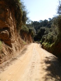 The sandy road seems to have been cut into the hill with big banks on one side, then the other with occasional glimpses over the fields when the banks disappear. There are trees around and nearby we hear the ratatatat of a woodpecker. The path gets a bit steeper (not so great if you're thinking of cycling up) before reaching a clearing in the woods. A small footpath forks off to the left along by a stream. We follow the footpath past an ugly font, then down the stream, criss-crossing over stepping stones as we go down. Eventually the path reaches a meadow and we continue following the track and it emerges by the side of Tamariu Campground. There's a chain across the path, so we're not entirely sure if the path we just came down is private, but there were no signs and it seemed well walked.
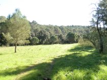 From the campsite we walk down in towards Tamariu. We could visit the town and go to the beach, but this time we follow a left hand road back up into the estate to the left above the village. We've included the walk from Tamariu to Sant Sebastian which has more about the village. Tamariu also has a route via the GR92 to meet up with the Aiguablava-Fornells walk but we're not so keen on the path between the village and Aiguablava.
The path up through the estate follows the roadway right to the top where the road ends and a small narrow path heads into the woods. We run along the top of the ridge with the main route from Tamariu to the Palafrugell-Begur road to the right beneath us (this is a gravel road, surprisingly untarmacked, but not so good to walk along). We meet the broad gravel path and walk up to the house by the junction, then across the main road towards Residential Begur.
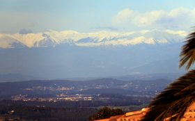 Now we are on hard footpaths by the road of the estate. We miss the path we would have liked to take towards Esclanya and instead walk in among the houses. At the brow of the hill we are greeted with a view over the Pyrenees in full snow-capped glory. We follow the roadway through the estate. Though we guess the estate was originally built as a holiday area, most of the houses have permanent residents. Many are out in their gardens enjoying an early spring day. The road heads down before turning into a gravel track down to Esclanya. In summer, the gravel tracks can get very dusty, particularly if you're passed by a car.
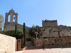 In Esclanya we reach a T junction and take the left-hand direction towards the old part of Esclanya. Esclanya dates back to Roman times and the old hamlet of no more than 20 or so houses has a very pretty church and castle. The main part of Esclanya consists of more modern estates with a small school as a small commuter village for Palafrugell.
Rather than head back towards the newer part of Esclanya, we cross the main road again towards Blanquers/Cemeterie. This road also peters out into a track and we follow the track at the back of the woods to find our way to the back of the new apartment blocks and from there back into Palafrugell.
Neighbouring walks: Mont-ras to Calella de Palafrugell and Llafranc - Far de Sant Sebastia (Llafranc) to Tamariu - Fornells and Aiguablava walk (GR92) - Regencos to Pals via Quermany Gros and Petit - Eulogy to the Ruta del Tren Petit (Palafrugell, Palamos, Mont-ras and Vall-llobrega)
Swimming: Swimming at the beach at Tamariu
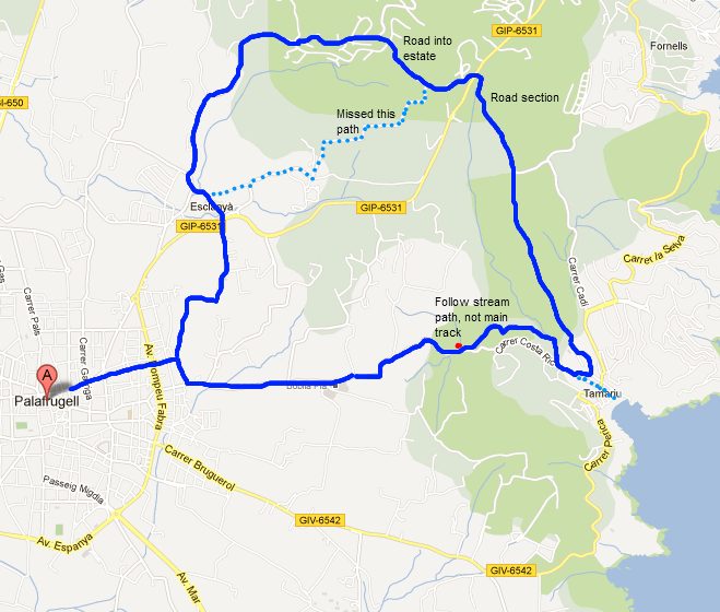
Day trip to Villefranche-de-Conflent and Mont-Louis in France
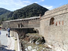 One of the advantages of being on the Costa Brava is how easy it is to get to France for a day out. The border is about an hour away and in another thirty minutes you can be in Perpignan. Historically speaking this is still Catalonia, and is now rebranded as Catalonia North, but culturally it feels French and there is a strong sense of being in a different country and culture to the Spanish side of the border. One of the big differences is rugby which is the main sport (in league and union forms) north of the border, but practically non-existent on the Spanish-side of the border.
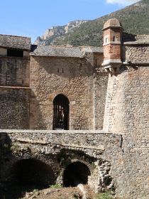 The other big change is in shopping. Though the French supermarkets Carrefour and Al Campo (Auchun in France) have crossed the border, the selection of products can be very different in range and quality to the products you would get in France. So from time to time we go across the border just to fill up with things we struggle to find locally, like syrup for squash, a joint of beef, duck or some more exotic cheeses that just don't seem to cross the border. And it would seem a shame not to make a day of it.
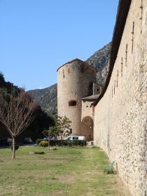 So this time we crossed the border, reached the outskirts of Perpignan and then turned towards the mountains in the direction of Prades and Andorra. It's currently ski season so there is snow across the top of the Pyrenees and a steady stream of cars coming towards us with skis on their roofs.
From the Costa Brava there are really four possibilties for skiing. The closest is to Valter 2000 which is above Camprodon about 4-5 km above the closest village of Setcases. The second is Val de Nuria above Ripoll on a fenicular railway both are a little less than 2 hours from the coast. Next on the Spanish-side, the next is La Molina/Masella, but this is a very bendy road from the Ripoll-side and is best reached from Berga through the Tunel de Cadi, and if you're going this way you could also reach Andorra. The alternative is to cross the border into France and head up to Font-Romeu.
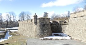 We weren't going skiing ourselves, but more sightseeing with the aim of visiting Villefranche-de-Conflent which is a walled town/fort situated in the valley that leads up to Font-Romeu that dominates the access to the valley. It sits just beyond Prades which is famous as the adopted home of two notable Catalans - Pau Cassals a world famous cellist, and Pompeu Fabra who wrote the first description of the grammar of the Catalan language. They came to the French side of the border as exiles from the Franco regime.
Villefranche-de-conflent sits on the confluence of two rivers and is a world heritage site. The area of Roussillon/Catalonia Nord has changed hands several times between the Catalans/Spanish and the French, finally becoming part of France in 1659.
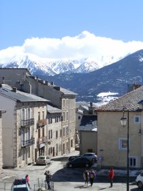 The town as it remains is unspolit in original condition reflecting the strengthening of the castle by Vaubon in 1700s. It's not large - about four streets wide each of about 150m length, so it doesn't take long to walk around and there are several cafes and artisan shops. At the sites of the drawbridge and portcullis you can still see the chains inside the gate house. There is a higher fort across the railway bridge above the town, but we chose not to visit.
Instead we decided to continue another 30km up the vally to Mont-Louis. This is another Vaubon fort but sits just above the col at the highpoint of the road - about 1600m. To reach it, the road curls up the valley and is bendy in places and broad double lanes in others. As mentioned, there was snow on the mountains and so when we reached the top there were the remains of snow piles built up next to the walls and houses, a huge contrast to the warm spring conditions back at the coast.
Mont-Louis is another fortress town, but with relatively few houses and a still occupied army barracks right at the top. From the ramparts you can look across to the mountains which were covered with snow at the top, and across the valley you could see chair-lifts and ski-ers on the pistes opposite.
On the way down we visited Ille-sur-tet, an old catalan town in the Spanish style, but not quite as interesting as it looked from the road as we passed. The shopping we did in Le Boulou (Le volo in Spanish) which is close to the border and saves having to go all the way to Perpignan.
Walk nearby: La Jonquera to Fort de Bellegarde (France) - Mollo (Camprodon) - Pyrenees to France
Neighbouring visits
White water rafting in Quillan (France) - Collioure (France) - Perpignan - Elne (France) - Ceret (France) - Andorra La Vella - Ribes de Freser and skiing at Vall de Nuria - Visit to Setcases - Puigcerda and Bourg-Madame
Comments | ||
adam@veggingoutwithadam.com |
17 Feb 2014 19:46 |
|
What a great blog. I am planning a walking holiday in the region and wonder if you can recommend the best walking maps, like UK ordnance survey ones. I shall be reading more of your walks over the coming days as we plan. Many thanks Adam | ||
Saul |
24 Feb 2014 17:25 |
|
Glad you're enjoying it. We have recommendations for maps in our 'Advice and FAQ' section | ||
Saul |
13 Jul 2017 12:46 |
|
Sorry I missed the comment, so I hope it's not too late - use the contact box if you'd like to send a message. For the coast, the GR92 is best and if you have driver you can just take it piece by piece. For hikers, around Cap de Creus is great, though it can be dry and hard walking in summer. For us, the stretch between Palamos and Palafrugell and on to Begur is the prettiest part of the whole Costa Brava and really good for walking. I'd probably also take the walk up and over Montgri, possibly starting at Pals, or L'Estartit to L'Escala. And though you said you prefer the coast, don't overlook inland routes as there are some wonderful villages and countryside out towards Girona, La Bisbal, or Olot. | ||
Sven-Gunnar Furmark |
24 May 2017 11:43 |
|
Hi, My name is Sven Furmark. I am from Sweden. I plan to go to Costa Brava with some friends (totally about 10 people) for hiking for one week (5 walking days). We are experienced hikers and we usually walk 4-6 hours per day. We prefer to walk along the coast as much as possible. We plan to rent a house and travel to each days hiking with a bus & driver which we plan to book for the whole week. Which five hikes would you recommend for us. Warm Regards Sven | ||

