 Walks and other things
 One of the joys of the Costa Brava is the variety of landscapes and we like to visit places and walk (a lot), particularly into and around the Gavarres. Sometimes we travel around on bike. In the summer, we swim and canoe.
These then are write ups of walks, hikes and activities that we've done since November 2012, with photos straight from the original walk or activity.
We like to make circular walks and our walks range in length from about 4km (an hour) to around 16km (four hours) - but probably about 2 1/2 hours on average - though if you want to reduce the length, there are usually shortcuts.
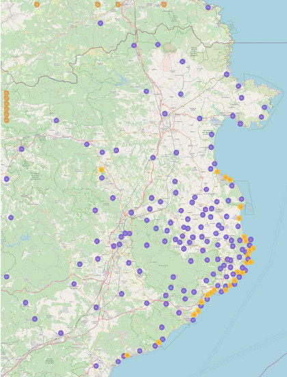
To find walks by location, click on the map, which goes to a full sized map with links to individual walks and visits. To our surprise, we were listed in the Sunday Times' Essential Costa Brava (Feb 2017).
The most visited walks are:
- Calella de Palafrugell/Cap Roig to Castell - classic wild Costa Brava
- Far de Sant Sebastia (Llafranc) to Tamariu
- Platja d'Aro and S'Agaro
- Sa Tuna, Cap de Begur, Begur
- Eulogy to the Ruta del Tren Petit (Palafrugell, Palamos, Mont-ras and Vall-llobrega)
- Fornells and Aiguablava walk (GR92)
- Mont-ras to Calella de Palafrugell and Llafranc
- Platja de Castell and La Fosca
- St Antoni de Calonge, Torre Valentina to Platja d'Aro (almost)
- Escala, St Marti d'Empuries and beyond
- Bell-lloc and Castell de Vila-Roma (Palamos)
- Platja Sant Pol to Sant Feliu de Guixols
- Roses - Canyelles beaches to Cap Falconera
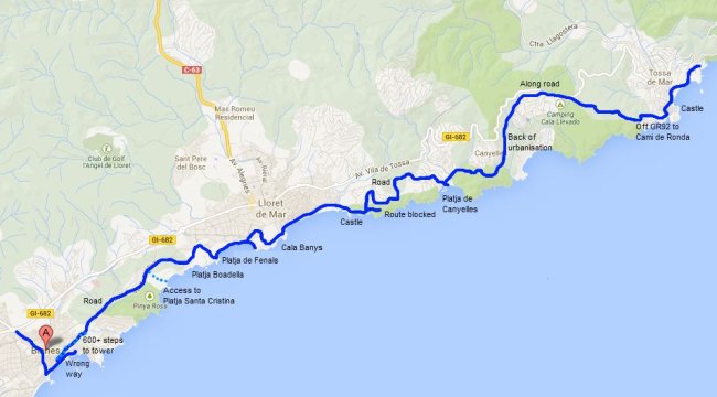
- Blanes, Lloret de Mar, Tossa de Mar by GR92
Lloret de Mar to Sant Pere del Bosc
 The southern part of the Costa Brava consists of three towns - Blanes, Lloret de Mar and Tossa de Mar, all on the coast, with hills behind. Around Lloret in particular, the hills are full of large sprawling urbanisations of houses and villas built to target holidaymakers and second home owners.
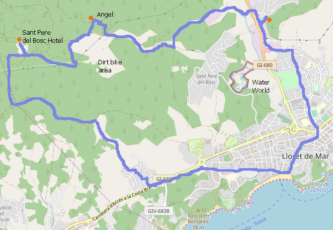
We have explored a little bit behind Tossa de Mar, but nothing into the hills behind Lloret, so seeing one of the spurs off the GR92 runs inland past something call "Angel" we thought we'd explore.
Our route starts just outside Lloret de Mar, just beyond Water World water park (which is open from the end of May to September), close to the Emita de les Alegries (or Aldi). The path is well marked with clear signposting, and the traditional red and white flashes that mark a GR.
We park just into the Urbanisation of Mas Romeu, and walk up to the first sign post. We have to cross the road which, being a main access road to Lloret, is busy with cars heading in and out, even though this is still March.
Crossing the road the path is easy to follow alongside a small stream and heads up towards the hills and it seems that Lloret disappears quite quickly from view.
The path heads up past a very large water works, with very large settling tanks that are empty at the moment, waiting for the influx of summer. The faint smell of sewage isn't so nice, and it's not the best start to the walk.
After the waterworks the track follows a tarmacked road up into the countryside, used by a handful of cars heading for a hidden restaurant.
We reach our first junction, and turn to the right. The tarmac disappears, but we are still on a gravel road, dry and dusty because winter hasn't had much rain this year.
 The path follows the track and unexpectedly we pass dog walkers and joggers - unexpectedly because it feels relatively remote. We're also passed by a handful of cars and a van that kicks up a huge amount of dust into the air without any consideration for ourselves or a jogger overtaking us.
As we go higher we see that the van is probably connected to a number of motocross riders as there is a dedicated track in the forest with several groups of motorbikers whining away on the hillside.
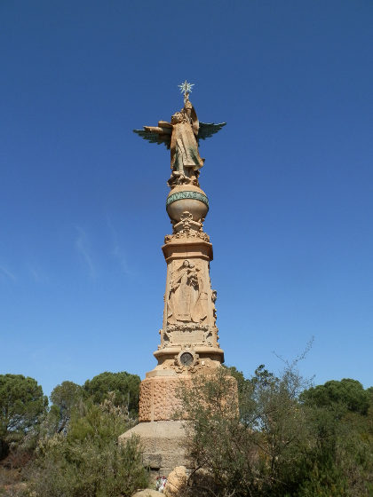
However, for us, to our right we see the signpost for 'Angel' pointing into the woods. It looks like it follows a track down, so we try that, but don't find anything. We retrace our steps and this time head upwards to find a tall finely carved monument with an angel on top of a column. The momument at some point must have been quite grand with steps and almost gardens around it, but now looks a little neglected.
From the monument itself though, we can see a house and what looks like a church in the distance. Though we don't know it, this is where we'll be heading - Sant Pere del Bosc, and the monument formed part of the large estate in the hills.
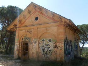 From the monument we return down to the GR92 on the gravel roadway. More motorbikers pass us and we walk past two modernista chalets/buildings, again in a poor state of repair and covered with graffiti, but indicating the grandeur of the estate at one point.
The road splits and we take the left fork, still on the GR, and it runs around the hill over a 20m high brick bridge over a gorge, with a little bit of water in the stream creating a wooded glen.
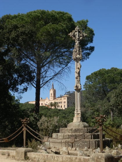
Now the track turns back up into the dry again, past flowering lavendar and rosemary, but feeling more arid. Towards the top we find an ornate stone cross and then the gateway to Sant Pere del Bosc - a hotel and spa now, but formerly a convent and then a count's mansion for Nicolau Font Comte de Jaruco (1830-1908).
The path runs around the outside of the hotel, but we go into the grounds to take a peak.
The main building retains its convent look with a large plainish front with arched windows, but a ceramic tiled church-like spire in the middle. This is now the main part of the hotel and looks over a crystal clear swimming pool in the garden.
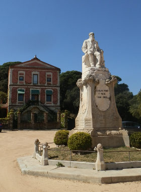
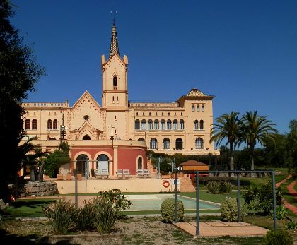 To the sides are two other buildings and a statue to the count who was the former owner. And in the grounds just outside is another small tower. With a morgan car on the driveway it feels like stepping back in time to the 1920s and 30s, with the woods, and sea and blocks of Lloret away in the distance.
The panel outside the hotel explains the history. A convent in the 11th century, destroyed by the French in 1759 and rebuilt in its present form, and then sold off when religious buildings were sold, and bought by Nicola Font i Maig Comte de Jaruco, one of the Catalan Indianos who made his fortune in Cuba who then refurbished the location and estate, followed on by his descendents introducing modernista elements.
We return to the GR past the hotel and back into the woods. At the top of the hill we aim to turn left and to take a mountain bike route (BR4) back to town and we have to check the map to find the right route.
The top of the hill gives views over the valley and town of Tordera, and to the right of Lloret town, we can see Blanes and the tower of Sant Joan up on the hilltop above the sea.
 The walk back down the bike route is more pleasant than the road way up as it's narrower and without cars with a gentle slope down past some woodland barracas.
We reach a well-kept vineyard, which feels a little out of place in the woods but is very pretty, and turn down towards Lloret and Santa Cristina. where it runs into a housing estate and down to the main road.
The road is busy, and it's not clear if there's a footpath into town, but crossing over we find a track that was hidden by the height of the road and return into Fenals and through the heart of Lloret.
Lloret itself is trying to divest itself of a reputation as a drunken boorish party town and the modern apartments around Fenals look attractive. It's towards the centre of town that you see the banks of hotels, with terraces like pigeonholes over looking their pools. The centre of town itself is where young people hang out in the season, with a large fairground catapult tower and bars and discos. During the day as we pass, there is nothing going on, but lots of Russian voices and older Catalan visitors in town.
We head up towards the modern sports area and schools that look as if they have had a lot of money invested with several sports halls, and an indoor olympic sized swimming pool. The area is more residential and park like with places to stroll besides the apartment blocks. Heading out it feels more local and less touristy. A small neighbourhood festival is happening in one of the parks.
As we get closer to the car, we're passed by families in traditional Sikh robes and turbans and we pass the Sikh temple where it looks as if there has just been a wedding with large numbers of ladies in ornate and brightly coloured saris.
Finally we reach the car feeling a little dry and red from the March sun and the relatively long walk.
Neighbouring walks: Platja Sant Pol to Sant Feliu de Guixols - Tossa de Mar north to Cala Pola - Tossa de Mar to Cala Llorell - Sant Grau and Cadiretes near Tossa de Mar - Cala de Sant Francesc (Blanes) - Lloret's Platja de Boadella, Platja de Santa Cristina
Swimming and beach: Swimming and beaches of Tossa de Mar - Swimming and beach at Fenals, Lloret de Mar
Sant Llorenç de la Muga
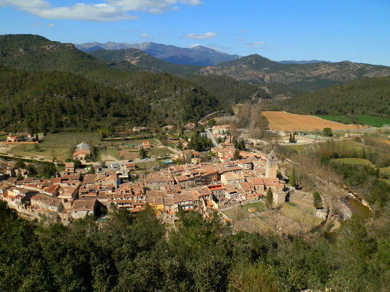
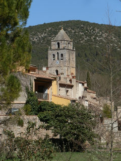 Sant Llorenç de la Muga is a small town situated in on the Muga river in the hills that rise behind Figueres to the French border and is a real find. The town with its old bridge, well-preserved centre and town gates complete with portcullis entrances is complemented with a tower, castle and walks into the pine woods along the river.
It's difficult to explain, but as you leave Figueres and pass through Llers into pre-Pyrenees the landscape seems to change dramatically within just a few kilometres. From the broad Empordan plain that stretches to the sea, suddenly you are in deep wooded valleys with high peaked hills and behind them views of the snows on Canigou. The trees are pine, instead of the lower Alzina and cork oaks nearer the coast, and the fields along the bottom of the valley are cultivated with crops rather than the olive groves of the drier fields of the Albere mountains that you would find closer to La Jonquera.
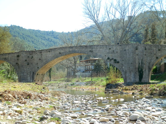 The town of Sant Llorenç de la Muga is found on a single in-and-out road that leads to Albanya and the Gorges de la Muga (which we intend to get to in summer). However, despite its relative remoteness the town is very well renovated and preserved, attracting French tourists from across the nearby border.
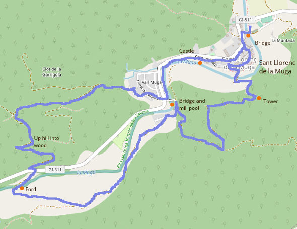
 For this walk we arrive and park in the first parking area, just before the new road bridge, and right next to the old original stone bridge that crosses the Muga.
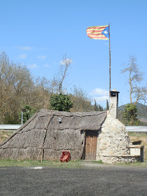
In the vicinity of the parking, down towards the river is a odd house clad in reeds or wood almost like thatch - something we've never seen in Catalonia - and it's not clear if it is a house or a working building as there are scattered remains of charcoal in a circle outside.
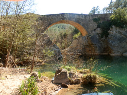
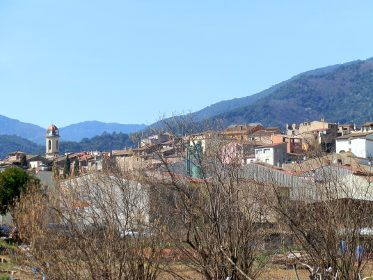
 After taking photos of the old bridge from the new bridge, we cross the old bridge into town. The bridge is a classic cobblestone bridge with clear shallow Muga river bubbling over the rocks and stones below and we can already see the church and the watchtower that stands above the town.
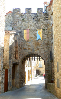
We head towards the town centre to explore a little. The first thing we come to is a town gate with portcullis in place, just beside the safareig (communal village laundery or wash place - very common in Catalonia towns) beside a smooth running stream.
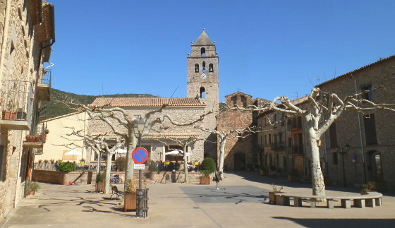 The portal gate leads into the main part of town, two small plaças and stone walled medieval houses that look as if they could have been built yesterday. Our tour of the centre discovers more gates, all with portcullis in place, and a large square in front of the ajuntament with French speaking visitors taking lunch on the terrace of one of the local restaurants.
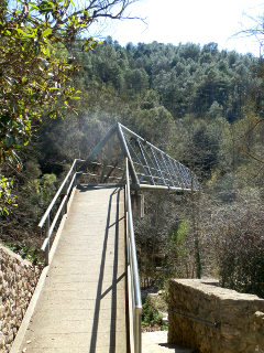
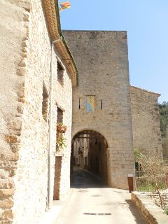 Leaving one of the town gates we find a strange triangular bridge over the river that seems to lead up to the watchtower above the town. Keeping it in mind, we return via the next gate to see the church - almost two churches actually - one older in front of the newer clock tower.
We now follow the river, crossing it on an older bridge just below the triangular bridge so our dog doesn't have to cross the metal gridded floor which is uncomfortable for her paws.
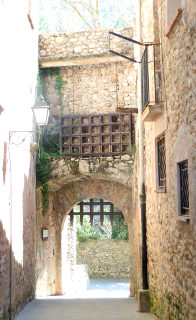 On the other side of the river there are a series of flagstone steps and pathway that climbs up to the tower. From the top we have a grand vista of the town and the river valley below, and out to the higher hill peaks in the distance.
From the tower, we take the track at the back down, rather than the way we came. This gently follows the rough direction of the river past a telephone mast, and then down through the pine woods and white blossomed shrubs and budding deciduous trees enjoying the spring sun.
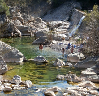
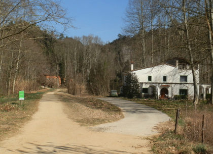
 At the bottom we pass a masia farm then arrive back at the river, just by a second old stone bridge. This time we can here music and rushing water and we can see a family swimming and picnicking in a water pool beside a waterfall close to the Ermitage de Sant Antoni. Its March, so it's surprising to see people swimming, but the water looks lovely - deep and clear, particularly under the bridge itself.
 Instead of returning towards town, we carry on out taking the path past the small number of houses and out back into the woods above the river valley.
After about 3km we take the path down towards the river, past another farmhouse and find ourselves with a ford and long-step stepping stones to cross the river.
 To make the loop back, we want to avoid the road - which is quiet, but we prefer to be off the tarmac, so we head up a track into the hill, climbing steadily at quite a puff. The first junction right takes us down on the far side of the hill and we follow the path steadily back down to an urbanisation close to Sant Antoni bridge. As we go down we pass more French tourists on a walk themselves.
 To connect back to town there is a path just beneath the road, which you find if you cross the road close to the Ermitage. Though it's close to the road it is quite separate and there is no road noise, and good views of the river.
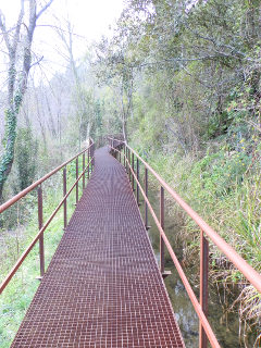
Eventually this path arrives at a metal gridded path/platform that runs above a millstream water channel for about 200m - the water clear with fish and water boatmen underneath the metal grid. It would be lovely, except for carrying our dog (who seems a little heavier than we remember).
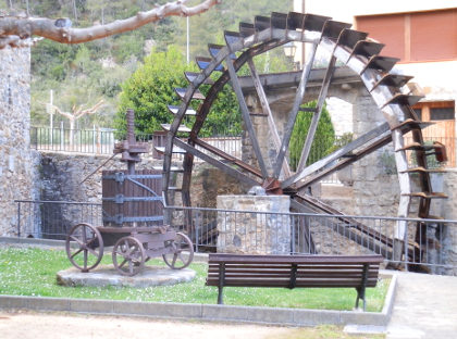 Eventually we reach steps at the bottom of an old castle - privately owned, so not visitable, but right next door is a working waterwheel powered by the mill stream we just walked above and along.
From here we connect back into town meandering back to the car park. A lovely walk and town that surprised us, but has already got us thinking about going back to explore further up the valley.
Nearby: Lladó (between Figueres and Besalu) - Figueres and Castell de Sant Ferran - Waterfall at Les Escaules (Boadella) - Espolla to Rabos - La Jonquera to Fort de Bellegarde (France) - Sadernes and river pools of St Aniol d'Aguja - Castell de Requesens (Cantallops) - Sant Llorenç de la Muga
Bonmati and Anglès
 Anglès is the main town that you'll reach if you head almost due west from Girona out along the river Ter. The town is situated on a small hill above the river plain but surrounded by hills, the main ones being the Guilleries Massif that acts as the divider between the plain of Vic and that of Girona.
(and it's through this range of hills where you'll find a series of spectacular river lakes (the Panta de Susqueda and Panta de Sau) formed from damming the river Ter as it passes through the hills starting at the neighbouring town of La Cellera de Ter).
When we were updating our map of walks, we realised that we haven't really covered this area west of Girona. We have visited and explored, but not actually written anything up, partly because we're not too familiar with the area. The geography is one of long river valleys - the river Ter, the river Llemena, below large sparsely populated hills and more isolated villages, some with high escarpments, making for more linear type walks.
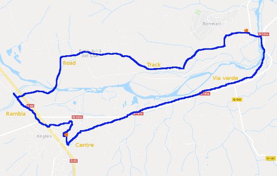
 So to try to provide more of a feel of what can be found in this area, we're doing a relatively flat exploratory walk starting in the new town of Bonmati (built in 1990), along the Ter and the Via Verde of the Carrilet that runs along the old railway line from Girona to Olot, and then back via Sant Julia del Llor.
We'd not visited Bonmati before - it's just beyond Bescano along the river, and the road, river and old railway route run close together in parallel. The Via Verde is used as a cycling path and is popular with cyclists who share the gravel track with walkers, some of whom are following the Catalan part of the Route of Saint James as it heads to Santiago de Compestella.
Bonmati isn't much to write home about, a few factories and warehouses and the bulk of the town consisting of new urbanisation housing and a large and very impressive sports centre. However, it's easy to park and connects directly to the Via Verde.
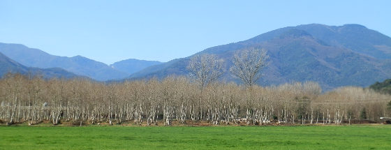 We're currently just pre-Spring and the buds are appearing on the trees, but no leaves at the moment. However, the day is warm and its pleasant to walk in a light jacket, with the blossom appearing on the almond trees.
The walk could be considered more of a stroll as the path is broad and flat with views to the river, which perhaps isn't at its most photogenic time of the year. Because the route is shared with bikes, we keep an eye out for families and other cyclists from both directions. Fortunately they're not fast - the quicker road cyclists can be seen on the road that runs beside the path.
In fact, we're close to the road for a lot of the time as we head to Anglès in the distance, and cars do use it as a main route, to there's a fair amount of noise.
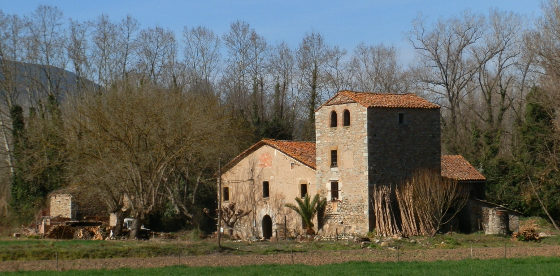 Everywhere around here seems to be allotments or vegetable gardens (horta), with soil carefully weeded and prepared and signs of onions, cabbages and cauliflowers, and bamboo frames for beans and peas. As we get close to Anglès we pass one of the old masia farm buildings (Can Biel) with a large square tower that looks unchanged from the 18th century - rough but sturdy, still farming the surrounding land.
As we get to the outskirts of Anglès we cross the main road (which diverts around the outside), to take a town road towards the centre, the church tower with its four clocks on the rise acting as our target point.
Anglès is a slightly strange mixture of modern, old and, it has to be said, the occasional derelict building. We've visited two or three times in the past, and it's fair to say that efforts are being made to upgrade the town - there is a sense of regeneration. However, Angles like some other communities into the hinterlands west of Girona carry a sense of mixed fortunes.
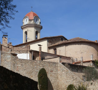 The older buildings and churches are interspersed with crudely built blocks of flats built in the 60s and 70s, and as the towns fortunes waned, some of the older buildings have fallen into disrepair. In more modern times, the money has gone into new buildings in current design, and it feels like it is only recently that older buildings are seeing restoration of their fortunes.
The result is a curious mish mash of styles where a brand new luxury apartment building might stand next what could be a decaying, but potentially very pretty, 1900s modernista building.
Along our route into town we cross a small stream, clearly recently cleaned up, waiting for rain to refill the cleared river bottom of displaced soil. The river itself trickling through, leaving large trout trapped in deeper pools.
And then we double back to the park of Can Cendra, before taking the road up the hill into the older part of the town to the church at the top with views across the town and out to the hills.
 The upper part of Angles is relatively small - the church connects along the old Carrer Major to the main town placa, unfortunately too full of parked cars to be very attractive. Along the Carrer Major, the older buildings have been marked and labelled giving a flavour of the history, but still with the odd mix of well and badly preserved buildings.
We navigate down to river level around the back of the placa, and then through the recently updated streets under the church - part of the restoration since last time we visited.
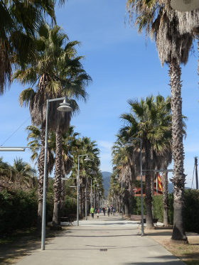
We then head out back towards the river and the large old Bures factory and past the old station. The old train line has been converted into a strolling route, almost a rambla, with tall palm trees marking the route as it passes the old station - the palms being a little incongruous this far inland with the greenery of the surrounding countryside.
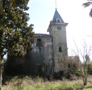 To the left of the station as we're walking we see a large modernista house (Villa Eulalia). It's slightly hidden from view by large trees so we loop back across a makeshift football field and this takes us to the Barri of Cuc - a small group of older houses close to Can Cuc, a beautifully preserved old masia with lovely exterior stonework.
We still want to see more of Villa Eulalia, but it's tucked behind a large gate. However, we can see that it is another one of the older grand buildings now in a poor state of repair with missing glass and out of control vines growing up the wall.
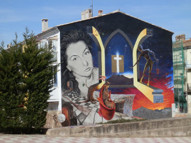 Leaving Anglès we continue a little way along the carrilet again considering whether to head to La Cellera to add the entrance to the Ter river lakes to the walk.
However, instead we cross the road and out to Sant Julia de Llor. The walk crosses the river along the road before turning to the right to Sant Julia, just past the remains of a ancient Roman wall or house. If we'd turned left we'd have reached a Roman bridge, but didn't realise this at the time.
Sant Julia de Llor stands slightly about the fields of the flood plain looking towards Anglès - a simple one road linear village. On the far side we finally return to a track and edge along the bottom of the hill back to Bonmati. It would be possible to go up to the top, but the air is still and the day is getting hot in the shelter of the hillside.
Nearby: Sant Esteve d'En Bas (Olot) - Els Set Gorgs (Campdevanol) - Rupit - Olot - capital of Garrotxa - Swimming and visit to Panta de Sau - Bescano, River Ter and free-style kayaking - Canet d'Adri - Brunyola - Arbucies autumn walk - Volca de la Crosa Sant Dalmai (Girona Airport) - Santa Coloma de Farners
Montgri Massif from Les Dunes L'Estartit
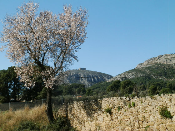 Montgri is probably the most iconic mountain of Emporda rising above the surrounding plains visible for miles in any direction, characterised as a reclining lady with its isolated castle acting as a beacon and signpost for visitors and migrating birds.
We have touched on Montgri in several walks in the past, but not really done justice to the mountain itself. For this walk we're following a route from Urbanisation Les Dunes, situated between Torroella de Montgri and L'Estartit, up to the top and along, then back down to Torroella to complete the loop along the flat.
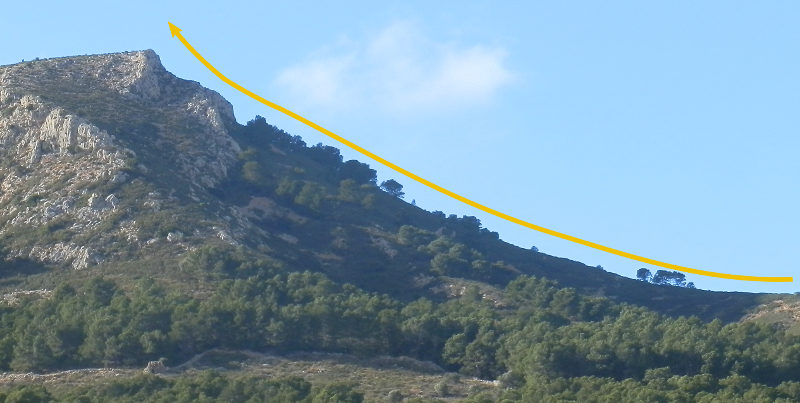 Though Montgri looks benign from below, in practice this is a challenging walk, particularly if you don't like heights or steep climbs. And unfortunately that includes me, so this is a walk that has parts I don't like - it's actually the second attempt to complete it, and even then, we didn't do the whole walk as I'll explain.
Montgri rises to 311m, so it's not that high as mountains go, and is a dry, relatively barren and rocky with vegetation limited to low holly and rosemary with plenty of loose stones and rocks underfoot. Even if just going up to the castle from Torroella, Montgri is a mountain that requires proper footwear.
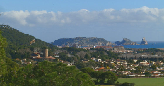 The walk starts gently, Les Dunes urbanisation up to the house of Les Dunes midway up is a walk on soft sandy paths through the cedar pine woods with views out to the Illes Medes and L'Estartit, and across the rice paddies around the Ter river.
At the house at Les Dunes, is a small picnic area and some parking, and views across to Cap de Begur. For walkers the Col de Sorres links paths to L'Escala and Sobrestany over the hills, with the main east-west path up to the mountain.
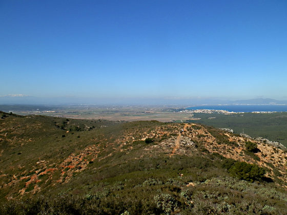 We take the path up, and soon we have left the trees behind us, and are fully on the hill, with the ground changing from softer soil to thumb and fist sized rocks lying loose on the ground, that slip and crunch as you walk on them.
The path steepens as it goes up - one of the features of the paths from this side is that they are steeper closer to the top. If you have a sensitivity to heights this generally means the walk will get worse for you the higher up you go.
The low scrub means that anywhere you stand you can see clearly in all directions with nothing to obstruct the view. The views initially are best to the left and behind to L'Estartit, but quickly you get to see the view over the Bay of Roses with a grand vista that takes in Cap de Creus and out to Figueres and the Albera mountains, and then on to Canigou currently topped with snow.
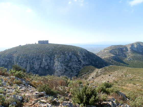 The path continues to go up. Ahead you will see a small white cabin - this is roughly the direction we'll take. The cabin is just above an escarpment, but our path will pass underneath and then come up from the other side. However, before then we have to keep going up. The higher we are, the more it seems the sides of the hill fall away, and we catch the wind blowing across the mountain.
Nothing is dangerous or difficult about the climb, but the height and steepness are uncomfortable for someone who doesn't like steep heights.
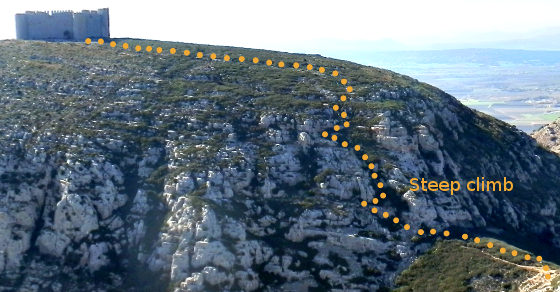 Eventually the path reaches a point under the escarpment and levels out tracking under the rocks above. The hillside falls away to the right but no sharp verticals, though clearly you feel high up. Across the mountain you can see remains of a strange small stone hut, and out in the distance see the watch tower at Montgo.
After passing along the flat path, we come to a T junction. The left hand path goes up into the escarpment and onto the top of the long flat peak of Montgri if you were looking from the bottom (Montpla). The right goes down and eventually reaches the church of Santa Caterina lower down, situated within the folds of the massif.
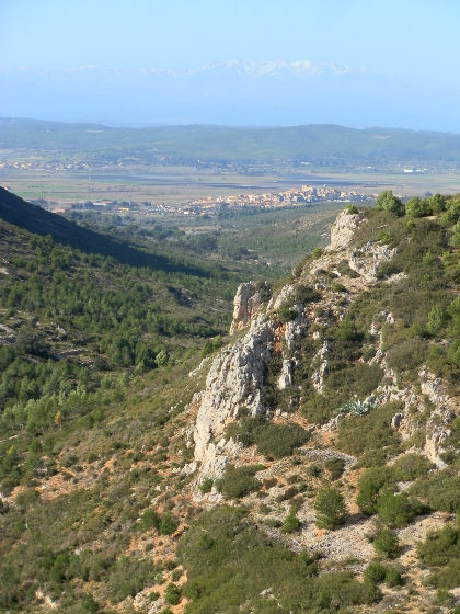 If you are walking and finding it uncomfortable because of the height, this is the first opportunity to find a different route down. There are very few connecting paths, so once you are on a route, the only other alternative would be to go back. The first time we did this I took this lower path, while the others I was with continued over the top.
This time we head up through the last of the rocks, coming out on a large rounded top for the mountain, with views in all directions but the same scrub and low vegetation, so not really a comfortable place for a picnic or to sit and take a breath.
Instead, we carry on along the top and then track down, past a small Catalan flag. We can clearly see the castle ahead of us on the neighbouring peak, and the path to get there. And we can see that this is not going to be a path I'll take.
 We follow the track down to the saddle point between the two peaks and ahead of us we can see another couple making the route up to the castle. From where we look the path goes up through the rocks and is steep with a drop.
Fortunately there is an alternative, to the right is a steepish path in loose scree that will take us down into the valley at the bottom. There are no other options. Ahead is a family with children who also look as if they decided the climb to the castle was not for them. This is not a good path - the loose rocks slip and roll under foot, however, the only other alternative would be to go back over the first peak and down.
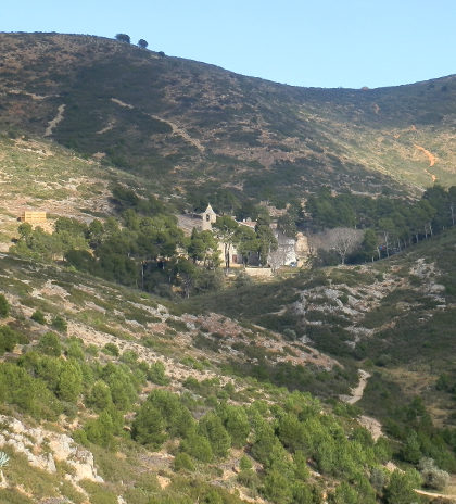
 After a rough scramble down, we get to the bottom and the main path to Santa Caterina church. The church is also the site of a restaurant and attracts visitors in the summer.
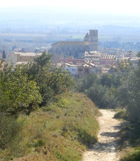
We head to the left, and to the saddle point with the cross that sits under the castle on the main route up from Torroella town to the castle at the top. From here, we then track back down to Torroella - the path remaining rocky and rough under foot, until you almost get down as far as the olive groves at the bottom. We turn past Sant Gabriel school on the road, past the football ground and out along the flat path past more olive groves and eventually past fields back to Les Dunes.
Neighbouring walks: L'Estartit to Cala Pedrosa and Cala Ferriol - Torroella de Montgri castle - Gualta, Llabia, Fontanilles and the lake of Ullastret - Pals beach to Gola de Ter - Sobrestany, Montgri and Bellcaire d'Emporda - Torroella de Montgri to Gola de Ter - Bellcaire d'Emporda, Tor and Albons - Torroella de Montgri and Ulla
2019 updating
When we started this blog in November 2012 we added a lot of walks and visits around the Costa Brava pretty quickly. Now, with nearly 200 walks and articles under our belt, we've slowed down considerably in terms of adding content.
It's not that we've stopped walking. We're still out and about following many of paths, or visiting many of the places we've mentioned (and adding updates to articles when we discover a change), but there are fewer new paths to add, and we don't include walks which we don't find too interesting.
Having said that, it's 2019, so we're going to spend a little bit of this year doing some housekeeping to freshen up the site. And along the way we might adjust focus to look in more depth at some of the towns and villages and hidden nooks and crannies.
Castell de Requesens (Cantallops)
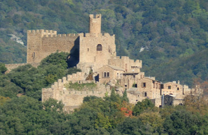 The Castell de Requesens is an oddly remote, yet wonderful semi-preserved castle set in the hills of the Albera mountains that separate Spain and France just to the east of La Jonquera.
When I say 'oddly remote' it's because the castle itself is approximately 6km from the nearest village of Cantallops, along a dusty gravel track that wends its way through the hills and with no obvious routes or lands that such a strong castle would need to defend.
We had seen pictures and we knew of the castle because it had cropped up in some deep history of the Catalan counties, and their warring counts, so on a clear day we headed towards the French border and La Jonquera, before turning out of the large cut-price supermarkets that cater to the departing French, and up to the small village of Cantallops.
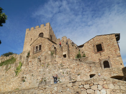 Our aim had been to walk from Cantallops up as there should be a circular walk to the castle and then back down. However, though Baix Emporda was clear as a bell, as our drive crossed into Alt Emporda the wind was blowing fiercely from the direction of the newly snowcovered Pyrenees.
By the time we got to Cantallops there was a fierce crosswind channelling along the hills. Not wanting to waste the journey we decided to attempt to drive up, at least to see what the castle was like.
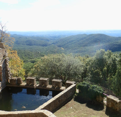 What we hadn't quite anticipated was the gravel track we'd need to take just after the exit of the village.
I'm not keen on untarmacked roads, particularly after having got stuck on Montgri a few years ago, and this was a typical one of those roads, pitted and potholed, narrowing at times and occasionally with an open drop to the side.
We didn't know it when we started, but it actually gets better further up. Our suspension got a work out as we made our way up, but we weren't the only ones on the route. This is a popular place to visit as we found when we got to the top.
The other part was that luckily we didn't meet anyone going up as we were early enough so all the traffic was in one direction.
This is a one way in and out road, so later in the day you would find vehicles coming from the other direction too.
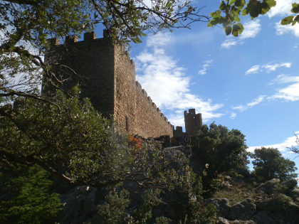 The road climbs for a 3-4 kilometres and then reaches a gate. The gate marks the start of the Requesens estate - a large area of hilly woodland. Just outside the gate a number of cars had parked up in the limited space available, but as we discovered, it was fine to go through the gate and to drive all the way to the top for either the castle or for the restaurant set just outside the castle.
We weren't sure if you really were permitted to drive on past the gate, and having the original plan of walking, it didn't seem too much of a hardship to walk the remaining couple of kilometres, so we parked up and walked, particularly since we were in the lee of the hills and so protected from the wind that we had seen further down.
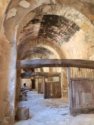 Our walk followed the gravel track, and we were passed by a regular drip of cars bumping along the track.
After the first corner we suddenly got the first glimpse of the castle standing on a hill surrounded by the hills. From a distance it looks like a very well-preserved large chateau-fort to use a French description of a traditional fortified castle, rather than one that is merely pretty.
As the track gets closer, there are signs of other buildings and a little bit more habitation - a monastery or convent in the mountain behind the castle, and old sawmills, and small fields nestle along a small stream at the bottom of the castle, with 10-20 of cars parked either for the castle or for the restaurant. All of which is quite a surprise for the apparent remoteness of the location.
The stream itself was another surprise - with water rushing down and a few small cascades through the rocks. For the height (the castle is at about 500m) and the comparative dryness of the area we wouldn't have expected to have such as strong water flow.
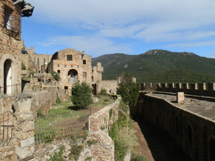 The track crosses the stream and then heads up to the castle itself. As we approached the main entrance we had to pass a herd of cows scavaging what grass they could in amongst the woods - another oddity.
The castle itself has large outer walls in good repair. It was renovated or rebuilt at the end of the 19th century as a summer residence for the Counts of Peralada (the Rocaberti) before being converted into military barracks mid 20th Century. Though it is empty now and shows signs of deriliction, it is by no means a ruin.
From the gatehouse at the bottom the first impression is something of a wedding cake of buildings layered on top of each other. Each layer is linked with stairs and walk ways up to the upper tower at the top (the tower itself isn't accessible).
Much of the castle rooms are open and can be explored with the remains of kitchens and storerooms as well as living quarters with enormous views out across the Empordan plain towards the sea and the Mountains of Montgri to the south.
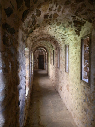 And there's another surprise as water seems to flow down and through the castle - as if it's been built on an active spring, with water flowing down small channels on the walls and into holding ponds built beside the castle walls.
The cost to enter the castle is €4 per person, but it has the impression of an Enid Blyton type of castle of adventure, full of nooks and crannies and strange passageways linking rooms and courtyards in among the buildings.
The rooms themselves feel a little abandoned and times, and there are signs of the time of military occupation with a hospital's red cross above one door. However some of the interior parts are clearly still being renovated and the castle has a certain joie-de-vivre.
And we weren't the only visitors, with several families and younger children coming to explore, or taking the day out for the castle and Saturday lunch.
The walk back was a little bit one way, though we did follow the stream a little more rather than the road through the narrow meadows by the ruins of the sawmill. And we were passed by cars going down from this strangely remote yet well-visited castle.
Nearby: Lladó (between Figueres and Besalu) - Figueres and Castell de Sant Ferran - Waterfall at Les Escaules (Boadella) - Espolla to Rabos - La Jonquera to Fort de Bellegarde (France) - Sant Llorenç de la Muga - Sant Pere de Rodes - Llança - Portbou to Cerbère (France)
Els Set Gorgs (Campdevanol)
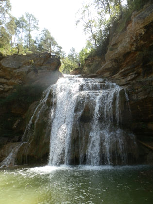 In Catalan the word Gorg refers to a river pool, and these river pools are often found in rivers in the mountains at the base of waterwalls, or where rivers run through gorges.
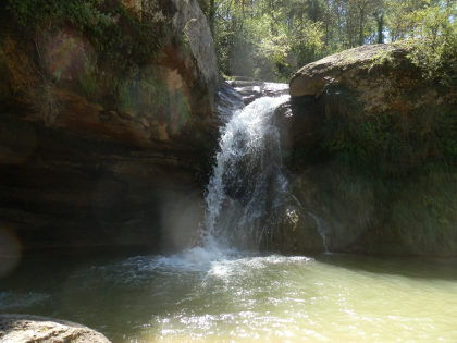
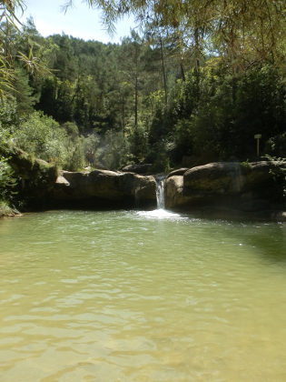
Els Set Gorgs is a series of seven pools (Set = 7) with waterfalls on the Torrent de la Cabana or Torrent d'Estiula in the hills above Campdevanol, a town close to Ripoll (there are only five pictured here).
Over the last few years we've started to take a day out to the mountains to find some hikes possibly with some rivers and mountain pools where the walk can be combined with a little bit of swimming away from the tourists on the coast - such as Sadernes.
The 7 Gorgs themselves are well known in Catalan, but perhaps not so easily discovered in English (where they are sometimes called the route of the seven waterfalls), and are sufficiently popular that during the summer the local council charges €5 'ecotax' per person to access the valley, and limits the number of visitors to a maximum of 500. (If you're looking at reviews online, many of the low ratings are complaints about the fee to enter, rather than the place itself).
The thought of an entry fee did put us off at one point, as we felt it could be over commercialsed. However, in practice the valley really is natural, and like the charge to walk the Cinque Terre route in Italy, it is clearly a charge designed to protect a very beautiful area from being spoilt by too many people.
 The drive to Campdevanol and Ripoll took slightly under 2 hours drive from the coast - about 120km (75 miles).
We don't have much in the way of maps for the area and though we found Campdevanol, we didn't quite find the right turning for the road. So instead we just parked in the town and walked finding directions at the station (which added a pleasant 3.5km to the walk along a stream).
As Campdevanol does have a station, it would be possible to catch the train up from Barcelona, then walk out to the gorgs.
If you're driving and find the way, there is car parking at the bottom of the gorg valley that you pay for (some say €10, some €3).
However, the walk out from Campdevanol was very clearly marked and followed a stream with crystal clear water up a broad valley into the hills. The path tracked the road, but apart from a short stretch walking was by the river or in the trees.
At Font de Querol we passed a large barbeque area by the river which was just starting to fill up (and was full when we came back).
After the Font de Querol, there's about another kilometre to reach the valley of the gorgs itself.
Finally, we pass by an adventure park and their very long and high zip wire across the valley, before getting up to the ticket booth and entrance.
 The number of picnickers was an indication that the area is popular, and because this was the last weekend of August, and we knew there was an entrance limit of 500, we were a little concerned as to whether the park would be too busy to get in. But it wasn't a problem, though the week had had some thunderstorms which had cooled the air a little which might have reduced the number of people wanting to visit.
As I said, we weren't so sure whether to go in, but having made the effort to get there, we decided to try it out - the answer is yes, it's definitely worth it.
The gorgs stretch out over about 3-4km, so although I doubt we had 500 people in the park when we visited, the people spread out over a larger area.
Although some of the smaller gorgs get a little crowded. (Note that you can take dogs, but they need to be on a lead and others will have dogs in and around the pools).
Inside the park, the gorgs are clearly indicated and it was just a case of following the signs. However, the paths do cross the streams and there were large patches of mud in places, most probably from wet shoes from people who had been in the water.
You can get around with dry shoes, but it's much easier with water shoes, or shoes you don't mind being wet in - though you might need a dry set too for walking back.
Secondly, though the path is marked and well used, it is a narrow track in places, and in some situations, quite a scramble.
We saw plenty of younger children, but you also need shoes you can walk in comfortably - flipflops don't make sense here.
 The first gorg, at the bottom, is the most difficult to get to. The path descends through the trees to the waterfall at the bottom, and it's relatively steep and, because of the wet feet coming back up, has a quite slippy mud surface. To help get up and down there are ropes strung up, and you definitely need them.
Our second problem was that we entered at about the same time as 3-4 other small groups, which did mean that we were all on the path to the first gorg at the same time. This is a good reason for the people limit.
Though the scramble down was slightly challenging, the waterfall and gorg at the bottom was beautiful. Immediately all doubts about coming in to the park disappeared.
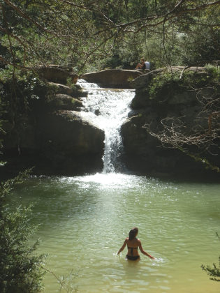
The pool is relatively small - the size of a large swimming pool, with a cascade of water. Around the edge was a little crowded and there was a stream that you could cross via rocks, or just wade through the water - it's a lot easier stepping into the stream.
Naturally we wanted to get in and try the water. So we did get in but lets say the water was 'refreshing'. Despite being the last week of August the water is very cool.
We actually swam in all the gorgs, but for each it was a quick plunge in to cool down and out again. Lovely to swim under the waterfalls, but not for very long. Other visitors were also pretty much quickly in and out too.
From the first gorg, after a scramble back to the main path, we carried on up the trail to each of the next gorgs. They are all different, all very natural, some larger and some smaller than then first one.
Being natural there are stones and rocks at the bottom of the pools, and the depths can be uneven. The largest pools were towards the top and invited swimming if you could manage with the temperature.
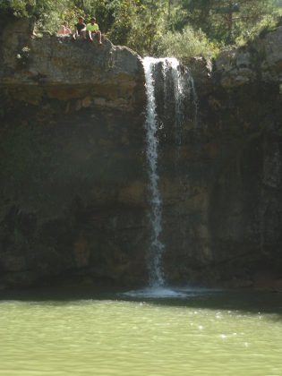
The smaller pools at the bottom weren't quite so deep, so though it was possible to jump from rocks into the water unless you've checked the depth beforehand, it's not advised. We did see some people jumping in Gorg 3.
 Generally the path goes up, but you have to divert to reach the gorgs themselves, often along a small side track.
We missed Gorg 5 at one point and doubled back along the river close to the water, but there isn't really any way of just tracking the river itself along the stream bed, so best to stick to the paths.
Each of the gorgs has a waterfall. The smallest were Gorg 3 and 5. At Gorg 1, the cascade is pretty broad and dramatic, while some of the higher Gorgs had longer but more narrow waterfalls. Each pool therefore had its own character.
The path continues up for about 3km following the stream and though you could walk it quickly, in practice while you're getting to the gorgs themselves, enjoying the water and taking photos, it can easily take 2-3 hours to work all the way to the top. Since it is a reasonable walk, quite hot in the sun, it is necessary to have water and sunscreen with you.
At the top just above the last waterfall is a small makeshift bar area with a meadow to relax. Then there is a broad gravel mountain track that takes you back down to the start point that runs along the hillside above the valley - about 30-40 minutes back to the bottom.
See also: Sadernes and river pools of St Aniol d'Aguja - Sant Esteve d'En Bas (Olot) - Olot - capital of Garrotxa - Mollo (Camprodon) - Pyrenees to France - Puigcerda and Bourg-Madame - Ribes de Freser and skiing at Vall de Nuria - Waterfall at Les Escaules (Boadella) - Swimming and visit to Panta de Sau
Swimming at Lake Banyoles
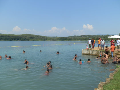 The largest freshwater lake in Catalonia is at Banyoles, just north of Girona. We've visited in the past for the walk around the lake, but not actually been to to the lake for swimming. This was a chance to try the water.
Swimming in the lake is only allowed in summer months in certain areas - two are paid for lido type closer to the town - at the bar of Banys Vells, or the Club Natacio. The third area is open to the public, at Caseta de Fuster towards the north of the lake past the sport complex, which is where we visited.
Outside of swimming, the lake itself is mostly used for rowing. There is however, also a 'cruise' boat that does circuits of the lake for tourists and I believe there is also an annual open water swim organised on the lake for more competitive swimmers.
Caseta de Fuster is found just to the north of the sports complex/ prehistoric village. The sports area includes the sports hall itself, areas for walking, picnicking and flat flood meadows that are dry in summer. Lots of families had come for picnics when we visited enjoying the ambience and being close to fresh water. There were also a good mix of Catalan and non-Catalans enjoying the summer sun, with the surprise of seeing a rough game of cricket being played by some Indian families on one of the flat fields (you can find cricket in the unlikeliest of places in Catalonia - almost always played by Indian or Pakistani community - we saw it an empty supermarket car park in Badalona at one time).
There's a short stroll needed along the path to get to Caseta de Fuster along the path. It's difficult to miss because there were plenty of people with towels and inflatables going the same way.
The area itself consists of a relatively small green grass meadow/lido area, and then the swimming area marked out into the lake by a string of yellow floats. It's not a very large swimming area and the green was also pretty crowded with people and towels on the grass. For swimming, you would be able to swim lengths, but the yellow buoys don't extend very far into the lake itself with a result that the waterside area could feel a little cramped compared to say the sea, and the whole area is monitored by two lifeguards.
The water itself was fresh and relatively clear. We were able to see the lake bottom about 2-3 metres down, and it was relatively deep . However, there was little in the way of 'beach' and the water was deep quickly, stepping off rocks from the edge straight up to the middle. And in the area to the right, the water was deep enough close to the edge, that people were jumping from the side into the water.
We didn't swim too much - a length or two up and down along by the floats. It was more for splashing about than just swimming - and a little crowded closer to the water's edge itself. For a change from the sea at the Costa Brava, it was different and definitely worth doing once - particularly for the fresh water - but having swum in a few lakes outside Spain this year, it might feel a little too contained for someone looking for the joys of real wild swimming.
See also: Banyoles lakeside walk - Serinya and Illa del Fluvia - Sadernes and river pools of St Aniol d'Aguja - Platja d'Espolla to Coves de Serinya (Banyoles) - Visit to Besalu and Banyoles
Swimming and beaches at L'Escala
L'Escala is an old fishing town, famous for its anchovies, with a modern residential area of holiday homes and villas that extends out towards the base of Montgri to the south, with a coastline that extends up to the ruins of Empuries to the north.
In the last few years, much of the sea front of the main old town has been renovated with plazas and piazzas and renewed town beaches and lots and lots of restaurants, together with increased pedestrianisation making for a very pleasant setting.
In practice there are two main beach areas for L'Escala town - those by the town which consist of 2-3 small pebble beaches (depending on how you count them) plus a grit-type sandy central beach. And secondly, the beach to Riells which is much larger with finer sand.
We've also covered the beaches just outside town, up around Empuries and Sant Marti d'Empuries, and we've also covered the beach at Cala Montgo, so this is the chance to fill the gap.
If you are on holiday here then, there are quite a number of options for different beach areas.
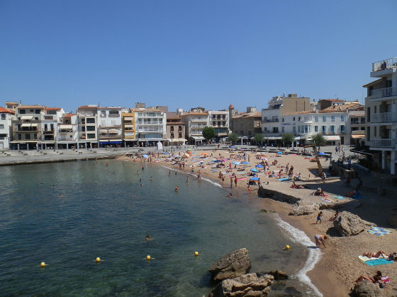
The town beaches
The town beaches consist of small calas.
If you're coming from the Empuries direction you'll see one or two (depending on how you count them) small undeveloped pebble beaches that sit under the cliff with fishing boats that attract a handful of snorklers, then comes the main refurbished town beach, and then, past the headland, a further small pebble beach.
The main town beach looks out to an island in the bay, which is within easy swimming distance.
We swam in the sandy town beach for this visit. As everything is relatively newly done, the sand still feels like the reclaimed sand, which then runs into the bay itself, so it doesn't feel completely natural, though further out the bay itself becomes more rocky.
The beach shelves gently, and actually the whole of the bay is relatively shallow - though still deep enough so as not to be able to touch the bottom.
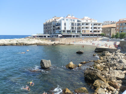 In summer they have a swimming platform in the bay which attracts lots of children. And in principle, with older children, it would be possible to sit in one of the very many bars and restaurants at the back of the beach, while watching your children on the beach and in the water.
Being a town beach, it does have lifeguards.
Sand quality
The sand is gritty. The pebble beaches don't have sand.
Swimming
The water was very clear for our visit, but felt shallow. It's easily possible to swim along the bays, but the depth is low in places.
Alternatively to swim to the island, but for longer swims you'd probably go more to Montgo or Empuries area.
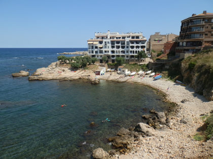 Parking
There are dedicated parking area for the town beaches as you come into town from the Empuries direction, plus some supermarkets where it might be possible to park if everything else is too busy.
Riells beach
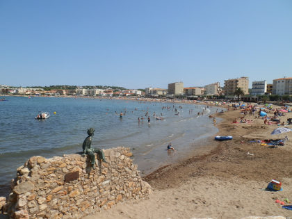 Riells beach is the largest beach in L'Escala approximately 2km from the old town seafront on an easy stroll along the bay. Because of the fine sand, it tends to attract a lot of families and feels much more touristy.
At the back of the beach is a boardwalk/esplanade with a range of souvenir shops plus bars and restaurants, and a number of the restaurants have terraces over the beach itself.
To one end is a small amusement park. Unlike the centre of town it feels much more seasonal (and out of season, the sand drifts onto the boardwalk) and has a slightly tacky feel - though better class bars have been appearing more recently.
We haven't swum here yet, but the bay looks gently sloping, and we have seen jet-skiers coming out of the port to the right of the beach.
Walking and exploring
Empuries and Montgo have areas to explore. L'Escala itself, in the middle, is white holiday homes and residential and not particularly exciting for exploring on foot away from the old town.
Nearby walks: Escala, St Marti d'Empuries and beyond - L'Escala Riells to sea cliffs and viewpoint of Montgo - Empuries Greek and Roman remains - Sant Pere Pescador river Fluvia
Next beaches: North to Sant Marti d'Empuries, South to Cala Montgo (L'Escala)
Swimming and beach at Fenals, Lloret de Mar
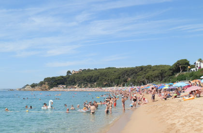 Lloret de Mar is known as the party town of the Costa Brava, and is very popular with young people looking for holidays with bars and rowdy clubs in the centre of town.
Lloret de Mar's ajuntament - town council - is trying to mollify the more anti-social elements, but for this reason, some people coming to the Costa Brava try to steer clear of Lloret.
However, as a town, though it is filled with hotels and apartment blocks with a strong tourist focus, it isn't a high rise town, and the beaches, calas and general geographic setting are very pleasant.
If you keep away from the 18-30 crowd, you'd find it is popular with families not just from northern Europe and Russia, but also with the Spanish themselves.
Lloret's main town beach is right in front of the town and is a big broad beach backed by bars and burger joints. However, we're visiting the neighbouring Fenals beach to the south, which is quieter with a better setting, as a large bay with rocks at both ends, and views down to Blanes, and backed by reasonably spaced out hotels and apartments which don't feel crowded.
The reason for the trip is a birthday treat to use some of the water sports facilities - banana boat, parasailing etc that operate from the beach, but also to enjoy the water and try out the location.
Because this is Lloret, this a beach that does get busy with a lot of visitors - it's not a secluded undiscovered bay, and it is a relatively long beach - for this visit we stayed to the lefthand half.
Despite the number of visitors on our trip the water was amazingly clear and transparent - as clean as anywhere we've visited, and out to the rocks on the left-hand side, the water attracts fish and cormorants who preen themselves on the rocks right next to sunbathing tourists.
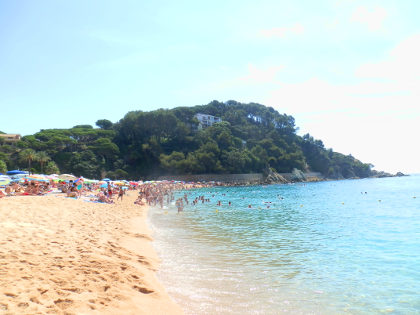 The sand is gritty, similar to other Costa Brava main beaches such as Tossa or Platja d'Aro, though the 'sand' isn't harsh under foot.
Entering the water, the bay shelves quickly, so you're quickly out of your depth. However, as said the water was lovely on our visit and it was very satisfying to make a long swim.
Behind the beach are tourist town type facilities - shops selling beachwear and inflatables and bars and restaurants.
Unlike most other parts of the Costa Brava, Lloret is about the last town remaining where you will find British pubs and bars among the range of eateries on offer. However, it's possible to enjoy the beach without getting swept into the tourism thing.
Parking nearby is difficult - all the parking was taken in the streets closest to the beach, so we parked out a little way and walked in.
Facilities at the beach
This is a major beach with lifeguards. There are also water sports operators for motorised 'fun' sports being towed by a speed boat operating on the beach itself.
One area of the beach is used by the Dofijet boat service that connects the beaches between Tossa de Mar and Malgrat de Mar on a shuttle service - swimming is out of bounds in this area, and enforced by the lifeguards.
Behind the beach are the facilities of a tourist town, but most a little way in, so the promenade at the back of the beach retains its charm.
Sand quality
The sand is gritty but smooth, so not great for sandcastles, but not a problem underfoot.
Swimming
On our visit, the water was very very clear and invited swimming. Being a big bay, long swims along the bay are possible, and because it gets deep relatively quickly, it gets more busy close to the shore, than out in the better areas for swimming.
For snorkelling, the rocks to the left had shoals of fish and areas to explore.
Parking
We found parking difficult, with spaces close to the beach and the neighbouring streets already full when we arrived.
Parking a little way off the sea is fine if you're prepared to walk.
Walking and exploring
The beach is on the GR92 (part of our Blanes to Tossa de Mar walk). The path runs around the rocky Cala Banys before getting to the main town beach to the north.
To the south, the paths head to the gardens of Coltilde, and the (naturist) beach of Boadella and down to Santa Cristina. The hills at the back of Lloret have a lot of estates will holiday houses and villas, and is an area we haven't explored much.
Next beaches
North to Lloret de Mar main beach - South to Lloret's Platja de Boadella, Platja de Santa Cristina
Festa de Sant Joan
The Festival of Saint John (Festa de Sant Joan) is one of the major festivals of Catalonia celebrating not just the religious day, but also marking the start of summer and the end of school, as well as being close to the Summer Solstice. It is also one of the noisiest and loudest festivals because it's traditional celebrated by letting off bangers - and the louder the better. Many people head to the beach for all nighters to drink, to set off fireworks, and to wait for the sun to come up.
For us, it's too noisy. Stalls selling fireworks open up for about a week before the night and slowly, during the build up to the day itself, we get more and more bangs. Until the day and night itself, where the bangs continue through the night. We used to live in Barcelona, and it was a night that was impossible to sleep.
Now being on the Costa Brava, things are quieter comparatively - partly because the economic crisis reduced sales, but also because fireworks are banned from wooded area for the risk of fire. However, there is still enough noise to scare our dog, and so we tend to take a short break into France to get away from the bangs. Most of which is just noise, and not the colourful flash and sparkles of prettier fireworks.
For the Costa Brava, Festa de Sant Joan is also the start of the Festa Major for Palamos (Sant Joan being the saint of Palamos). Festa Majors happen up and down the coast through the summer. Though they sometimes look as if they are tourist promotions, actually they are very much local affairs for local inhabitants with long historical traditions usually including a procession of Giants or Cap Grossa (big heads) that represent the town.
During the day things are quieter, but often with events for children, or something cultural or sporting on. This year Palamos is commemorating the 475th anniversary of the 1543 attack and sacking of Palamos by the Ottoman Admiral/Pirate Barbarossa and his fleet of 20 galleys.
The main events start in the evenings and are known as 'barraques' with music from local Catalan bands and partying into the night with neighbours and friends, usually starting quite late - about 11pm and running into the night.
Palamos's festival ends with a major firework display on the main beach running up to midnight. This time proper fireworks that light up the sky and are visible from a wide area.
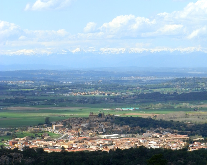
View from Quermany (Pals)
We're in that lovely transition from winter to spring, with snow still on the mountains, but more sun and blue skies and everything green or in flower. This is the view from the 'mountain' of Quermany (it's only 277m high) between Regencos and Pals, a bit of a hidden surprise as to just how good the views are. Pals is in the foreground. Behind is Peratallada and in the distance are the snow capped mountains of the Pyrenees. We walked it here: Regencos to Pals via Quermany Gros and Petit
Puigcerda and Bourg-Madame
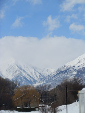 Puigcerda is the main Catalan town in the Pyrenees, on the border with France practically joined to Bourg Madame on the French side of the border. Being February, the Pyrenees are covered with snow with conditions perfect for skiing, so we caught the train to Puigcerda from Vic, and while the children got off for the slopes of La Molina and Masella, we stayed on the train for an explore of the snowy Puigcerda.
in fact, one of the joys of the Costa Brava is the variety of landscapes and locations in such a small area and the ease of making connections. Seven days ago we were exploring a new bay at the coast in Blanes, then we went cross-country for a volcano near Girona, and then the day after we're in the snow and mountains mixing with skiers and snowboarders.
Our journey did start early however, as we wanted to connect to the Barcelona train at Vic and to give the children a full day, so we left at 6.15 and headed past Montseny on the C21 for the train at Vic at 08.16. We took the train because our car isn't really set up for winter driving, so we didn't want to drive up into the mountains themselves for the risk of getting caught in the snow. And secondly, because there are combination train and ski tickets that include a ski-pass with the rail-ticket. And thirdly, just for the train ride into the snowy mountains.
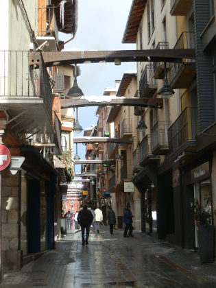 In fact, this combination ticket (Ski-Tren) is available from all stations out of Barcelona, as the train we were catching comes from BCN Sants, through Granollers, then up to Vic, to Ribes de Freser where is connects to Val de Nuria, or on to the much larger ski area around La Molina.
In practice, our journey from the Costa Brava to Vic took around 90 minutes, so we could have left a little later - even though we didn't hurry, it's a fast route. There weren't too many people catching the train from Vic itself, and we did have other options - for instance to join it later at Manlleu or further up to Ripoll, but for the trade-off of driving over train Vic seemed a good compromise.
The train itself is slow and steady. It definitely doesn't feel express. Journey time should have taken about 90 minutes to La Molina, and then another 20 minutes on to Puigcerda, but we had a 30 minute delay in Planoles as we had to wait for another train to come down.
 The delay in Planoles was fun though, as the station was full of snow (about 60-70cm) and they opened the doors so children on the train could go out to play and South American tourists went out to take selfies.
The journey does feel like it goes slowly though, but you have the joy of climbing up into the snow, so that from Ripoll we had a rough covering of the ground. Then by Ribes de Freser depths were more like 10-20cm, until La Molina where passengers were warned about the depth of the snow as there was about 60-80cm on the platform with cars with quiffs of snow on their roofs.
The reason for the slow journey is that the route is single track so the trains coming down can only pass those going up at specific stations. The single track route then passing through narrow tunnels or along narrow embankments about the valley.
 Having let the children off at La Molina (they were heading back to Barcelona to stay over at the end of the day - last trains back at either 17.17, 17.57 or 19.24), we continued on to Puigcerda, the capital of Cerdanya.
The train comes out of the mountains, down past Alp, and then onto the plain. Cerdanya has a large plain that is surrounded by mountains, and in the distance Puigcerda sits on a hill that rises above the plain. The landscape was all covered snow, with horses in the fields seeking shelter in the hay stalls, or standing looking cold in the fields.
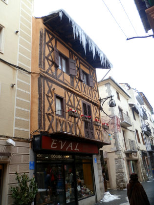
The station in Puigcerda is at the level of the plain and to get into the town means a climb. After jumping in the snow for fun, the first thing we noticed was the huge icicles on the buildings. Naturally, this is all chilly weather, so we were prepared with proper boots, gloves, scarfs and winter clothes. It would be easy to forget this is proper winter weather if you've come from a mild warm coast. However, the roads and steps up were clear of snow and it was relatively easy to walk up into town, and in places there are lifts/elevators too.
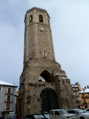
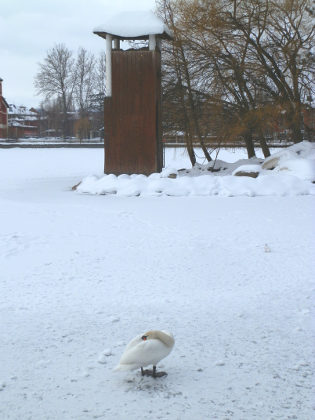 The town has a criss-cross of streets with a good selection of shops as it's the main shopping centre for the area. The position on the hill gives great views and we could see the chair lifts back at the ski resorts on the mountains opposite in the distance. The main monument in the town is a church tower in one of the squares, where only the tower remains, the remaining building seems to have been destroyed. A second church also exists and stalls were out for a market with produce from the area.
We explored around the edge of the town and found the lake and park. The lake was completely frozen apart from a small patch which was full of ducks, geese and swans. The ice was covered with snow, but it was strictly no going on the ice.
From the park we headed to France. We actually tried to follow the roadsigns and found ourselves having to walk on the road as the snow was too deep on the footpath, so this wasn't too nice, but eventually we found the crossing point. You see the customs point first, then walk along the road and over the bridge and suddenly you're in France and Bourg-Madame. The language changes, the signs change and that quickly, you're in somewhere that feels like a different country, with the oddity of seeing a cafe selling huitres (oysters), a dish that is classic in Roussillion but that we never see in Spain.
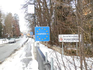 Bourg-Madame is not large but has a supermarket and a small collection of shops (closed on a Sunday). It also has a station for the Little Yellow Train (Train Jaune) that links down to Perpignan on the French side. In fact, the train to Puigcerda continues to La Tour Carol (La Torre de Querol in Catalan) which is also the end point for the Little Yellow Train. We went to the station, but there weren't many connections for winter - the train is quite a tourist attraction in the summer.
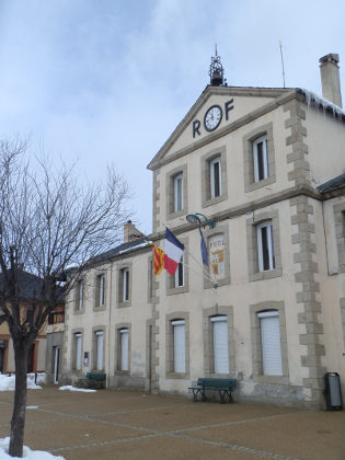 Returning to the town we took a coffee in one of the many cafes and just browsed around the shops. For those who come up for skiing, Puigcerda can be a good base as it feels quite lively. The one time we stayed in La Molina (in summer and a while ago admittedly), it felt like it lacked a few amenities that you might expect for a mountain village, though this could have improved by now.
And then the train back. We didn't wait for the ski train, but came back mid afternoon, nonetheless it still was getting quite busy.
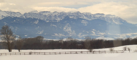
See also: Ribes de Freser and skiing at Vall de Nuria - Andorra La Vella - Mollo (Camprodon) - Pyrenees to France - Visit to Setcases - Villefranche-de-Conflent and Mont-Louis (France) - Olot - capital of Garrotxa
Volca de la Crosa - Sant Dalmai (Girona Airport)
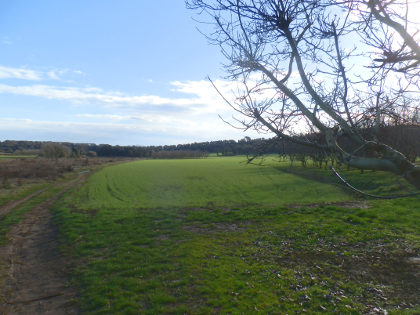 The area around Girona, particularly La Garrotxa and Olot, is famous for extinct volcanoes and these extend south from Girona too, around the airport. In fact, if you're in Girona airport and look out to the surrounding countryside, you'd easily spot the classic tall, flat-topped mountains that in former times (millions of years ago), would have been active volcanoes.
The largest extinct volcano on the Spanish mainland is the Volca de la Crosa which is just a few kilometres from the airport itself between the villages of Aiguaviva, Salitja and Sant Dalmai. However, this isn't one you'd see easily, as the walls of the old caldera are relatively low rising no more than 30-40m above the plain with woods now on the sides.
Since we currently have to make regular weekend trips to Caldes de Malavella to pick up and drop off for the train to Barcelona, we spotted the green star marking a place of special interest that we thought we'd explore. Of course Caldes de Malavella itself is town with hot springs, and former Roman baths, and it too has a hidden volcano out at the Camp del Ninots.
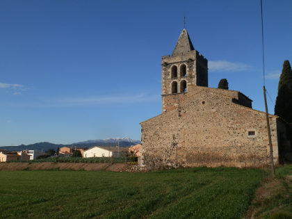 Early February is also the most likely time in the year for snow to come down to the lower hills and mountains. As the temperatures drop, the lower the snow comes. If the conditions are right it can even come down to sea level, and we've had a short flurry in the air one day this month. However, for the most part the snow stays higher than 600-800m meaning only the higher hills and mountains turn white.
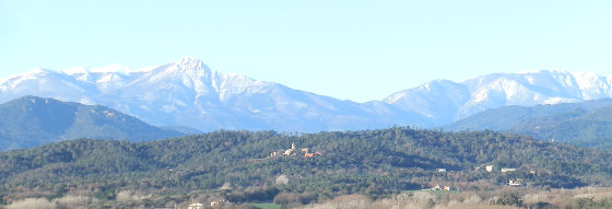
Nevertheless, this is still sufficiently low for the upper parts of Montseny to have snow. In fact Montseny rises to about 1500m, and can be seen in its snowy-dress from the beach in Barcelona on a clear day, and while we're used to seeing a white Canigou on the Pyrenees in the distance, seeing Montseny with snow is quite magical because it's much closer.
So having done the train drop, we continued out past the airport and then across to Aiguaviva with a white-coated Montseny in the near distance, and down to the large parking area that sits just outside the volcano itself, with views to Brunyola and Montseny beyond. The day itself was clear, as the Tramuntana wind had blown away the dust, and with a bit of sun was still 10-11C, so perfectly good walking weather.
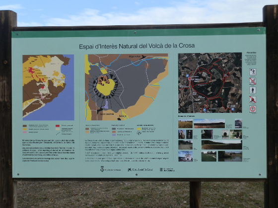
The Crosa itself has well marked tracks and lots of useful signposts to explain the history and generation of the volcano. The caldera itself is around 1250m in diameter - so more than a kilometre around, but once you add the rim and walk across the centre, and then out to the villages, our walk took more like 2 to 2.30 hours - around 8-9km.
However, since the rim is relatively low, and the centre of the old volcano is now flat meadow lands with orchards of walnut trees, it doesn't have spectacular pictures as you might expect from a volcano. Instead it makes a pleasant walk.
In practice we meandered around the paths, and this is as good a way to explore as anything, so there's no set route as such. From the parking we followed the rim to the east, before following the path into the volcano centre. From here we walked across the centre in want is now flat fields and small walnut groves, before climbing the rim almost where we started. From here we went south along the rim top through the woods, before heading to Sant Dalmai. Sant Dalmai is a small farming village with a small church, but not so much else of interest. We then linked to the next village of Salitja before turning back to the volcano at the Ermitage of the Fonts. The Ermitage has a small natural spring next to a low chapel, though the water is untreated and not for human consumption. From the chapel, we returned to the rim top of the volcano and completed the circuit via the eastern side.
See also: Hostalric stroll - Lake at Sils - Castell de Montsoriu - Brunyola - Arbucies autumn walk - Visit to Roda de Ter and Espinelves - Caldes de Malavella - Llagostera to Sant Llorenç - Girona and Castell de St Miquel - Girona valley of Sant Daniel - Cassa de la Selva - Bonmati and Anglès - Santa Coloma de Farners
Cala de Sant Francesc (Blanes)
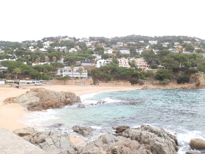 If you follow the GR92 walk from Blanes to Tossa de Mar, a fair bit of the walk is away from the coast along the hills above the sea. This is because there are two stretches of coast that can't be connected by paths directly - Santa Cristina beach, closer to Lloret, and Cala de Sant Francesc closer to Blanes (and between the two is are the Botanical Gardens of Pinya Rosa). We'd not actually visited Sant Francesc, but Blanes council said they had done up some of the GR92 walking and we had to visit Tossa de Mar, so on a wet January weekend we went to explore, partly to add it to our list of Costa Brava beaches.
As an orientation, Cala de Sant Fransesc sits below the Castell/Tower of Sant Joan that stands above Blanes and is on the other side of the hill from the town itself. Blanes has the benefit of being on the train-line to Barcelona, but to get to the bay walking from Blanes requires walking up hill out of town, and it's a good couple of kilometres from town, so realistically is more accessible by car (though I guess in summer the parking would be difficult). If you drive past you'll see one of the access roads is blocked as marking a private estate, however, there is a second road that will take you down to the bay.
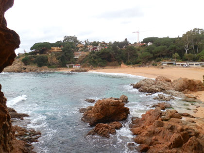 We parked at the top and simply followed the road down from the top to the beach, explored a little, then navigated back up via the series of connecting stairways that provide short cuts up the zig-zagging roads. This is very much villa country with the hillside filled with mature and attractive coastal properties looking out to sea. These surround a private tennis and sporting facility that looks very well maintained and cared for and it feels quite luxurious, without some of the industrial feel that Blanes itself has.
At the bottom is a very pleasant beach, with gritty yellow sand of a type similar to that found in Lloret with a bar and restaurant at the back. To the left and the right are walks around the bay, and it looks as if these were the areas recently improved with new wooden rails. We did try the routes to both to the right and left. The one to the right takes you up close to a tall island that you don't realise is an island until you walk past, as the channel is so narrow. This ended in a doorway marked private in Spanish and Russian. The door was open, but we didn't go any further.
Instead, we returned to the beach and tried the lefthand walk. This again was newly done, but came to a stop at a large iron gate. The path and the same wooden rails continued on the opposite side of the gate, so it is possible that this might be open at a different time of the year. However, for us it meant that there was no way out of the bay except back up the hill.
As a beach, it's very pretty and we may return in the summer to test the water for swimming. And if you are in Blanes it would provide an alternative to the town main beach.
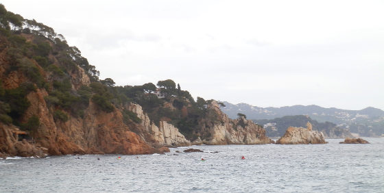
Update March 18: Diari de Girona is just reporting that the stretch of path after the gate has been opened and should allow continuation towards Lloret. We'll revisit during summer to see.
See also: Blanes, Lloret de Mar, Tossa de Mar by GR92 - Lloret's Platja de Boadella, Platja de Santa Cristina - Tossa de Mar to Cala Llorell - Palafolls castle - Lloret de Mar to Sant Pere del Bosc
Calella de Palafrugell to Llafranc Marbrava Swim race
We just headed to Llafranc for leisurely stroll and coffee, only to find the village was filled with swimmers for the Calella de Palafrugell to Llafranc 7km swim via the Isles Formigues. Out to sea there were hundreds of swimmers making their way into shore shepherded in by support boats and canoes. The Radikal Swim website who organise the event says that there are a range of swimming events taking place over this weekend (14/15 October) for all ages and abilities with the 7km event being the longest.
As we've mentioned before there are a number of long distance (2km+) swimming routes in the Costa Brava now between beaches and around headlands (Via Braves). For more sporty visitors and triathletes, this gives an additional more competitive option to enjoy the waters here. Now we have the date, I'll take a camera next year, or maybe take part, depending on how fit I feel.
For swimming nearby see our Swimming and Beach series: Swimming and beach at Llafranc - Swimming at the beaches of Calella de Palafrugell - Swimming at the beach at Tamariu - Where are the best beaches on the Costa Brava?
Catalan Referendum and Strike October 2017
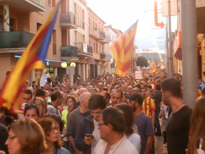
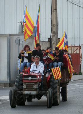
 Yesterday, October 3rd 2017, was a general strike in Catalonia against violence seen during the Catalan Referendum on Sunday 1st October. As part of the general strike, towns and cities throughout Catalonia came out onto the streets to demonstrate support in the evening. We went down to attend the local march in Palafrugell and to give a sense of the demonstrations and the strong desire for political change in Catalonia.
At this point I'm going to try to give a potted history and explanation of where and why Catalonia believes it should be independent and some background to what's going on. It's fair to say that for people from outside the region, it can be difficult to understand what is going on, and why there is such a depth of feeling among the Catalans. We certainly had little understanding of the situation or very much understanding of the history of Spain much beyond the discovery of America and the Spanish Armada. However, having lived here and being extremely interested in the history and geography, I've come to realise the rich and complex tapestry of Catalonia and its relationship with Spain.
 The simple history of Spain, which is most frequently presented by Spanish nationalists, sees Catalonia as a region that becomes part of Aragon before, in 1479, being unified with Castille under the Catholic monarchs Ferdinand and Isabella to create the modern Spanish nation. In this view Spain is an indivisible whole and Catalonia was never a country, and so has no legitimate claim for independence. The current claims are 19th century romanticism and a desire to pay less taxes.
To get beyond this, and really into the deep emotional feeling that lies beneath the independence push needs a more nuanced view of Spanish history, one which sees Spain as part of a unified crown, but still being a set of semi-independent territories, each with their own governance, laws, taxes and duties. The Aragonese were not allowed to trade in the Castillan West Indies for instance until the mid eighteenth century.
 These element of self-government and self-identity of the semi-independent territories were swept away in a wave of French-style single-nation laws and centralisation (the Nueva Planta decrees) that followed the Spanish conquest of rebellious Catalonia in 1714, and that included banning the use of Catalan in primary education and official documents. Though Spain remained relatively at ease with itself until Napoleon's invasion, reactions to the events of the start of the 18th Century continued to reverberate through Spain in the 19th and 20th centuries as it struggled under revolts, civil wars (plural), loss of overseas territories and a push-me-pull-you of politics that saw regions pull against centre, and various forms of radicalised politics emerge.
Into this melee, Catalonia rediscovered itself and developed its own idea of Catalonia as a nation, distinct from Spain. It was finally allowed to use its own language in official work in 1931 (216 years later), only to have this removed by Franco in 1936. So that within living memory are groups of citizens who were not allowed to use Catalan at school, and who were ruled by proxies of the central Spanish government, rather than through their own elected officials.
As a result, there are extremely deeply felt opinions that go far back in time with family memories of Spanish crack downs on Catalan separatist views from even the 1900s. While Spanish nationalists will point to the financial crisis as a catalyst, other forces were already at play, seeking the Catalan Statute of Autonomy for instance. Regional identity versus centralism is a topic that bubbles away through Spanish history.
An overview of the history of Spain and Catalonia
We start the story in 719. At this time, Spain had been conquered by the Moors (mainly from Morocco) who had captured the Peninsula as muslim lands. The Moors pushed into France until they were defeated at Poitiers/Tours in 732. The development of modern Spain then starts with the slow reclaiming of Spain by Christian forces.
Resistance to Moorish rule grew in the north first, from Asturies in 722 - the first of the Spanish kingdoms to emerge. The second northern kingdom was Navarre/Pamplona from 824. Then in a complex story of kingdoms and rivalries, Asturies expanded across northern Spain eventually leading to the establishment of the Kingdom of Leon (910). Leon then joining with Navarre. From these northern Spanish kingdoms, the Kingdom of Aragon emerged in 1035 and Castile finally became its own kingdom, from a county of Leon, in 1065 providing the foundation for modern Castilian Spain.
Meanwhile on the Mediterranean side, the Franks under Charles Martel ('the Hammer') pushed back the Moors, building on the victory at Tour/Poitiers 732. Between 759 to 801 when Barcelona was captured from the Moors, Frankish victories established the counties of the Spanish March (Marca Hispanica) in what is now Catalonia (and a bit beyond), as a buffer realm between France and the muslim Spain. Unlike the northern territories that (self-) declared themselves kingdoms, the lands of the Spanish March remained as counties (ruled by a count) with local rivalries.
However, over time, the Count of Barcelona came to dominate across the counties of the Marca Hispanica as a whole, subduing or forging marriage alliances with the other counts. The 'marches' tended to be remote from the main centres of royal power (in Aachen at this time) and the counts had to be self-sufficient and independent minded allowing counts to take liberties with their realms. Wilfred the Hairy, for instance ensured the title of Count of Barcelona was inherited rather than by appointment of the king, and eventually the counties became de facto independent from the central Frankish power. The earliest claim is in 985 when Borrell II failed to get support from the Franks and so curtailed his allegiences.
Both the Kingdom of Leon/Castile in the north, and the County of Barcelona (Catalonia) were growing both in prestige, and in size, through the expulsion of the muslim invaders from lands of Valencia and the Taifa of Zaragossa (the story of El Cid comes from this epoch).
Between Castile and Catalonia was the Kingdom of Aragon, which had emerged from Navarre in 1035. Through marriage, Aragon became a possession of the Counts of Barcelona in 1137 and the counts switched to take the titles of King of Aragon as their main title. However, despite being unified under the the same monarchy, Catalonia and Aragon continued to exist as separate territories each with their own system of laws and cortes including custom posts, taxes and duties, not as a simple unified state as we might consider today. The Crown of Aragon grew to include Aragon, Catalonia, Majorca and Valencia plus territories in the Mediterranean including Sicily and Sardina and at one point to Athens.
Castile and Aragon continued to develop separately, but slowly the ruling families became intertwined by marriage until the ruling crowns of Castile and Aragon united by marriage in 1469, with Isabella becoming queen of Castile in 1474, and Ferdinand (Ferran in Catalan) becoming king of Aragon in 1479. Once again, the two parts of Spain, Castile and Aragon, remained quite separate with distinct royal councils.
During the reign of the Catholic Kings, America was discovered, and the final expulsion of the Moors started with the fall of Grenada in 1492 to the Castilians. Both events reflect the complexity of the kingdoms, under a united crown. When the Americas were discovered these were established Castilian territories and Aragonese merchants did not have access, with access almost exclusively through (Castilian) Andalucia (Cadiz and Sevilla).
But even before Ferdinand had got to the Spanish throne, Catalonia had already been through a civil war (1462-1472) in the Revolt of the Remences against John II with involvement of the French and loss of Roussillon (for the first time). So by the time of Ferdinand, it was already past it's high point, and with the discovery of America, and eviction of the Moors followed by coastal attacks by the Ottomans navy/pirates, its importance in Spanish affairs diminished.
In short order, by wealth and marriage, Spain became the leading European power. Joanna, daughter of Isabella and Ferdinand married Philip the son of the Holy Roman Emperor Maximilian I, and so their son, Charles V, Spain became Emperor with great lands in the Americas, joined with the European holdings of the Holy Roman Empire (that included Netherlands, Belgium, Burgundy, Savoy, Germany and Austria) - the original empire where the sun never sets.
At this time, Catalonia, and Barcelona became a gateway to the Spanish European territories, though via the sea across to Genoa (the Spanish Road) as rivalry with France prevented overland access to the Italian, German and Dutch territories. However, it wasn't all plain sailing, discontent with Charles led to a series of revolts in both Castile and Valencia and Majorca of Aragon (Revolta de les Germanies), as local needs were overlooked for issues of the greater empire.
Such large territories were also proving expensive and difficult to maintain. Over the next period, the Spanish Empire fell into wars with the Dutch, the British (Spanish Armada) and the French. An empire of such a size was proving unsustainable and expensive. The vast gold and silver wealth from the Americas brought inflation to Spain and Spain defaulted on its debts (1557, 1560, 1569, 1575, 1595), lost the Armada to England. The cost of war and rebeliousness in the Netherlands (the 80 years war) took its toll and Spain's star started to diminish. Meanwhile wars with France over Italian territories of the Holy Roman Empire and involvement with the French Wars of Religion, spread into plain old wars with France, starting with rivalry over Spanish territories in the north of France (1595-1598).
The Spanish European empire fell into a complex war with the Thirty Year's War (1618-1648) involving religion, Netherlands, Sweden and central Europe. As the conflict spilled over, Catalonia become something of a piggy-in-the-middle between Spain and France, as the Thirty Year's war developed into a Spanish-French war of 1635-1659, with the French attacking Spanish territories through Italy, and in northern and eastern France.
Spain seeking to protect the border with France, put Castilian troops into private houses in Catalonia (which included forcing peasants to provide food for the soldiers). The result was a Catalan Revolt of 1640 - also known as the Guerra dels Segadors - when Catalonia declared itself independent under the protection of France. The song Els Segadors based on this period of history is considered the national anthem for the Catalonia.
At the time, Portugal had also revolted against Spain and the Catalans looked towards the recently liberated Dutch for inspiration. This 'Independence' lasted until 1659 when a Spanish-French peace returned Catalonia to the Spanish King, but with the final loss of Rousillon (Catalonia Nord) to the French, and a continuing bitterness towards the French.
Tensions didn't diminish though with another revolt (Barretines - named after the traditional Catalan red cap) 1687-1689 which was more of a class war, again partly because of tension between Spanish soldiers and the local population, and the Nine Year's War 1688-97 again between Spain and France.
With all this turmoil, by the outbreak of the Spanish War of Succession in 1701, Catalonia was out of sync with the rest of Spain. The war which encompassed half of Europe, was over the choice of the Spanish king from one of the two major European royal houses. The Bourbons from France, supported by most of Spain and the French, or the Hapsburgs of Austria supported by Britain who feared a French-dominated Europe. Catalonia took the side of Britain and supported Charles, the Austrian candidate for Emperor.
In theory, Britain had promised to help the Catalans and to protect the Catalan institutions under the Pact of Genoa, but as the war continued and the circumstances changed, the view in Britain shifted, eventually abandoning Catalonia to its fate as the last bastion against Bourbon king. The final chapter for Catalonia was the submission of Barcelona on the 11th September 1714 (a date commerated with the Diada - the Catalan National Day). This was written up in a couple of English pamphlets at the time denouncing the English failure to support Catalonia (The Case of the Catalans Consider'd and The deplorable history of the Catalans 1714)
With the victory of the French Bourbon king, he sought to impose a French-style centralisation on Spain. In the Nueva Planta decrees the historic institutions, governance, tax raising powers of Catalonia were removed and the Catalan language was no longer to be used in official documents. At the same time, the centralised monarchy installed vice-roys to take command of the provinces backed by Spanish troops effectively throwing out hundreds of years of autonomous rule and traditions across the Spanish provinces.
Catalonia was not the only Spanish province that felt the rules were unfair, but matters didn't come to ahead until after the Napoleonic invasion had passed (when parts of Catalonia were subsumed into France as a new French department).
These underlying tensions in the 19th Century, led to Spain being repeatedly pulled apart through a complex series of revolts and wars, including a civil war from 1833-1839, shifts from monarchy to republic and back again, and internal factionalisation as another royal succession dispute gave rise to Carlists - who were in favour of Infante Carlos V's - Don Carlos's - claim to the throne based on the French derived male succession rule, over Isabella II, his niece who became queen, based on the older Spanish rule that allowed female succession. This seemingly arcane rule created tensions and rebellions right up to the 1930s. And at the same time, Spain, like much of Europe, was developing a complex set of new political ideas including anarchism, as working classes became more powerful.
Meanwhile, industrialisation had come to Catalonia, and it began to rediscover its language and heritage (the Renaixença or rebirth) that started to emerge after the liberation of Spain from Napoleon. Through the 1830s to 1860s, this rekindled ideas of Catalonia and Catalan nationalism as Catalans reviewed and romanticised their history and their relationship to Spain. To start with this led to calls for federalism, but later to calls for full independence.
This idea of separatism got swept up with the prevailing moods of anarchism and revolt so that by the late 1800s Catalonia had a firm secessionist movement that was being prohibited by the Spanish authorities with suppression including martial law in 1900, and a short lived revolt in 1909.
This sense of nation and historical identity from the 19th century is then swept into the troubles of the 20th century. The eventual outcome was the Spanish Civil War and the rise of Franco, but before this there was another period of dictatorship and republicanism leading to Spanish Second Republic of 1931. The chaos of the pre-civil war politics even led to further declarations of Independence, but all was lost with the collapse into war between the Franco nationalists, and the Spanish Republicans. George Orwell's Homage to Catalonia gives a good flavour of complex mix of factionalism and war in Barcelona and Aragon.
Franco's victory came with the exili - a max exodus of refugees into France as can be seen on some of the walking routes or the museum at La Junquera, with camps on the French side of the border at Argeles and Elne. And under Franco, Catalan institutions and language were once again suppressed, so that even now there are old people in Catalonia who were not allowed to learn Catalan at school. Franco initially had a policy of self-sufficiency, which drove Spain into the ground. After the Second World War, more liberal policies were adopted and Spain opened up, bring tourism to the Costa Brava and industry back to Barcelona but sold as Spain, not Catalonia, with tradition Spanish totes like bull-fighting and flamenco dresses.
However, Catalan pain and pride remained undiminished. From the end of the dictatorship, the Catalan civil societies have been working to reestablish Catalan institutions, language and elements of culture with a view to gaining recognition of Catalonia's status and history.
In 2006 Catalonia agreed a new Statute of Autonomy (approved by Catalan referendum and supported by the Spanish government), however this was ruled in part to be unconstitutional in 2010 by the Spanish Constitution Court supported by PP. The rejection of the Statute of Autonomy caused many in Catalonia to demand greater autonomy and, combined with the economic crisis, led to a great renewal of independentist feeling with a major grassroots demonstration in 2012 (more than one million people out of a population of 7.5m), that effectively pushed Catalan politicians to become more focused on independence, and was then followed by huge marches and demonstrations in each of the subsequent years.
So behind the current political stand-off is a deep sense that Catalonia should be respected for its traditions, history, language and culture which are distinct and not the same as Spain. Among Catalans there is a perception that Spain imposes itself on Catalonia - it is the relationship of a dominant father who demands respect from an errant daughter, instead of being a relationship of kinship, peers and mutuality. This local view sees the unwillingness of the central Spanish government to listen or respond to the Catalan protests, which were met with practical silence and sitting on hands, as further examples of the difficult nature of the relationship.
The intransigence and inaction of the Spanish government, combined with deep seated local feelings about Catalan identity has allowed the situation to develop so that now Catalonia believes it has a mandate for independence. How this will play out will strongly depend on how the Spanish-side react and whether it seeks to find compromise. While it's not entirely clear how strongly Catalans want to be separate, or whether they just want to have a more balanced relationship with the rest of SPain, the one thing is clear is that some political movement will be necessary. For visitors, it's also worth pointing out that from the Catalan side this has been entirely peaceful with large marches and demonstrations, but in good spirits with no tolerance of trouble.
See also: Via Catalan and the Diada - Dia de Sant Jordi in Palafrugell
Cadaques to Roses
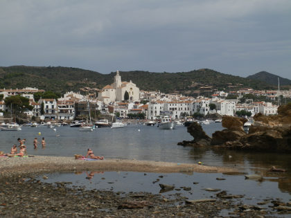 One of the classic longer distance hiking routes for the Costa Brava is around Cap de Creus taking in Roses, Cadaques and then Port de la Selva via the GR92 calling in on hidden bays and over the hills of the Cap de Creus natural park. The route from Cadaques to Roses is around 21-23km so too long for a round-trip walk which we tend to prefer, so this was done as a linear walk. For visitors it would be possible to take a boat from Roses to start (or to get back).
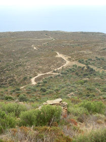 We walked in July, but luckily on a partially cloudy day, as this is quite a demanding walk with a lot of up and down as the path goes from a beach at sea level, then over the top to the next bay several time. The route is sparsely population, though there are isolated campsites and hotels along the way, so taking a good supply of water is essential - even Zina our dog managed to get through 1.5 litres.
The route follows the GR92 (red-white flashes). Along the way there were some occasional smaller paths marked, but trying a couple to get off the wider track, the paths were often overgrown with low sharp gorse, and it was easy to lose the path itself. We also missed one turning for the GR92 on Cap Norfeuga.
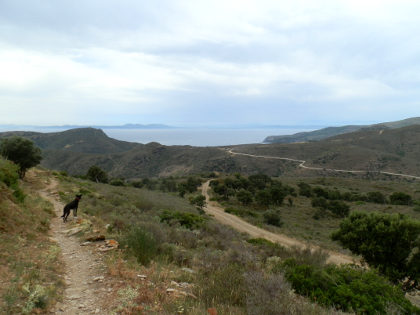 To start we were dropped off in Cadaques. Cadaques itself is relatively isolated but extremely iconic white village at the end of Cap de Creus. To reach it involves a long windy road over the top of the hills from Roses. Despite it's relative isolation, Cadaques is extremely popular with tourists, not just for the village, the bay, the landscape etc but also because it's the site of Dali's house in Port Lligat.
For our walk though, we were heading in the opposite direction, heading out of the southern side of the village after reaching the sea and then following the road around the collection of small grit and grey pebble beaches on this side of the main Cadaques bay. Cadaques isn't really a village for a beach holiday, but many sunbathers and swimmers were enjoying the calm water of the morning.
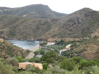 As we continued around the bays we slightly deliberately went the wrong way. Instead of following the roadway out we took a short detour along a low headland to an island joined by a small greystone bridge for photographs back towards the town itself. One feature of the walk we discovered is that the geography with relatively harsh rocky headlands and inlets means it's not possible to walk entirely along the coast and in fact the main route out of Cadaques almost immediately heads up into the hills along a dusty track instead of keeping to the coast.
The track climbs into the hills and it becomes clear that the dry ravines and rocky terrain make the over the hill route the most practical. The path up climbs for ages, and below us we can see Cadaques and the sea. Up above are one or two white farmhouses in among the scrubby landscape and above them a radar or observation point but little else. Most of the countryside is quite harsh, made up of low knee-high or thigh-high shrubs, gorse and rosemary packed in amongst jagged rock formations. Despite being isolated, we do get overtaken by a couple of mountain bikers and see a few other walkers also following the path.
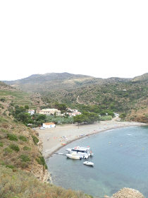 With the climb and the dry heat, even this early in the walk we're talking on water. There are boats out on the sea in the distance and we can just see a lighthouse. One feature of Cap de Creus that always intrigues me is the number of terrace walls and the amount of terracing, much of it overgrown and disused now. Since creating terraces and dry stone walls would have been very hard work, I wonder why the terraces were abandoned. The modern climate seems too dry to make it worthwhile for farming. Perhaps they were grapes that were abandoned in the phyllexora outbreaks at the end of the 19th Century, or olive groves out competed as transport improved, or perhaps the past was just wetter and more fertile than now?
Towards the top, we pass another farmhouse, well-renovated with grand views situated by a small stream that surprisingly enough had a small amount of water, enough for Zina to quench her thirst, and the walk levels out across the top.
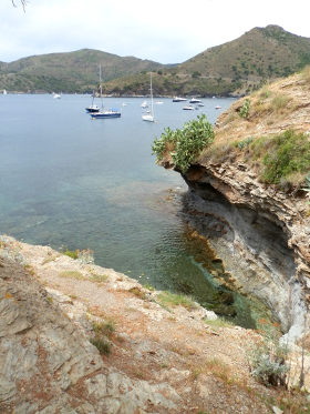 After a while the track turns around the hill and we lose sight of Cadaques and catch our first glimpse of the bays and hills on the other side of the cape. There are roads and the odd car in the distance, but our path leaves the dusty track and takes a smaller path, hugging a hill-line down to a distant bay beneath us. The path is well walked and looks like it has been laid with supporting stones on the side.
The bay ahead of us is Cala Joncols and we can see yachts in the water under the cliffs. A steady stroll down the hill and we arrive at a house and then down to a small nest of houses on the bay itself. There are cars too and a car park that is reasonably full, particularly given the only access is by a gravel-track road.
The beach is broad and has people and another small river with water. At the back is a hotel, and a tourist boat is pulled up to a platform just off the beach. The sign post points to steps and track up from the far side of the beach, and we head up again into the shrub. For some reason we miss the path and get a little lost in amongst the gorse and just try to head up to see if we can see a way out. At the top we can see a couple of other hikers picnicking and that helps us get back to the path.
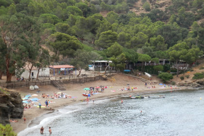 At this point we're cross the peninsula of Cap Norfeu, and from the top we can see the bay behind us and the coming bays on the way to Roses. For anyone with a boat, this seems to be the place to come and there are plenty of yachts and boats moored in each bay.
On the other side we walk to another signpost, and see a few more cars. The signpost says the GR92 goes along the peninsular a little way before swinging back around, but we find that this way around we can't find the path down that was marked. It looks as the only paths are heading up to the small tower on the top of Norfeu. It's only when we look back from the other side of the bay we can see how the path runs along the side of the headland and we just had to trust that the path would turn back.
Instead we walk down the fence to join the GR92 a little further along and then along the low cliff tops above the sea to the small bay at Pelosa where an open air restaurant is heaving with people and scattered families are playing on the beach.
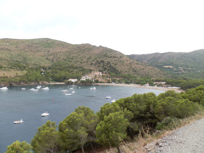 From here we follow the path around the bay-tops before having to join the road to be able to reach Cala Montjoi. We're passed by a few cars on the road and they throw up clouds of grey dust, so it's a relief to find steps down to the Cala.
Cala Montjoi itself is famous, though you might not have heard of it. It's the location of El Bulli, the world famous 3-star restaurant run by Ferran Adria, proclaimed the best in the world until it closed in 2011. Now they are transforming the restaurant into El Bulli Foundation reworking all the buildings. However, the bay and beach themselves are very pleasant - with a broad sandy beach, open and natural with a campsite in the back.
From Montjoi, the path climbs up over the top of the next set of cliffs - higher this time with views back to Norfeu. By now we're getting a little tired, but there is a constant up and down as we go up and down for the next couple of bays to Cala Murtra, the last of the swimming type beaches before Punta Falconera, and a naturist beach from the last time we walked this way.
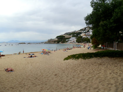 From here we climb again to the top and the path runs on top of the cliffs (not too close to the edge). Punta Falconera has old gun emplacements built into the ground that look out towards the Bay of Roses and across to the Isles Medes and Montgri on the far side of the bay. On a clear day you can see for miles down the Costa Brava, or looking back to the hills and mountains in the distance behind Roses.
We're now on a route we know and we head back towards Roses and reach the first built up areas for the bay of Platja Almadrava, full of sunbathers and holiday makers enjoying the sand or the bars and restaurants. We carry on following the man-made path around the bays to be met at Platja Canyelles, before a further walk in and on past Roses town to find the car.
See also: Port de la Selva - Roses - Canyelles beaches to Cap Falconera - Roses and Roses Ciutadella - Cadaques and Port Lligat - Llança - Sant Pere de Rodes - Espolla to Rabos - La Jonquera to Fort de Bellegarde (France)
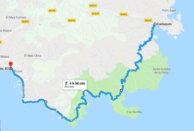
Swimming and beaches of Tossa de Mar
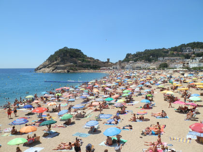 Tossa de Mar is one of the main package holiday locations on the Costa Brava for northern Europeans with a large selection of hotels, restaurants and bars, but will a much more genteel ambience compared to the party town of Lloret de Mar down the coast.
Tossa de Mar has three beaches in the town itself - Mar Menuda at the far end near the rocks and island, the main beach Platja Gran, and Platja de Colodar which sits just under the old town walls.
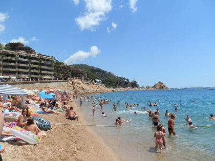 Mar Menuda is rockier, it is the best area for snorkelling, but also attracts large numbers of divers, and people learning to dive. When we were there at the end of June we saw lots of groups of 10-12 shuffling down to the beach in wet-suits, and then had the entertainment of swimming over the top of them as they inspected the nooks and crannies at the sea floor.
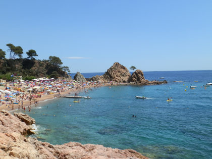 Platja Gran is the main sun-bathing beach and gets quite full in the main season. The sand is gritty and similar to that of Lloret or Platja d'Aro main beach, and were it not for the location with Tossa de Mar behind you and views to the town-walls/castle to the right, it wouldn't be that special. The bay shelves quite quickly, and there are channels on the beach reserved for pedalo/canoes and for the Dofijet boats that take visitors up and down the coast down as far as Blanes.
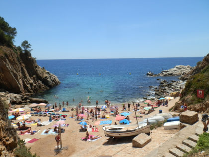 Platja Codolar, is the smallest of the beaches and is tucked away under the town walls. It's narrower than the other beaches with more rocks and often good clear water full of irredescent small fish. If the wind is in the wrong direction though, it can attract flotsam that you have to swim through.
Facilities at the beach
The beaches have all the facilities of the active tourist town of Tossa de Mar behind them - including bars and restaurants and chiringuitos. All have lifeguards and the main beaches have areas like toilets. Platja Gran has sunbed hire and pedalo and canoe hire.
Sand quality
The sand for all the beaches is fairly gritty rather than sandy and in some places more like pea-stones, so it's not super soft for sand castles or under foot, but it's fine for walking barefoot, so long as it's not too hot.
Platja Colodar has rockier areas around what is a relatively small sandy area.
Swimming
 Mar Menuda is probably the most fun area for swimming as there are more rocks and more fish and it's possible to swim around the headland or island if the sea is calm. Certainly when we were there, we really enjoyed swimming over the top of the scuba divers, though on busy days this can make the water quite crowded.
From Mar Menuda, a longer swim takes you across to Platja Gran and then across the bay. The main bay is sandy and the boat channels (for the diving boats on Mar Menuda, and for the pedalos and Dofijet on the main beach), curtail longer swims. The main Platja Gran beach shelves quite quickly to a sandy featureless bottom. Under the town walls is rockier, but didn't have that much sea-life for snorkelling when we swam.
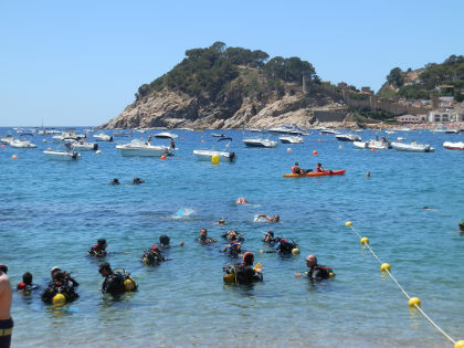 Platja Codolar is rockier and clearer and definitely has more fish, with the ability to scramble over the rocks if you like diving or jumping in.
Parking
Tossa de Mar has paid-for town-parking. We tend to park a little out from the centre in quieter areas and then walk in.
Town facilities
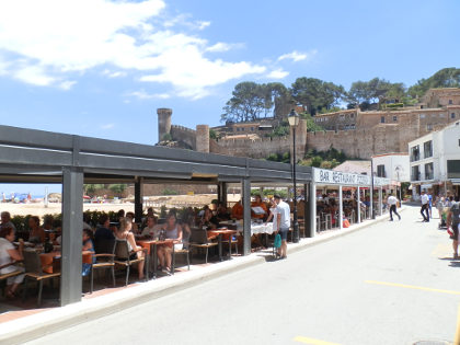 At the back of the beaches and into the town itself are a wide selection of restaurants, bars and hotels. Tossa de Mar has a selection ranging from Michelin starred to everyday beach bars. Though Tossa is a very popular holiday destination, it is quite genteel in style, and very different from the brash party town of Lloret further down the coast.
Alternative beaches
For somewhere a little quieter Cala Pola is to the north or Cala Llevandou to the south are 40-50 minutes walk away, or further still to Platja Canyelles midway to Lloret.
Walks and exploring
Tossa de Mar is on the GR92 and we have included walks to Cala Pola. The stretch from Tossa to Sant Feliu de Guixols is possible by GR92, but would be too long for a round-trip walk.
Tossa de Mar north to Cala Pola - Lloret's Platja de Boadella, Platja de Santa Cristina and The Fence - Blanes, Lloret de Mar, Tossa de Mar by GR92 - Tossa de Mar to Cala Llorell
Gardens of Cap Roig - Palafrugell
Spring is in the air, and with flowers coming into bloom and a rush of budding plants turning the Costa Brava green, it seemed a good time to visit the botanic gardens at Cap Roig, a castle built in the 1920s and 30s that sits above the sea, just on the outskirts of Calella de Palafrugell.
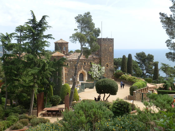
Cap Roig itself is one of the earliest influences of overseas visitors on the Costa Brava. The house and gardens were formally owned by an English aristocrat Dorothy Webster and her Russian husband Colonel Woevodsky who fell in love with the area around Palafrugell built the castle and instigated the gardens.
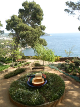 Now, the house and gardens are owned by a La Caixa foundation (if you bank with La Caixa entrance is free) and are maintained as botanic gardens overlooking the Mediterranean sea with beautiful views in addition to the plants.
It is also the location of the Cap Roig music festival that runs through the summer with musicians of the quality of Tom Jones, Lady Gaga and Sting in recent years.
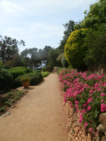 The gardens are spread over 17 hectares (about 60 acres) across the slopes below the house towards the sea.
From the main entrance by the car park, you enter into a small nest of buildings, then walk along extremely well manicured paths around the the main castle. The castle part was undergoing some renovation, but I don't believe that part itself is open. Just below the house/castle is the festival area which is closed off.
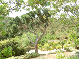 The gardens closest to the house are laid out as formal terraces with names like the Nuns' Terrace or Lovers' Garden, giving views across to Calella de Palafrugell and Llafranc. These areas have clipped trees and statues in among the formal specimen plants and seem specially designed to emphasize the views and vistas.
Below the terraces more towards the sea and the red headland of Cap Roig itself (Roig meaning red in Catalan) are firstly flower terraces and then further down towards the sea a set of cactus gardens.
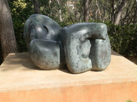 Back up above the house are then the Mediterranean gardens drawing on the local plants many of which can also be seen wild in the woods that surround the estate via the many footpaths that take walkers down towards Platja de Castell and the fields of Mont-ras.
Further out, back towards the entrance are more palms and laid paths using the natural slope of the hillside. What looked like a new childrens area was also found in this part, set close to orange groves in among the various types of palms.
For gardeners, the plants are all labelled and extremely well looked after. For the rest of us, this is an idyllic location just to enjoy the view and colours of spring.
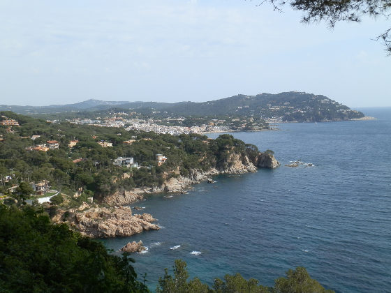
See also: Calella de Palafrugell/Cap Roig to Castell - classic wild Costa Brava - Cami de Ronda Calella de Palafrugell - Mont-ras to Calella de Palafrugell and Llafranc - Eulogy to the Ruta del Tren Petit (Palafrugell, Palamos, Mont-ras and Vall-llobrega) - Swimming at the beaches of Calella de Palafrugell - Swimming and wild beaches of Castell-Cap Roig
Romanya de la Selva to Platja d'Aro via Golf d'Aro Mas Nou
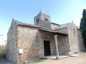 If it's a choice between shopping or walking, mostly I prefer walking. So to give the family time to go clothes shopping around the boutiques and chain stores of Platja d'Aro, I got them to drop me off at Romanya de la Selva with a plan to walk to meet them.
Romanya de la Selva is a small stone-built hamlet at the top of the Gavarres, above Sant Cristina d'Aro with walks to Puig d'Arques, or possibilities to follow a route down through the Gorges de Salenys. The village has a handful of restaurants with fabulous views out towards the plain of Girona in the distance.
We've walked this way before to Puig d'En Ponç through the woods. This time though we walked along the ridgeback of the main hill. If you're driving the dual carriageway from Llagostera to Sant Feliu - the main access road from the autoroute - this is the hill to your left as you drive down the valley to the sea.
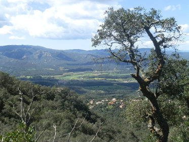 As mentioned, there are options on the route to take paths through the woods, but we stayed on the road which is quiet and not heavily used. The road is initially in the woods which masks the view a little, leaving only snatches of vistas in four directions - out towards Massanet behind us, down to the valley of the Aro below right, across the Gavarres to the left, or the views to the sea and out towards Palamos and the bay at Sant Antoni ahead. We did try the path up to Puig d'En Ponç again, which took us to a great spot, with a triangulation point, but as mentioned before, because the trees were so high meant we couldn't actually see out (it would be a great spot for a small viewpoint tower).
After Puig Ponc, we came across the first fences marking the very posh golf club of Mas Nou. It's always a pity where a golf club seals off the countryside with fences to stop walkers, but the road passes right through the middle, so we didn't lose the views and instead we could observe the golfers in their trolleys and the manicured fairways and bunkers with views to the sea.
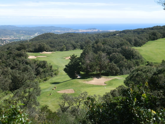
Golf is extremely popular on the Costa Brava with at least six golf courses nearby including a PGA championship course at Caldes de Malavella, and three courses near Pals. Golf d'Aro at Mas Nou, with it's position on the crest of the hill and views towards the coast seemed somewhat exceptions and might explain the handful of expensive cars that passed us on their way to the greens. Certainly the lush fairways and ponds for water make for a pleasant walk even though it's on the other side of a fence.
 At the far end of the golf club is Hapimag resort - a large upmarket hotel complex and golf resort with views over the Aro valley and obviously connections direct to the golf (from the dual carriageway below as you drive past Sant Cristina d'Aro you can see the buildings looking like a medieval village above the valley).
Beyond Hapimag the road enters the Mas Nou estate residential area. It has a barrier (which was open), but the road seemed open and there were no private keep out signs. The estate is well-to-do, in keeping with the golf course, but as you reach the two radio masts underneath is the shell of an abandoned restaurant and estate club area with an empty swimming pool, weeds growing through the children's play area and grass poking through the tarmac of the tennis courts. Given the aparent wealth of the area, it's a suprise to see something in such disrepair. But it is quite common. Older estates were built at a time when buyers wanted communal facilities like pools (rather than have their own pool) and sports and other leisure activities and so developers added them to the urbanisations that popped up across the Costa Brava in the 1970s and 80s.
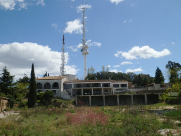 However, when the estates were finished and the houses were sold, the developers had no interest in maintaining the complexes, and the house owners decided not to pay the fees, or didn't visit enough to make the facilities worthwhile. The result is that many older estates have these disused and abandoned estate centres, despite the fact that the houses themselves around are well used and well cared for.
And so on past the radio masts, after taking the view from the Mirador road, and it's time to go down to Platja d'Aro. The views to Palamos and out to S'Agaro are great but we're still on the road and it is remarkably steep (17% or 1 in 6) almost forcing us to jog down, so it's good we weren't coming up.
The road comes down just behind the Aiguabrava water park at Platja d'Aro past the church of at Fenals d'Aro and a set of older houses of what would have been the original village. Prior to the 1950s the area was known as Fenals d'Aro, changing to become better known as Platja d'Aro (beach of the Aro, or as is occasionally still seen in Castilian Spanish Playa d'Aro) as the area opened up to tourism.
And so back into town and off to find the shoppers.
Nearby: Romanya de la Selva - Solius, rocks for climbing and ruined castle - Romanya de la Selva to Puig d'Arques - Castell d'Aro and estate of Mas Nou - Calonge (Cami de Molins and over Cabanyes) - Romanya de la Selva to Platja d'Aro via Golf d'Aro Mas Nou - Via Ferrata at the Gorges de Salenys
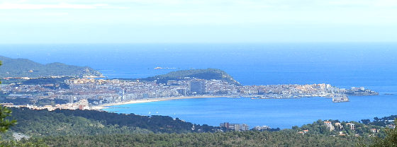
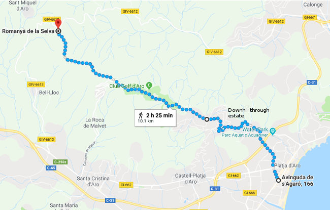
Olot - capital of Garrotxa
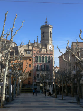 Heading towards the mountains from the coast past Banyoles and then Besalu, the first major town is that of Olot located on a plain surrounded by extinct volcanoes and home of the recent winners of the Pritzer Architecture prize, so a place recently in the international press. We've passed by many times on the way to Vall d'En Bas, Rupit or Campodron but as is normal with Catalan towns and villages, it is very easy to drive past on the way to somewhere else without actually seeing anything of the town itself. So to make up, we took a day walking in and around the town to try to get to know it better.
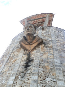 The first thing to note is that the Garrotxa is a rich and fertile area, so it's quite green and verdent. We were visiting at the end of Spring and in the background behind the volcanic hills, we kept catching glimpses of the snow on the Pyrenees in the near distance.
We parked nearish to the centre, but were immediately struck by the hills and the temptation to head high to get a panorama was too tempting, so rather than head straight to the centre, we took a footpath up towards the remarkable church tower of Sant Pere Martir which stands on Montolivet in among an estate of houses with an enormous sculpture of a head embedded on the tower looking down at the town.
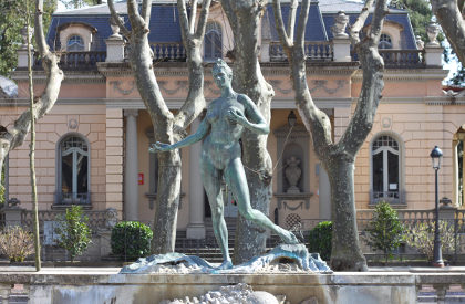 We hoped to be able to follow a walk from the church around the woods and so to follow the outskirts of the town, but after tracking a few footpaths, we decided the only route was to head in towards town. But wanting to leave the town centre to last, we turned out towards Vall d'En Bas and were amazed to see what looked like French architecture at Placa Manuel Malagrida. Now obviously Catalonia neighbours on France and, at various points in its history was assimilated into France in one way or another, but in general there are relatively few buildings in a grand French style.
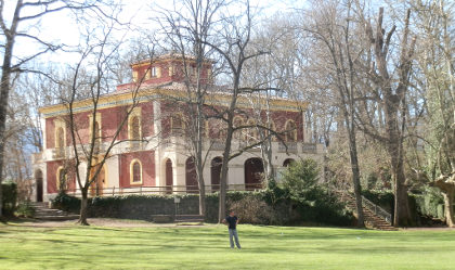 Our next surprise was that behind the pavillion the streets led into an area of 1920 villas arranged as part of a garden city. The estate is laid out like two spoked wheels with vistas and ramblas along the diagonals and one long passeo that joins the middles and heads out to the park (Parc Nou) and the Museu dels Volcans. The museum is in one of the villas (Torre Castanys) in the centre of the Parc's landscaped gardens. We didn't visit the museum itself, but just looked around the park.
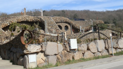 From here we followed our nose on the outskirts. We were actually looking for an unusual 'hobbit' style house that was being built on the road towards Santa Pau, and to see if we could see any of the architecture which won the prize.
Our route was a little haphazard as we passed the main bypass road and a large blue sculpture like a picture frame, and then across the fields towards the area of Sant Cristofol de les Fonts, past a memorial to Francoists shot during the early part of the Spanish Civil War.
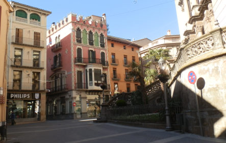 The hobbit house was in development and looked to be private, but consisted of a very organic piece of architecture of curves like a rabbit warren. When it is finished, it's quite possible it won't be as easy to see from the road, and there was no way of visiting to see more. From the house we could look back to the city and see the snowy mountains behind the town.
But we decided that it was time to head back to the centre to see what Olot really has to offer in the centre.
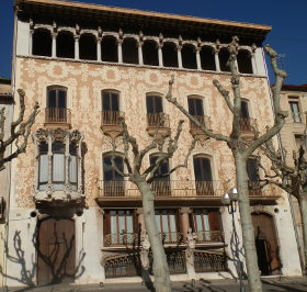 The town itself is a traditional mix of squares and old high narrow terrace streets of shops. Being a Sunday it was quiet as the shops were closed, but the amount of commerce suggests that it gets busy when everything is open.
By the main church a wide rambla heads away from the centre and on the rambla is a delightful modernista house. Continuing on, we pass the slightly daunting very modern architecture rust-steel covered building of Sala El Torin.
In the end we didn't quite see the architecture of RCR Arquitectes, the prize winners - though we have seen their buildings in Besalu and Ripoll, but all in all a very interesting town to see. And as we got back in the car, we noticed one of the restaurants offering Olot Potatoes - a speciality of the town with potatoes stuffed with meat and fried. Next time...
Nearby: Mollo (Camprodon) - Pyrenees to France - Sadernes and river pools of St Aniol d'Aguja - Sant Esteve d'En Bas (Olot) - Els Set Gorgs (Campdevanol) - Rupit - Serinya and Illa del Fluvia - Ribes de Freser and skiing at Vall de Nuria - Banyoles lakeside walk - Puigcerda and Bourg-Madame
La Bisbal d'Emporda
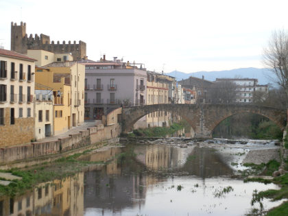 Spring rains on the Costa Brava have come, and what are often dry riverbeds now have water, the most noteworthy being the River Daro at La Bisbal d'Emporda where its old stone footbridge into the old town has a chance to show its purpose.
The villages around La Bisbal d'Emporda are some of the gems of Costa Brava, small stone-built medieval villages of narrow streets, cobblestones and vaulted central squares like Monells, Peratallada, Corca, Mandremany, Vulpellac, and Fonteta. La Bisbal itself is often overlooked.
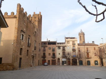 For tourists, it is easy to take the main road through La Bisbal or to take the ring-road around outside and to see it as just a line of pottery and ceramics shops on the way to the coast. But, in fact, the central older town of La Bisbal, that is not visible by car has a lot of charm and history. Being the main town for Baix Emporda and a seat of the Bishop of Girona, it hides a classic continental market town with squares and passageways and its own original Jewish Call.
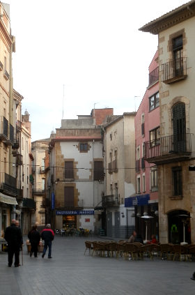 The name La Bisbal means "the bishop" and comes about because the town was ceded to the Bishops of Girona from the 11th Century. La Bisbal and the surrounding villages were important both religiously and politically, with the neighbouring Baronia de Cruïlles being one of the important controlling families in the area, with their influence eventually taking in Peratallada and out to Begur and Esclanya, and with some family members becoming bishop of La Bisbal.
 The history of medieval Catalonia is a little confusing, because unlike the burgeoning kingdoms in the north of Spain, that eventually became the kingdoms of Asturias, Leon, and then Castille, in Catalonia there were continuing tensions between the counts and ruling families. Overtime the Counts of Barcelona established primacy over the other counts of Catalonia, including the counts of Empuries who somewhat confusingly alternated in name between Hugh and Ponç. But at the same time, the Bishops of Girona sought influence over the Basilica in Castello d'Empuries (Catalan wikipedia link gives more details). The struggles between the various Counts in Catalonia seems to be one reason Catalonia as a territory never became a kingdom with regular power struggles sometimes leading to full on conflict (eg Aragonese Crusade or the Catalan Civil War in the 15th century) often with the help of the French.
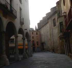 Over the centuries, the Emporda region has seen regular flow of Spanish-French conflicts and intrigues, the last being during the Napoleonic Penisular Wars when La Bisbal was the site of a battle when the very Spanish sounding Henry O'Donnell took La Bisbal from the French (the Imperial army was commanded by the very French sounding Jacques MacDonald). As an indirect link, the Hotel at Castell d'Emporda has what they say is the largest scale model of the Battle of Waterloo, for those interested in Napoleon's time.
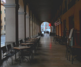 More recently La Bisbal is best known for its ceramics and terracotta - hence the shops along the main road and the presence of the chimneys through the town. The town has both a terracotta museum and a school for ceramics for what became the most important industry for the town.
In current times, except for market day when the streets throng with local people, La Bisbal can feel quite quiet, undiscovered and undisturbed but there are lots of nooks and crannies to explore. If there were a few more cafe terraces it would be perfect as a place to sit and enjoy the history.
Neighbouring walks: La Bisbal, Vulpellac, Castell d'Emporda, Fonteta - Canapost, Poblet Iberic and Ullastret - Palau-sator and Peratallada - Santa Susanna de Peralta and Sant Climent de Peralta - Llofriu, St Llop and Torrent - Mont-ras to Fitor and on to Fonteta and Vulpellac - Canapost to the medieval fair at Peratallada - La Bisbal fields by Cruïlles
Castell de Montsoriu
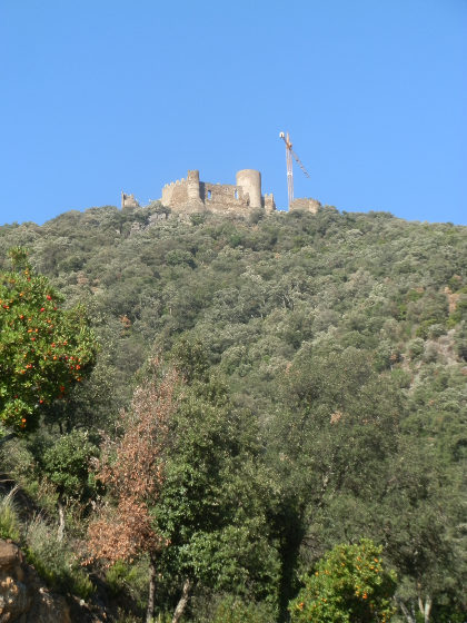 If you take the AP7 from Barcelona to Girona, as you leave the Valles Oriental towards Hostalric and you find yourself passing the last heights of Montseny, then you will see a castle standing isolated on the top of its own peak looking across the valley towards Hostalric and the sea. This is the castle of Montsoriu.
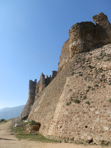 We came this way in November (so I'm being a little slow in adding the content) to revisit the castle after our first trip several years ago. The castle itself in that time has been subject to a lot of renovation work, but nothing can change the fabulous views from the top looking out to Girona, or across to the distant sea. Our day wasn't the clearest, and the views will be best on a colder day in winter when the air is fresh and clear and the Pyrenees are capped with snow.
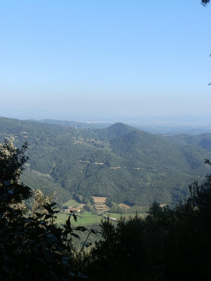 The castle is just off the road from Hostalric to Arbucies and well signposted. There are two places to park, one at the bottom of the hill next to the turning for the road up, or two separate car parks at the top, though to get to the castle itself you still have to walk up the final stretch.
We didn't know about the upper car parks, and the lower one was full so we actually parked off the road midway and then walked up through the woods. There are a number of paths but because the castle is right at the top, all directions up get to the castle.
At the top we were surprised by how much renovation work had been done since our previous visit. If I remember correctly, previously we had been able to explore the castle freely in its more tumble-down state, as the castle has been updated, they have also introduced an information centre and access to the main part requires an entrance fee. And in Autumn the castle is only open Thursday to Sunday with the option of a guided tour.
We were visiting on a Monday, so couldn't access the castle itself, so had to stick to the exterior and the walls. The castle was built in the 10th century but was abandoned in the middle ages with the last work being carried out on it in the 14th century.
Nearby: Palafolls castle- Hostalric stroll - Lake at Sils - Castell de Montsoriu - Santa Coloma de Farners - Brunyola - Arbucies autumn walk - Volca de la Crosa - Sant Dalmai (Girona Airport) - Visit to Roda de Ter and Espinelves
Comments | ||
adam@veggingoutwithadam.com |
17 Feb 2014 19:46 |
|
What a great blog. I am planning a walking holiday in the region and wonder if you can recommend the best walking maps, like UK ordnance survey ones. I shall be reading more of your walks over the coming days as we plan. Many thanks Adam | ||
Saul |
24 Feb 2014 17:25 |
|
Glad you're enjoying it. We have recommendations for maps in our 'Advice and FAQ' section | ||
Saul |
13 Jul 2017 12:46 |
|
Sorry I missed the comment, so I hope it's not too late - use the contact box if you'd like to send a message. For the coast, the GR92 is best and if you have driver you can just take it piece by piece. For hikers, around Cap de Creus is great, though it can be dry and hard walking in summer. For us, the stretch between Palamos and Palafrugell and on to Begur is the prettiest part of the whole Costa Brava and really good for walking. I'd probably also take the walk up and over Montgri, possibly starting at Pals, or L'Estartit to L'Escala. And though you said you prefer the coast, don't overlook inland routes as there are some wonderful villages and countryside out towards Girona, La Bisbal, or Olot. | ||
Sven-Gunnar Furmark |
24 May 2017 11:43 |
|
Hi, My name is Sven Furmark. I am from Sweden. I plan to go to Costa Brava with some friends (totally about 10 people) for hiking for one week (5 walking days). We are experienced hikers and we usually walk 4-6 hours per day. We prefer to walk along the coast as much as possible. We plan to rent a house and travel to each days hiking with a bus & driver which we plan to book for the whole week. Which five hikes would you recommend for us. Warm Regards Sven | ||


