 Walks and other things
 One of the joys of the Costa Brava is the variety of landscapes and we like to visit places and walk (a lot), particularly into and around the Gavarres. Sometimes we travel around on bike. In the summer, we swim and canoe.
These then are write ups of walks, hikes and activities that we've done since November 2012, with photos straight from the original walk or activity.
We like to make circular walks and our walks range in length from about 4km (an hour) to around 16km (four hours) - but probably about 2 1/2 hours on average - though if you want to reduce the length, there are usually shortcuts.
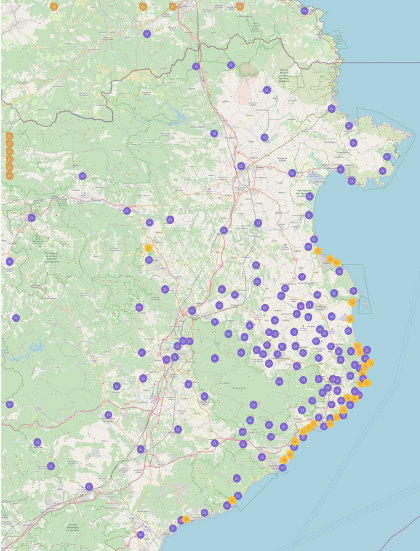
To find walks by location, click on the map, which goes to a full sized map with links to individual walks and visits. To our surprise, we were listed in the Sunday Times' Essential Costa Brava (Feb 2017).
The most visited walks are:
- Calella de Palafrugell/Cap Roig to Castell - classic wild Costa Brava
- Far de Sant Sebastia (Llafranc) to Tamariu
- Platja d'Aro and S'Agaro
- Sa Tuna, Cap de Begur, Begur
- Eulogy to the Ruta del Tren Petit (Palafrugell, Palamos, Mont-ras and Vall-llobrega)
- Fornells and Aiguablava walk (GR92)
- Mont-ras to Calella de Palafrugell and Llafranc
- Platja de Castell and La Fosca
- St Antoni de Calonge, Torre Valentina to Platja d'Aro (almost)
- Escala, St Marti d'Empuries and beyond
- Bell-lloc and Castell de Vila-Roma (Palamos)
- Platja Sant Pol to Sant Feliu de Guixols
- Roses - Canyelles beaches to Cap Falconera
- Blanes, Lloret de Mar, Tossa de Mar by GR92
La Bisbal d'Emporda
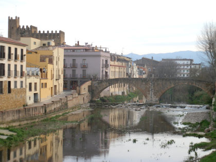 Spring rains on the Costa Brava have come, and what are often dry riverbeds now have water, the most noteworthy being the River Daro at La Bisbal d'Emporda where its old stone footbridge into the old town has a chance to show its purpose.
The villages around La Bisbal d'Emporda are some of the gems of Costa Brava, small stone-built medieval villages of narrow streets, cobblestones and vaulted central squares like Monells, Peratallada, Corca, Mandremany, Vulpellac, and Fonteta. La Bisbal itself is often overlooked.
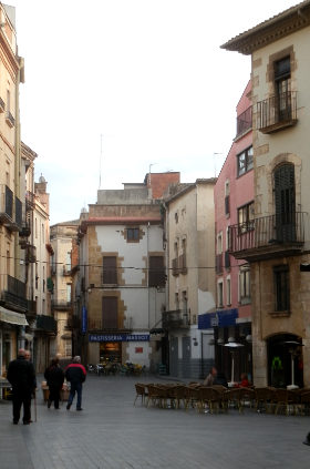
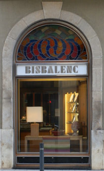
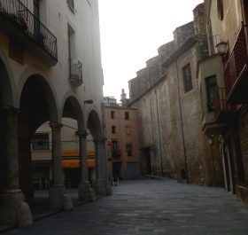
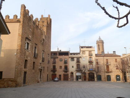 For tourists, it is easy to take the main road through La Bisbal or to take the ring-road around outside and to see it as just a line of pottery and ceramics shops on the way to the coast. But, in fact, the central older town of La Bisbal, that is not visible by car has a lot of charm and history. Being the main town for Baix Emporda and a seat of the Bishop of Girona, it hides a classic continental market town with squares and passageways and its own original Jewish Call.
 The name La Bisbal means "the bishop" and comes about because the town was ceded to the Bishops of Girona from the 11th Century. La Bisbal and the surrounding villages were important both religiously and politically, with the neighbouring Baronia de Cruïlles being one of the important controlling families in the area, with their influence eventually taking in Peratallada and out to Begur and Esclanya, and with some family members becoming bishop of La Bisbal.
 The history of medieval Catalonia is a little confusing, because unlike the burgeoning kingdoms in the north of Spain, that eventually became the kingdoms of Asturias, Leon, and then Castille, in Catalonia there were continuing tensions between the counts and ruling families. Overtime the Counts of Barcelona established primacy over the other counts of Catalonia, including the counts of Empuries who somewhat confusingly alternated in name between Hugh and Ponç. But at the same time, the Bishops of Girona sought influence over the Basilica in Castello d'Empuries (Catalan wikipedia link gives more details). The struggles between the various Counts in Catalonia seems to be one reason Catalonia as a territory never became a kingdom with regular power struggles sometimes leading to full on conflict (eg Aragonese Crusade or the Catalan Civil War in the 15th century) often with the help of the French.
 Over the centuries, the Emporda region has seen regular flow of Spanish-French conflicts and intrigues, the last being during the Napoleonic Penisular Wars when La Bisbal was the site of a battle when the very Spanish sounding Henry O'Donnell took La Bisbal from the French (the Imperial army was commanded by the very French sounding Jacques MacDonald). As an indirect link, the Hotel at Castell d'Emporda has what they say is the largest scale model of the Battle of Waterloo, for those interested in Napoleon's time.
 More recently La Bisbal is best known for its ceramics and terracotta - hence the shops along the main road and the presence of the chimneys through the town. The town has both a terracotta museum and a school for ceramics for what became the most important industry for the town.
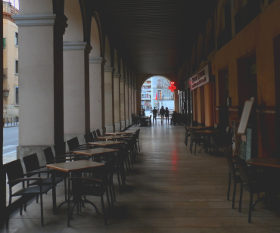
In current times, except for market day when the streets throng with local people, La Bisbal can feel quite quiet, undiscovered and undisturbed but there are lots of nooks and crannies to explore. If there were a few more cafe terraces it would be perfect as a place to sit and enjoy the history.
Neighbouring walks: La Bisbal, Vulpellac, Castell d'Emporda, Fonteta - Canapost, Poblet Iberic and Ullastret - Palau-sator and Peratallada - Santa Susanna de Peralta and Sant Climent de Peralta - Llofriu, St Llop and Torrent - Mont-ras to Fitor and on to Fonteta and Vulpellac - Canapost to the medieval fair at Peratallada - La Bisbal fields by Cruïlles
Castell de Montsoriu
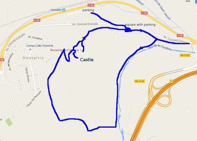
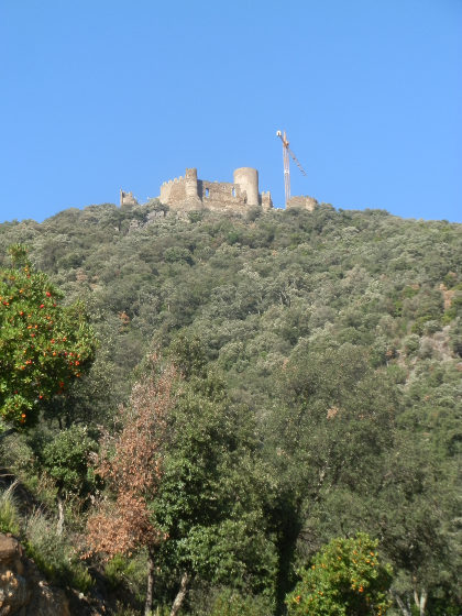 If you take the AP7 from Barcelona to Girona, as you leave the Valles Oriental towards Hostalric and you find yourself passing the last heights of Montseny, then you will see a castle standing isolated on the top of its own peak looking across the valley towards Hostalric and the sea. This is the castle of Montsoriu.
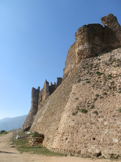 We came this way in November (so I'm being a little slow in adding the content) to revisit the castle after our first trip several years ago. The castle itself in that time has been subject to a lot of renovation work, but nothing can change the fabulous views from the top looking out to Girona, or across to the distant sea. Our day wasn't the clearest, and the views will be best on a colder day in winter when the air is fresh and clear and the Pyrenees are capped with snow.
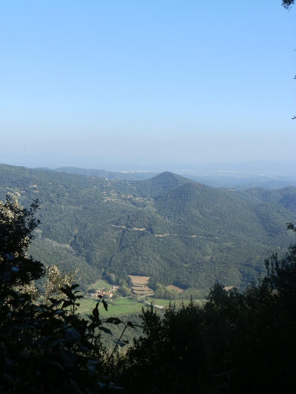 The castle is just off the road from Hostalric to Arbucies and well signposted. There are two places to park, one at the bottom of the hill next to the turning for the road up, or two separate car parks at the top, though to get to the castle itself you still have to walk up the final stretch.
We didn't know about the upper car parks, and the lower one was full so we actually parked off the road midway and then walked up through the woods. There are a number of paths but because the castle is right at the top, all directions up get to the castle.
At the top we were surprised by how much renovation work had been done since our previous visit. If I remember correctly, previously we had been able to explore the castle freely in its more tumble-down state, as the castle has been updated, they have also introduced an information centre and access to the main part requires an entrance fee. And in Autumn the castle is only open Thursday to Sunday with the option of a guided tour.
We were visiting on a Monday, so couldn't access the castle itself, so had to stick to the exterior and the walls. The castle was built in the 10th century but was abandoned in the middle ages with the last work being carried out on it in the 14th century.
Nearby: Palafolls castle- Hostalric stroll - Lake at Sils - Castell de Montsoriu - Santa Coloma de Farners - Brunyola - Arbucies autumn walk - Volca de la Crosa - Sant Dalmai (Girona Airport) - Visit to Roda de Ter and Espinelves
Waterfall at Les Escaules (Boadella)
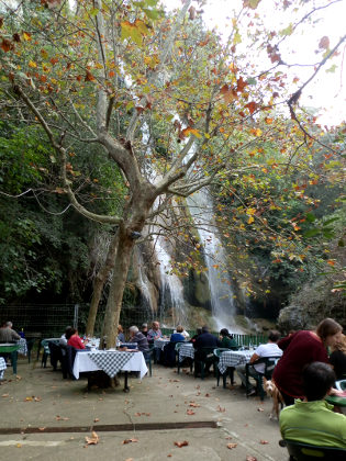 Over the summer we went back and re-explored some the Catalan gorges for swimming, along the way we came across details of The Salt de la Caula which is just by Les Escaules, north of Figueres, a little way into the hills by the Muga river. We also read that the gorge was no longer suitable for swimming, but we thought we would take a look and, eventually, found ourselves at a restaurant almost sitting under a 30m waterfall.
From what we read the gorge was thermal water and it is still listed as being open in some places, though it's not clear if this is the river above the waterfall, or further downstream. However, at the restaurant, the sign said that there had been a rockfall in 2010 during heavy rain which dropped a lot of rock and stone into the gorge leaving a very pretty waterfall, but taking away the space for swimming.
However, before we got to the restaurant we paid a short visit to the castle above Les Escaules and the village itself having actually driven past the waterfall and restaurant parking (just before the turn to the village). We also got a little stuck driving into the village looking for parking - the roads get very narrow with little space to turn around, so if you do visit, park outside and walk in.
The most remarkable part of our visit was the landscape which becomes quite dry and barren and what trees are around seem to have been blown over leaving hillsides of low scrub and rock. We parked just outside the village and walked up to the ruins of the castle above the village and the fallen trees are all around, and it seemed odd then to see such a great flush of water coming from the waterfall when we finally found it.
The village is a long narrow medieval village with a small church and square situated above the Muga river below. At the lower part of the village by the bridge you can get access to the river for paddling.
But to get to the restaurant we had to double back and then could see the waters cascading off the cliff and the noise of the water that we hadn't been able to hear from the car. The restaurant has tables and seating almost directly underneath next to the little stream fed by the water. We sat and waited for a drink (and waited and waited) enjoying the view and the strange sense of such a lot of water in such an apparently dry area.
Returning, we carried on the Boadella and then up into the almost Provencal hills to Torrades. Again another surprise and new landscape.
Nearby: Serinya and Illa del Fluvia - Banyoles lakeside walk - Sant Miquel de Fluvia - Bascara - horses, fords and lost - Esponella and River Fluvia - Espolla to Rabos - La Jonquera to Fort de Bellegarde (France) - Ceret (France)
Begur - Festa d'Indians
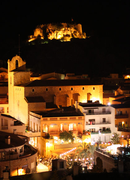 At the first weekend of September Begur holds what is one of our favourite festivals of the year - the Festa d'Indians which celebrates Begur's connection with Cuba and the Caribbean. The town's small streets become jam packed with people dressed in white wearing straw hats, drinking Mojitos and rum cocktails with music and the sounds of the samba and rumba on every street corner.
The festival is Begur's Festa Major and runs over three nights of the weekend with a lilting relaxed family atmosphere with people of all ages (many of them in their 'jubilacion' - retirement) dancing, chatting, eating and drinking with sidestreets with market stalls and bars liberally making cocktails. The special fact that everyone gets involved, people make an effort and dress up with white shirt and cotton trousers for men, or white lace cotton dresses for women gives it a very unique feeling, as if you're transported back in time to 1920s Cuba.
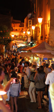
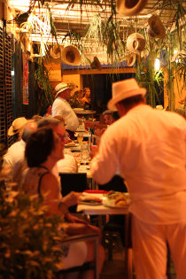 It's called Indians because the festival draws its inspiration from the many of the Catalan entrepreneurs of the nineteenth century and made their fortune in the tobacco and sugar trades of the West Indies, and in particular Cuba, came back to settle in Begur with their houses (Indianes) built in the South American style contrasting with the traditional Catalan village houses and leaving their mark not only on Begur, but also on other coastal villages where you'll find the Indianes almost as the first villas-by-the-sea.
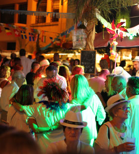 Being night and dark, capturing the spirit in photos is difficult, but if you happen to be among the chic villages of the central Costa Brava for the first week of September, the Festa d'Indians is strongly recommended.
For local walks see: Begur, Ses Negres and Sa Riera - Sa Tuna, Cap de Begur, Begur - Palafrugell, Tamariu, Begur residential and Esclanya - Masos de Pals, Begur, Sa Riera and Platja de Pals - Fornells and Aiguablava walk (GR92)
Swimming: Swimming at the beach at Aiguablava - Swimming and canoeing at Sa Tuna (Begur) - Platja Fonda (Begur) - Sa Riera (Begur)
Meetup Group for Web and App Developers
A brief change to our normal walking and events blog. For anyone in the Costa Brava or Girona area we're trying to start up a Meetup group for Web and App Developers. There's loads going on for internet start ups and internet companies in Barcelona, but relatively little happening in this region.
We're lucky enough to have been offered the use of a meeting room at Cinc Business Center in Girona (http://www.cinc.es) and have an aim to have a talk at least every month on some aspect of Internet technologies. Cinc offers serviced offices and space for co-working and business meetings if you are looking to start up a venture in this area.
Update 2018: The location is shifting to civic centres in Girona with help from Girona Empren. If you want more information, either use the meetup page, or contact us via this site.
See also information about the Internet Community in the Girona and Costa Brava area
Mollo (Camprodon) - Pyrenees to France
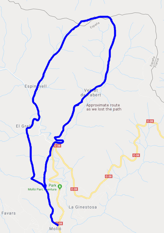
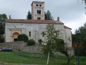 We were visiting Camprodon recently and saw a number of walks up into the hills/mountains up to the French border. The distance from Camprodon itself would have meant a two day walk, so instead we travelled a little further up and decided to make the walk from the village of Mollo via Espinavell which was more of a 4-5 hour hike.
Before getting to the walk, I should mention Camprodon as it's one of our favourite towns in towards the mountains. It's relatively small but has a real mountain feel to it with the sound of cowbells, the smell of fresh grass and a number of small streams running through the centre with crystal clear mountain water - almost a complete change in geography from the sea and coast. There's an old peak-arched bridge and nestle of old greystone houses with the odd modernista building. If you're lucky you'd be able to go into the town museum (it has no formal timetable) which houses a collection of articles, posters and artifacts from the civil war and WWII, from when the region was one of the escape routes for downed British airmen fleeing occupied France.
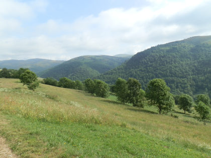 Our walk however, started from Mollo which is the next village up, about 7km up the valley towards the pass into France. Mollo itself is a small village with a church, a square and a few paved stoned streets, but we saw several walkers while we were there.
To go up we follow the marked footpath. The route is a GR and so marked by red-white flashes and mostly signposted and easy to follow. To begin with we follow the path out of the top of the village out into the fields with the valley running below to the right tumbling away behind us. In early summer the weather was cooler than at the coast but still warm and with lots of water around, there was a classic feel of vitality and verdent meadows.
As we continued the path ran through some woods and we could hear the sound of animal bells. Expecting to see cows, we were surprised to be greeted by horses in the woods and on the path ahead of us taking water at one of the streams.
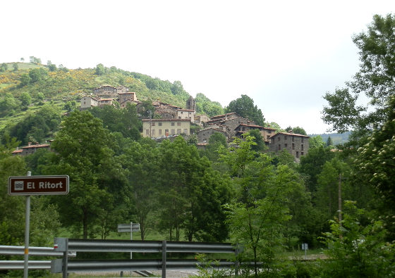
As we got closer to Espinavell some of the directions got a little more tricky. The GR took us along the top of a terrace wall in the woods lined with stinging nettles on one side and a 1-2m drop on the other side. We're not so used to stinging nettles as they tend not to grow in the drier areas by the coast and so were unprepared just wearing shorts and low socks.
The terraced path eventually reaches a stream and the marked route is in the water of the streambed down to the road for Espinavell.
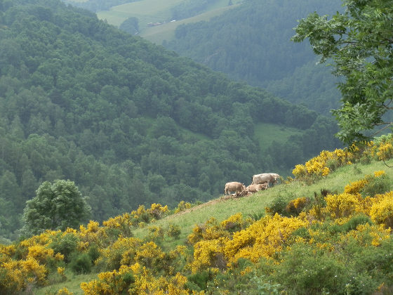
At Espinavell we ran into mountain bikers coming downhill from the pass up above on the route we were wanting to take up. Some had called in at the local cafe for a break. Espinavell itself has a small church and a set of rough hewn houses that look back down the valley in one direction, or up to the yellow gorse covered mountains behind. The roads in the village are very steep, lined with stones carefully laid in a pattern. And by the time we had climbed out of the village to the path at the top we were seriously puffing.
The path then tracks upwards into the gorse, some of which was high and dense and we were guided by the route marked for the mountain bikers. At the top we were met by the border marker and the sight of clouds coming up to the ridgeway from the French side and so didn't get the views of Canigo we were expecting.
The area on top is open grass covered and apart from the border stone at Col Pregon, no visible sign of a border so we followed the path on the French side over a couple of small hills that took us over 1600m and watched by French cows in the fields.
Coming down we could have taken the route back to Espinavell (there's a clear and easily marked path), but we wanted a little more of a loop so aimed to take a path down from Puig Sec and the Basses de Fabert where there was a small pond.
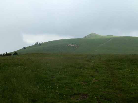
However, this created something of a problem in that though the path is marked, it turned out that it was very well covered with vegetation and so finding and tracking the route down through the grass was much more difficult than we expected and we lose the path on various occasions. Fortunately we know the direction we were heading and just about manage to find our way to the proper route, only to lose it a little later as it zigzagged down a meadow. Fortunately there are no cliffs and it's open countryside, so nothing dangerous but it would be easy to get lost among the stream valleys running off the mountain, so do have a map.
Eventually we cross a number of streams and passed water pools with baby salamanders resting in the water under a small waterfall and reach the hamlet of Fabert. In theory from Fabert there is a marked route along the stream valley but when we tried to follow the path it was so overgrown from the new summer nettles that it was practically impossible to follow and we had to turn back and take the paved track back going down to the main road. The main road is busy so we climbed a little higher to find the route through the fields back to Mollo feeling our legs a little.
Nearby: Sadernes and river pools of St Aniol d'Aguja - Sant Esteve d'En Bas (Olot) - Ribes de Freser and skiing at Vall de Nuria - Olot - capital of Garrotxa - Els Set Gorgs (Campdevanol)- La Jonquera to Fort de Bellegarde (France) - Villefranche-de-Conflent and Mont-Louis (France) - Puigcerda and Bourg-Madame - Portbou to Cerbère (France) and back
Webcams for the Costa Brava
We've added a few links to local webcams - for when you want to see how busy the beach is or if the sea is smooth or choppy. Click on the link above, or go here. I'll add more as we find them, or make a suggestion in the comments....
Cervia de Ter
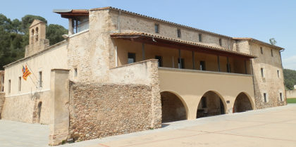 Cervia de Ter is a village on the northern side of the river Ter not too far from Girona. We headed to Cervia de Ter almost just to tick a box as it was one of the few villages we haven't visited, and then, like many places on the Costa Brava it surprised us.
As with many villages, the main road skirts the fringes and its only by stopping and walking do you find the real character of the place. Our surprise was to discover this was a town with a monestary and a castle (in ruins), part of the Ruta del Santiago from Sant Pere de Rodes and so formerly more important than the current sleepy unknown village it is today.
 A monestary and a castle means an older town centre with nooks and crannies to be discovered almost like a rough unspoilt French village transplanted into Catalonia.
 We park near to the school on the east of the town and then walk through towards the centre. The first building we come across is the old monestary and church, now converted into council offices (adjuntament). Inside are cloisters, though we didn't visit this time around.
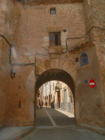
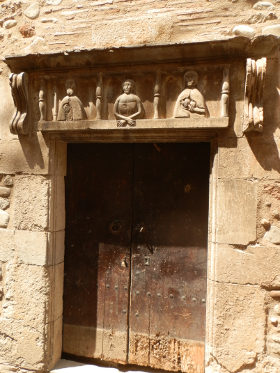 From here we take a bit of a haphazard route through the streets to explore passing through one of the old town gates along cobbled stone streets. On a Sunday, as with many Catalan towns, the place is quiet and sleepy dormant in the spring sun. A carved lintel above an old doorway has a series of three figures marking one of the important town houses.
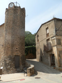
We find a route marked towards the castle and come to a tower with a clock that marks the route up to the castle and the line of the town wall above the street. Trying to get to the castle we find narrow streets that end with old in-town farm houses with geese and chickens in the yards and hapazard buildings. These are the types of ancient rural living that would be perfectly in place in the Dorgdogne or the centre of France.
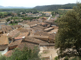
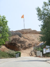 The road up to the castle is blocked due to renovations, so we walk back into the village and then follow the road up the hill to the castle from the back. The castle stands above the village with views across the roof tops and out tot he valley of the river Ter.
To make it more of a walk than a visit we carry on up the hill past the castle and out into the woods and fields at the back. As we go up the views become better with vistas across to the hills around Girona in the distance. The road is easy to follow as it just loops around and fields of wheat and barley are turning from green to gold in the sunlight, dotted with red poppies.
 The road turns past a couple of farms and we turn into the woods not quite knowing where we're going, but trusting that the track is taking us back to Cervia as the map we have has Cervia just on the merest corner. Fortunately the tracks are broad and easy to follow through the woods and we emerge by a farm at the bottom of the hill with the Ruta de Santiago signs (a scallop shell) marking the way back to Cervia.
Banyoles lakeside walk - Bascara - horses, fords and lost - Palol de Revardit to La Mota - Serinya and Illa del Fluvia - Roman fort at St Julia de Ramis (Girona) - Sant Jordi Desvalls, Colomers and Sant Llorenç de les Arenes
Girona Temps de Flors
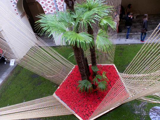
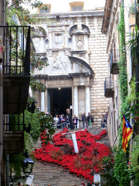
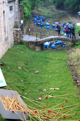
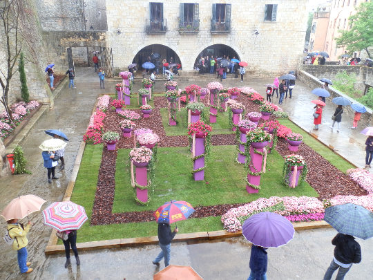
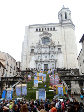 In May, Girona has its Temps de Flors (time of flowers) festival where the city has a floral festival with displays of flowers, and installations in many of the buildings in the heart of old Girona and out in the parks. We visited in the rain which we thought would keep crowds away, but the Sunday was extremely busy with people, the restaurants and cafes looked full and streets packed with umbrellas. Below will be some photos of some of the things that were on. There's too much to see everything, but it's a perfect time to visit the city - even the rain didn't matter too much.
The exhibits are very varied. Street decoration could be very simple with flowers lining the steps, or hanging displays, or some very large installations, including, for this year, a large display with a sword harking to Girona's recent use as a location for the "Games of Thrones" series.
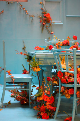 In contrast to the exterior street displays many of the buildings and museums in the old city were open and had various displays - often very artistic in nature. As a time to explore it would be perfect with the city itself acting as a backdrop, but with the chance to sneak a peek in some corners of the city that otherwise might not be accessible.
The only slight problem was the crowds which made everything quite busy. The rain was encouraging people to go to the interior displays perhaps more than might happen in better weather, but in some ways it added to the atmosphere with crowds still eating outside, but underneath the arches or under umbrellas outside the restaurants.
The crowds though weren't combing very well with bringing our dog Zina with us. So we didn't visit too many of the interior displays and instead headed out through the old city gates towards the Sant Daniel area underneath the cathedral. In this area more of the displays were in the gardens with a little more space than in the confines of the streets. These were also more garden type displays filling the space with colours.
We walked out along the valley for a breather, before coming back into the city at top, just under the walls at the quieter Jardins dels Alemanys to find more exhibits.
Girona walks: Girona valley of Sant Daniel - Gavarres Montnegre and Montigalar - Ruta del Carrilet - Girona cyclepath to the coast - Bescano, River Ter and free-style kayaking - Girona and Castell de St Miquel - Roman fort at St Julia de Ramis (Girona)
Nearby: Figueres and Castell de Sant Ferran - Olot - capital of Garrotxa - Banyoles lakeside walk - Visit to Besalu and Banyoles
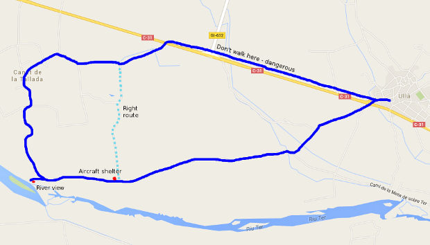
Ulla to Canet de la Tallada and civil war remains
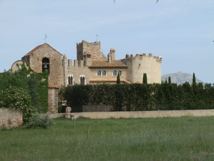 Ulla is a small village just outside Torroella de Montgri, set slightly back from the road behind the warehouses for the Costa Brava fruit co-operatives. Our walking routes have taken us to Torroella de Montgri along the Ter, and into the Montgri hills at the back of Ulla, but we'd never gone the other way heading upstream towards Canet de la Tallada - a place we'd not visited before, so this was a little bit of an unknown explore.
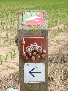 Unlike the dry lower slopes of Montgri behind Ulla, the area along the Ter is a flat plain of espalliered fruit orchards and, in May, of ripening wheat and other crops. We park in Ulla and cross the busy C31 that connects to Verges and L'Escala, heading into the fields. There are strong notices on the way in that going in among the fruit trees is strictly prohibited so to stay to the path.
The orchards are mostly apple with the last of the blossom just disappearing, leaving small burgeoning fruit buds in their place. The walk is fine as a stroll in the sun along the gravel agricultural track, which eventually opens out into more fields and views of the trees lining the unseen River Ter.
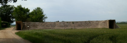
It's only as we reach one of the farm houses that we see an unusual-shaped building just to the side of the path, a long concreate structure with two open door ways. From a distance we take guesses as to what it was for - it looks like a defensive fortification. As we get closer we can see a sign which explains that the area we are walking was used as a large airfield for the Republican (anti-Franco) Spanish in 1938. The building we're looking at was a large air-raid shelter for the military personnel. What's more the area we're walking provides a tour around several of the sites related to the airfield.
 As we walk around the Costa Brava and Emporda areas we keep coming across these types of historical sites. The ebb and flow of wars and attacks from civil wars, wars with France, Napoleon, attacks from Ottoman pirates reflect a land with a turbulent history. When refugees are coming into Europe from the East, Catalonia still bears the scars of the last exodus of Spanish refugees within living memory.
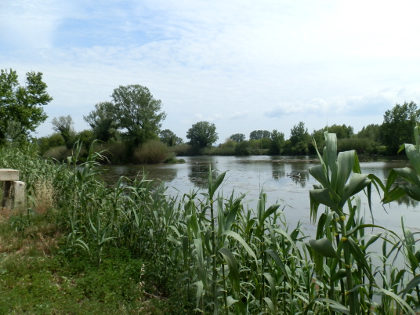 Finding out about the airfield piques our interest and we continue following the marked circular route. The first part links to the Illa de Canet - an island in the River Ter formed where a weir holds back the water leaving a large semi-lake of water full of waterfowl. It feels like an area that is rarely visited it's so quiet, but the path and riverside have been carefully tended with a steel wall that can be used as a hide for watching the birds.
We follow the path into Canet de la Tallada looking out for the curiously shaped farm/castle-cum-church. The houses in the village are spread out and feel as if they are spreading out their gardens like wings taking in the afternoon sun.
 Our route back follows the same marked track up to the point that we divert to the next historic shelter. Instead of following the prescribed route we walk out to a large buildings warehouse on the main road, hoping to find a track back through the fields on the other side of the C31 back to Ulla.
Unfortunately there are no crossing points and no obvious routes to take, so we are forced to follow the C31 by the side of the road. This is seriously unpleasant. The road has no verge or footpath, just a ditch to each side and we are forced to walk towards the rapid oncoming traffic hoping that the cars take notice of our vulnerability. Eventually we find a small bridge and can cross to the other side of the ditch and totter along the edge of the field slightly further away from the road. As the road passes another set of orchards, the walking gets easier but there is still no sign of a footpath. Eventually we come in towards Ulla - forced back on the road to cross a stream with a bus looming at us, and then back into Ulla. If you are taking this route do stick to the pre-marked route - we didn't see any real alternatives to get back to Ulla.
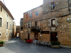
The village itself is a small stone-built medieval village, a little sleepy, off the beaten track. A short walk to the church and the centre for photos and then back.
See also: Torroella de Montgri to Gola de Ter - Torroella de Montgri castle - Gualta, Llabia, Fontanilles and the lake of Ullastret - Serra de Daro, Fonolleres, Sant Iscle d'Emporda
Ruta del Carrilet - Girona cyclepath to the coast
 The Costa Brava and Girona area is a fabulous area for all types of cycling. Professional cycling teams use Girona as a training base and can be seen riding into the mountains up to Vallter 2000, or doing climbs up to Els Angels or Rocacorba, or tracking around the coastal route between Sant Feliu de Guixols and Tossa de Mar. Others take mountain bikes up into the Gavarres, or out into the hills of the pre-Pyrenees.
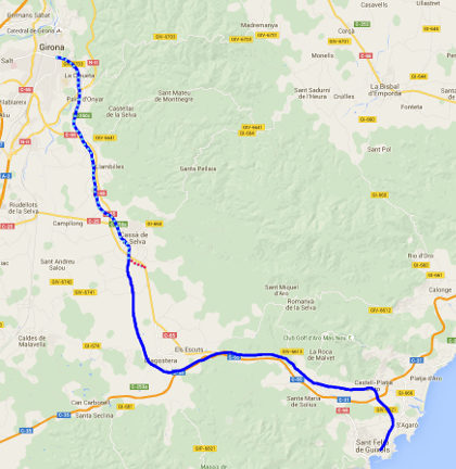
For less arduous cycling, a number of old railway routes have been converted into easy flat cycles paths or green-ways (Vies Verdes), that can also be walked. Close to the coast between Palafrugell and Palamos is the relatively short Ruta del Tren Petit, but for something longer the Ruta del Carrilet (http://www.viesverdes.cat/CA/54/RUTA-DEL-CARRILET-II.html) runs from Olot down through Girona and then to Sant Feliu de Guixols via Cassa de la Selva and Llagostera - a total length of 93km.
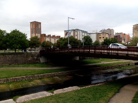 To provide a taste of the route, I walked the stretch from Girona to Cassa de la Selva while the family was shopping in Girona, getting picked up as they drove back home. Girona to Sant Feliu (or diverting north to Platja d'Aro) is about 39km.
The first thing to note is that this is a route that is really best done by bike than on foot. The path is gravel but fairly broad and solid under foot and it encourages you to speed through the countryside on long straight routes through the fields, with not too many diversions for walkers who might like to explore a little more into the centre of the towns and villages.
Our starting point was in Girona at the Pont de la Font del Rei across the River Onyar in Girona. The Onyar is the smaller of Girona's two rivers, but the one that runs along the old city in the centre before meeting the River Ter just beyond the Cathedral on the way out to the sea at L'Estartit.
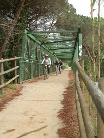 We could track the river in a couple of directions - there's a path along the channel, or two road routes, one either side of the river. The main bike route stays on the south side of the river, but wanting to explore a little we took the left-bank, north side under the hill with the great radio mast and out along the plane-tree lined road.
At the crematorium (Tanatori) I realised we were making a bit too much of a diversion, so we crossed down to the river across a narrow zig-zag foot bridge and out to the Parc Scientific of the University of Girona. From here we took the Ruta de Carrilet proper into the fields tracking the Onyar against the flow. It's spring with a relatively wet April so the fields are full of wheat and poppies and the yellows of rapeseed and marigolds. The rain seems to have put off the cyclists a little and though we see a few on the route, it's not as busy as it has been in the past.
 The path reaches the NII and double backs to pass under the road - there's a split point here and it would be possible to continue straight on to walk to the southern parts of Girona. We take the marked path and then cross the Onyar using a green-box bridge across the water just as a group of cyclists meet us. The rules for the path say dogs must be on a lead, and since the bike go relatively fast, I keep Zina on the lead whenever there are bikes about.
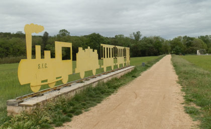
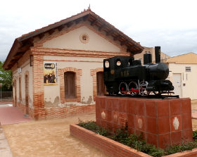
The path continues it's very straight, but slightly uphill passage to Quart, the first small town outside Girona. The runs along a back road through the village, past the quaint old station marked with a model train and then past the small Museum of Terrissa (pottery).
On the far side of Quart the path is back to gravel and runs alongside the main Girona-Sant Feliu road so there's the steady hum of traffic. A yellow-painted metal train sign marks the route for the cars but otherwise it's a steady walk to Llambilles and the next disused station. In the park nearby a collection of bike statues mark how popular the route has become for local cyclists.
 We track even closer to the road for a while with more box-bridges, but with almost no-one on the path now. The route deviates a little from the road behind a Repsol station and over the hill we can see the tower marked Inresa in stencil letters of Cassa de la Selva. It's a steady walk past the odd farm house through the fields.
As we reach the outskirts of Cassa de la Selva, the Carrilet path tracks through the industrial estate (poligon industriel) past large grey warehouses, quiet on a Saturday afternoon, but not particularly enticing for walking. On a bike you'd zoom through, but on foot it takes a while before the Carrilet turns up towards the town of Cassa de la Selva.
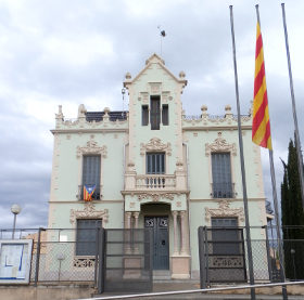
We go past Cassa's old station and the very ornate Can Nadal before heading out into the countryside again. The road leaving Cassa isn't so well marked so at one point we thought we had lost the path, but after climbing past farms and then over the main road we see we're on the right path as the signposts point across the countryside towards Llagostera.
We're about done though. Shopping has finished in Girona so we leave the Carrilet and take a track to the last Cassa roundabout to wait for our lift home.
Girona walks: Girona valley of Sant Daniel - Gavarres Montnegre and Montigalar - Girona and Castell de St Miquel - Roman fort at St Julia de Ramis (Girona) - Girona - Festa Major of Sant Narcis - Girona Temps de Flors - Llagostera to Sant Llorenç - Cassa de la Selva
Sant Pere de Rodes
Sant Pere de Rodes is one of the emblematic elements of the Costa Brava. Set high in the hills of the Cap de Creus above Port de la Selva (about 500m), this ancient monastery has a bewitching charm with commanding views over the countryside and coast below.
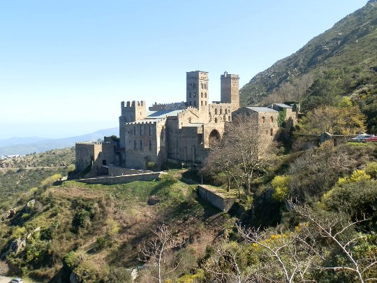
Sant Pere de Rodes can be reached from either Port de la Selva or from Vilajuiga on the Roses side. We drove up from Port de la Selva - the narrow road climbs quickly with hairpins and is relatively open to the hillside falling away beneath you so the drive is relatively dramatic taking about 8km to climb in to the hills of Cap de Creus with grand vistas over the sea behind you.
 We were visiting at Easter weekend, so there were lots of cars and visitors around and we parked in parking about a kilometre away from the monastery. The main building is not the only element of the 'conjunct' - there is a small chapel (Santa Helena de Rodes) and abandoned medieval village at Santa Creu de Rodes, plus a separate ruined castle of Verdera above the monastery.
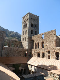
 The monastery itself was abandoned in the 18th/19th century, but has been maintained as a historic monument since the 1930s with many elements that have been restored. The site charges for entry (€4 for an adult in 2016) but even if you don't go inside there is enough scenery and interest to make for a worthwhile day trip.
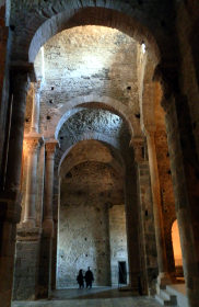
We did go in, and the light through the old windows into the stone nave and cloisters is almost haunting at times with tall arched ceilings. A good visit can be done in a hour, and there is a restaurant with views over the bay of La Selva below.
After the monastery we split into two groups. One went up to the castle of Verdera above, and then along the top with views across to the Gulf of Roses, while the other group went back along the road and took in the sunshine and views from Santa Helena de Rodes
We took the road down to Vilajuiga which wasn't quite as hairpinny as the way up and possibly would be easier access from Figueres.
Neighbouring walks
Roses and Roses Ciutadella - Llança - Cadaques and Port Lligat - Port de la Selva - Cadaques to Roses - Espolla to Rabos - La Jonquera to Fort de Bellegarde (France) - Peralada - Castell de Requesens
Palafolls castle
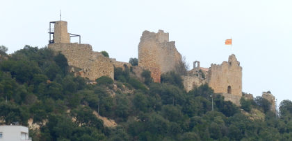 Palafolls, just south of Blanes is technically just outside the Costa Brava on the far side of the Tordera river tucked a little away from the coast behind Malgrat de Mar - the first of the Maresme coastal towns that run all the way down to Barcelona and if you take the coastal C32 motorway up from Barcelona you pass this crumbling castle in imposing locat to the right as the motorway comes to Tordera - this is the castle of Palafolls.
 We came visiting playing it by ear, so without a map aiming just to stop in the town and then follow what paths we could find up to the castle. We came in from Tordera itself on smaller rural type tracks, and discovered later there is easier access directly from Blanes or Malgrat.
 The weekend we were visiting was start of the Easter holidays and in our part of the Costa Brava the Mediterranean International Cup was taking part, a youth football tournament that attracts the youth teams of leading clubs from around the world like AC Milan, Barcelona and Real Madrid. At the same time as the MIC, a lesser tournament takes place in and around Palafolls for more everyday teams.
So when we arrived we were surprised to see an number of buses from Italy and England at the Palafolls football stadium so we parked near by to see what was going on and saw small groups of supporters with Italian flags.
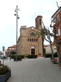
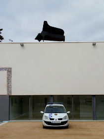
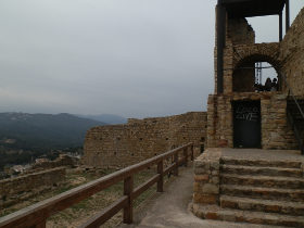 From the stadium we followed the road in towards the centre of the town. The castle was easily seen across the fields up to our right and we ignored the Cami de Castell to continue to the centre of town. Much of the town is newer and it was closed on a quiet Sunday afternoon, but towards the centre there were a small nestle of older buildings and we eventually navigated to the church in the centre next to two or three imposing municipal buildings. The surprise was the police station which seemed to have been extended very distinctively with a walls of spaced bricks jutting out at odd angles. The oddity of the police station was made more strange by a police car parked beneath a grand piano that was positioned on top of the local theatre.
The town itself is quite open to the fields at the back and we headed out along the dry river valley towards the hills and castle. We found a crossing of the river and walked up past the school which stands in the open before taking what we hoped was the right path up the valley towards the castle. The area has many masia farmhouses spaced along the valley and, to our surprise, the fields were full of lettuces, which must be the main spring crop.
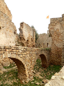 The road continued linking all the masias along the edge of the valley, but we didn't see an obvious route up to the castle - many of the paths we saw were private. So we found ourselves walking past the castle and practically all the way to the motorway and the housing estate at Mas Carbo.
At this point we were climbing up to the top and it was very clear how to reach the castle along the estate roads. From the vantage point above the valley we could look across to the sea and the gridded town and hotels on the coast and then through the lettuce green valley to the hills that mark the start of the Serra Litoral that runs behind the Maresme.
The castle itself holds a prominent position on top of a tongue of hill with views to Blanes on one side and towards Malgret on the other. We spotted the slides of Marineland, a water park that we hadn't come across before on the hill behind Palafolls.
The castle was open with no restriction on access. It's large enough that we had thought we might have to pay, but it is probably enough out of the way not to draw casual visitors. The castle has some parts that are prepared for visitors with metal steps and a small ladder to get half way up one of the towers. However, other parts, like those round a small chapel and in amongst the old keep feel much more like ruins with rough ground and, in some areas, open drops so visitors need to take care.
The castle must have been pretty large in its hayday in the thirteenth and fourteenth centuries as many of the remaining structures are quite imposing. The small inner chapel is quite quaint, though dark and decaying inside and it would have been interesting to find out more about the history and situation.
When we'd seen enough, we headed down back towards Palafolls and the shouts of the football stadium that drifted up to the castle walls. The path is actually labelled as being in the direction of Tordera, but connected us straight back to where we'd parked the car. And whereas the walk up had been in the region of 40 minutes, getting back was only about 20.
Nearby: Hostalric stroll - Lake at Sils - Castell de Montsoriu - Santa Coloma de Farners
Lake at Sils
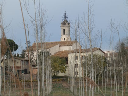 If you take the train from Barcelona to Girona, one of the towns you'll pass through is Sils which looks from the train window to be an unprepossessing place of new houses and villa estates of the type that are scattered just south of Girona at the far end of Barcelona's Rodalies train network. There are isolated housing estates dotted all the way up from Maçanet, across to Lloret and up to Vidreres and Caldes de Malavella, some visible from the train or motorway and others much more hidden away.
We discovered by chance that Sils has a lake (Estany) driving through on an explore so took the chance to call in. This was the end of January so we're a little behind on adding to the blog this year for a variety of reasons.
The lake as it is described on the maps is more accurately described as an area of wetlands with much of the water filled with reeds and, in a number of places around the lake hides for bird watchers.
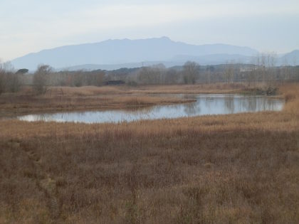 Access is easy - with parking at the railway station. The older parts of the town are relatively small with a church and a collection of older buildings, before spreading out into newer areas beyond. The lake is well signposted with an easy broad path around it, though the reeds keep open water, and so birds, a little into the distance.
Like many flat wet, or previously wet areas, the lake is lined by regimented rows of trees in plantations. In spring when the leaves come this would be very pretty, but in winter colours the trees were bare and the plant life in winter dormancy.
The path around the lake seemed popular with people in the area. In all, if you are nearby its a good place to walk, but probably not one that you'd travel miles to do.
Nearby: Palafolls castle- Hostalric stroll - Castell de Montsoriu - Santa Coloma de Farners - Brunyola - Arbucies autumn walk - Visit to Roda de Ter and Espinelves - Caldes de Malavella - Cassa de la Selva - Volca de la Crosa - Sant Dalmai (Girona Airport)
Hostalric stroll
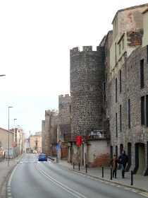 Hostalric is a walled town with a large castle on the river Todera at the start of the Valles Occidental beneath Montseny heading towards Barcelona from Girona. Its location made it an important strategic post and the town retains its fortified walls and large castle. Despite its impressive history, the town is small and easy to bypass rushing through from Barcelona to Girona on the AP7 or on the train, so even for Catalans its an easy place to miss.
We've visited a few times, firstly from Barcelona as it's on the main train line and easily accessible. For visitors to Blanes, Lloret or Tossa de Mar, Hostalric is relatively close for the chance to get away from a beach to somewhere a little different. It would also be easy to combine with a visit to Montsoriu castle which sits high on an isolted hill with fabulous views all around, and to Montseny itself.
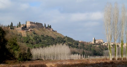 Our aim was more a day out than a walk so we found a stroll rather than a long country walk, though there is plenty of walking and hiking nearby. The town has a main square with parking, but this was full so we parked down the hill closer to the station. This meant we had a good view of the impressive grey granite walls of the town from the outside. The walls are well preserved and in places have been converted into modern accomodation. There are a handful of gates into the town, but we headed to the main square area were a couple of cafes look out over the river plain below.
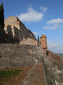 We wanted to get down to the plain so we followed the Carrer Ravel down the hill past an isoltated, tall defensive tower. The tower has steps and presumably it would be possible to go up to the top, but when we were visiting it was closed.
We walked all the way down the street before we realised that there was no access to the river from the lower end. It was only as we were walking back up that we found the path and we walked down and across to the river. There was water flowing and the size of the river bed suggested that in spate it could get quite wide, but at the moment in January it was quiet and lititle more than a big stream.
The path follows the river under a few tree plantations before turning back across the fields. Above us we could see the castle - a proper fortress - dominating the view. Our path reached a road and we followed the signs up to the castle walls.
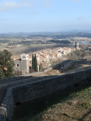 The castle itself is a ciutadella type castle with big earthern walls at jagged angles in the style of the 17th century fortresses, designed to resist cannon fire. The building of the walls is in brick with view points above the moats and spaces created by the angles. A signboard explained how the fortress was captured in the War of Spanish Succession in 1713 as the Bourbon Spanish king conquered Catalonia.
The castle has good views over the plain and Hostalric below, and through to the hills and Montsegur on the other side. Walking around the walls is free, but there is a restaurant at the heart of the castle with a bar and terrace if you want to enjoy the view.
The path down from the castle crosses the old walls and down into a corner of the old town. Hostalric's old town sort of only has two streets running in parallel down from the castle with cut-throughs from time to time. We took Carrer Major with it's houses tucked behind the town wall. It's quaint but still very much as working type town. And we emerged at the bottom by the placa to sit in the sun and watch the world go by.
Nearby: Palafolls castle - Lake at Sils - Castell de Montsoriu - Santa Coloma de Farners - Brunyola - Arbucies autumn walk
Collioure (France)
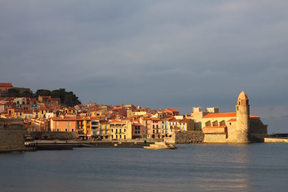 Collioure is a very pretty picturesque French town on the Mediterranean coast just the other side of the Spanish border (Cotlliure in Catalan). We visited in early December (2015), but as we've been busy prior to Christmas and having Christmas in England, this is the first chance to write it up. Zina, our dog, is now fully recovered so we can venture out more easily once more, though a very active sporting agenda for our teenagers means getting out and finding new places to explore at the weekend is getting more challenging from the point of view of time so posts to this blog are likely to be more sporadic.
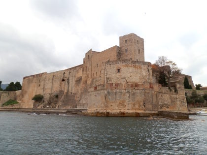 Collioure is accessible from Spain either from the very windy coast road up from Llanca, or more easily over the main autoroute crossing between France and Spain at Le Perthus, then driving along the plain beneath the Albera hills towards Argeles-sur-Mer. Collioure is then the first time into the hills south of Argeles. It would also be possible to reach by train and foot from Port Vendres - the next town along.
The journey into France is normally very easy, but because of the terrorist attacks in Paris, the border to Spain now has checkpoints as in the days before Schengen. For us, this meant a queue of traffic about 4km long from Spain to France which added about an hour to our journey. And over Christmas, we saw reports of queues of 21km to cross into France on some of the busiest days of the year.
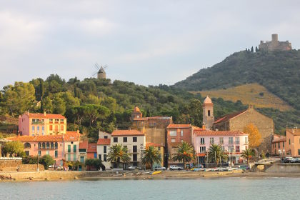 Collioure itself is tucked under the hills so you can't really see the town from the main Argeles to Banyuls-sur-Mer road and you don't really see the centre until you actually reach the centre of the town. Since, as per usual, we hadn't looked up another about the town it was therefore a very pleasant surprise to see how charming the old port and castle (Le Chateau Royal de Collioure) were, backed by the old Fort Saint-Elme in the background up on the hill. The town itself is not large with a few small back streets and an easy stroll along the sea front.
The chateau is large and you can pay to visit (we didn't). It was founded by the Knights Templar and formed a strategically important defense of the old Catalonia before the separation of Catalonia into the northern part now in France in 1659. After the French took the town, it became and important part of the French defences and is another of the Vauban strongholds that lie along the French side of the Spanish border (eg Bellegard above Le Perthus and Mont-Louis in the mountains, or Palace of the King of Majorca in Perpignan).
More recently, during the mass exodus of refugees fleeing the Spanish Civil War (the Retirada), Collioure and Argeles were used to house refugees, with Collioure Chateau being used practically as a prison to hold refugees considered dangerous.
The town has connections with impressionist artists, like Matisse and Signac and maintains many galleries in among the back streets. For someone interested in art, a tour combining Figueres, Port Lligat, Ceret and Collioure would encompass many famous early 20th Century painters.
Also in France close to the Costa Brava
White water rafting in Quillan (France) - Villefranche-de-Conflent and Mont-Louis (France) - Perpignan - Elne (France) - Ceret (France) - Andorra La Vella - La Jonquera to Fort de Bellegarde (France) - Portbou to Cerbère (France) and back
See also: Llança - Port de la Selva - Cadaques and Port Lligat
Fish hooks
Hectic weekends going hither and dither with children means we've slowed our rate of new walks considerably, returning to old favourites close to home. And so we are in November with temperatures up and over 20C during the day and headed to Platja de Fonollera (Pals Beach) with Zina, our dog heading to Gola de Ter.
Out of season, this is a lovely open beach scattered with driftwood and mounds of white sea-washed sticks and tree-trunks. The Gola de Ter where the river meets the sea forms a vast lake with views across the reeds to Montgri, and open water across the sea to the Isles Medes in the sun. The fresh water is great for Zina to swim and chase sticks in the water.
This weekend though it didn't turn out so well. Walking along the beach Zina found something to eat washed up high above the waterline. We didn't pay too much attention as she often finds something washed up and is either sniffing and occasionally finds a fish washed up.
It wasn't until after she came out of the water at the Ter that we noticed a line of fine thread dangling from her jaw, glinting in the sunlight. At first it looked like a long hair possibly that had been floating on the water. No. Unfortunately whatever it was that she'd eaten further up the beach had been attached to a line and an hook. We pulled once to see if the line would dislodge, something we probably shouldn't have done, but it was stuck fast and she coughed up a little blood.
 So straight to the vets (there's an animal hospital next to the bus station in Palafrugell). Overnight the vet operated to remove the hook which was caught in her oesophagus, leaving us with a vet's bill of about €800 and a confused and uncomprehending dog with a big shaved patch, a scar on her side and a catheter on her leg who needed several x-rays and several days of observation. We can't say whether the line and hook had been discarded by a careless fisherman, or had washed up from a boat offshore, but a big lesson to be careful with dogs on the beach.
Sadernes and river pools of St Aniol d'Aguja
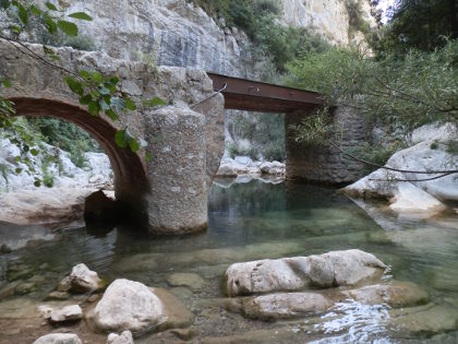 Just to the north of Besalu and Castellfollit de la Roca (both worth visiting in themselves) are the the largely unpopulated hills and mountains of Alta Garrotxa that run to the French border. In amongst the hills is the small hamlet of Sadernes and a popular Catalan walking route through gorges up to a small refuge/chapel at Saint Aniol d'Aguja, along a small river that in summer forms a series of deep pools of crystal clear water that attracts families and locals for swimming. Along the way we walked past steep overhangs and sheer cliffs that were being tackled by intrepid climbers.
The path and walk is well-known among those who live near Girona and there were lots of families on the path, but it's well off the tourist trail. We saw it on the Costa Brava & Girona Hiking / Biking Meetup Group run by local English resident Nigel Perrin, who organises group hikes and walks in this area.
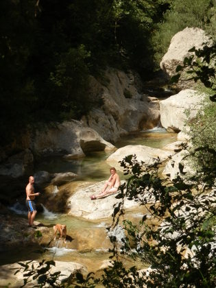 The walk itself is relatively long. Though the river runs through Sadernes, from what we could see the best parts of the river pools start about forty-five minutes up the gorge, so there is a a good walk to be had before 'the start' along a somewhat dry track. Once the pools proper start, the path becomes a narrow track along the river that continues for about 60-70 minutes until you reach St Aniol with opportunities for swimming or dipping all the way up.
Despite the relative length of the walk, we saw lots of families with young children, and some groups laden with picnic boxes walking up for swimming. In fact the swimming is fabulous, so do take swimming trunks, but water shoes (or trainers you don't mind getting wet) help under foot.
For our walk, we parked at Sadernes itself. The small car park by the church and hotel/hostel was full when we arrived and we went back to park in an earlier layby, but as we started the walk we discovered there was additional parking past the chapel.
The track heads out along the valley and though the signs said no vehicles it is used occasionally by locals for the two or three houses along the valley. The track itself runs along the edge of a gorge to one side, but mostly we couldn't see the bottom, and where we could the river bed seemed to be dried out, so we weren't sure whether we'd see water. The path continues up, crossing the river at one point just below an high rocky overhang being used for climbing. As we were getting to the bridge we could hear shouts and splashes, possibly of a group canyoning through the streams, but again we could not see.
 From the bridge, the track continues but with high cingles (escarpment cliffs) above us on the far side of the river. The scenery feels a little harsh with the bare rocks, trees and dry path with a sense of remoteness were it not for all the people walking as we passed a group every five minutes or so.
The path makes its way up steadily but after about 40 minutes or so we weren't sure if there was anything worth going on for and we might have turned back were it not for the other people who clearly knew something we didn't.
The change came as the track turned across the river with stepping stones needed to cross the water and became a small single track path. Ahead of us we passed a group of Argentinians hauling big picnic boxes up the path, wearing flipflops of all things, though this was a proper walking path.
The path then continued along the side of the river up and down, meeting the water at points and climbing up over the sides high above the water in others. The river has a very rocky bed with large rocks smoothed by the water that have created large deep pools that are separated by small streams and waterfalls. The pools are full of cystal clear water, a little cool, but with the rocky ledges around, perfect for jumping into the pools and swimming around. As we walked up the path, families would drop off to take a place by one of the pools setting out for an afternoon enjoying the water and the scenery.
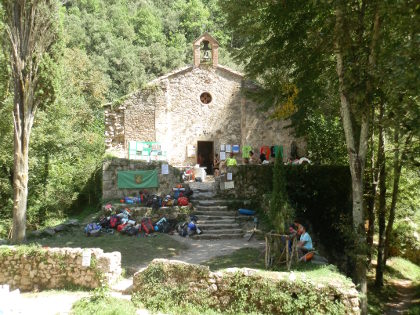
We continued up taking the path all the way to St Aniol where a small chapel and an old refuge house in the process of being renovated stand in a small dell reached by crossing a small suspension bridge. The place was busy with hikers and families sat around eating picnics with large numbers of rucksacks outside the building.
Above the refuge are two further paths. One goes up to a waterfall Salt de Brull (Salt is jump or used for waterfall in Catalan) with a deep blue pool of water where teenagers were jumping into the water. The second makes a loop back towards Sadernes via the Salt de Nuvia. We did try this path, but the path goes up and crosses across the top of some cliffs which triggered a dose of vertigo, so we eventually came back down the way we came.
Update 2016:
Returning this summer a little earlier in the season (July) there's more water, but it's a little chillier - though fine for a hot day. This time we were a little more prepared and though we didn't go all the way to the top, we had a great time coming down the river for part of the way back through the rock pools and waterfalls with water shoes in and out of the deep pools and over rocks.
Nearby: Mollo (Camprodon) - Pyrenees to France - Serinya and Illa del Fluvia - Banyoles lakeside walk - Olot - capital of Garrotxa - Sant Esteve d'En Bas (Olot) - Rupit - Els Set Gorgs (Campdevanol)
Swimming at Gola del Ter (Pals/L'Estartit)
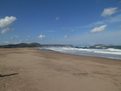 Gola del Ter is where the river Ter meets the sea mid-way along Pals beach between Platja de Pals at one end and L'Estartit at the other.
For our swimming series this is a little unusual because it's not so much about the beach, or the swimming and more about the wonderful novelty of swimming between fresh water and salt water environments.
The river reaches the beach and forms a large lake of fresh water behind the beach. In the summer, Rosa del Vents a specialist in children's camps for Spain has a windsurfing and canoe hire centre for the lake.
On the other side of the beach, the sea brings waves into the shore on a sand bar while the river cuts the beach in two, the north to L'Estartit and the south towards Pals.
In winter this means you can't take the beach path all the way up, but have to find the first crossing of the Ter in Toreolla de Montgri (6-7km). But in summer, if you don't mind the swim you can swim across the Gola, or just play between the fresh and salt waters.
Because the beach and river are quite a way from the towns, dogs are permitted on the south side (just not on the sand dunes) and part of the beach a little further north towards L'Estartit explicity allows dogs, so this is a popular area for dog-lovers, and the dogs tend to really enjoy the fresh water.
We wouldn't come here for long swims or snorkelling, but the two types of water make for a fun experience.
On the river side, the water is a little murky and lake-like and of uneven depth from where the channel of the river moves. Parts are very shallow (less than 50cm deep), and then other parts drop away rapidly, so take care with small children. The lakeside water tends to be quite warm - several degrees hotter than the sea.
Following the river to the sea, the channel through the beach is often more for wading or paddling than for swimming before reaching a low sandbank.
As the river reaches the sea, the water becomes wavy and much cooler with a scent of saltiness. Further out it's just like swimming in the sea again, albeit on a big open bay.
Facilities at the beach
Rosa del Vents has an area with windsurfers and canoes for use on the river/lake side.
There are no other services and no apparent lifeguards - the beach is a bit remote, though popular, so don't expect anything nearby.
Sand quality
The sand is soft both into the river mouth and along the beach. If the wind is blowing it can feel quite windswept.
Swimming
For real keen swimmers it's not the best location, but the novelty of the two types of water is worth discovering.
Take care over water depth though if you have children. All the children from Rosa del Vents wear life vests when doing their water activities.
Parking
There are gravel tracks out to sandy areas used for parking from both Torroella and to the south.
We usually park by the Balena Verd campsite to the south. You should expect to need to walk as this is a remote location.
Walks and exploring
See our walks Pals beach to Gola del Ter - Regencos to Pals via Quermany Gros and Petit - Masos de Pals, Begur, Sa Riera and Platja de Pals
Next beaches
South to Platja de Pals/ Isla Roja - North to L'Estartit
Serinya and Illa del Fluvia
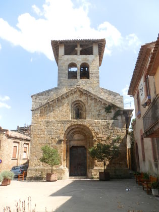 Serinya is a small village situated between Banyoles and Besalu and we're walking here for no other reason than to explore the area a little. As with exploratory walks, we're probably not taking the best route or seeing everything the area has to offer, and in fact we did go the wrong way several times, ending up on tracks that were blocked or that lead to houses or farms.
However, we were particularly impressed with the almost secret lake made from the weiring of the river Fluvia at the Illa de Fluvia.
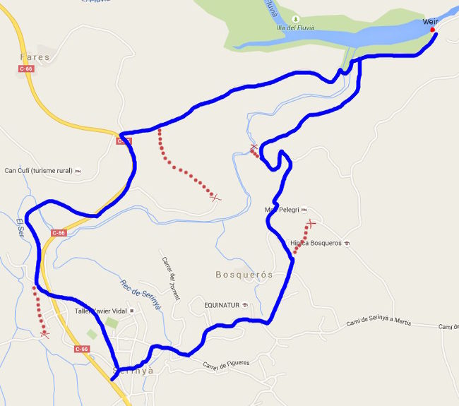
We start just outside the centre of the village looking at the church, which from the outside looks strangely lacking in windows. The old village centre is quite small and behind the church is a small courtyard that leads out to a lane over a small brook. As we're off the coast and August has been quite stormy this year, the brook has water. Following our nose we head out towards the neighbourhood of Bosqueros along a small quiet road that passes a different farm house every two hundred metres or so. Unlike the tight clusters of houses towards the coast, this is farming country and the houses are more spread out with big gardens and yards.
Our route is taking us towards a couple of horse riding centres, firstly past Equinatur and as the road bears to the right directed towards Hipica Bosqueros, we take a gravel track straight on and in towards the woods. On the map we think we're trying to get to a path at the back of the riding centre, but the route runs to a large gate and private road at Mas Pelegri, so we take a previously passed track down towards the woods, passing a small group of riders on the way up.
The track curls down the hill, past a couple of fields towards the river at the bottom where we can see evidence of the horses. The path on the map is marked as going along the river, but we can't see the path, so we have to go back up a little in order to take a smaller track into the woods which does go the way we want snaking through the overgrown scrub of the woods above the river.
We emerge at a much larger road with a large expanse of water in front of us. This is the Illa del Fluvia a broad lake formed by a weir on the river with soft greenish water that looks like it would be better for fishing than for swimming. We can hear the weir, so we walk along to find a large embankment and old electricity station seemingly in the middle of nowhere. The trees around are tall and cool the air and with all the greener around we could be in the middle of France.
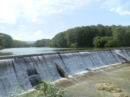 Returning from the weir we cross a bridge across the river, a small terrapin perched on a stick in the river dives into the water to hide.
The track climbs gently back towards fields at the top, and we can see from the map that we have a busy road ahead of us. A marked path seems available to avoid at least some of the road, so we follow it down the hill, only to find ourselves practically in the garden of a house, with a big imposing gate barring our way. So back to the top, the August heat now starting to get to us and a stretch of unpleasant fast road to contend with.
Crossing the road we find a quiter route along the old road, connecting with one of the GR routes. This takes us back towards Serinya - at least it would if I hadn't mis-read the junction, so we have another double back before finding the proper route under the road, then through the small woods and back. For our explore, the Illa del Fluvia was delightful, but next time we'd want to find a better way to make the round trip that doesn't involve so much road.
Nearby: Sadernes and river pools of St Aniol d'Aguja - Banyoles lakeside walk - Esponella and River Fluvia - Sant Miquel de Fluvia - Bascara - horses, fords and lost - Waterfall at Les Escaules (Boadella)
Sant Esteve d'En Bas (Olot)
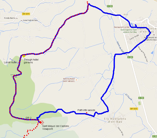
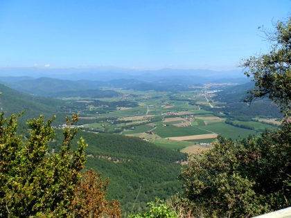 August is upon us and every car park on the Costa Brava is full, boats are moored in every cove and the whole place is buzzing in French, Dutch, German and English. So we headed out for a day to the Vall d'En Bas just south of Olot - a beautiful flat valley, verdent in the summer sunshine, beneath the hills and escarpments of the Garrotxa and Puigsacalm/Collsacabra. Starting out as mainly a visit, as we passed this way as we headed to Rupit, we found a walk up to the Emitage of Sant
 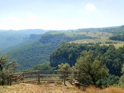 Miquel de Castello perched on a promontory high above the valley with great views along the valley to Olot and out to the Pyrenees.
The starting point was in the village of Sant Esteve d'En Bas a small village with some character and hidden streets of vaulted archways, but otherwise not particularly distinguished.
We park by the swimming pool, having discovered that the main road runs past the village quickly without obvious signs of parking by the church. We the head up the small hill to the older streets above the more modern parts of the village on the flatter plain below. The village looks out across the Bas Valley towards the escarpments on the other side of the valley, and on top of a small peak we can see the signs of a small chapel.
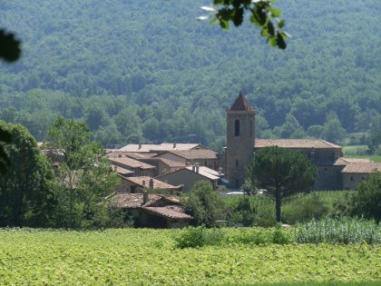 Taking a guess we leave the older streets and find a footpath marked by the scallop symbol for the local part of the route of Saint James (Sant Jaume), part of an old pilgrims route to Santiago de Compostella. This takes us into the flat of valley through the fields high with corn towards Hostalets.
Just before we get to Hostalets, we see the sign for the path to Sant Miquel. Guessing that this is the chapel above us we take the road up towards a few small farms. At the back of the last one we spot another sign which leads into a narrow track running around the back of the farmhouse climbing into the woods. Being August, the temperatures are still relatively high, so it's good to get into the moist shade of the woodland.
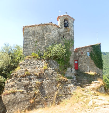 The path climbs steadily - at parts steeply through stream beds, but the route is very clearly marked. It's a very steady 40-50 minute energy sapping climb through the woods leaving us sweating and breathing hard at times (do take water!). The trees around make it difficult to judge how far up we are, or how much further there is and the path zigs and zags as we climb.
Eventually we hear voices above us and our steep path emerges at a flatter path at the top where a couple of families are heading down. The path passes through a cutting in the rocks before curling around to the promontery and the refuge of Sant Miquel del Castello. The refuge is run but GEiEG - Girona's long established excursion and sports club and in theory it should be possible to stay a night in the refuge, but it was shut when we were there, so probably requires prior arrangement to use it as a stay-point on a walk.
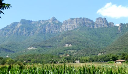 Sant Miquel is high above the valley floor with views almost all around. To the right we can look to the farms and meadows above the escarpments which almost Swiss-like with cows grazing, while to the left we can see the peaks of the Pyrenees devoid of snow now in summer, but presumably bright white in spring. Beneath us we have the valley floor a few hundred metres below us. The whole area is fenced off, but the drops are quite steep down.
After a little lunch and recovery, we return to the the path, following the route taken by the families down a steady downward path along the edge of the beech woods, leaves crunching underfoot. This is the GR2 - so another of the Grand Radonee major national footpaths and is marked by red-white flashes on the rocks and trees.
Downhill is easier than up, though there are a few steeper places. Midway along we pass through a sheep/goat field where the trees have been removed and the hillside opened to pasture - another Swiss-like feature. One of the amazing and enjoyable things with Catalonia is just how many different landscapes are in such a small area.
The path continues down and we pass other hikers coming up. As we get closer to the valley floor again, our path splits from the local path (to Joanetes) and we keep following the red-white flashes emerging, to our surprise, through the gardens of a hotel newly created from a restored masia farmhouse. We feel a little uncomfortable following our path (still the GR2) past their swimming pool with guest lounging at the side.
At the end of the hotel gardens, the route is a little unclear. I was going to head down the road, but instead we find the path a little over grown running along the side of the hill. Again for a national route the overgrown and unkept nature here is a little strange and we keep having to check we're on the right route. Eventually we emerge at the fields at the bottom and it's an easy stroll across the flat of the plain before turning back up to Sant Esteve.
Nearby: Olot - capital of Garrotxa - Palol de Revardit to La Mota - Sadernes and river pools of St Aniol d'Aguja - Rupit - Serinya and Illa del Fluvia - Els Set Gorgs (Campdevanol) - Banyoles lakeside walk
Swimming and beach at Platja Fonda (Begur)
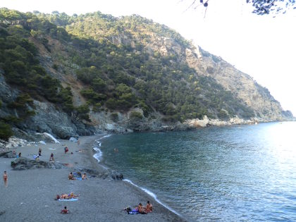 Platja Fonda in Begur is an almost hidden beach around the corner from Fornells on the Costa Brava on the same stretch of coast as Aiguablava. The contrast with Aiguablava almost could not be greater.
Whereas Aiguablava is a fine sandy beach that opens into coves and the sea, Platja Fonda is a dark brooding beach sitting under the cliffs that rise up to the top of Cap Begur with dark grey pebble-grit stone and high steep vertical hillsides behind.
We tend to swim in the evening, and as the beach faces east, the beach was in shade by the time we arrived, but the sun was still catching on the waves and few yachts out in the bay.
We may also have been lucky, but the water was almost millpond still, and with superb water clarity the swimming was like being in a giant fish-aquarium. The bay itself is relatively deep with a rocky bay below and as we swam we almost got a stationary column of fish hanging like a mobile in the water.
The beach itself only has one entrance and exit via a relatively steep set of stairs from a small lane from a smallish car park above through the small estate of established hillside houses (the turning is marked on the main road, or a connection to the road to Fornells). A walking path also runs along the coast to connect to Fornells village and hotels.
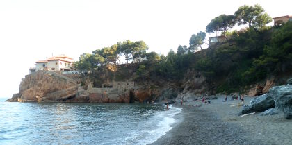 The path gets into the beach on the right hand side with the main cliffs at the other side of the relatively long beach.
The signposts warn of potential falling rocks as you come into the beach. To the right looking out to sea is a house on a rock promontory and a handful of teenage boys were climbing to get to points on walls and rocks to jump into the sea.
As mentioned, the sand is mostly small dark grey pebbles with some larger rocks in the beach and occasional patches of finer grey grit-like sand. The pebbles are relatively smooth so it's not too bad underfoot, but not good for sand castles.
Entering the water, the bay shelves steeply into the very clear water. The bottom of the bay falls away quickly leaving a deep column of water with the rocks below in the depths. For swimmers there is no need to look out for obstacles and the swimming is clear and easy.
Facilities at the beach
There are no facilities at the beach. It is left natural and there are no lifeguards. The closest facilities are in Fornells along the path.
Sand quality
The sand is unusual in that it's small rounded pebbles and grey grit (almost like the type of stones you might use for a garden path). Some patches are sandier than others, but in general the rounded pebbles predominate and run into the water.
Swimming
We might have been lucky, but the water was super-still and being relatively deep and clear it was like swimming in a fish tank. The bay has enough distance for laps and we guess that it would be possible to swim around to Fornells and Aiguablava for longer distance swimmers.
Parking
Above Platja Fonda is a small carpark and a lane down to the beach. The car park is also used for Fornells so may get busy. For us on a Friday evening in the height of summer it was actually quite quiet with plenty of spaces
Walks and exploring
Walking would involve connecting with Fornells and then routes to Aiguablava Fornells and Aiguablava walk (GR92). To get to Begur would involve going back up the hill to find the steep path up the hills.
Next beaches
South to Aiguablava/Fornells (Begur) - North to Sa Tuna (Begur)
Swimming at Aigua Xelida (Tamariu)
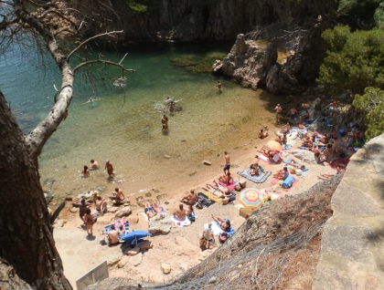 After a very hot June, summer is fully with us for July and we're returning to the beaches for swimming and canoeing. Having revisited Aigua Xelida near Tamariu for a walk, we returned by canoe from Tamariu, and then a third and forth time for swimming because of it's lovely hidden coves and ravines which make for excellent adventure-style swimming.
Aigua Xelida itself is just around from Tamariu, a diversion off the Tamariu to Begur road that runs past Aiguablava and Fornells. As a beach it is tiny - space for less than forty people with a mix of grit and rocks and a small stream cutting through half the beach. Normally the water is a beautiful crystal clear emerald colour with a bay that is framed by cliffs and rocky outcrops. The beach actually sits on the righthand side of the bay (looking to sea), but the bay continues around two fishermen's houses to a second even smaller gritty beach surrounded by rocks and a headland/island.
What we hadn't realised until we explored by canoe, was the number of coves and hidden passageways in between the rocks and islands. In particular there is a long narrow sea-ravine just behind the second gritty beach, a hidden cove, and out of the cove and into deeper sea, too the left is another hidden bay under the cliffs inaccessible except from the water, but with lucent clear water.
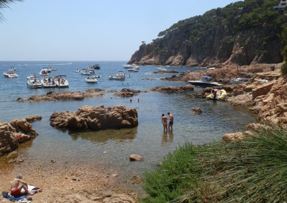 For swimmers who like to explore there are lots of rocks, fish, clear water pools and even opportunities for jumping from rocks into some of the deeper pools like in the ravine. The one piece of advice would be to wear water-shoes when swimming both to help clambering in and out of the rocks, but also because the bay is a little stony in places and there are occasional sea urchins in the water. Goggles to keep an eye on the water depth are also recommended.
We also discovered that there is now a long-distance (1.2km) Vies Braves swimming route around the headland to the right ending at Tamariu. This is the first time we've seen these routes, but there are now ten long-distance swimming routes up and down the Costa Brava.
Facilities at the beach
There are no facilities at the beach. It is left natural and there are no lifeguards. Neither are there shops or other facilities nearby. Because it's tiny in summer there is barely enough space for all the towels.
Sand quality
The sand is rough with occasional small stones and runs into rocky outcrops under a small barraca (fisherman's hut) at the back of the beach. Although not too bad underfoot by the water, getting into the water there are pebbles and stones under foot. Water-shoes makes the swimming much much easier.
A second, even smaller beach, is accessible by the path behind the fisherman's houses with grittier sand and a shallow but rocky bay.
Swimming
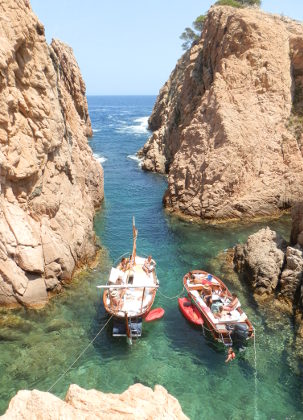 Into the bay from the main beach the shelf is gradual to start but then runs deeper. Once in the water you're almost immediately swimming in a bay lined with rocks and underwater ravines in among little islands and rocky outcrops. There are plenty of fish and items of interest under water. The rocky outcrops and islands mean that you should keep an eye out for water depth as many rockier areas get close to the surface.
The water further out gets deeper and the bay fills with boats, so would be good for longer distance swimming, but the whole area is just excellent for exploratory and adventure swimming.
If you swim across the bay, you'll need to navigate through the gaps between the rocks, or clamber over the low islands but there is a lot to explore. Our favourite feature was the ravine behind the second grittier beach on the left hand side. The whole headland has small sea canyons - the main ravine is accessible from the beach side of the bay and cuts through the headland/island. It has steep walls but deep pools and we've seen people jumping from high into the water. The ravine is very sheltered and occasionally boats and canoes visit. At the far end it opens into the open sea, but from the sea side there are further hidden coves under the rocks.
The ravine has a channel off to the right (looking out to sea) and this gives a small channel that accesses back into the bay after a scramble over rocks. Next to the ravine to the left is another small bay which also opens out to the sea. The gap is narrow and if the sea has a swell it might be difficult to get in and out.
Since the ravines and coves are often hidden from view or inaccessible from the land, we'd recommend swimming in pairs or with a boat nearby. It would be easy for an inexperienced or younger swimmer to get into trouble unseen and then find swells and rocks barring access to safer waters.
Canoeing
Canoeing is excellent, but there is nowhere to launch the canoe from, so it would involve paddling around either from Aiguablava or from Tamariu. We went from Tamariu with a south wind, which meant a swell on the sea, but very calm conditions protected by the bay in Aigua Xelida.
Parking
The estate above Aigua Xelida has parking. If the car park is full, so is the beach.
Walks and exploring
We covered Aigua Xelida recently on our walks Tamariu - Aigua Xelida. A route is available that connects with Tamariu town (lots of steps though), or it's up-hill on the road and over to Aiguablava.
Next beaches
South to Tamariu - North to Aiguablava/Fornells (Begur)
White water rafting in Quillan (France)
The days are getting hot and summer has just about reached the Costa Brava. For us, that makes it a good time to travel north out of some of the heat and so we took the chance for an overnight camp in Quillan, a small town just south of Carcassonne on the river Aude and close to spectacular gorges as the river comes out of the Pyrenees.
I wasn't originally going to write it up in this Costa Brava blog, as it doesn't seem that close, but in fact it is just over two hours drive from here - so closer than Andorra or skiing in Ribes de Freser, and we had such a great time doing white water rafting with Sud Rafting from their base near Axat that we just had to add it yet another possibility for people who live in the Costa Brava.
For holidaymakers who are starting to flock here for the summer season, it might seem strange that as the temperatures rise, we might look to places further north, after all summer on the Costa Brava is why most people come to visit. But we have the advantage of being able to pick and choose, and so while the beaches are filling with sunbathers it's also a time to take a few days here and there to escape the heat and hordes of the high season.
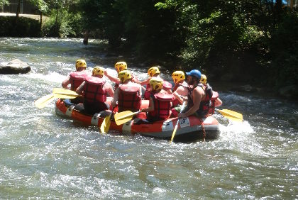 Quillan is a small town in the Cathar region of France tucked into the foothills of the Pyrenees and the rivers that have carved deep gorges coming off the mountains. The Cathar region is famous for the Cathar Heresy and as the location of the Albigensian Crusade in 1208 with the remains of strong castles built on isolated peaks and hilltops that led to later legends of secrets and myths, that modern times have added to and transformed including the story of the Holy Grail and the Da Vinci code which draws on Rennes Le Chateau.
For a weekend, it's relatively easy to throw tents in the car and head into rural France without needing to book and taking advantage of the cooler weather compared to the heatwave on the coast. So we took the road to Perpignan, turned left just past the airport and headed out along the dry landscape of Roussillon towards the mountains and valleys south of Carcassonne.
The countryside becomes greener and more wooded as the roads head inland reaching the river Aude at Axat, a small valley village at the head of the tourist train route (Le Rouge) that runs up the from Rivesaltes just outside Perpignan. The first day we spent touring, but we called in on the tourist office and were informed that rafting needs a reservation, so we booked for the next day and so found ourselves on one of the white water raft trips with five guys from Southampton and Julien, our guide. The experience was fantastic - eight of us on a rubber inflatable boat going down a fast moving wide river running into rapids and falls and drops and lots of white water.
Of the eight on the raft/boat, all but one had never rafted before, so the first stage was to get going and get instructions. We were on the longer route, so we started about 6km above Axat - taken there by minibus all kitted out in wetsuit, life jacket and helmet - and through the early parts of the journey and lots of tumbling into the water we were shown through a series of jokes, deliberate calamities and practical demonstrations, how to get safe on the raft, how to stay on the raft (mostly, or at least when Julien wanted us to stay on) and a variety of practical ways to cope in the fast moving water. So as the boat moved through the more advanced rapids and ran into rocks or bounced off the gorge walls we'd have some idea of what to do.
Over the course of the next two hours we travelled some 13km down the river paddling when Julien said paddle, stopping when he said stop and falling in the water any time he wanted to prove a point. He steered and seemed to know every rock and pool of the river.
Along the way, we got thrown out of the raft a few times, jumped off rocks into the river and swam across the stream, flipped, spun, slid forwards and backwards and bounced across the waves, occasionally scraped a hand on a rock, or took in water from a sudden unplanned disembarkation. And then considered tested and ready we ended on some big category four drops and rapids for the last two kilometres of the gorge. It was just such good fun out among the elements, wet (but not cold in the wetsuit), and having a real natural roller coaster ride with moments to enjoy the wagtails tracking us down the river below the 100m high walls of the gorge, before the rush of another rapid bouncing the raft off rocks as we bobbed down the river.
The Aude also offers other forms of white-water sports including canoing, hydrospeed. The area is also obviously also very French, which means a complete change in landscape and culture to the one we find in Catalan Emporda with the more open French-style towns and broad rivers and the raft of French produce and wine sold by the roadside.
For white-water rafting on in Spain, we would need to go to Sort - towards the Val d'Aran - to have the same type of opportunity, which would be more like four hours drive from here, so sometimes we need to look laterally to find other ways to get into the mountains.
Also in France close to the Costa Brava
Collioure (France) - Villefranche-de-Conflent and Mont-Louis (France) - Perpignan - Elne (France) - Ceret (France) - Andorra La Vella - Puigcerda and Bourg-Madame
Walking by the border
Comments | ||
adam@veggingoutwithadam.com |
17 Feb 2014 19:46 |
|
What a great blog. I am planning a walking holiday in the region and wonder if you can recommend the best walking maps, like UK ordnance survey ones. I shall be reading more of your walks over the coming days as we plan. Many thanks Adam | ||
Saul |
24 Feb 2014 17:25 |
|
Glad you're enjoying it. We have recommendations for maps in our 'Advice and FAQ' section | ||
Saul |
13 Jul 2017 12:46 |
|
Sorry I missed the comment, so I hope it's not too late - use the contact box if you'd like to send a message. For the coast, the GR92 is best and if you have driver you can just take it piece by piece. For hikers, around Cap de Creus is great, though it can be dry and hard walking in summer. For us, the stretch between Palamos and Palafrugell and on to Begur is the prettiest part of the whole Costa Brava and really good for walking. I'd probably also take the walk up and over Montgri, possibly starting at Pals, or L'Estartit to L'Escala. And though you said you prefer the coast, don't overlook inland routes as there are some wonderful villages and countryside out towards Girona, La Bisbal, or Olot. | ||
Sven-Gunnar Furmark |
24 May 2017 11:43 |
|
Hi, My name is Sven Furmark. I am from Sweden. I plan to go to Costa Brava with some friends (totally about 10 people) for hiking for one week (5 walking days). We are experienced hikers and we usually walk 4-6 hours per day. We prefer to walk along the coast as much as possible. We plan to rent a house and travel to each days hiking with a bus & driver which we plan to book for the whole week. Which five hikes would you recommend for us. Warm Regards Sven | ||

