 Walks and other things
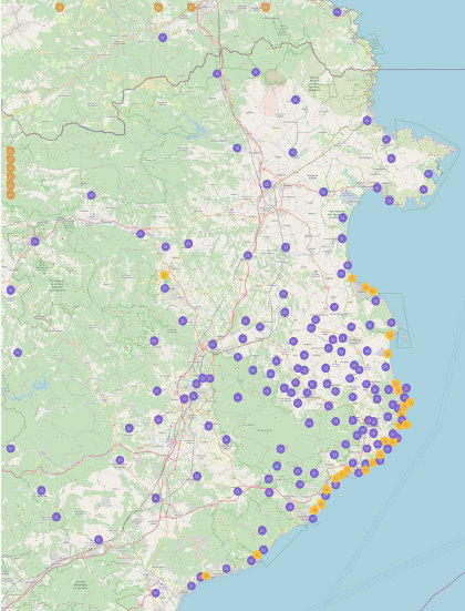 One of the joys of the Costa Brava is the variety of landscapes and we like to visit places and walk (a lot), particularly into and around the Gavarres. Sometimes we travel around on bike. In the summer, we swim and canoe.
These then are write ups of walks, hikes and activities that we've done since November 2012, with photos straight from the original walk or activity.
We like to make circular walks and our walks range in length from about 4km (an hour) to around 16km (four hours) - but probably about 2 1/2 hours on average - though if you want to reduce the length, there are usually shortcuts.
To find walks by location, click on the map, which goes to a full sized map with links to individual walks and visits. To our surprise, we were listed in the Sunday Times' Essential Costa Brava (Feb 2017).
The most visited walks are:
- Calella de Palafrugell/Cap Roig to Castell - classic wild Costa Brava
- Far de Sant Sebastia (Llafranc) to Tamariu
- Platja d'Aro and S'Agaro
- Sa Tuna, Cap de Begur, Begur
- Eulogy to the Ruta del Tren Petit (Palafrugell, Palamos, Mont-ras and Vall-llobrega)
- Fornells and Aiguablava walk (GR92)
- Mont-ras to Calella de Palafrugell and Llafranc
- Platja de Castell and La Fosca
- St Antoni de Calonge, Torre Valentina to Platja d'Aro (almost)
- Escala, St Marti d'Empuries and beyond
- Bell-lloc and Castell de Vila-Roma (Palamos)
- Platja Sant Pol to Sant Feliu de Guixols
- Roses - Canyelles beaches to Cap Falconera
- Blanes, Lloret de Mar, Tossa de Mar by GR92
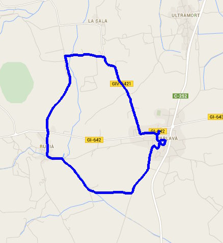
Parlava, Rupia and La Sala
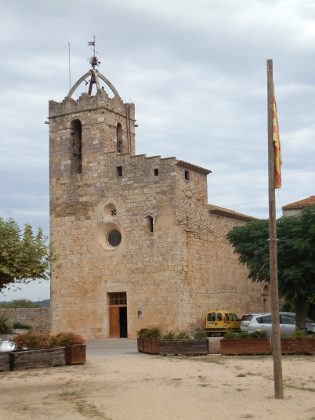
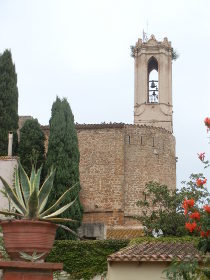 Parlava is a small village on the main route between La Bisbal d'Emporda and Figueres prior to crossing the river Ter at Verges. As such it's a village that many people will pass through on their way to somewhere else. This is really a walk of three churches and the September day had a strong autumn mist, so it was not a good day for photographs.
It would be fair to say that Parlava is not a particularly noteworthy village. It has a church and a handful of old streets but nothing that really catches the eye. The walk though is relatively flat and links with Rupia and La Sala - an area we've walked before (Rupia and Foixa) coming at Rupia, which is more interesting, from a different direction.
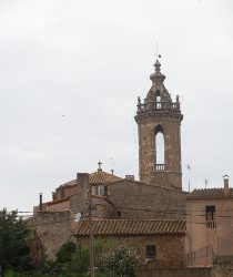 After visiting the village centre we follow the bike route out in the direction of Casavells which leads out into the fields. At this time of year, fields are being ploughed and the landscape is a mixture of earthy browns and khaki greens. As we're walking there are views to Castell d'Emporda but otherwise it is a simple flat walk.
At the first proper turning right we follow the track towards a pig farm - there are no signposts but it is obvious that it is going towards Rupia in the distance where we can see the church. The track turns into a lane by the farm and we simply follow it to the stream at the entrance to Rupia. There are children playing with sticks in the water and a small playground.
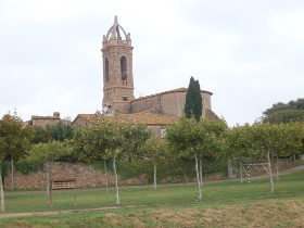 A quick visit of Rupia and we head out across the main road (which links Flaca to Torroella de Montgri). This is part of our early walk so we know we will find the strangely isolated church at La Sala along the road.
At the crossroads, we turn up past the La Sala church and can see that it seems to be linked or connected to a farm. There are a number of old and new farmhouses in the area some of which look quite luxurious. After the church we need to walk on the road, turning right up the hill to link back to Parlava. For a quiet back road there are more cars than we would expect, but this could just be the time of day.
And so back to Parlava along the main road - a walk of three churches, but not too much else.
See also: Verges, Tallada d'Emporda and Maranya - Colomers and Jafre - Vilopriu and Valldavia - Serra de Daro, Fonolleres, Sant Iscle d'Emporda - La Pera, Pubol and around - Parlava, Rupia and La Sala
Bascara - horses, fords and lost
 If you take the old N II (pronounced as N-two) road between Figueres and Girona instead of the AP7, then you will pass through the village of Bascara just after crossing the Fluvia river. Strategically this would have been an important crossing point for the river particularly as the village stands above the river. However, if you pass through now it's easy to miss the older part of the town which is off to the side from the main road.
Older crossing points of major rivers are usually good for walking as there is normally a history to the town including a castle or tower, and a mix of geographic features, so following our visit to Sant Miquel de Flluvia, Bascara seemed to be the next interesting place along. Unfortunately we managed to get a little lost on private roads, so I've avoided putting the path we walked.
 To start with we park just off the main road in amongst the village itself by a playground. Bascara isn't that big and the older part consists of about 4-5 older streets leading off from a central square and street that can be reached from the main road via an old gateway. We explore a little - the area is pedestrianised and the older streets have houses with lots of plant pots outside.
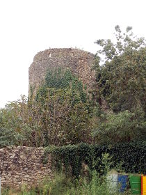
At the far end away from the square we reach the church which stands in its own large placa unusually a little off the centre of the town. However opposite the church are the remains of the old castle - barely a tower standing and with no access to see more. The location of Bascara means that it has been under attack many times in its history. The last time when it was occupied by the French in 1808-9.
 The castle and church then have an open space to the town walls. The town stands about 20-30m above the river Fluvia below and, unlike the castle, the walls have been renovated.
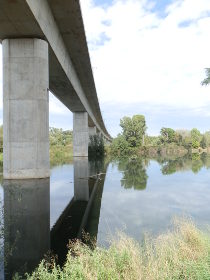
We take a path through the walls down to the river bank below. To start with we head up river. The Fluvia is quite broad at this point with a weiring system controlling the water flow. The river passes underneath a new bridge for the AVE high speed train line to Figueres. And as we follow the very pleasant river path we see that the AVE line also passes over a horse race track and equestrian centre.
Horse riding is popular in the Costa Brava with a number of Gymkhanas and active riding schools and competitions all over (directly around us are 4-5 riding stables). However, until Bascara, we'd never seen a race track which was always something of a suprise given the number of holiday makers and its popularity in the UK and France (may be it's an opportunity for someone).
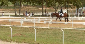 The track itself now runs under a high (50m or so bridge for the AVE train), and is sand-based rather than grass, and though there is a riding centre there are none of the stands or paddocks you'd see in the English courses. While we were there a showjumping gymkhana was taking place with children doing dressage.
Having seen the race course, we decided to turn back and go a little more downstream. We walked under the main bridge that carries the N-II and on a gravel track that headed into countryside before turning down towards the river. This was our crossing. However, the map hadn't shown that the crossing was actually a ford (quite a long broad one). The water wasn't deep (5-10cm) but we had to take our shoes and socks off to cross to the other side.
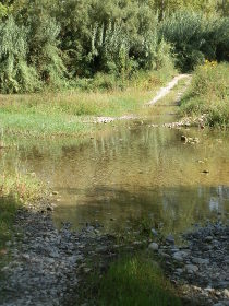 On the opposite side we followed the river back upstream to the opposite side of the river to the horse riding. The walk wasn't special, but there was a dappled light through trees and an open gravel track. The map showed a path that curled round and then climbed back up to meet the N-II bridge which should take us back to town. However, at the point we turned away from the river the track split and there was a Cami Particular sign. Unfortunately it wasn't very clear which of the two tracks it applied to. We assumed the path that went on along the river since there were further signs marking it as private.
Not sure, but wanting to make a loop, we followed the track past rough fields as the track curved under a small rise. At the end of the track where we thought we could continue, the track came to an end and we found ourselves following a path that took us into the farm lands and barns that sat on top of the rise, slowly feeling more like we were in the wrong place. We could have turned back, but it would have meant a walk all the way back to the ford and knowing the buildings would have an exit at some point we pressed on. Luckily we didn't run into anyone but it was a rare occasion when we've felt we were walking somewhere we shouldn't be. Unfortunately the maps don't distinguish between public and private roads but generally the walking in Catalonia is open and relaxed and all tracks can be walked - even if you end up on a bit of a wrong track it tends to be a short connection between two paths usually because we've approached the path from the back rather than from the road.
We did eventually find our way out (and it was private) and found the N-II bridge over the Fluvia back into Bascara, though the N-II is a busy road so walking the bridge wasn't too pleasant (the ford on the other hand was a lot of fun).
Nearby: Serinya and Illa del Fluvia - Banyoles lakeside walk - Sant Miquel de Fluvia - Cervia de Ter - Waterfall at Les Escaules (Boadella) - Canet d'Adri - Celra, Juia and the Castle of Palagret
Lloret's Platja de Boadella, Platja de Santa Cristina and The Fence
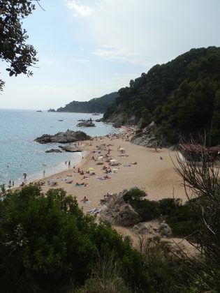 Lloret de Mar is the Costa Brava party town, but even for walkers it has it's attractions.
Aside from the main beach and neighbouring Platja de Fenals, there is also the quieter discrete (and naturist) beach of Platja de Boadella, and next door again the grander beach of Platja de Santa Cristina.
However, last year we walked the GR92 coastal route from Blanes, past Lloret de Mar and on to Tossa de Mar we noted how the G92 seemed to miss out these beaches.
So we return, to find out what options there are to link these areas. And as we discover though Boadella is reached easily and there are signs for the GR92 close to the beach, Santa Cristina has been entirely fenced in and there are no options other than to follow the road for the GR92.
It is still possible to go in to the Santa Cristina area for the hermitage and the beach, but access is only through the access road (or via the hotel).
All the way along the Boadella side is a long fence that reaches down to the cliffs above Santa Cristina beach.
So while the two beaches (Santa Cristina includes one larger and one smaller beach Treumal) in the fenced in area are beautiful, the lack of a coast route access is very disappointing, made more so by the fact that the Santa Cristina area is run by the Lloret council.
It is an area used for festivals and is very well maintained and the beaches themselves feel quite private and privileged, so maybe it's not all bad.
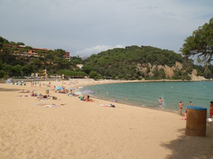 To reach the beaches we start just in among the new flats and apartment blocks of the Fenals area of Lloret de Mar.
Most holidaymakers will go to Fenals beach - the quieter of the two main Lloret beaches.
We're heading for Boadella and to get there you pass around the Jardins of Santa Clotilde and into the woods at the side.
There are a number of tracks that then take you down to Boadella beach. This is definitively a nudist beach with plenty of naturists particularly among the rocky coves to the right and to the left of the main sand beach.
Boadella has a chiringuito on the sand, but facilities are relatively simple compared to the more dynamic Lloret beaches.
From Platja de Boadella we follow the marked tracks that point to Santa Cristina - these are marked as GR92 but on our walk from Blanes we didn't quite get as close to the beach.
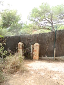
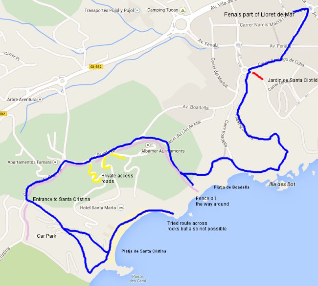
The tracks climb into the woods above the beach and we really want to try to keep to the coast, but in front of us we run into The Fence. This is a large and long fence covered with a matting that runs all the way from the cliff edge closest to the sea, up to the road.
There is no way past or through the fence for walkers, and just the occasional tantalising glimpse of the beach and hermitage on the other side.
 So our GR92 route was right and there is no linking path other than by road. We follow the road around - there are a couple of access points into the Santa Cristina area but these are private. The first is just access to apartments, the second access for hotel guests only to take them down to the hotel on Santa Cristina beach.
So we are stuck following the road around the outside to the main entrance where we can walk down through the car park (entry is free for walkers, or €6.50 a day for car parking).
The gardens and hermitage, with its tiled dome, are beautiful and very well taken care of, with the restricted access making the whole area feel quite exclusive.
The hermitage itself is a large decorated church built in the 18th Century built from money collected among the people of Lloret. Santa Cristina hermitage and gardens therefore hold a special place in the hearts of the local population and is the location for festivals and traditions.
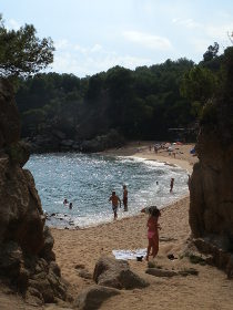
 At the bottom of the gardens, we reach the beaches - there are two separated by a small rocky outcrop and along the paths there are copies of famous paintings made of the beaches and area.
The smaller of the two beaches (Treumal) is separated from the larger main beach by a rocky headland with a sheltered corner tucked under the rocks.
We walk along the beach which is quiet and reserved.
The grounds of the hotel extend down to the edge of the sand and there is a largish bar and restaurant area.
On the far side of the beach, there are rocks at the bottom of the cliffs and it is possible to scramble around.
For the sake of discovery we tried to see if we could get all the way to Boadella over the rocks, but the way is blocked by a couple of impassable bays.
It would probably be possible to swim across the final bays, but it's not a practical option for walkers. So the only option was to head out the way we came, effectively retracing our steps.
The beaches and area of Santa Cristina is beautiful, but it remains a pity that it remains a diversion from the GR92.
See also: Cala de Sant Francesc (Blanes) - Blanes, Lloret de Mar, Tossa de Mar by GR92 - Tossa de Mar to Cala Llorell - Swimming and beach at Fenals, Lloret de Mar
Sant Miquel de Fluvia
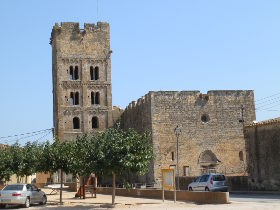 The village of Sant Miquel de Fluvia is tucked away between Figueres and Girona, not directly on a main road to anywhere in particular, but on the river Fluvia and also on the train line. It's an area of low rolling hills that rise gently above the plain of Alt Emporda, and an area we don't know very well.
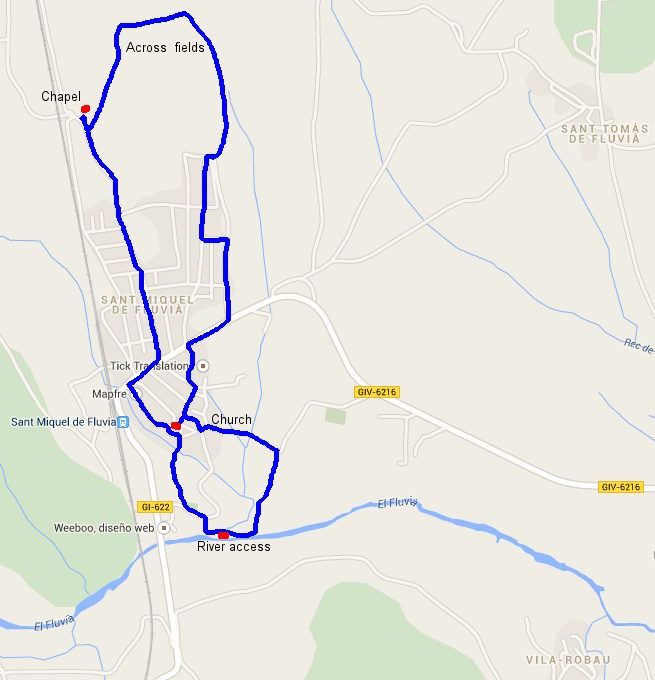
The aim of this walk visit was simply to see what the area was like and to see a village we've not visited before. Our walking route is therefore unlikely to be the best or most picturesque, but gave us a feel for the area.
We park just off the main road through the village on the Carrer de Forn Roma, not far from the Embotits (sausage) factory. We decide to head for the distinctive 11th Century Romanic church that we could see as we drove in with it's square tower set with open window spaces.
The street though has a hidden secret. Just off the footpath in what at first seems to be a font (or even a bus shelter) is a Roman Kiln or Oven. The entrance is actually below street level and it's very dark to see very much at all.
 We continue along the street and arrive at the church and main old village centre. There is a collection of old farm-house type buildings, the traditional terraced streets and the church standing grandly above them all. Around the side of the church are excavations though we can't tell what for.
Before visiting the village though we cut out through an archway towards a spring font in the hill nearby, close to the old safreig (communal area for washing clothes), and seeing a walk through the woods we head down and out towards where we think the Fluvia river is.
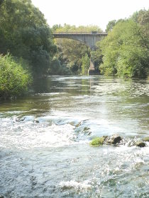
Eventually though we reach a road and turn back towards the village, before spotting a sign pointing to the river. This takes us right down to the waters edge. We're in early September and the river is clear and fast flowing and it would be very tempting to take a dip. It certainly looks like the area is used by swimmers or paddlers.
We try to follow the river along a marked footpath through the grass that has been cut recently, but it ends in a dead end and rather than retreat the way we came we force through to a path at the bottom of a fenced field and then up past a farm to the road where we re-enter the old village from the other direction.
The village has the classic ring of houses for protection and a main street that is never straight. Apparently the curving of the streets was defensive - if you were being pursued the curves mean that the pursuers can't see all the way along the street making it easier for someone to slip out of view and escape.
We leave the old village and arrive back at the road through, heading to the right. We could go towards the neighbouring hamlet of Sant Tomas de Fluvia, but instead continue up along the new estate of houses on the hill. Though the countryside is rolling with some views to the distance it's not so pretty and the landscape feels a little unkempt.
Leaving the new houses we attempt to follow a marked footpath, only to lose the trail when we meet a ploughed field with no obvious direction to go in. So we cut across the rough fields with extremely sticky grasses clinging to our heels.
We find where the path would be for the return trip and walk past the fields and the edge of the woods. Where the path meets the road again, we make a short diversion to see a small tumble-down chapel next to what looks like an old gun emplacement. The chapel looks abandoned but just outside the door is a small bottle with a virgin.
We head down back to town. Around us is a another modern estate that falls away to the train line to our right. We had expected more given the presence of the station and the river and though the older part is pretty, and the Fluvia left us itching to go for a dip, the remaining parts of the village were not particular noteworthy.
Nearby: Banyoles lakeside walk - Bascara - horses, fords and lost - Waterfall at Les Escaules (Boadella) - Palol de Revardit to La Mota - Serinya and Illa del Fluvia - Cervia de Ter - Canet d'Adri - Celra, Juia and the Castle of Palagret - Sant Pere Pescador river Fluvia
Swimming and beach at L'Estartit
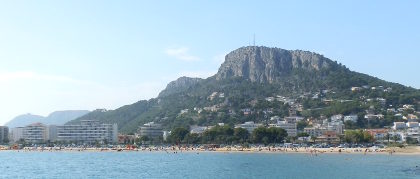 L'Estartit is popular holiday town just beyond Torroella de Montgri under the hills of Montgri and the main access point to the Isles Medes, reputatedly one of the best diving and sub-aqua areas on the Mediterranean.
L'Estartit itself has a large port and older fishing area linked to the old town with shops and restuarants, and next to the port a long and very broad beach backed by modern hotels and apartments.
The area is popular with the British both for camping and package holidays particularly for families, and has a handful of British bars - something that is now quite rare in the mid and north parts of the Costa Brava.
The beach itself stretches from the port wall all the way along to Gola de Ter (about 4-5km) and then down to Platja de Pals with sunbathers spread along to the limits of the town - but with enough space that it doesn't feel crowded.
At the main L'Estartit end the beach is very broad - 60-70 metres wide with enough space for parking at the back of the beach.
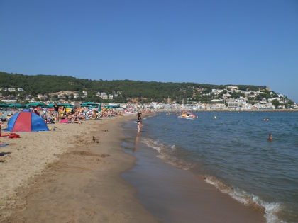 The sand is fine and soft, perfect for sand castles or beach sports, and the bay shelves gently out to sea making this an excellent beach for small children.
The shallow water also means that the water is warmer at the earlier and later parts of the season - there is no problem swimming in September.
The bay itself is all sand with a sand bank about 30m out shallow enough for standing when we were there (sand banks move so this may change), however the sandy bottom means there are relatively few fish visible.
Swimmers who like to explore will find the swimming a little dull, though it is easily possible to swim long distances.
Facilities at the beach
As would be expected the beach is monitored by lifeguards. Pedalos, canoes and other water craft can be hired as can loungers and umbrellas. Showers can be found at the back of the beach by the car park.
There are three or four chiringuitos or beach bars on the beach itself, but not so much on the street directly behind which is mainly hotels and apartments.
The main town centre is a little way away from the beach behind the port and in among the streets of the hotel/apartment blocks.
Sand quality
The sand is excellent - fine and slightly powdery sand all along the main beach with no stones or grit.
Swimming
This is really a family orientated beach. The bay shelves gently into the water (it's at its gentlest closest to the port wall) deepens and then has a sand bar some 20-30 metres out from the shore which is shallow enough to stand on.
The bay has a sandy bottom and though there are fish (and the occasional reedy weed) it is not particularly interesting for snorkelling. However, for snorkelling and seeing fish there are boat trips to the Isles Medes.
Parking
Parking is easy at the back of the beach, or in the back streets of the town all of which are free parking.
Closer to the old heart of L'Estartit there are fewer spaces so parking closer to or on the beach is generally the easiest option.
Walks and exploring
The beach stretch can be walked down to the Gola de Ter where natural Aiguamolls (sea marshes) can be found behind the beach.
In winter, without sunbathers around, this is a good beach area for walking dogs. In addition, the Ter can be followed back to Torroella - see Torroella de Montgri to Gola de Ter
To the north, the paths run into the Montgri hills which can be quite wild and deserted and lead to a couple of very isolated bays: see L'Estartit to Cala Pedrosa and Cala Ferriol
Next beaches
South to Gola de Ter where the beach meets the mouth of the river Ter - North to Cala Montgo (L'Escala)
Swimming and beach at Llafranc
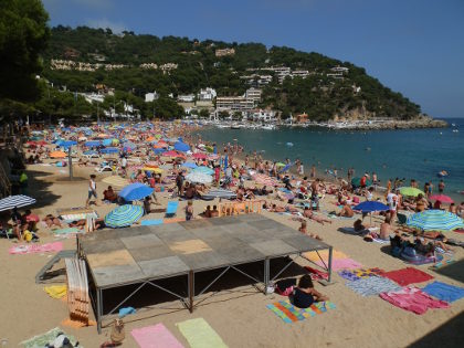 Llafranc is probably the prettiest of all the beach-side villages on the Costa Brava with a perfect-sized golden-sanded beach backed by chic upmarket restaurants and hotels that look straight over the bay. To the right, looking out to sea, are rocks and the headland that leads to Calella de Palafrugell (about 20 minute stroll). To the left are fishing boats and a small marina underneath the hill that leads up to the lighthouse above the village. In many ways it's the picture perfect seaside location, small and discrete retaining its original fishing village charm.
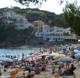 The downside is that during the height of summer, Llafranc can become busy and crowded with a towel on almost every square metre of the beach and with parking almost deliberately limited, it can be hard to find get access unless you're in Llafranc itself, willing to walk or starting out early in the morning. Fortunately this only really applies for the four-five weeks of the end of July and August. June and early July are just perfect, and by the first week of September the crowds have melted away leaving more knowledgeable travellers and locals to enjoy the beach and swimming.
The beach itself is sandy - a little gritty towards the rocks to the right, but finer without being powder soft, in the centre and to the left before the fishing boats. For snorkelling the rocky areas to the right are best - you may even get lucky and spot an octopus even in the August height of summer. The rest of the bay is quite deep and sandy - it deepens relatively quickly after the first 2-3m and is clear for swimming, though the bay always feels a little shorter than it looks as swimming to the left hand side is limited by the channel for boat access to the marina.
Facilities at the beach
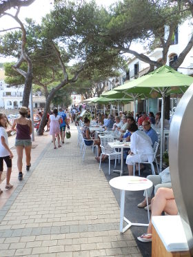 The beach is backed by a promenade and restaurants and hotels where the well-heeled sit taking coffee or wine looking over the sunbathers and out to sea. Given how good the location is, not surprisingly, the bars have a tendency to be a little on the expensive side. Llafranc has one Michelin starred restaurant for foodies. There are a handful of small boutiques and shops and then hotels and villas dotted around the village.
On the beach, lifeguards are on duty and canoes can be rented to the left side of the beach just before the fishing boats. As with most beaches, there are beach showers with fresh water for washing off sea water (soap is not allowed).
Sand quality
The sand is gritty towards the right, but finer elsewhere and a beautiful golden colour.
Swimming
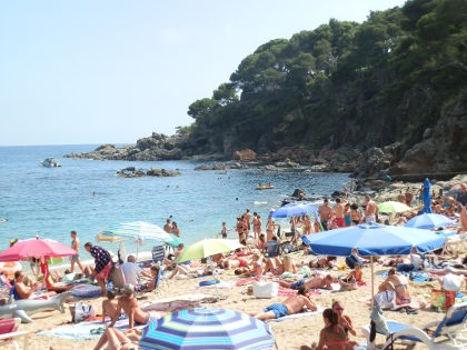 The beach shelves quite quickly and the bay itself is quite deep - mostly of sand except for the rockier areas. Despite the sandy bottom, it's still possible to see fish, but obviously for snorkelling there is much more to see to the right hand side. For long distance swimmers the bay feels quite short, but off the peak season we have seen people swimming laps out by the marker buoys that separate the swimming area from the moored boats further out.
Parking
Parking is complicated. In the peak of the season spaces are difficult to find and quite limited. There are two main parking areas - both of which get full quickly. Firstly is just off the road from Calella de Palafrugell under trees to the right as the road runs down towards the village centre. Secondly, there is parking off the back road to Llafranc past the Llafranc Tennis Club that can be found as a right hand turn from the road between Palafrugell and Tamariu. The back road fills with cars parked on the side of the road all the way to the school vacation house about 10-15 minutes walk from the beach. For this reason coming early in the morning, or just coming later in the evening is advised.
Walks and exploring
Llafranc is a very easy 20 minute stroll around the headland to reach Calella de Palafrugell. In the other direction, are routes to Tamariu or into Palafrugell. To get to Tamariu you need to get to the lighthouse (Far de Sant Sebastia) which is a properly steep walk up from the beach, but with great views from the top, followed by a good hike across the cliffs and up and down into the bays. Mont-ras to Calella de Palafrugell and Llafranc - Far de Sant Sebastia (Llafranc) to Tamariu
Next beaches
South to Calella de Palafrugell - North to Tamariu
Swimming and beaches at Sant Marti d'Empuries (L'Escala)
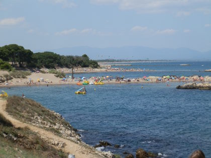 Between L'Escala and Sant Marti d'Empuries are a series of open sandy bays separated by small low rocky outcrops.
The beaches have very soft sand and shelve gently into the bays with views across the Bay of Roses to Cap de Creus and Roses town itself.
Behind the beaches are a series of dunes and cypressa woods with a few houses, the Hostal d'Empuries hotel and then large archeological site of the Ruins of Empuries.
Parking is relatively easy (though paid for during summer) and there is a long wooden path than links the beaches and headlands along the coast.
Though it lacks the dramatic cliffs and rocks of the more southern Costa Brava, the quality of the sand, the clear water and the linked bays, beaches and small islets put this in among the top beaches for the Costa Brava.
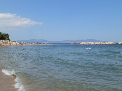 In practice there are a series of four bays to choose from giving a lot of places to choose.
The beach closest to L'Escala is the least interesting looking, but the bays that start with the Hostal d'Empuries (the only commercial outlet until Sant Marti d'Empuries village), up to Sant Marti are all delightful linked by spits of sandy beach and rocks at each end.
The most northerly beach also has the remains of the Greek port wall separating part of the beach from the sea.
The area is popular, particularly with French visitors, but as there is only the one hotel nearby and the beach area in total is quite large even in July, the beach didn't feel over-crowded.
Facilities at the beach
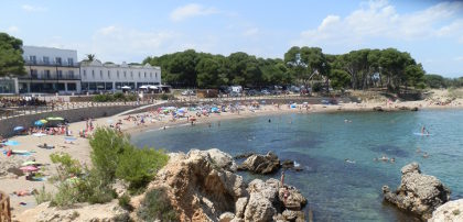 The beach is in front of the ruins of Empuries (an abandoned Roman and Greek town now in ruins) with easy car access and parking in amongst the trees at the back.
The only commercial establishment is the Hotel d'Empuries behind the second beach which also has food and a bar. The village of Sant Marti d'Empuries is also full of bars and restaurants.
On the beach, umbrellas and loungers can be hired (the natural 'palm' type of umbrellas) and there are facilities for hiring longboards and pedalos.
The dunes behind the beach are a protected area and add shelter from behind. Lifeguards monitor each area.
Sand quality
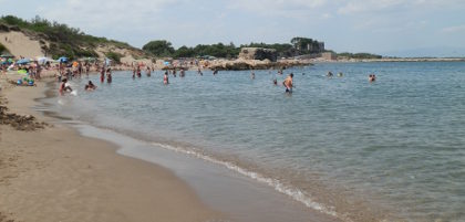 The sand is some of the finest on the Costa Brava being smooth and fine both on the beaches and into the water - perfect for sand castles or playing beach sports (if there's enough space).
Around the edges of each beach are rockier areas and, in one place islets that can be reached by wading out.
Swimming
The beaches are all gradual into the water, which with the smooth sand, makes them excellent for small children.
Swimmers can swim across the bays and around the headlands allowing for long-distance swims.
The bays are mainly sandy, but interspersed by some rockier areas and in the rockier areas there are fish which makes them good for snorkelling. The small islets also give something to swim to.
The occasional rocks mean that some care is needed in shallower areas so as not to bump.
The water was very clear, but the open nature of the bays means there's the possibility of flotsam accumulating at one end of a beach blown by the wind.
Parking
Parking can by accessed by following the signs for Ruines d'Empuries. There are a number of paid-for municipal parking areas under the trees.
Alternatively park closer to L'Escala and then take the very pleasant stroll up to the beaches.
Walks and exploring
The beach stroll is recommended in all seasons, as is a visit to Empuries itself (Empuries Greek and Roman remains). For a longer walk we have: Escala, St Marti d'Empuries and beyond
Next beaches
South to L'Escala, Riells (L'Escala) and Cala Montgo (L'Escala) - North to Sant Pere Pescador
Swimming and beach at Sant Pol (S'Agaro)
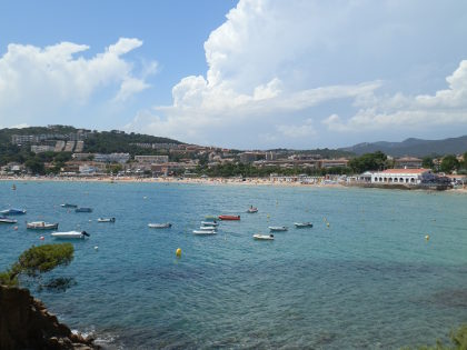 Sant Pol is a long sand crescent beach between Sant Feliu and the luxury estate of S'Agaro. The beach opens up onto a natural bay and was one of the earliest beaches for tourism in the 1910s and 1920s when people came to take the waters rather than for the sun and sand, and Sant Pol still retains beach huts - the only beach on the Costa Brava like this. Perhaps because it was discovered in the early part of the 20th century, the beach and promenade area has been relatively protected and retains an authentic charm with modernista buildings directly behind the beach and any hotels that can be seen further back giving the whole area a relaxed charm.
The beach itself is quite long - about one kilometre from end to end with a wide bay - and all sand of a rough light grit. The area to the right looking out to see is rocky and the best area for snorkelling and seeing fish, and links to a series of rocky coves and bays all along the side, so of which are only accessible from the water. These right hand rocks are also have places used for jumping and diving into the crystal clear blue water below.
Behind the beach, in addition to the modernista buildings (one or two are now restaurants) are a number of discrete bars and restaurants, a large childrens play area, protected wild dunes and the Sant Pol Sailing and Kayaking school. From the beach it's possible to hire canoes, pedalos and we saw speed boats for water skiing and banana-tubes.
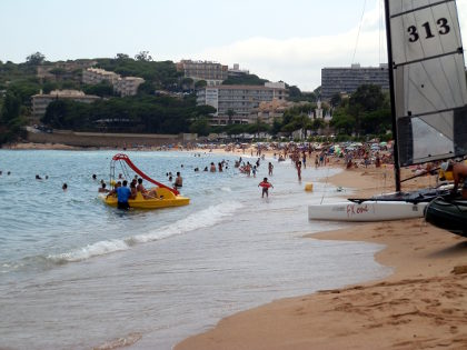 The water in the centre shelves quickly, but there is a sand bank just off shore where it's possible for adults to stand (I'd expect this sand bank may move or shift). The water was crystal clear when we were there, with boats including a very large 50m+ motor boat moored in the bay out beyond the swimming area.
Facilities at the beach
Behind the beach are a number of bars and cafes and behind these the small shopping/village area of S'Agaro/Sant Pol. The main hotels are all a little way back from the beach over looking the bay. There are lifeguards at the beach, a promenade and road and an older beach side centre/restaurant situated close to the beach huts mentioned above. The beach is quite active for water sports with sailing, catamarans, canoes, pedalos and even motor boats for water skiing at the S'Agaro end of the beach. For canoeists, the rocky bays to the right (looking out to sea) are areas to explore. There is at least one volleyball court on the beach and a childrens play area in the back
Sand quality
The sand is golden light grit almost across the whole beach. Not too bad underfoot and fine for sunbathing, but a little coarse for sand castles.
Swimming
From the centre of the beach, the shore shelves quickly (it may be more gentle at the two sides) but then had a sand bank about 20m out that was shallow enough for adults to stand on. It's possible to swim long distance both left and right and out to the further limits of the swimming area. The bay is sandy at the bottom and so not so good for snorkelling except towards the rockier parts to the right. These rocky bays are excellent for exploratory swimming and extend all around the headland.
Parking
There is marked blue-bay parking all around the roads which does require payment. A little beyond this is street parking more into the estates towards Platja d'Aro. We didn't have a problem finding a space in July, but it may be busier in August.
Walks and exploring
The coast walk Platja d'Aro and S'Agaro around S'Agaro is a very pretty walk/stroll on a broad well-maintained estate path, with rocky bays for snorkelling (walking access only) - non-residents can't take cars into S'Agaro. The path to the right Platja Sant Pol to Sant Feliu de Guixols along the rocks and round to Sant Feliu de Guixols is also recommended.
Next beaches
South to Sant Feliu de Guixols - North to Sa Conca, S'Agaro
Swimming and beach at Montgo (L'Escala)
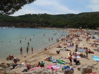 Montgo is one of the four beach areas of L'Escala and is a long sandy stretch in a half moon bay surrounded by cliffs on one side and modern houses and villas on the other on the hill below the tower of Montgo.
The area is some way away from the main centre of L'Escala but there are seasonal bars, shops and restaurants on and around the beach and a large campsite area meaning that it does become relatively busy during the summer season.
The beach is broad with fine sand, though there are pebbles in amongst the sand towards the back. Looking out to sea along the left hand side, the coast is rocky underneath the villas above with a path that reaches to the bay entrance.
On the right hand side, a path (which is rough underfoot) runs over the top of the cliffs to unspoilt hills on the far side of the bay with caves in amongst the cliffs.
When we were visiting there were long-distance swimmers with safety floats swimming the cliff side of the bay which is part of a bigger swimming club SwimTheCostaBrava.com which also organises long distance swims (4-6km) along the Costa Brava during the summer.
The beach itself by the water has good sand and shelves gently into the water making it very suitable for children and the building of sand castles. On a July weekend it was popular - parking nearby was relatively full - but not too busy. We saw many French and Dutch people at the beach.
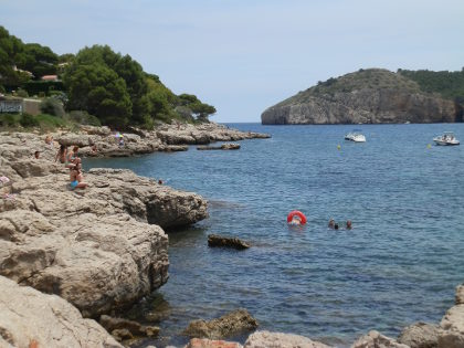 For swimming the bay has very clear water to a sandy bottom with good opportunities to swimming a reasonable distance either along the side or across the bay.
We saw fish in the sandier areas - shoals of anchovies which is appropriate for L'Escala - and there are more closer to the rocks.
Facilities at the beach
The beach is backed by a small summer community with a supermarket, wine store and a variety of souvenir shops.
Directly behind the beach are many discrete bars and restaurants looking over the bay without feeling built up or over developed. And directly behind these is a large campground and then the estate of villas on the hill so it feels developed without being spoilt.
On the beach is a Chiringuito and it is possible to hire pedalos (which a long slide), canoes and stand-up paddle-boards.
Sand quality
The sand is fine particularly close to the water where we saw lots of sand castles.
At the back the sand has rounded pebbles in it - not enough to be stony, but enough to make it unsuitable for football or beach volleyball.
Swimming
The bay has a gentle slope so would be good for children. We found the water to be a little chillier than we were expecting in July, but the area to the right side of the bay seemed warmer, but this may just have been the day we were visiting.
There are good opportunities for long distance swimming and as mentioned we saw what looked like an official swimming club practising sea-swimming along the right hand of the bay underneath the cliffs. (See SwimTheCostaBrava.com which is the open water swimming club)
For snorkling, most of the main bay is sandy so not so good for fish. The rocks to the left and right would be better, but we didn't explore too much.
Parking
There is parking behind the beach and along the roads, particularly by the campsites.
We struggled to find parking spaces close to the beach on a July Weekend, but had no problem with a 5 minute walk from the roads further back.
Walks and exploring
It's possible to walk into L'Escala along the coast and by the port or to walk across the clifftops into the Montgri Massif.
The walk to L'Escala/Riells is quite far and if you take the road is just a town walk. See: L'Escala Riells to sea cliffs and viewpoint of Montgo
Next beaches
South to L'Estartit - North to Swimming and beaches at L'Escala, L'Escala town and to Sant Marti d'Empuries
Bescano, River Ter and free-style kayaking
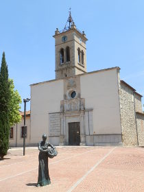 Bescano is a small town just outside Girona close to Salt and the first town or village out towards the hills to the west of Girona. Originally we were just passing through aiming to explore the hills and cliff outcrops (cingles) in the direction of Angles and Olot, but as we were driving out of Salt we noticed there seemed to be an event on the river - which we later discovered was the World Cup for Free-style Kayaking.
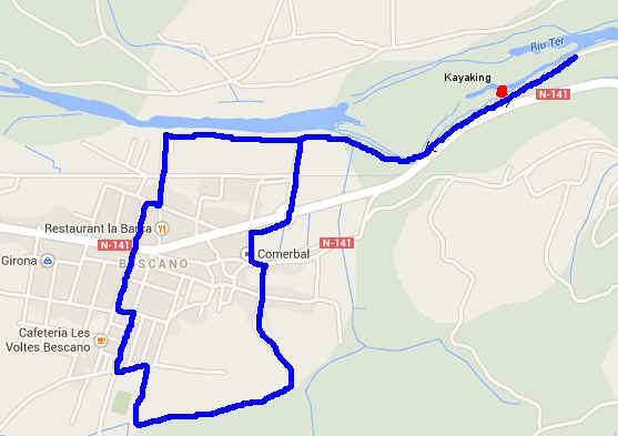
Bescano is on the Ruta de Carrilet a long distance bike path created from a disused railway route (the Carrilet was the name of the train) that stretches from Girona to the coast at Sant Feliu. In a westerly direction is follows the Ter out towards Angles and, as we discovered later in the day, is part of a route that follows the Ter through Les Guillieres hills where dams have created the lakes of Sau and Susqueda.
 To begin with though we just started in and around the town. Bescano, like many places to the west of GIrona is surrounded by wooded hills which are much wetter and deciduous than the drier alzina forests closer to the coast. The presences of lots of water makes walking feel more like English or French countryside with hazards like stinging nettles and brambles which are practically non-existent to the east.
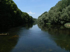
 We parked in the munipical car park and then followed a track that met up with a mill-stream at the bottom of the hill, then followed the mill-stream around the outskirts of the town to the sports stadium. We then crossed the main road and found ourselves at the back of a very languid river Ter which looked shallow enough for wading/swimming.
We then followed the river along the path down towards where we had seen the canoeing event. The river itself was broad and slow almost like the Dordogne with a lovely walk through the woods to the side. There is a man made bridge across the river but access is restricted for quarrying. Instead we continued through the woods to the side, before taking a turning up to the Ruta de Carrilet path. This runs next to the river and just below the main road for a while, but with the docile pace of the river it was difficult to imagine what the canoeing would be like.
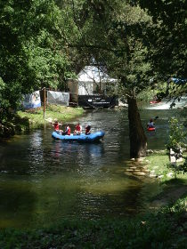
 At we were walking on the Ruta de Carrilet there was a steady stream of families coming the other way and then almost just around a corner we came to the main event the free-style kayaking World Cup which was taking place on the river. It really was quite unexpected.
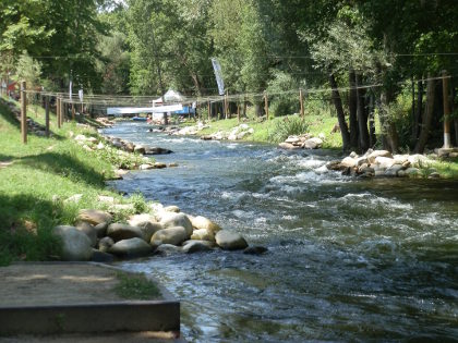
From what we saw, free-style kayaking consists of small duck-like boats which competitors are able to flip, spin and somersault in the water. Though the upper waters of the river were docile, in this particular stretch the river narrows and runs over rapids suitable for white water kayaking and slalom. For free-style, kayakers have a boat that is about 1.5m long and they drop into a white water pool where they basically play in the white water performing spins, flips and tricks while paddling to stay in the pool. (Youtube video: http://www.youtube.com/watch?v=ULn6Ao9ZHx0)
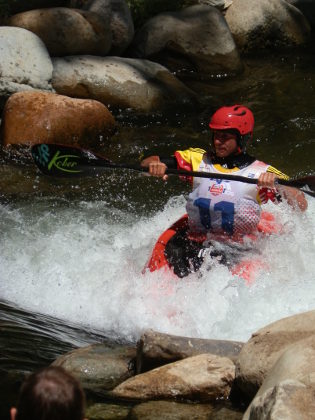 Even without the competition, the who canoe area is almost like a mountain stream specially prepared for white water kayaking. The only other place we've seen this type of set up in Catalonia has been in La Seu d'Urgell in the mountains. To find the centre just outside Girona was therefore a real surprise.
Having watched for a bit (and allowed our dog a good swim in the river) we returned along the Ruta de Carrilet to the town to see the centre and as we were walking we realised that many of the mountain bikers were numbered following a Ruta del Ter biking event.
The centre of Bescano is pleasant enough being well maintained, but really is more as a commuter community than perhaps a place to visit on its own. But would make a good stop if you're planning to visit the river and surrounding countryside.
Nearby: Bonmati and Anglès - Serinya and Illa del Fluvia - Banyoles lakeside walk - Sant Miquel de Fluvia - Bascara - horses, fords and lost - Cervia de Ter - Canet d'Adri - Girona valley of Sant Daniel - Roman fort at St Julia de Ramis (Girona) - Girona - Festa Major of Sant Narcis
Mont-ras Festival of Corpus Christi
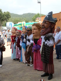
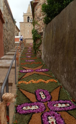 Mont-ras, as we've said before, is our neighbourhood and this year, for the second year, it held a Festa de Corpus Christi in the old-part of the village. The highlight of the festival was the construction of Catifes de Flors (flower carpets) along the route up to the church and in front of the church. The flower carpets have been a village tradition for many years, but only recently has it been combined into a general village event with craft stalls, capgrosses (part of the Spanish and Catalan tradition of people dressing up as giants or with big heads - literally capgrosses).
 Catifes de Flors can also be found in other Catalan villages and are made from flowers, petals and leaves laid out on the ground to form a picture or design. The petals dry quickly in the sun, so they are constructed in the morning both for decoration but also as part of the procession of Corpus Christi.
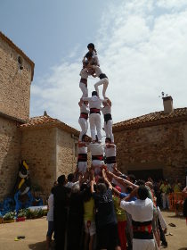 Corpus Christi itself is a Catholic feast day, so the church plays an important part of the ceremonies, but there is a lot of other things to see too. As someone not too familiar with Catholic traditions, this celebrates the Eucharist - the belief that the bread and wine of communion are considered to be transformed in the body and blood of Christ. On Corpus Christi, the transformed bread is placed in a monstrance and shown around the village by the priest dressed in finery and his entourage. As the procession returns to the church it walks over the flower carpets, before prayers in front of the church and the blessing of the Capgrosses.
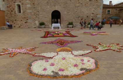 Mont-ras has turned this into a more general village festival. The streets below the church are laid out with craft stalls selling everything from baskets made by the local basket-weaving club, to pastries and jams from restaurants and crafts like woodwork or needlework. In the car park at the entrance is pony riding, and the village hip-hop dancers and Colla de Mont-ras festival float is around.
The highlight for us was seeing Castellers building the very typical catalan human towers in the square to the side of the church.
See also: Mont-ras to Calella de Palafrugell and Llafranc - Mont-ras 'boar' walk - Mont-ras Fountain walk - Llofriu, St Llop and Torrent
Swimming at the main beach of Palamos
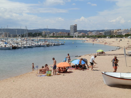 June is upon us in the Costa Brava, so swimming season has started for the summer, though the water still has a chill and needs about another couple of weeks full on sun to really warm up. So we're back on our swimming series adding the beaches we didn't get to add last year.
Palamos is a former royal port and fishing town with a harbour large enough to take small cruise ships.
The main beach at Palamos curls around from the fishing port with its market, Museu de Pesca and harbour where fishermen lay their nets out for maintenance. At the far end it joins with the beaches of Sant Antoni de Calonge and on to the rocky bays at Torre Valentina.
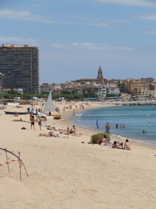 The beach itself is very much a town beach with restaurants at the back and a long beach-side boulevard for taking a paseo in the summers evenings. Boules/Pentanca can be found being played at the back and the paseo has a children's play area and old now rusting canons looking out to sea.
This is then a beach of activities - whether kite surfing in the windier autumn months, or taking boats or canoes out. On the sand itself are permanent volleyball courts and a sand football pitch.
The main part of the beach looks straight at the harbout and boats opposite so it's not quite a pristine open view to the horizon, but the older part of Palamos is attractive and there is a constant buzz of activity around the port
However, despite being long and broad, the beach itself lacks a little of the charm of the smaller bays and coves, feeling slightly artificial with the protective groynes.
The sand is a little rough underfoot and a bit stoney.
Swimming, because of the port/marina directly opposite is not particularly special though you can see fish even though it's a sandy bottomed bay.
However, as the beach is easily accessible, it is a beach where you do see long distance swimmers in training swimming parallel to the shoreline to and from Sant Antoni.
Facilities at the beach
Being a town beach, all the facilities of the town are nearby.
At the port end of the beach is a small funfair for children and several restaurants that look over the beach.
The main town of Palamos with mainstream and souvenir shops is at the port end of the beach to the north.
Across the beach are permanent volleyball nets, some football goals and a sailing centre and there are several chiringuitos (beach bars) directly on the beach.
There are also regular lifeguards and lifeguard points along the beach. Behind the beach is a walk for paseo and areas for boule/petanque.
Sand quality
The sand is rough with occasional small stones and there are hard patches of compressed sand on some of the volleyball courts.
At the sea's edge the sand feels finer but is not the fine sand of La Fosca or Castell further to the north.
Swimming
There is no steep drop at the town end of the beach, but neither is it a very gradual change in depth - so a bit half and half.
The swimming is relatively plain - there are fish in the water, but no rocks and the bay is sandy, but being a long open stretch of water it is popular with people practising long-distance swimming.
The presence of the boat and marina opposite mean that the lifeguards do whistle to warn people if they look as if they are leaving the marked swimming area.
Parking
A large open pay-for municipal car park on the sand takes the space immediately behind the beach at the town end with access via ticket and a pay-on-exit system.
There is additional parking along the road that passes at the back of the beach - again paid for via ticket machines during peak summer months (free otherwise).
Walks and exploring
This is primarily a town area. The paseo walk along the promenade to Sant Antoni de Calonge is very popular.
At the port is Palamos's famous Museu de Pesca (Fishing Museum) and there are the attractions of the older town of Palamos.
Next beaches
South to Sant Antoni de Calonge - North to La Fosca, Palamos
Palafrugell Festa de Primavera
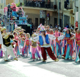 Palafrugell, unlike other towns on the Costa Brava, doesn't celebrate Carnival (Carnestoltes in Catalan) - the great Catholic festivities just before Lent when people dress up and parade through the streets. Instead, Palafrugell saves up for the Festa de Primavera, this year because of a late Whitsun at the start of June, but normally in May.
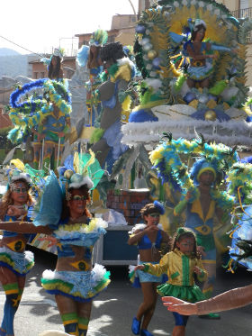 The highlight of the festival is a grand carnival procession with floats, dancers and music that wends its way through the main streets of the town full of colour and creativity taking 2-3 hours for a journey that would take 10 minutes to walk. Each float is richly decorated and has large sound systems that blast out the music for the dance routines for the troupe that follows, pausing for a few minutes to perform where the crowds are most dense more moving on to the final performance for the judges.
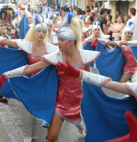 Since our eldest daughter likes to take part, we know it takes hours and hours of practice on dance routines and costumes with groups trying to win prizes for the best 'show' that are handed out at the big after-party festival that takes place in the evening. The festivities are big enough that they are shown live on the local Costa Brava TV station.
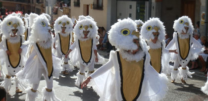
In practice, with all the effort required, many of the more serious Collas - the groups who make and decorate the floats and who dress up and arrange the dance routines - actually take part in several of the festivals that can be found up and down the coast. This year Palafrugell had groups from Sant Feliu and as far away as the Garrotxa out towards Olot. Most start with the Carnival at the beginning of Lent in Palamos or Platja d'Aro - but the weather can be showery and the evening a little cool in the days before the clocks change - so more places now have a Festa de Primavera in the May or June sunshine when there are more visitors about.
Madremanya and Millars
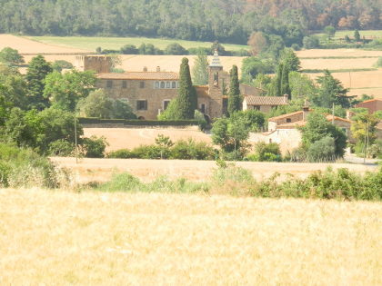 When driving to Madremanya from Monells we've noticed the grand castle at Millars but not stopped. So as the temperatures are rising and Summer's here, we made a short walk from the village of Madremanya - with its honeyed stone with small streets and lanes with gates and archways - out and around and through the castle hamlet of Millars. We were also surprised to find a number of English residents outside their houses on the walk.
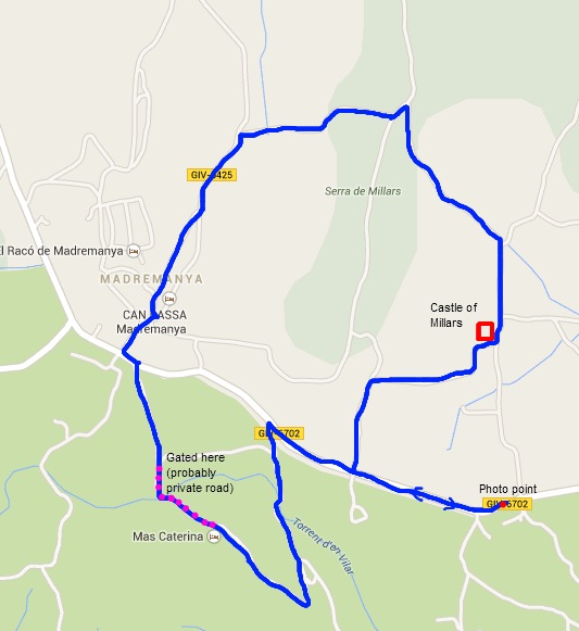
We start in Madremanya but didn't go and visit the inner parts of the village this time around (see Madremanya to Els Angels walk for more pictures) as we were looking for a shortish walk. Instead we started around the eastern fringes of Madremanya, north into the countryside. Surprisingly we found ourselves walking on a well-kept tarmac road - surprising because the road doesn't particular connect to anywhere north of Madremanya and our experience of country type walks is that they quickly become gravel tracks.
The road continues through the fields, now golden with wheat and barley but still dotted with poppies in the summer sun, before turning to the right up and over a hill to Madremanya. We're still surprised to be on tarmac, since this piece of road definitely only goes to the hamlet and castle at Millars (may be the castle owner was mayor once...?). From the top of the hill we have the first views to the castle complex and the nest of supporting houses just outside. In the distance the countryside rolls away towards La Bisbal and the Gavarres hills.
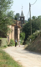 Finally, the well appointed road turns to a track and down towards the castle hamlet. Across the fields are a number of large well-restored masia farmhouses. The track returns to tarmac and we walk along the main 'street' - a line of old stone houses that must have been the quarters for the individuals supporting the castle. We also have English voices as people are chatting outside enjoying the sun and the flashes of colour from the gardens on the opposite side of the road to the houses.
From close up, we can't see too much of the castle, but we pass the main gate. If the post boxes are anything to go by it seems the castle is now divided into several private houses so there is no opportunity to see more than peering through the gate posts. It's a little bit of a pity because the view of the castle from the main road is so impressive.
We have a choice now of either continuing on the road and then more road, or following one of the marked 'health' paths - small yellow signs that mark a local route for walking for fitness - around the fields. We take the track to get off the tarmac, but though it's fine to walk, we don't quite get the picture perfect photo of the castle. So when we reach the main road, I double back to find the photo.
From our position, we can see that we are above a small valley with a stream below us, but the map doesn't indicate any paths (this doesn't mean there aren't any) and the direct route across the road just seems to lead to a farmyard. So we then have a little bit of a walk along the main road before doubling back down towards where the valley is.
We pass a farmhouse nestling into the valley, and then cut up the other side of the valley on a path that's clearly marked on the map. As we come over the side of the valley we can see we're entering an area of a masia with some well appointed stables from the back. We'd not seen any signs so we kept going. The stables are actually an equestrian centre (there's lots and lots of horse-riding on the Costa Brava) and as we pass the main house we meet the owner, who turns out to be English too. I think she's a little surprised to see us as she directs us along the road to the gate. The whole area seems to be a very pleasant riding and horse centre with holiday accommodation for guests, but I think private for walking - it just happened we came through the back (this happens from time to time) - as indicated by the definitely closed gate we have to pass through.
However, from here it's just a brief walk back to Madremanya. With more time, we'd have taken a drink in the village which is delightful, but not this time.
Neighbouring walks: Madremanya, Els Angels, Sant Marti Vell - Cruilles, Monells and Sant Sadurni de l'Heura - Corça, Casavells, Matajudaica - Monells spring walk in the woods
 .
.
Cal Negre - traditional paella in Roses
Paella is the quinessential dish of Spain, a mix of rice, meat and seafood served straight from the paellera pan. Tourist restaurants will offer branded paellas with pictures of the dish, but for the Spanish, this is a dish treated with almost reverance, normally eaten at lunchtimes (too heavy for later), and most commonly on Thursdays. The quality of the sea-food, the rice cooked to an al dente perfection and the rich deep flavour of the caldo cooked in a traditional home-made fashion.
We were lucky enough to be invited up to Roses by some friends of ours whose family have had a house in Roses since the time before holidays by the sea were popular and they took us to Cal Negre, a restaurant the family has visited for many years.
This isn't the right place to rave about restaurants, but it is interesting the way in which the seafront restaurants are rarely the ones chosen by locals. In among the backstreets, restaurants have to offer something different or better as they can't trade on their location so much. And they so they will need to make their mark on their reputation, serving good food to people who are year round residents, rather than chasing a fast buck in the short three months of summer.
Cal Negre is one of those small back street family-run restaurants that locals know and which we would never have known about without our friends introduction. As paella takes a while to cook, though the table was booked, our friends telephoned beforehand, so they could prepare a paella for ten.
We do not eat paella very often (despite having been here for some time), so we claim no great expertise, but this was a proper paella served in a single large pan for ten prepared specifically for us, not pre-cooked or pre-prepared, with crab-legs that you have to suck the meat from, langoustines and crayfish and chicken pieces and freshly cooked gambas.
Like many other authentic restaurants it's tucked away. Something we've found, is that for a restaurant slightly off the main strip to survive, they must be doing something right with their food.
Bellcaire d'Emporda, Tor and Albons
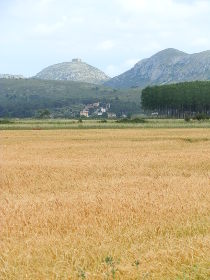
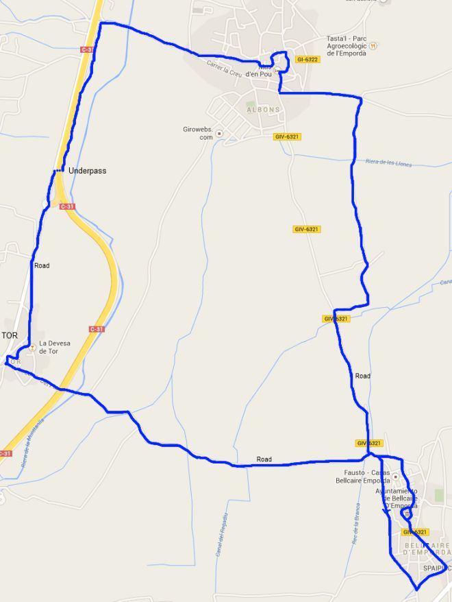
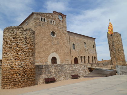 Situated just outside L'Escala are a number of smaller villages - Bellcaire d'Emporda on the road to Torroella de Montgri, Albons towards the C31 link road and Tor - a small hamlet to complete the loop. The landscape between the villages is a flat plain, the remnants of an ancient lake or sea-marshes, that is now cultivated with wheat and espalliered orchards for growing fruit. To the sides are the dominating hills of Montgri and the lower ranges of the Muntanya de Sant Grau. Because of the ditches that drain the fields, there aren't too many footpaths and so we're walking on road more than we would like, however, this does mean that this would be perfect for some easy cycling.
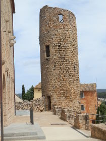 Our starting point is in Bellcaire d'Emporda. The village is situated just below the Massif of Montgri and was the home town of Barcelona's former coach Tito Vilanova. The village is just off the main road from Torroella de Montgri to L'Escala and it is a village we have frequently bypassed without actually visiting.
This time instead of continuing towards L'Escala we drive following the signpost for Albons and find the municipal car park to the left, just by a small stream. Taking the time to walk through the village our initial impression is of an older town with terraces of 18th century houses. However, it's not until we climb the low hill to the castle that we really appreciate the historic importance of Bellcaire. At the top of the hill is a very impressive castle surrounded by towers and a wall, and around this a dry moat. The castle was the former residence of the Counts of Empuries in the 13th and 14th centuries (the time of the Plantagenet's Edward I and Edward II in England), when the area of the north Catalonia was often in dispute with the Count of Barcelona/King of Aragon. The result being that the castle of Montgri was built by the Jaume II to watch over the Empordan territories, together with the neighbouring castle at Albons.
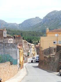 Coming off the castle hill, we pass a small old and slightly battered looking romanic church of Sant Joan, then continue out towards the north of the village. Ahead of us we can see the village of Albons, but rather than go directly, we take a turn to the left past the fields in the direction of Tor.
The area between Bellcaire, Tor and Albons is all very flat with fields and lines of fruit trees separated divided with ditches and water ways. We're on the road and, if truth be told, walking on the flat on a tarmacked road isn't our ideal walk. The old lake of the Estany de Bellcaire which was use for growing rice before being drained in the 19th Century neighbours this area, and it's not entirely clear if the fields we're walking through were also connected with the lake some time in the past.
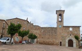 Our route continues to Tor, a small nucleus of houses around a small old chapel just off the new main C31 road. We now walk on the old road towards Albons (signposts for the bike path tell us we're heading to Verges when we know we're actually going north). To the left of us are the low hills of Sant Grau and the walk runs in parallel to the main road making it somewhat dull and unremarkable. We cut through on of the drainage underpasses for the main road to reach gravel track and continue into the outskirts of Albons and then into the centre along a newly built path by the side of the road.
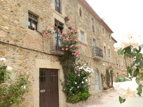
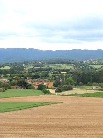
 When we were looking to move to the Costa Brava, Albons was a village we looked at because it met our criteria of having a local school and a good community feel to it with houses close to the older centre and it still retains a lived-in charm. The road forks and we head up the hill towards the Ajuntament. Like many villages, the older part is on the hill and with the plains there are views towards L'Escala and back to Bellcaire. The centre itself has the old castle of Albons next door to the church on a large placa and surrounded by a network of smaller streets, not as pretty as some of the villages closer to La Bisbal, but still interesting.
To avoid taking the main road back to Bellcaire, we leave Albons close to the community social centre and into the fields in the direction of the deixallaria (village tip) past a number of small gardens and allotments. At the first right we turn down across the fields towards some isolated farms. From the farms, there is no easy way back purely across the fields because of the ditches, so we have to take the road for a brief time, then skirt around the bottom of Bellcaire and back to the car.
Neighbouring walks: Torroella de Montgri to Gola de Ter - Torroella de Montgri castle - Torroella de Montgri and Ulla - Sobrestany, Montgri and Bellcaire d'Emporda - L'Escala Riells to sea cliffs and viewpoint of Montgo - Verges, Tallada d'Emporda and Maranya
Monells spring walk in the woods
 Monells is a delightful village of stone built houses with a hidden centre full of vaulted arcades that almost feels like a film set for the three musketeers. We're in spring and the fields and hedgerows are bursting with flowers, cuckoos are in full voice, and the strange whooop whooopp that sounds like a car alarm are actually small Scope's owls calling to each other during the day time. In Girona, the Temps de Flors flower festival has just finished and temperatures are climbing into the 20s with just the last odd day of rain before summer.
This walk is just a simple walk through the fields and woods. It was unplanned in that we didn't have a map, but just wanted a walk in the countryside.
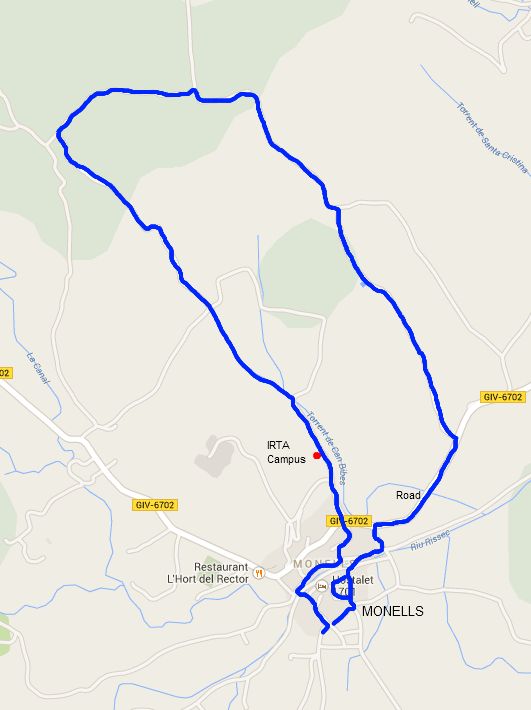
 We start by coming into Monells from the Sant Sadurni road and park just above the village in a marked car park. We could go into the centre, but the aim is to do that later, so instead we skirt the outskirts of the village, across the low crossing over the river and then along the river by the row of houses on the far side. Almost immediately we get the scent of roses drifting towards us, their deep perfume coming from the flowers climbing the walls of the houses. Unlike England where roses are a summer flower, here in Catalonia they are at their best at the height of Spring.
We take a cutting between the houses and up and across the main road to Madremanya. If you're driving from Corca don't assume that what you see of Monells from this road is the village. As with many empordan villages, the old heart is tucked away from the much more recent modern roads.
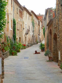 Ahead of us is a lane into towards fields and woods and gentle rolling countryside and arrows to the IRTA campus - a farming college. We follow the road past IRTA along a track that is lined with rangey two-metre (6ft) high thistles with purple heads. In amongst the thistles are red poppies and yellow wild flowers. The road is just below the fields to the left with wheat in the transition from green to gold.
Our route is very simple - a few fields nearby and some woods on the far side of the closest field, with no particular features, just a good country walk. Behind us we can see Monells and the Gavarres behind the village, a picture of a country idyll.
We walk into the woods a little way and turn to the right past a ruined farm enjoying the warmth of the May sun. At the next junction we turn right and start to head back. We pass a large well just outside an older farmhouse. There is honeysuckle in amongst the trees and a natural variety of snapdragon.
We get to the road and turn towards Monells. The pomegranate trees are in full bloom with bright orange flowers in amongst the dark green foliage. Turning to the left we return to Monells village itself just by the Arcs de Monells Hotel.
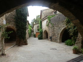 Monells itself is a village famous for its vaulted arcades - it's almost impossible not to be charmed by the number of arches and walk ways into the centre. Right in the middle of the village are an number of restaurants and while we were there, two or three children playing football in the main central placa. We turn and head out up the long terrace street that is almost like a Hovis advert and return to the car.
Neighbouring walks: Madremanya and Millars - Monells and Mont-negre - Cruilles, Monells and Sant Sadurni de l'Heura - La Bisbal, Vulpellac, Castell d'Emporda, Fonteta - St Pol de Bisbal and Santa Lucia - Corça, Casavells, Matajudaica
Via Ferrata at the Gorges de Salenys
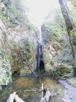 Via Ferrata or 'iron routes' are combination walking and climbing routes that run across rock faces and up and down steep slopes using iron pins, ladders, rope bridges and safety wires for carabinas. The Costa Brava has three Via Ferratas, with the easiest at the spectacular Gorges de Salenys in the hills close to Romanya de la Selva and Bell.lloc just outside Santa Cristina d'Aro. However, knowing it exists is one thing and finding it another. Although we knew where it was on the map, we didn't entirely know what the best route was to get there or what it would be like when we arrived. (See the update below - but basically if you're on the Romanya-Llagostera road, it's marked as Font Penedes - nothing about the gorge).
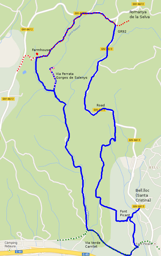
Knowing it would be in the valley of Salenys we started just by the Urbanisation of Bell.lloc just outside Santa Cristina D'Aro just off the road up to Romanya de la Selva. We parked just by the intriguingly named Font Picant (spicy fountain - its actually ferruginous - containing iron). Like many natural springs in Catalonia, it's quite common to see people collecting water and filling large plastic bottles with the spring water. Agua de Salenys was once bottled and sold as for medicinal purposes as water from the Costa Brava (update: and is back on sale on the coast as of 2018), as can be seen on the faded advertising painted on the side of the house just at the bottom of Bell.lloc.
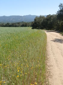 We weren't very sure of our route to start with or where the Gorges started or connected. So to begin with we headed into the woods above Font Picant generally trying to head north and east. The path turns and then continues to the north through woods and past fields with corn flowers and poppies and maturing wheat giving views back towards the sea at S'Agaro. It's a steady up hill and we continually wanted to break off to the left, down to where we thought the gorges were, but there were no routes.
Instead, we eventually reached the road that links Bell.lloc to Romanya de la Selva. The road has been upgraded recently at the higher parts so it is broad with new tarmac and looks like it is made for hundreds of cars. Unfortunately we have to follow the road up, which though it looks like it should be busy is actually very quiet. Along the road we can see the valley dropping away to the left, but still no paths down. We can though hear, but not see, a cuckoo which almost seems to be following us as we walk.
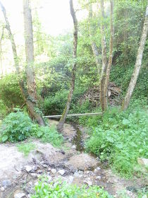 On the map we reach the first of the potential paths to the gorges only to see that it is a Cami Particular (private road). We carry on and join the GR92 cutting through a small copse before again joining a road that links to Romanya. The second potential path to the gorges is also a Cami Particular with the same sign as before. At this point we're close to Romanya de la Selva and at this stage it seems this would have been a better start point.
We follow the GR92 (red-white flashes) to the left into the woods. We know from the map the gorges are to the left of us still and some tracks and paths go in the direction we want, but there is no sign post and when we try one it seems to get too narrow in among the lower trees to be a route.
The actual access route we find just after passing a farmhouse - a path to the left is marked with a signpost to Santa Cristina d'Aro and the Via Ferrata. The path heads down a narrow river valley emerging at a picnic site where two large families are taking lunch, their cars parked nearby. We weren't expecting cars here and as we pass them and continue on the narrow pit-holed track they must have driven on, I don't think I would have brought a car.
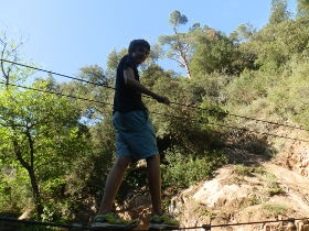 The valley though is quite deep with a small stream with water at the bottom and tall deciduous sycamore or plain trees. It's quite verdant and green being narrow and sheltered it doesn't feel as arid and mediterranean as the more open south facing slopes of the Gavarres, instead being more northern European in character without the normal cork trees and alzinas normally found on the Gavarres.
To get to the Via Ferrata we have to take a signposted track down into the valley, and at the bottom we turn to the left, almost back on ourselves. We had assumed the gorges would be on the route to Santa Cristina, but in reality it is more like its own separate secret route.
A few people are coming up out of the valley. The entrance is more or less a stream with some rope bridges and a path but at the far end it starts to get rockier and we can see the first of the wire-walk bridges above our heads and the valley narrows to rocky walls. Ahead of us the stream runs through a narrow crack between two rocks - less than a metre wide and along this section is are the wires of the Via Ferrata so you can take yourself through the narrow pass. To reach this part you have to work your way around pins stapled into the rock at a height of about 3-4m up. This is where you need climbing gear to do the Via Ferrata, which we don't have.
A sign on the entrance also says that helmets, harnesses and carabinas (and climbing insurance) are necessary to do the via ferrata with the suggestion that they can be hired from Sant Feliu Adventures. However, the via ferrata is not the only route up. There is a path to the right which takes you over the rocks - it's a bit of a scramble and we go up and discover that the valley is like a series of levels or steps with water pools on each level, then rocks to scramble up again at the back and further via ferrata routes up.
We do a little exploring but then work our way back down and out, exhilarated by the possibilities. At the point we turned into the gorges, we turn to the left and take the path marked towards Santa Cristina at the stream level through the valley. The walk is really pleasant with light dappling on the trees and the sound of our cuckoo in the distance.
Eventually we pass the Aigua de Salenys bottling plant and reach a bigger gravel road, which then connects to the Carrilet Via Verde - the old train route between Girona and Sant Feliu de Guixols which has now become a long distance bike route. We follow the Via Verde almost as far as the old station (now restaurant) for Font Picant and turn back up to the park.
Update June 2018
Having been a while since we last visited the gorge we decided to try again - twice. Thinking that we knew where we were going, we didn't take a map. So the first day we parked at Romanya de la Selva and walked down the road, and walked and walked. Once we got to the crossroads which connect to Sant Miquel d'Aro, we stopped and did a different walk through the estate. We hadn't gone far enough down. We drove down, but didn't see the gorge signposted...
So we tried again on the Sunday, but this time from the bottom of the valley. There is access from the C65 dual carriageway just before the Els Tinars restaurant and the path is clearly marked. The first thing is the bottling plant is back working. You can buy Aigua de Salenys in some of the restaurants on the coast. There was a group climbing - the Via Ferrata runs all the way to the top, but since it needs climbing gear, we haven't been that high.
And at the top, we found the signpost to look out for from the road (our original walk connected via a footpath). At the top it's marked as "Font Penedes", and there is no obvious marking saying gorge from the top.
Neighbouring walks: Romanya de la Selva - Calonge (Cami de Molins and over Cabanyes) - Castell d'Aro and estate of Mas Nou - Solius, rocks for climbing and ruined castle - Sant Feliu de Guixols Pedralta - Romanya de la Selva to Platja d'Aro via Golf d'Aro Mas Nou - Romanya de la Selva to Puig d'Arques
Tossa de Mar north to Cala Pola
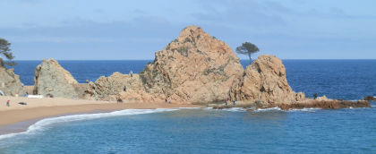 Tossa de Mar with its castle and walled older part over looking the sea is one of the most popular Costa Brava destinations but it is separated from Sant Feliu de Guixols by the Massif de Cadiretes and high cliffs with a single very windy road that makes coastal walking challenging. However, having walked the GR92 routes to the south last year of Tossa de Mar last year, our aim this time was to explore more of the northern parts and into the hills at the back of Tossa.
Our starting point was parking near to the river just outside the centre of the town. Despite being Easter Monday, parking was very easy and the town itself felt like a place slowly still waking from its winter hibernation. The main tourists seemed to be French in small groups rather than the sea that washes over the town during the main summer season. At this time of year, the sea is still too cold for any but the most hardy of swimmer or those with wetsuits. Normally there would be enough sun for a few sunbathers on the beach, but the Easter weather has been relatively overcast this year.
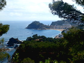 We almost follow the river down to the beach past blocks of rented apartments and hotels with early visitors visible on the balconies. Tossa is very popular because of its beach and compact historic centre and is full of low rise hotels and bars and restaurants, maintaining its traditional character, but still more focused on tourists than the Costa Brava villages of Emporda.
At the beach we follow the road around to the left towards the beach of Mar Menuda in the opoosite direction of the castle. For this walk we want to explore newer areas so we're heading out to the hillier north.
Just before the Mar Menuda beach, we take the last junction to the left and head up the hill past the back of a couple of hotels. The road reaches a switchback corner and according to the map we should be able to continue straight on, but the road looks more like a private driveway. As we're pondering whether it's the right way some Catalan walkers catch up with us and tell us it is the right way. Looking closely we can see a green flash painted on the post next to the entrance to the path/drive.
The path turns into a track and splits in two. To the right the route is now signposted to Cala Bona, Cala Pola and Cala Giverola which are the coves we are heading for, but we can see from the map that the path must go down (To the L'Infern d'en Caixa) and then back up to meet the path ahead of us, so we continue straight on.
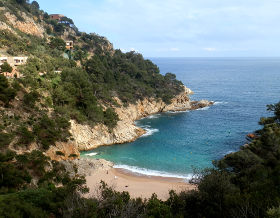 Our path climbs up towards the road above us, but firstly we pass a viewing point marked by a clearing and a wooden pole from where you can look back to Tossa. It's actually high up on a cliff top over the sea (about 150-250 feet up) and I discover I'm rather closer to the edge than I'd like with the result that I catch a dose of vertigo.
We climb the track up to the viewing point on the road and then have to follow the road for a while. The road is quiet. Though it is the most direct route between Tossa de Mar and Sant Feliu de Guixols, it is an extremely bendy road across the cliff-tops and in and out of the bays and so extremely slow going, and with no turn off alternatives. The main visitors who use it are tourists and so it has traffic in summer but few cars now. In fact the main travellers we see are club or pro-cyclists out for a day trip (the route Girona, Sant Feliu, Tossa is about 100km/60 miles round trip).
The road climbs to the next corner and we see a sign-post for the path to Cala Bona down into the next bay. Unfortunately I'm still feeling spooked by the earlier cliffs and we're a little higher now so as the road is relatively quiet we choose to stick to the road as it turns inland and around the back of the natural little cove of Cala Bona down towards the sea.
On the far side of the curl we find the path again as it rejoins the road, though there is also a path below the road that comes into the next bay of Cala Pola. Cala Pola is an odd mixture of developed houses, what looks like a hotel, and campsite above a sandy beach in Cala Pola itself. It feels quite isolated as there are no other facilities nearby other than the resort itself, which at this time of year has just a handful of people around - with 5 or 6 down on the beach below us.
We walk around to the back of the campsite across a bridge and then start our route into the hills. The path loops round the back of the campsite and at times it's not clear what is private and what is public, but there are signmarkers around if you look.
The path climbs up into the hills at the back and we leave the sea and the bay behind us into the pines. The path climbs to a col where we meet the GR92 path as it heads up into the Cadrites hills as it continues to Sant Feliu. The GR92 between Tossa and Sant Feliu does not follow the coast probably because it would have to follow the same route as the road. Instead it climbs up into the higher Cadrites above us (500m) - about the same height as the Gavarres, but from our path it looks higher and steeper.
We turn down the GR92 and head down the hill back towards Tossa de Mar with a typical walk through Mediterranean woods along a gravel track. As we reach the bottom of the hill we emerge by the river which at this time of year has running water and tadpoles and connects to a small park at the back of the sports area for Tossa de Mar.
Update: Cala Pola was used for the 2014 summer's Estrella Damm advert (it was Pals/Platja del Roca beach in 2013).
Neighbouring walks: Blanes, Lloret de Mar, Tossa de Mar by GR92 - Tossa de Mar to Cala Llorell - Sant Grau and Cadiretes near Tossa de Mar - Llagostera to Sant Llorenç - Swimming and beaches of Tossa de Mar
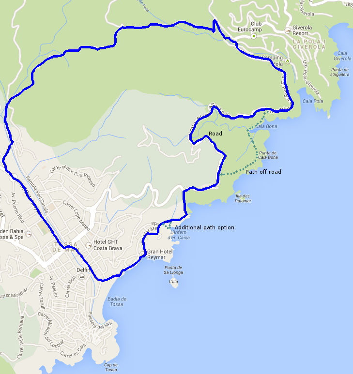
Vulpellac to Castell d'Emporda
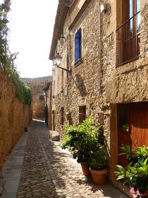 Vulpellac is one of the many villages with honey-coloured stone houses that can be found close to La Bisbal d'Emporda - almost like the Cotswolds by the Mediterranean. This is a variation of a walk we took from Vulpellac around La Bisbal, but we keep to the flatter fields to the east, rather than walk along the ridge top to Castell d'Emporda. The route back is not much different from the route out, so an extra variation would be to go via Canapost and Clots de Sant Julia.
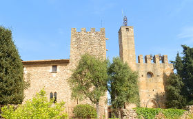 We park in the car park just by the roundabout just off the main Bisbal-Palafrugell road just below the village. We walk through the village to start with past the new ajuntament building built in the traditional stone of the rest of the village. There is some new building here, but it is all in a stone-style to keep the look of the village.
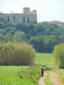 We walk through a small lane and emerge at the main centre with cobblestone streets and a run of pretty terraced cottages linked to a fortified tower. Over the wall we can just make out the castle and we go through the tower to loop back to the church. The castle itself is a private residence built in the 13th Century so no access is possible. The castle also has a story in that a former lord heard a rumour that his wife-to-be was unfaithful and he was so jealous that he locked her in a tower and tortured her until he realised he had been misled. In his distress and penance he sought an audience with the Pope and left the inscription Ego Sum Pecavi (I am he that has sinned) around the castle.
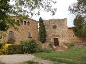 From the main street we keep going north into the fields. This is part of the walk we have done before on the loop through La Bisbal, but at this time of year there are poppies everywhere and long grasses along the lanes. The lane continues slowly more becoming more and more grassy until it reaches a stream and we have to cross via some wobbly stepping stones. On the other side, the grass is thick. Around us are small plantations of lime trees among the flat fields. To the left is the hill ridge for the Castel d'Emporda and we can see the castle jutting up above the ridge.
Our grassy path reaches a more substantial track and we turn left across the stream again directly towards the castle. The castle stands high, but a series of cottages seem to tumble off the hill down to the plain below untouched by modern developments.
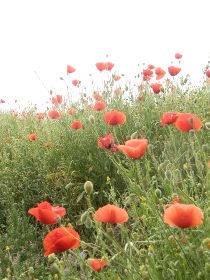 We reach a tarmacked road beneath the castle and quickly visit the castle for views over the fields. Tractors are out today, one ploughing followed by a line of egrets picking out the insects from the newly turned soil.
After our diversion to the castle we continue on the road northerly to start, before it turns to the right past the farmhouse and old chapel at Sant Marti de Llaneres - part of a former walk between Canapost and Ullastret.
An option is actually to come back via Canapost and then past the Clots de Sant Julia again, but we decide to keep the walk short and turn to the right towards a house under a lime plantation. This connects with the paths we had come on, so for variation we link around the fields. It's not too exciting just walking through flat fields, but it makes for an easy connection back to Vulpellac.
See also: Corça fields and views - Canapost to the medieval fair at Peratallada - La Bisbal d'Emporda - La Bisbal, Vulpellac, Castell d'Emporda, Fonteta - Canapost, Poblet Iberic and Ullastret - Palau-sator and Peratallada
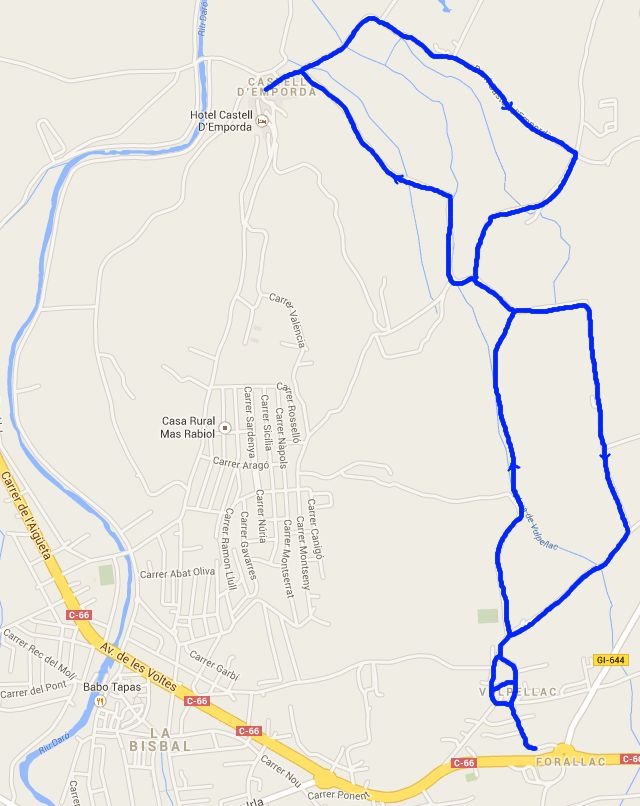
Esponella and River Fluvia
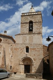 Out towards Banyoles and Besalu, the countryside of Catalonia changes from the broad plains and Mediterranean hills of the Costa Brava to the start of a more Swiss Mitteland type landscape with rolling hills, forests and river valleys in the pre-Pyrenean countryside. Esponella is just north of Banyoles (famous for it's lake) and a few kilometres downstream from Besalu (famous for its bridge and as one of the prettiest towns in Catalonia). However, our choice of Esponella was based more on its geography than on any recommendation as the village sits just above a bridge just after the river passes past an escarpment.
 Our starting point is just outside the adjuntament building just off the main road to Crespia and to start with we head up through the village to towards the church. We were slightly expecting more from the village given it's position. It is pleasant enough with stone built houses and narrow streets climbing up the side of the valley to the church and a host of newly renovated buildings, but we're a little bit spoiled for choice of pretty villages closer to home.
We reach the church with it's ornate hinged door, then continue straight on into the woods past the colonies house of Can Que. The woods are green and deciduous with a mass of flowers and grasses growing in the damp undergrowth. Down to the right is a campsite on the side of the river. As we're walking we can hear a cuckoo in the distance and it feels like a summer walk in a more northern European country.
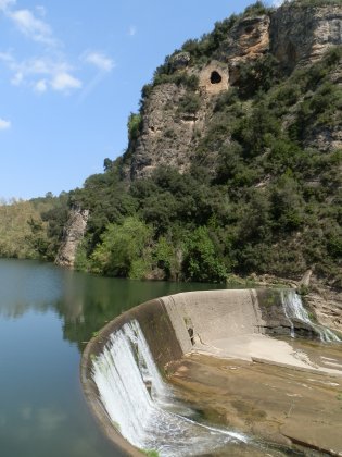 The track continues gently downwards and is marked as a BTT route for mountain biking. As we get closer to the river we're passed by a group of four riders coming up the track. The BTT route forks to the left, but we continue down to a weir and electricity generating station now able to see that the river is quite broad with deep pools and cliffs on the opposite side of the bank. In the wall of the cliffs is a wall with a hole - marked on the map as the site of a former hermitage.
The weir itself is high, like a small dam with water rushing over the top. Behind the weir the river forms a broad tranquil lake in amongst the trees. We keep walking now level with the river next to a plantation of regularly spaced lime trees. The path seems like we could continue walking all the way to Banyoles following the river, but instead we take the first left up the hill into the woods and walk up to the top to find fields and views towards the Pyrenees.
We rejoin the BTT route and follow it as it turns to a tarmacked road past farm houses and an old people's centre. The road passes fields now - of bright yellow rapeseed and growing fields of wheat. In the distance the hills ebb and flow rolling away to the distant mountains.
 We reach the upper part of Martis and cross the road through the back of the hamlet following the track down the hill to the castle ruins just above Esponella. The castle would have been quite large, but now is little more than thick tumbledown walls.
We continue down to the village and past the church once more. Since the bridge is marked as a feature on the map we go down to the river to find a narrow but relatively modern looking bridge of stone arches and metal before returning to the square by the ajuntament.
Nearby: Sadernes and river pools of St Aniol d'Aguja - Sant Esteve d'En Bas (Olot) - Serinya and Illa del Fluvia - Olot - capital of Garrotxa - Banyoles lakeside walk - Visit to Besalu and Banyoles
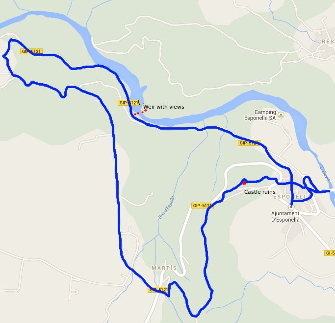
Torroella de Montgri and Ulla
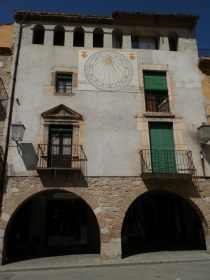 Torroella de Montgri is a historically important town and former royal port that that sits below the iconic Massif de Montgri and castle of Montgri, one of the most iconic and distinctive markers of the Empordan part of the Costa Brava. It is three or four kilometres from the coast at L'Estartit but remains an important crossing point for the river Ter.
Modern Torroella as a town is an odd mix. The outer parts of the town - where most people drive is a collection of modern town houses and apartment blocks. The inner part is much older and more medieval, but unusually for older towns is laid out on a grid pattern which can make for a confusing set of smaller narrow streets.
Our walk is also a mix - taking in the town, out to the dry and rough lower levels of Montgri with its rocky olive groves and harsher scrub, then coming down through Ulla to the extremely fertile banks of the Ter with apple trees in full blossom and hortas (allotments) showing their first crop of the year.
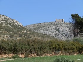 We park at the southern end of the town in the municipal car park next to the CAP on the opposite side to Carrefour. The older centre is straight on, along Carrer de Hospital and almost immediately we pass the old hospital building. The way older Catalan towns were built was with flat fronted terraces with the front of the house directly on the street, instead of separated by a garden or space. The result is that the street looks like a uniform collection of buildings like the older Victorian terraces in English working towns. However, unlike English terraces, the buildings in a Catalan street can vary enormously and often extend deeply at the back into gardens with older houses having Boveda ceilings (vaulted ceilings). This means that on a old Catalan town street you might walk past an old grand Palau building one moment and a small 2-up 2-down the next. The facade initially looks the same.
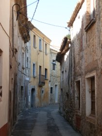 This is the case when we pass the old hospital building. Looking linearly down the street you would struggle to say which building was which. But as you pass and look laterally, the find carved windows and size of the frontage and the quality of the doors show the the ancient hospital building was a rich and important part of the town.
As mentioned Torroella de Montgri is laid out on an old grid system. The inner streets are relatively narrow - little more than one car's width and with the the layout of the facade, the only way to explore is to walk the street - a simple look along the street doesn't show you what you will find.
We walk along the Carrer de Hospital until a left turn that takes us into the main town square - an area with arches and vaulted arcades with tables and bars. From here we continue up to the main church and the old castle (now a hotel in front of the church). Skirting to the left of the church, the back streets lead to one of the old town gates. Prior to the silting up of the Ter, Torroella de Montgri was a royal port and so an important walled town, though now only a few of the rampart towers are remaining.
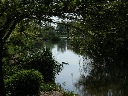 Across the main road we walk through some of the newer streets with houses and apartment blocks. For many who just drive through Torroella these newer buildings will be their only impression of the town. We're heading up and follow the road to the right as it curls up towards the Montgri hill.
The road comes to an end and we have the choice of several tracks into the scrubby and rough terrain of the lower part of the hill. Above us we can see Montgri Castle on top of the mountain of Santa Caterina built by the Count of Barcelona (also King of Aragon) Jaume II, around 1300 as part of a power struggle for control of the Empordan lands with the more local Count of Empuries.
We take paths up towards the hill, but generally heading left where the paths split. The original aim was to go over the saddleback and walk around the base but we miss the connection up the hill and instead follow a side track past the rough olive groves that run around the base. The mountain is dry and dusty underfoot with grasses browning in the April sun, and we pass a farmer trimming the trees ready for new growth.
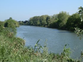 We navigate by eye finding routes around the base before emerging at a road that looks like it will take us to Ulla just past an isolated metal recyling site. On the road are two climbers, who are just packing up. We can hear the shouts of voices higher up. Looking to the top of Puig Rodo we can just make out tiny figures abseiling down the rocky cliffs.
We take the track we've found down into Ulla. By car the main road between Torroella and Ulla is a collection of warehouses and shabby apartment blocks used by the migrant workers who find employment picking apples and other fruit from the espallier orchards along the Ter. From our path we enter into directly into the older part of Ulla.
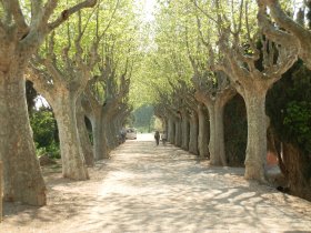 Ulla centre is an old stone village of narrow streets with a small romanic church in the centre and houses with wisteria climbing up the walls, with many renovated houses. The village seems larger than might be expected from the road and the interior part has a sense of improving prosperity.
We leave the village toward the main road past slightly untidy breeze-block walled farms, arriving at a roundabout on the main Torroella to Verges road.
Crossing the road we walk into the orchards. The apple trees are in full blossom. The grasses are verdant and butterflies flit around our feet. The orchards and fruit are a huge part of the agriculture along the Ter with miles upon miles of espallier frames with bound netting ready to keep birds off the fruit. The abundant fertility is in marked contrast to the drier rougher mediterranean hillside we have just left.
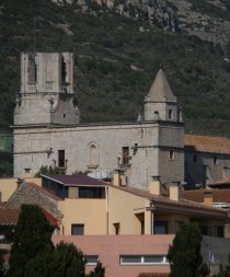 The path is clearly marked as both a cycle route and for walking, though warning signs explicitly prohibit leaving the path to enter the fruit trees. The path runs straightdown, then turns to the left and we start to follow the line of the Ter.
Our first sight of the Ter is at an old stone built weir station from 1650 (the name of the maker and date is carved into the stone). I'm not entirely clear of the purpose, but part of the waters of the Ter has been channelled through the weir station with rushing streams passing underneath, possibly to power a mill, or for irrigation or an early form of flood control. The weir itself is delightful with rushing water and translucent greens from the sun coming through the leaves of the trees.
The path continues, now following the Ter and we can see how big and wide the river is. On the other side of the path are allotments with gardeners busily preparing for the spring season. Just after a bird viewing platform that stands above the river, the path turns back towards the town and we walk through a small avenue of pollarded trees which emerges by Espai Ter which houses the Tourist Centre in Torroella.
We traverse the centre again. Shops are opening at 5pm as the long weekend lunch break (1pm to 5pm) comes to an end. On the far side we reach the main avenue that drivers would see coming through the town and walk the avenue back down to the car.
Neighbouring walks: Torroella de Montgri to Gola de Ter - Torroella de Montgri castle - Bellcaire d'Emporda, Tor and Albons - L'Estartit to Cala Pedrosa and Cala Ferriol - Gualta, Llabia, Fontanilles and the lake of Ullastret - Ulla to Canet de la Tallada and civil war remains
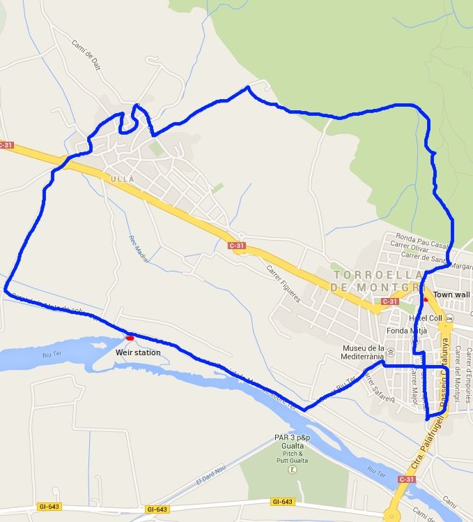
Brunyola
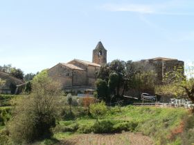 As we had to be at Girona Airport at the weekend, we looked for a walk nearby and found the village of Brunyola just off the main road to Vic. Brunyola is a tiny hamlet sitting on top of an isolated hill with views all around; south to Montseny, out towards Cassa de la Selva and the Gavarres to the east, and of course views to the hinterland of Girona and the Pyrenees. The village itself is barely more than 30 houses, but has a castle, church, restaurant and children's colonies auberge and for time we were there, it seems quite a number of visitors who had come in for Sunday lunch.
Access to the village is pretty much one road in and one road out so you have to come from the west off the C-63 road. Driving into the centre the few streets that are below the church are full of cars with visitors who have come for the local restaurants. So we park just around the corner on a patch of rough ground that looks out towards the airport plain. The village stands above the plain for the airport and we can look out towards Girona in one direction, or turn and look towards the mountains in other directions.
We firstly walk up to the church and then around the corner to the conjoined castle which looks more like a private house now. The hamlet only consists of 3 or 4 streets so there is not too much to see, so from the castle street we continue past a row of new houses and into the woods at the end. We could take a small windy road down off the hill, but we cut into the woods and track the road through the woods working our way down the hill before re-emerging by the small road at the bottom.
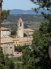 We follow the road around the bottom of the hill by fields full of crops bursting into growth in the warm spring sun - certainly warm enough that we don't need to wear jumpers or coats. The road itself is very quiet, really just connecting a few farms and the hamlet and is marked as part of a longer footpath from Sant Colomers de Farners to Angles. It's pleasant good walking countryside in among hills, but without being spectacular.
The marked footpath leaves the road and takes a track past two expansive masia and we could continue, but as we want to make a round trip, we take a left down the track back towards Brunyola's hill. At the end of the track we are back on the road, but this time we practically just cross over and go back into the woods across a small stream and follow the path as it snakes around the bottom of the hill. We're looking to climb the hill and for a while it looks as if there is no path up, but as we're approaching another farm by an olive grove, we see a switchback to our left that takes us up the hill.
As the path climbs, the views get better, but we're starting to feel the heat from the sun now so we're perspiring as we get towards the top. There's a viewpoint right at the peak, but we cut around the edge and follow the path along the top of the hill as it slowly descends to Brunyola. As we get back, the colonies house seems full of families after their lunch with children playing in the playground.
Nearby: Palafolls castle- Hostalric stroll - Lake at Sils - Castell de Montsoriu - Santa Coloma de Farners - Arbucies autumn walk - Caldes de Malavella - Volca de la Crosa - Sant Dalmai (Girona Airport) - Castell de Montsoriu
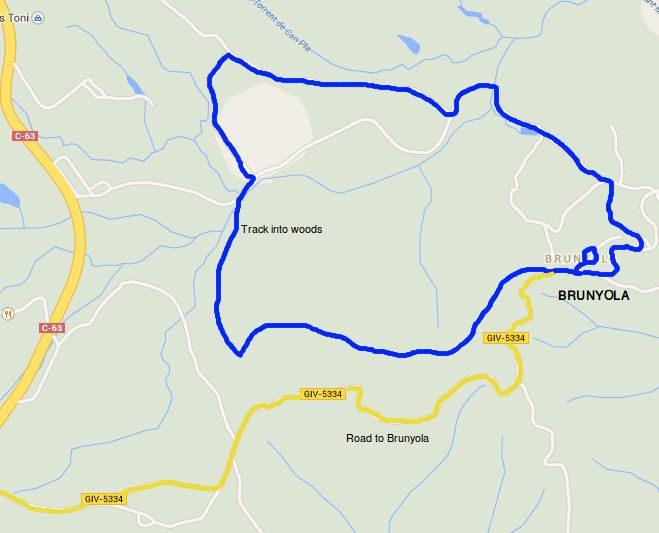
Cadaques and Port Lligat
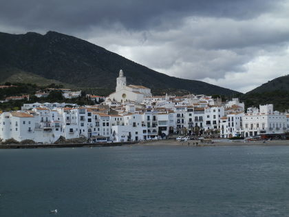 Cadaques is one of the most famous coastal villages in Catalonia and was where the surrealist painter Salvador Dali lived and worked in his coast-side house at Port Lligat. The town is on the Cap de Creus penisular and is really quite isolated separated by 12km of winding narrow roads over the hills from the neighbouring towns of Roses or to Port de la Selva. The remoteness, the narrow streets - some less than a metre and a half wide - and white washed buildings and arid hills behind makes Cadaques feel unique. In some ways it is almost more like a Greek Mediterranean village than Spain. It's this remoteness and uniqueness combined with the pure light of the coast that lures people to Cadaques
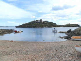 For us this is only our second visit so we're not aiming for a complex route - something simple and straightforward to get a feel for the area is perfectly fine for us, so this is just a standard easy-to-follow Cami de Ronda route.
Arriving in Cadaques by car there are big signs about the general lack of car parking with the advice that cars should park in the main paying municipal car park which we did, but it's a little expensive - close to 3 euros an hour. If you are walking, we discovered there is free parking out towards Port Lligat and the cemetery which is far enough out of town to be a good 10 minute walk to the centre and would have space out of season.
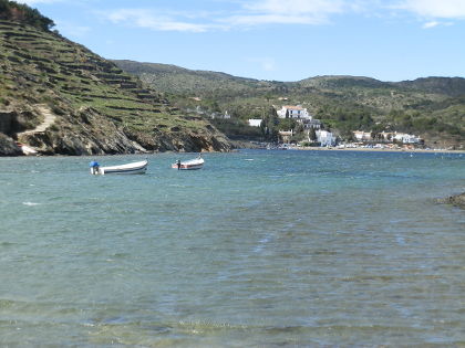 The old part of Cadaques sits on a small hill with the church at the top. The main car park sits just behind this hill, but lower down, so to start we head up the hill towards the church, through the very narrow streets lined with terraces of white-walled houses that give Cadaques its distinctive look. The streets themselves have a stoned surface, though unlike cobblestones these are narrower more slate-like stones with edges upwards in diagonal or herring-bone fashion and in places the road itself is actually the raw rock of the hill.
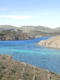 The church, being the high point of this part of the town, has views from its small courtyard in the front towards the sea and along to the cliffs and lighthouse in the distance on the right. Taking our fill, we head down towards the sea through the lanes passing by houses with plant pots outside their windows and pots lining the street edges.
At the beach, the town suddenly seems busier. The beach at Cadaques is a rock and shingle beach - people generally wouldn't come here for a beach holiday - the town has much too much character for that, and the area is generally rocky and stony, with the sedimentary layers of the rocks occasionally turned vertical and eroded and sharp, but perfect for diving, fishing or water sports. The beach itself has plenty of people even for March, though wrapped in coats against the wind. Around the beach area are restaurants and bars and a central statue of Dali looking back towards the town.
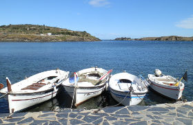 We continue across the beach and then around the Cami de Ronda. To begin with the path shares the road as it runs next door to the sea. We're on the leeside of the bay so the wind has dropped and each time we turn back we get another picture postcard view of Cadaques.
Towards the end of the bay we cross another small rough sand beach and take the path around the outside of a house as it runs around the top of the final set of rocks that have views back to town. Across the bay we can see the cliffs and an isolated lighthouse. There is more walking in this area including routes to Roses about 16km away - too far for a family round trip.
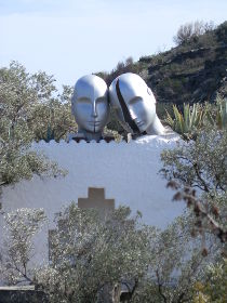 Around the house and the headland, Cadaques disappears and the scenery changes - becoming bleaker with much more rock stringing out into the sea. Across from us is a small island with a house and a watch tower on it. From behind it looked like another headland, but we can see now there is open water between the beach in front of us and the island.
The path continues around any number of rock headlands - perfect for hunting crabs in the summer or for skimming stones from the beaches. The sea in the distance from us is stormy with white horses, but close to the bay the water is smoother. Just inland from the sea front are newer houses and modern architecture villas that seem a little out of place from the wildness of the coast.
At the end of the headland we cross a rise and get the full blast of the wind in our faces. The sea below us is much more open to the elements with waves crashing against the rocks, but with a deep blue sea that we can see all the way to France.
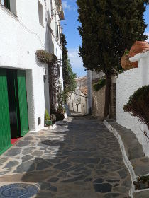 We follow the road down past a row of seaside houses that seem to be snuggling next to each other to keep out the wind. The headland is more like a spit so we have to turn around. Fortunately we see the Cami de Ronda sign which takes us down a narrow track into the woods and a scramble down to the bay between the spit and the main land. In front of us we can see a wild, almost Scottish landscape with the huddle of houses of Port Lligat in the distance, but no other buildings nearby.
We cross the beach in the bay and follow the track along the side of this new bay. Above us are ancient looking terracing for olive or vine cultivation that look as if they could have been on the hill since Roman times. The path is still narrow and 2-3 metres above the sea. At one point we have to cross sloping rocks that seem to want us to make us slide into the sea.
And then we arrive in Port Lligat, a handful of brightly coloured fishing boats on the small quayside and then around the corner at we're at Dali's house. We're not visiting the museum and from the port side it looks like a large traditional Catalan house, but with white walls with a few neighbouring houses. We take the chance to enjoy the view and the location then take the road up the hill. As we go up we can see the Daliesque touches like ceramic eggs on the roof and two silver heads, but it is much more subtle touches than Figueres for instance.
Then back into town, cutting into the confusing network of small lanes to see if we can navigate our way back. We arrive at the main square with trees wearing knitted sleeves and navigate through more streets and back to the car.
Neighbouring walks: Cadaques to Roses - Roses and Roses Ciutadella - Roses - Canyelles beaches to Cap Falconera - Port de la Selva - Sant Pere de Rodes - Llança - Collioure (France)
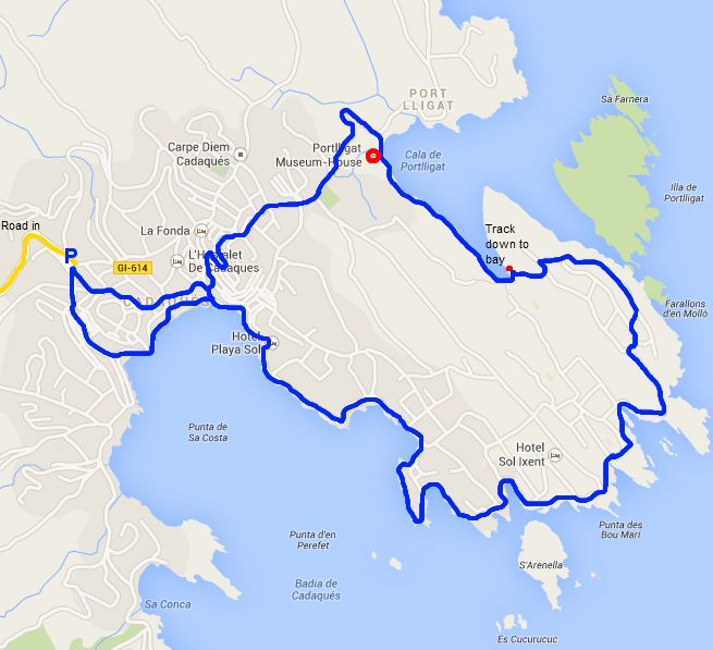
Comments | ||
adam@veggingoutwithadam.com |
17 Feb 2014 19:46 |
|
What a great blog. I am planning a walking holiday in the region and wonder if you can recommend the best walking maps, like UK ordnance survey ones. I shall be reading more of your walks over the coming days as we plan. Many thanks Adam | ||
Saul |
24 Feb 2014 17:25 |
|
Glad you're enjoying it. We have recommendations for maps in our 'Advice and FAQ' section | ||
Saul |
13 Jul 2017 12:46 |
|
Sorry I missed the comment, so I hope it's not too late - use the contact box if you'd like to send a message. For the coast, the GR92 is best and if you have driver you can just take it piece by piece. For hikers, around Cap de Creus is great, though it can be dry and hard walking in summer. For us, the stretch between Palamos and Palafrugell and on to Begur is the prettiest part of the whole Costa Brava and really good for walking. I'd probably also take the walk up and over Montgri, possibly starting at Pals, or L'Estartit to L'Escala. And though you said you prefer the coast, don't overlook inland routes as there are some wonderful villages and countryside out towards Girona, La Bisbal, or Olot. | ||
Sven-Gunnar Furmark |
24 May 2017 11:43 |
|
Hi, My name is Sven Furmark. I am from Sweden. I plan to go to Costa Brava with some friends (totally about 10 people) for hiking for one week (5 walking days). We are experienced hikers and we usually walk 4-6 hours per day. We prefer to walk along the coast as much as possible. We plan to rent a house and travel to each days hiking with a bus & driver which we plan to book for the whole week. Which five hikes would you recommend for us. Warm Regards Sven | ||


